
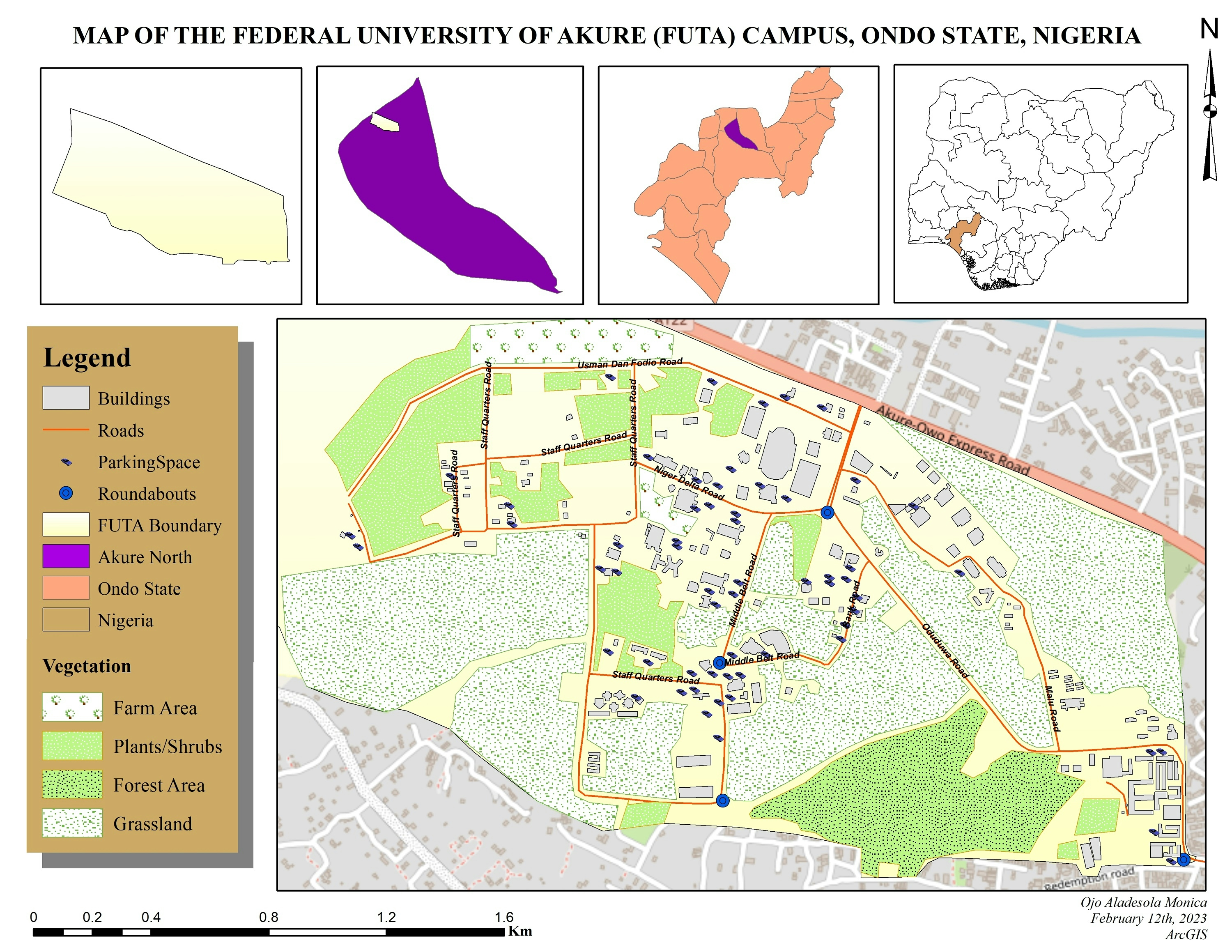
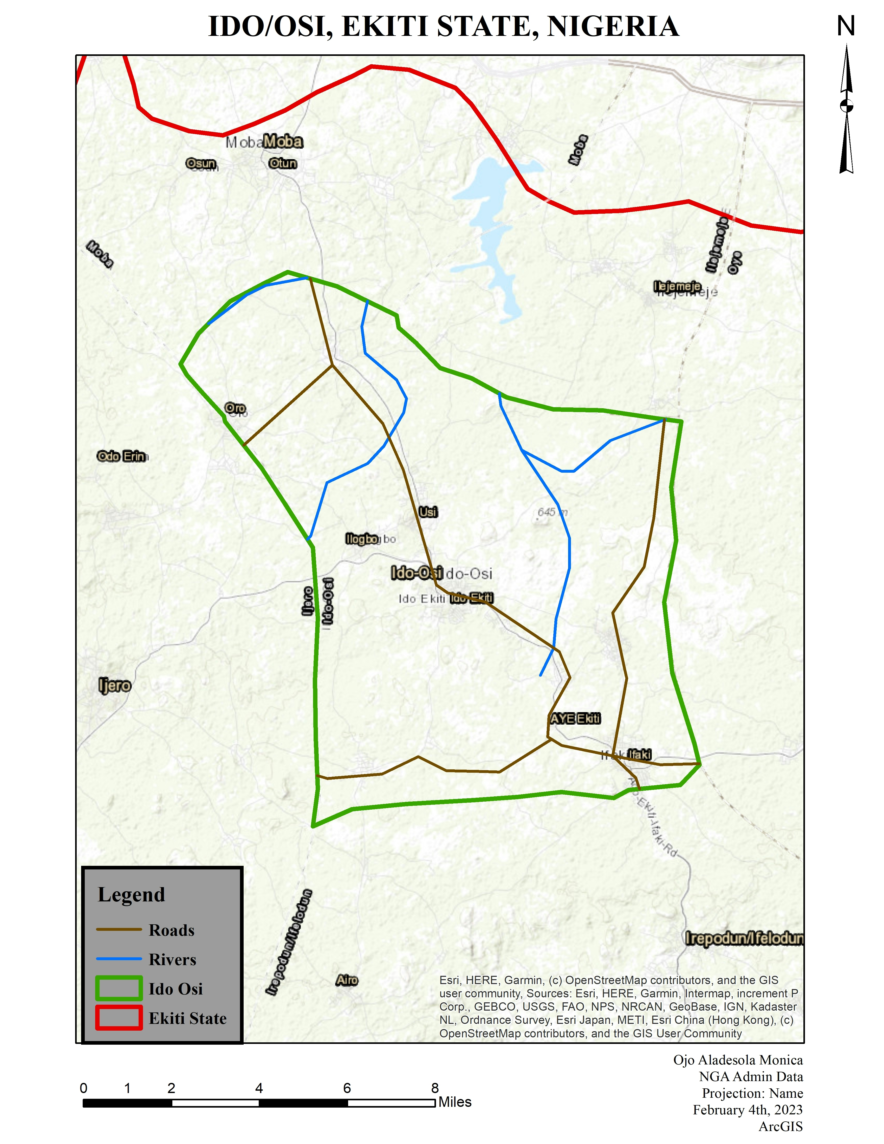
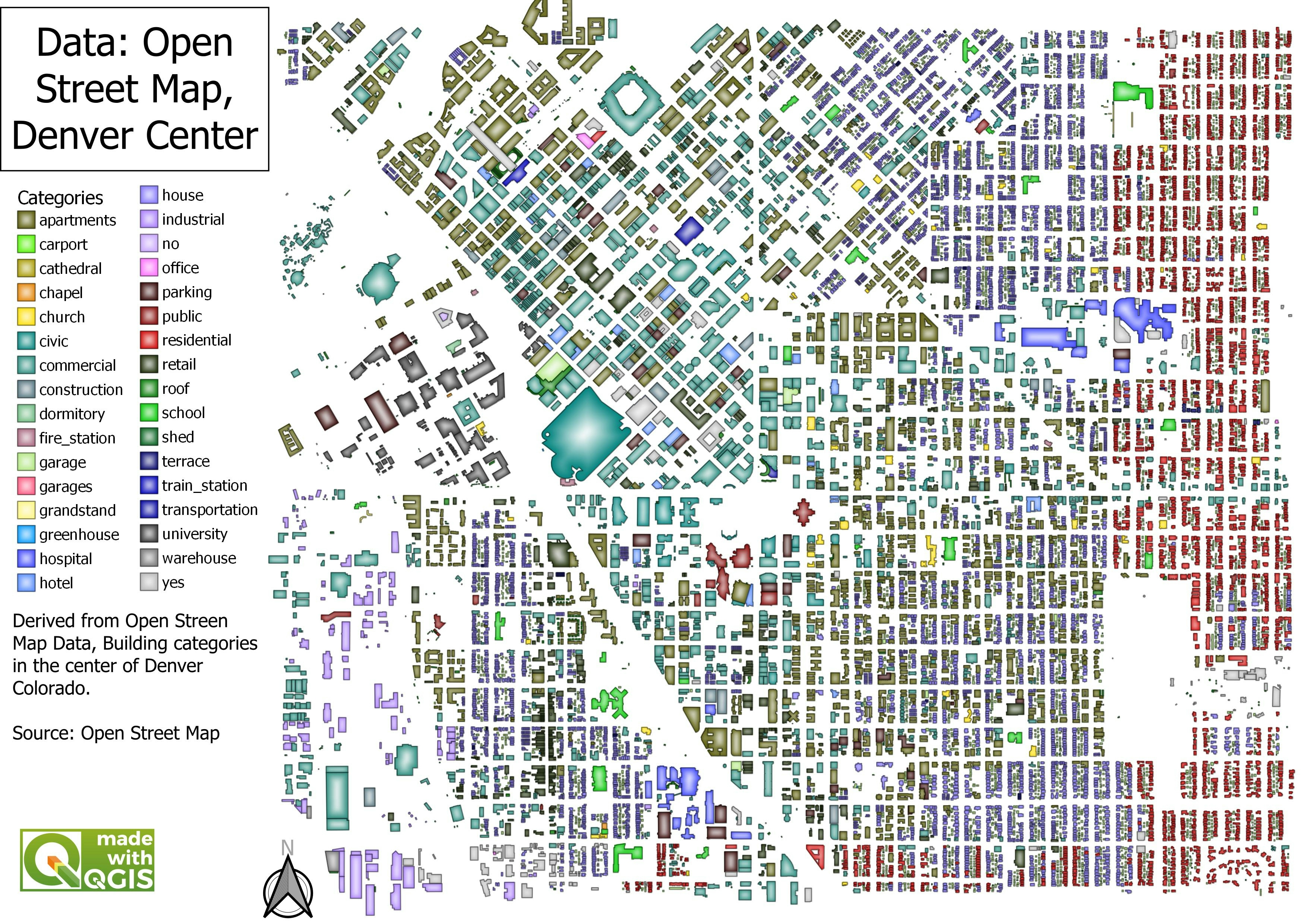
This map was created through georeferencing and digitization processes. ArcMap was used for all of the processing. Openstreet basemap was also instrumental in completing the digitization process. Groundtruthing was also carried out to adequately relate some structures on ground with what is represented on the map.
Digitization of FUTA Campus
Tools used
ArcGISArcMapOpenStreetMap
Plug-ins used
Data ManagementDigitizing Layout ExportOpenStreetMap
tags
ArcGISArcMapdigitisingGeor
More by Ojo Aladesola Monica


You might also like


Join the community!
We're a place where geospatial professionals showcase their works and discover opportunities.