
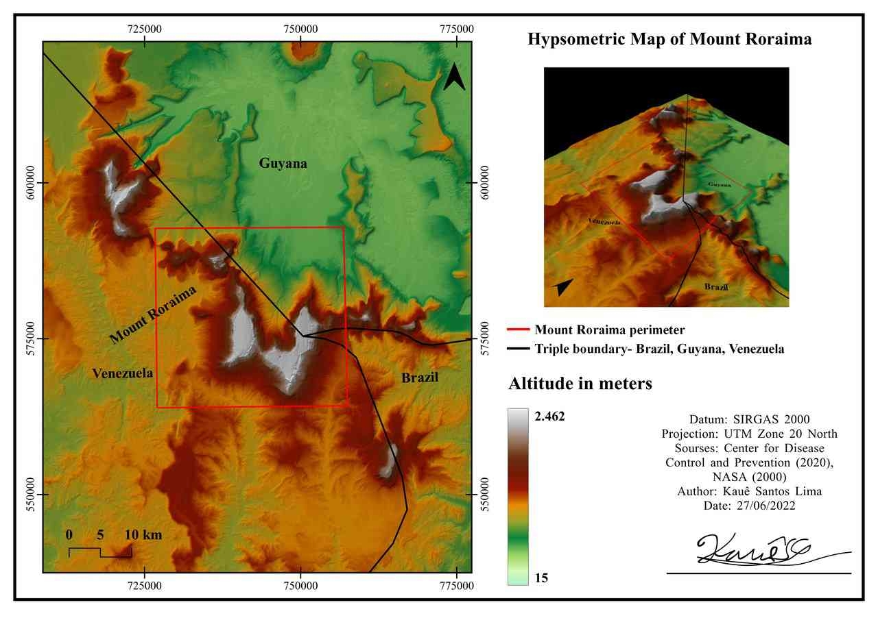
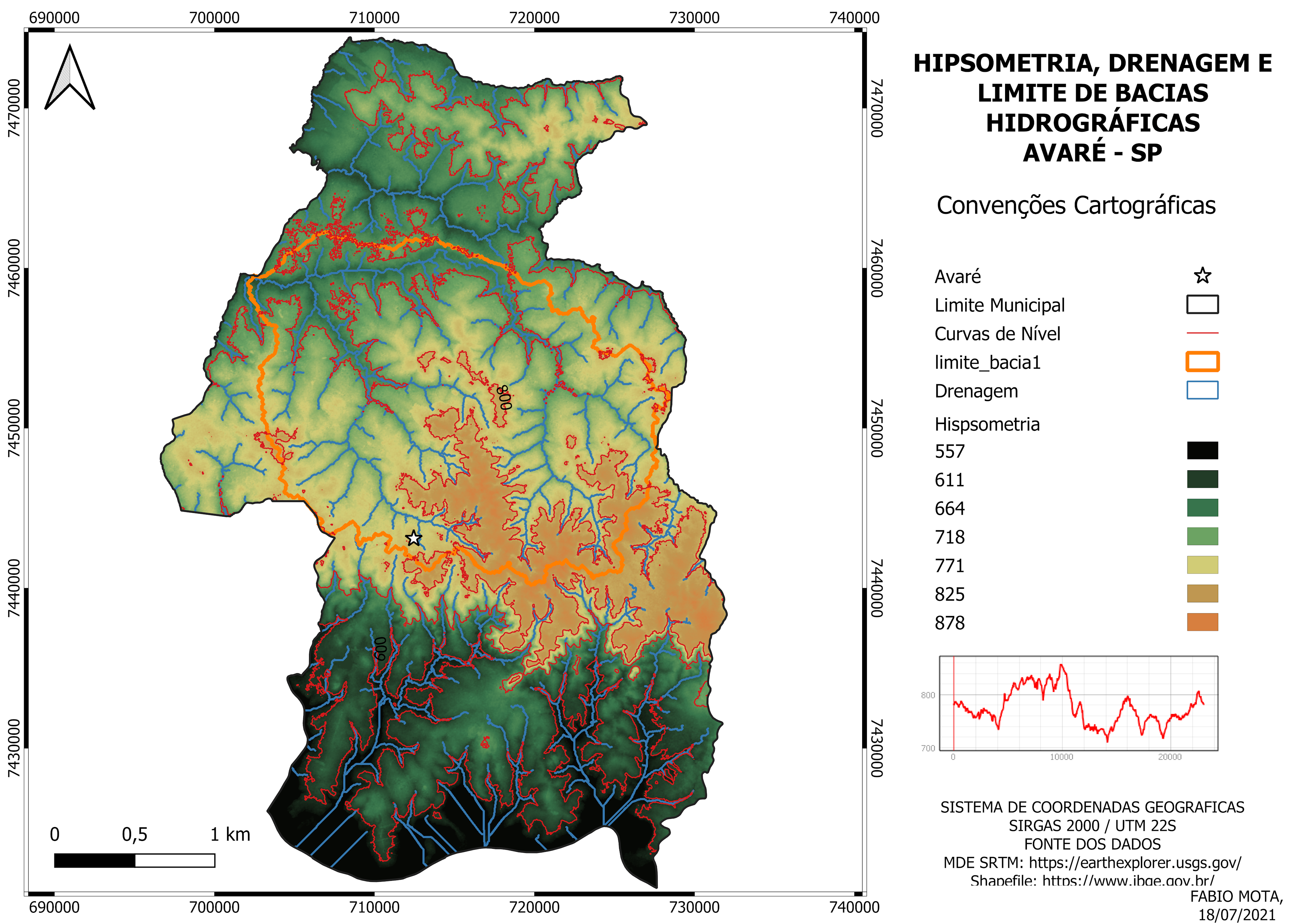
This production sought to represent the elevation of the feature of Mount Roraima, located on the border between Brazil, Guyana and Venezuela. Possessing 3D visualization, perimeter of the geological feature and also the limits of the borders.
Hypsometric Map of Mount Roraima
Tools used
3d mapQGISRASTER PROCESSINGvector addition
Plug-ins used
Qgis2threejsQuickMapServices
tags
hipsometry Qgis2threejsRaster
More by Kauê Santos Lima

You might also like


.jpg&w=3840&q=100)


Join the community!
We're a place where geospatial professionals showcase their works and discover opportunities.