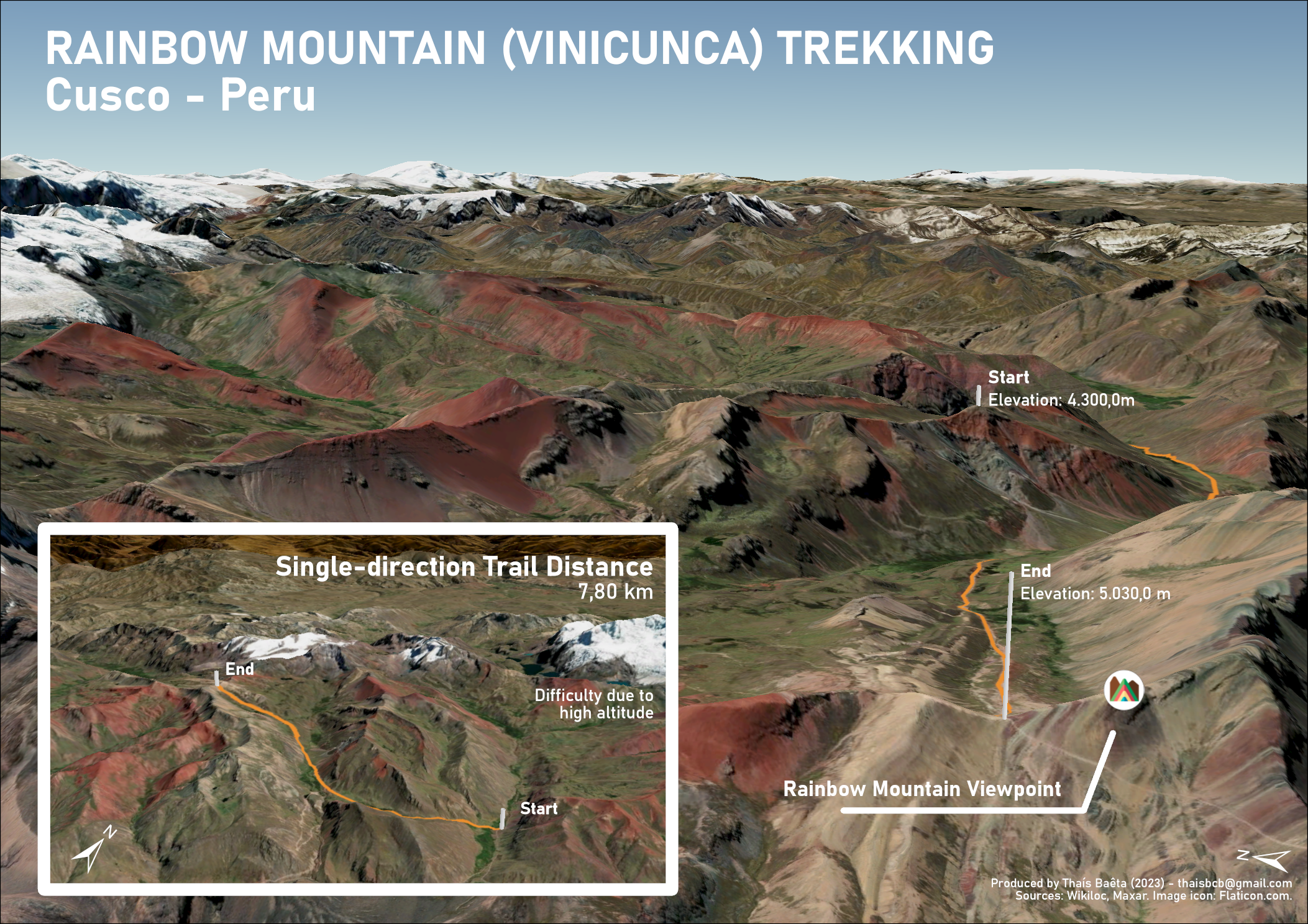
For this map, the 3D model from ArcGIS Pro was used to display the elevation of an area located in the Peruvian Andes in Cusco, Peru, which is just 3 hours away from the historical center.
The purpose of this map was to show the main trail leading to the famous Rainbow Mountain, also known as Vinicunca. This mountain has become a major attraction for tourists to visit either before or after Machu Picchu. Its rainbow-like appearance is created by the sediment of minerals throughout the area, giving the mountain a range of colors, including turquoise, lavender, gold, and others. The mountain was only recently discovered due to the snow melting, revealing the hidden gem.
One interesting aspect to observe is that the coloration of the mountain can also be seen on the map generated from the 3D model and the use of satellite imagery from ArcGIS Pro.