
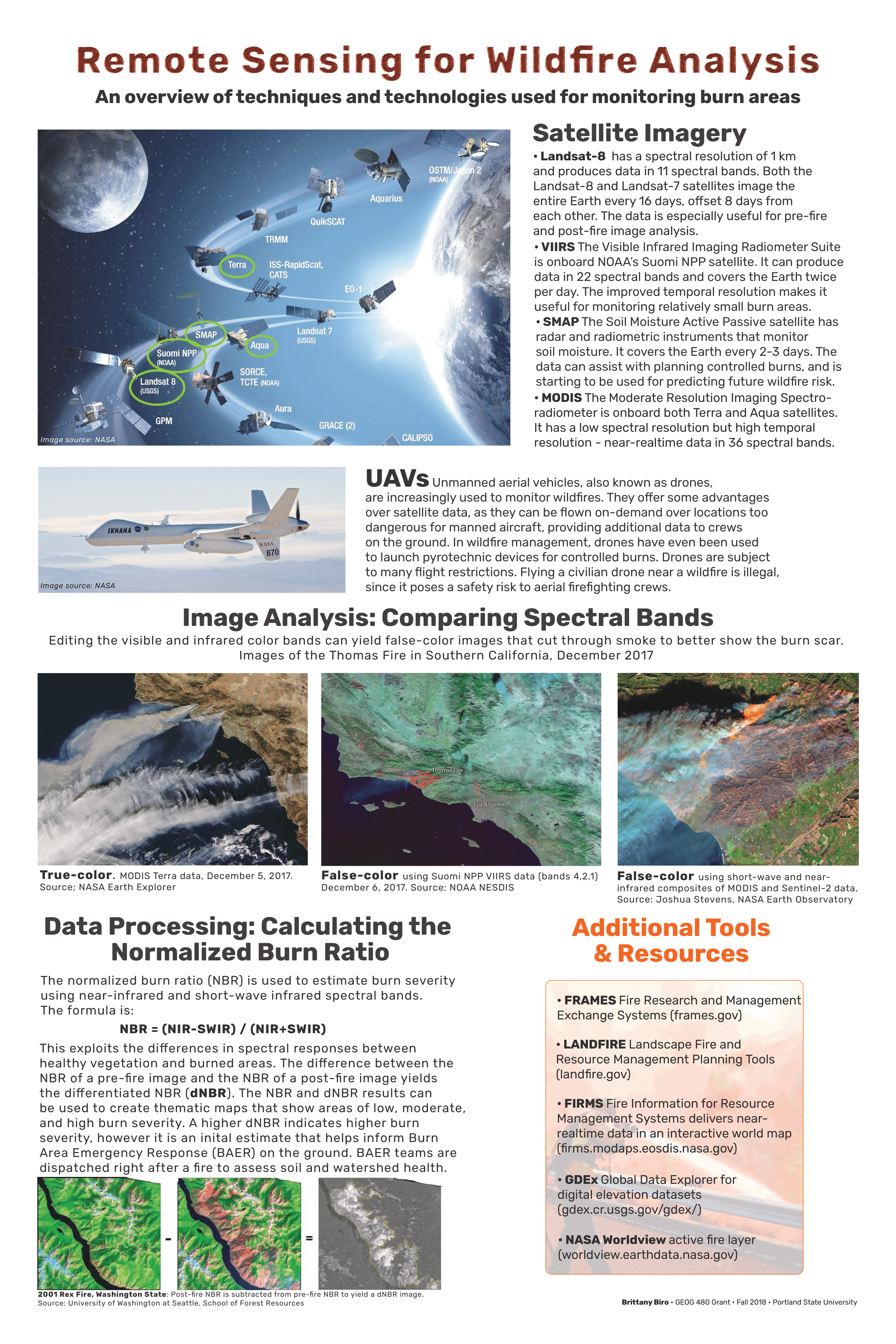
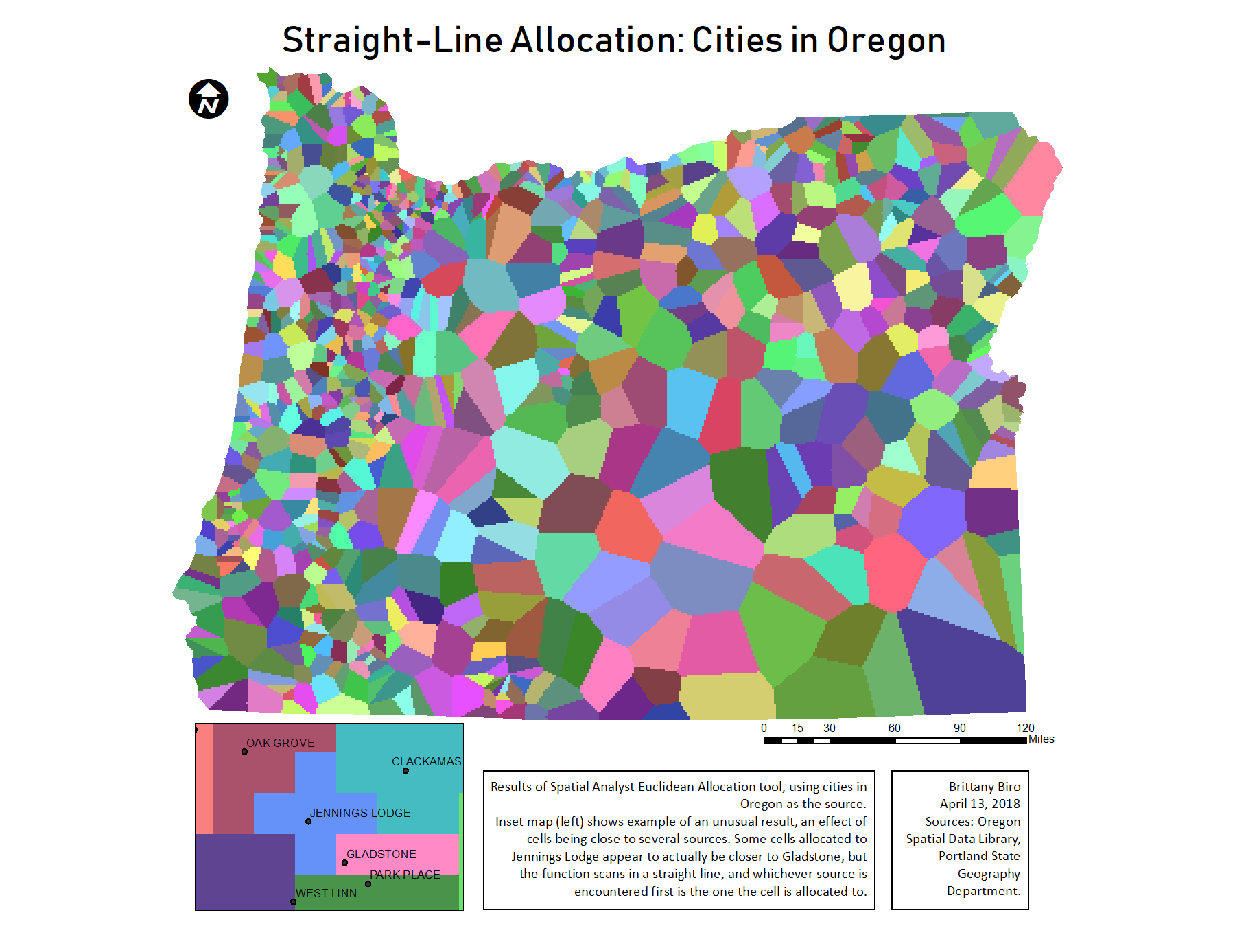
An informational poster displaying the ways that remote sensing technologies are used in wildfire management. Final Project for GEOG 480, Remote Sensing & Image Analysis, Portland State University, 2018.
Remote Sensing for Wildfire Analysis
Tools used
Adobe Illustratornormalized burn ratio
Plug-ins used
None
tags
DroneposterRemote SensingUASwildfire
More by Brittany Biro
You might also like


Join the community!
We're a place where geospatial professionals showcase their works and discover opportunities.