
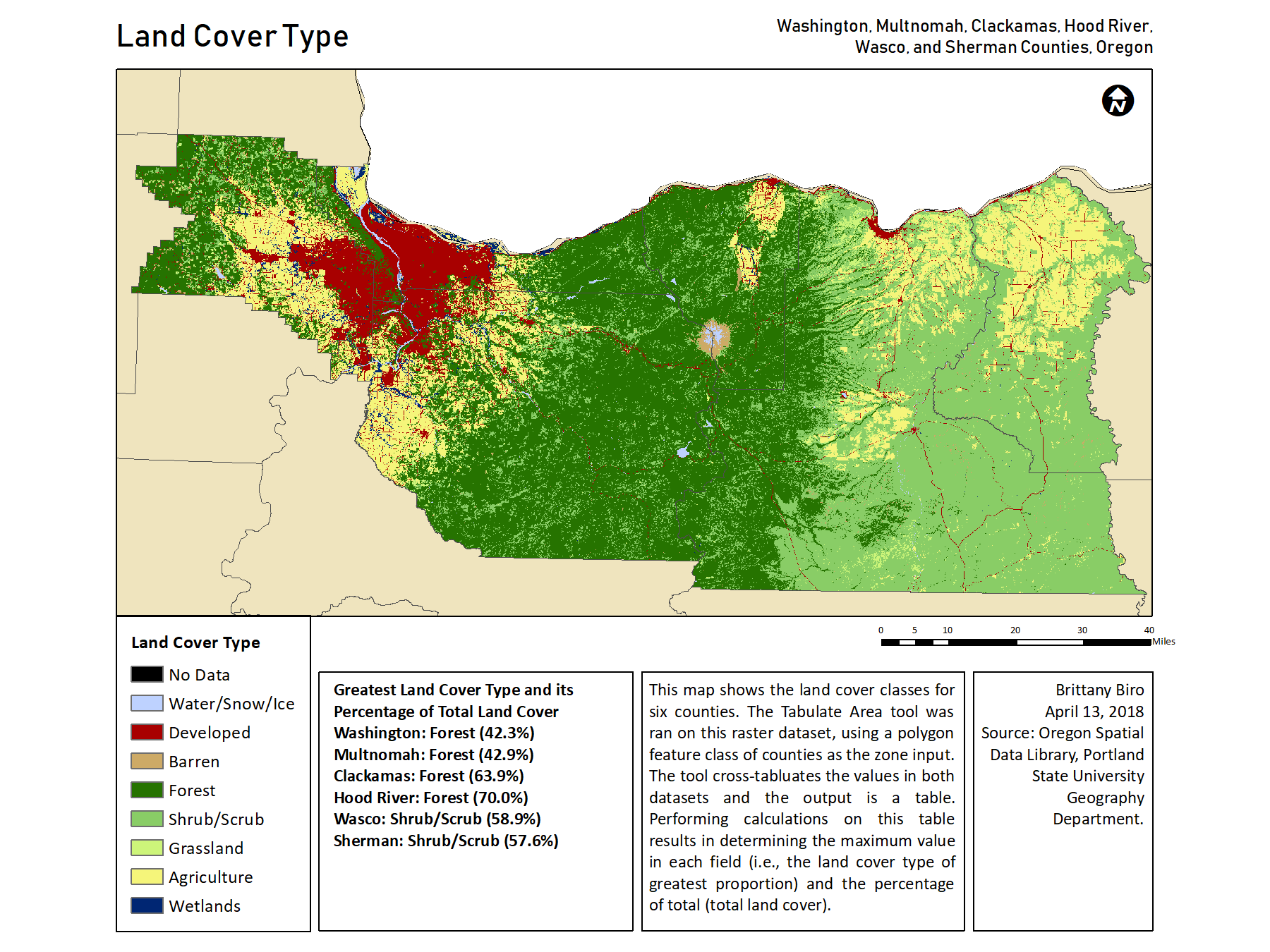
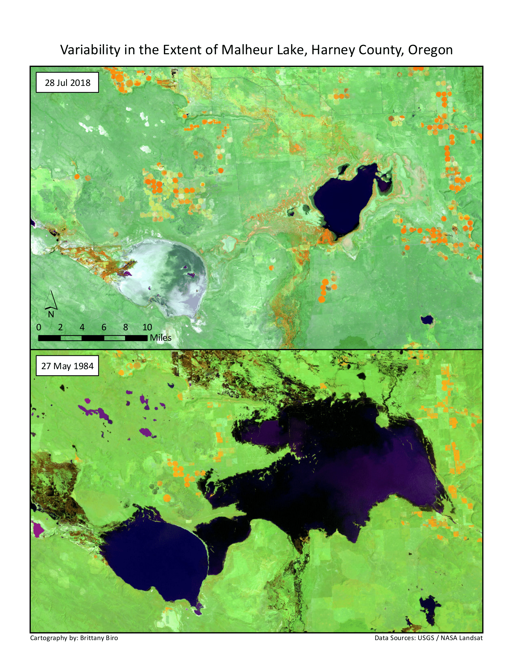
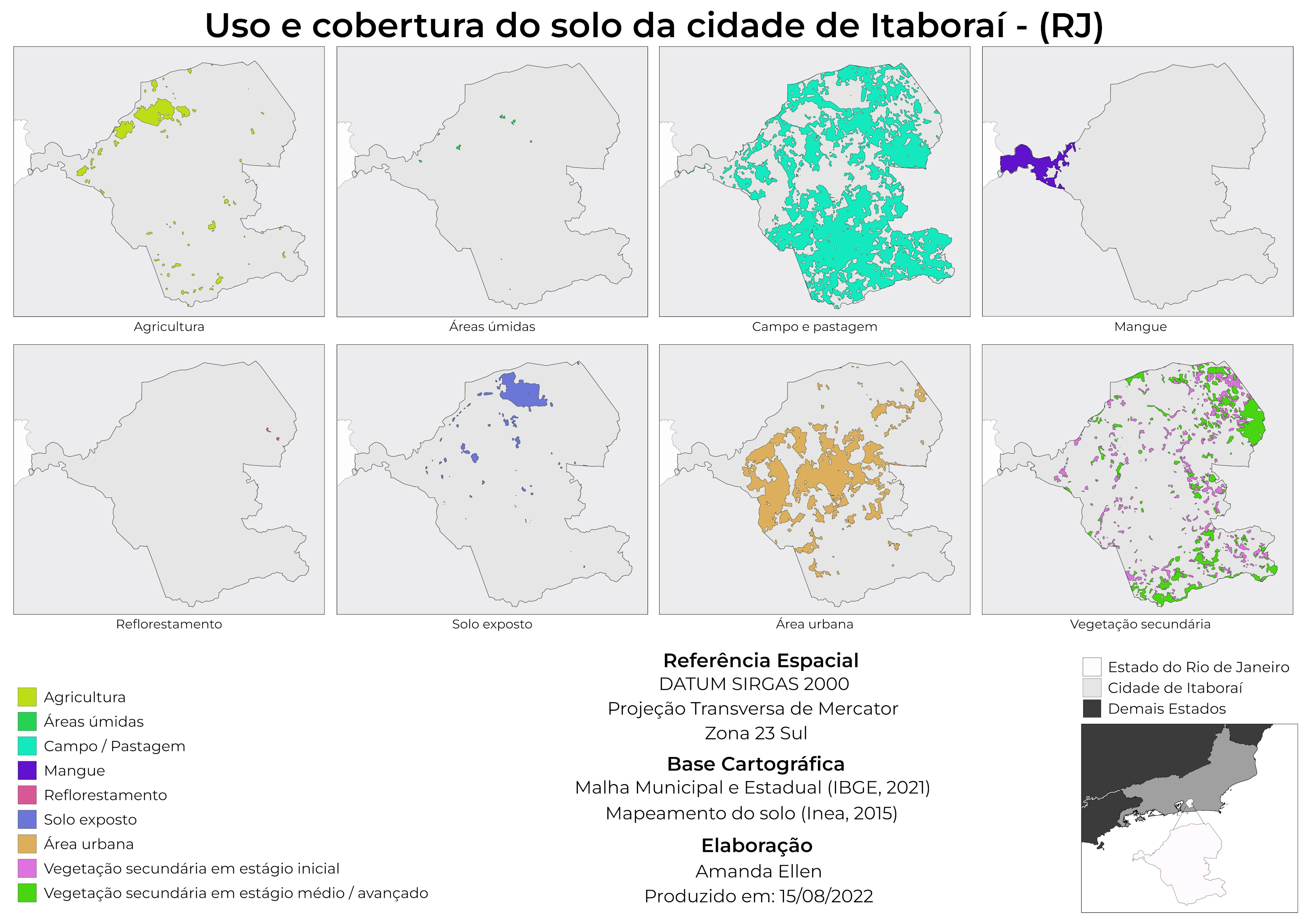
Land cover map of six Oregon counties produced using calculations on raster data.
Land Cover Types in Oregon Counties
Tools used
ArcMapraster calculator
Plug-ins used
None
tags
ArcMapland coverRasterRaster Calculator
More by Brittany Biro
You might also like


Join the community!
We're a place where geospatial professionals showcase their works and discover opportunities.