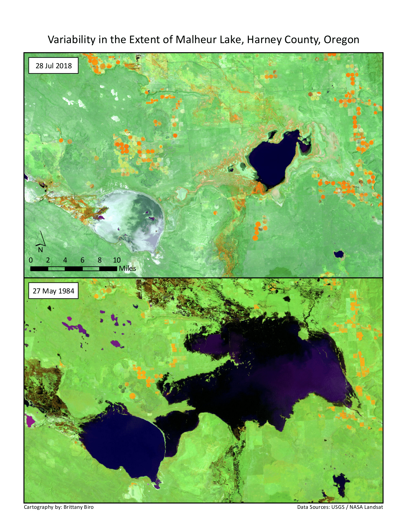
A look at variability in the extent (surface area) of Malheur Lake in
Harney County, Oregon, using Landsat data.
May 1984 data is from Landsat 5 TM (Thematic Mapper). The 2018 composite image uses data from Landsat 8. Landsat 8 bands 5,6,4 are equivalent to Landsat 5 bands 4,5,3 (NIR, SWIR, and Red
respectively).


.svg "Keran Nkongolo")