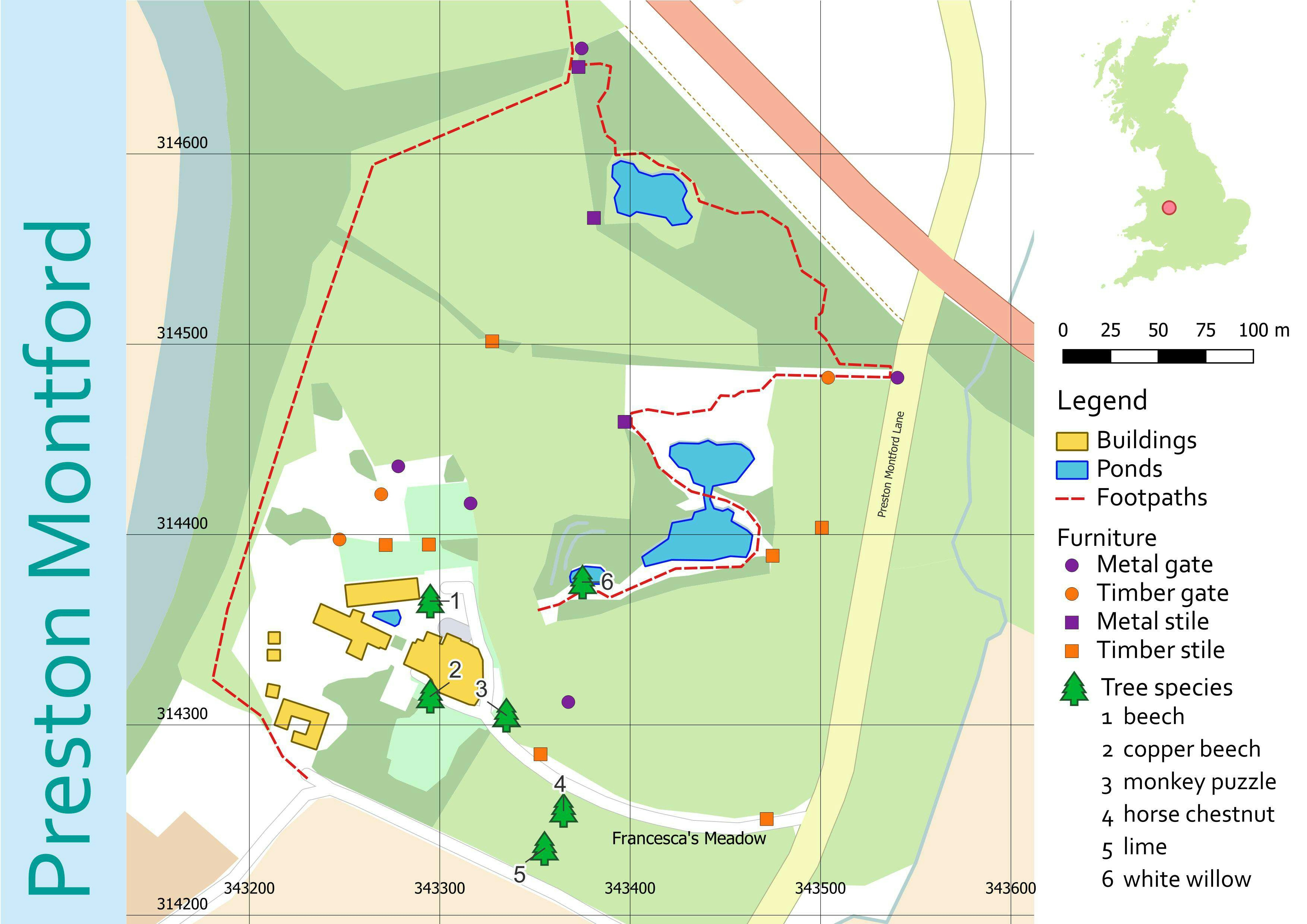
This map was made for a class project to demonstrate using DEM to create hill shade and adjusting the transparency of the base layer for legibility of trail map.
This map is similar to the maps I made when I was a Field Technician at O'ahu Invasive Species Committee. I produced maps for surveys conducted for invasive plant eradication and often used trails and landmarks as boundaries for our survey polygons.


.jpg&w=3840&q=100)