Principais ocorrências Terras-Raras - MG


Tools used
Google MapQGIS
More by Miriela Ulloa Santana


You might also like


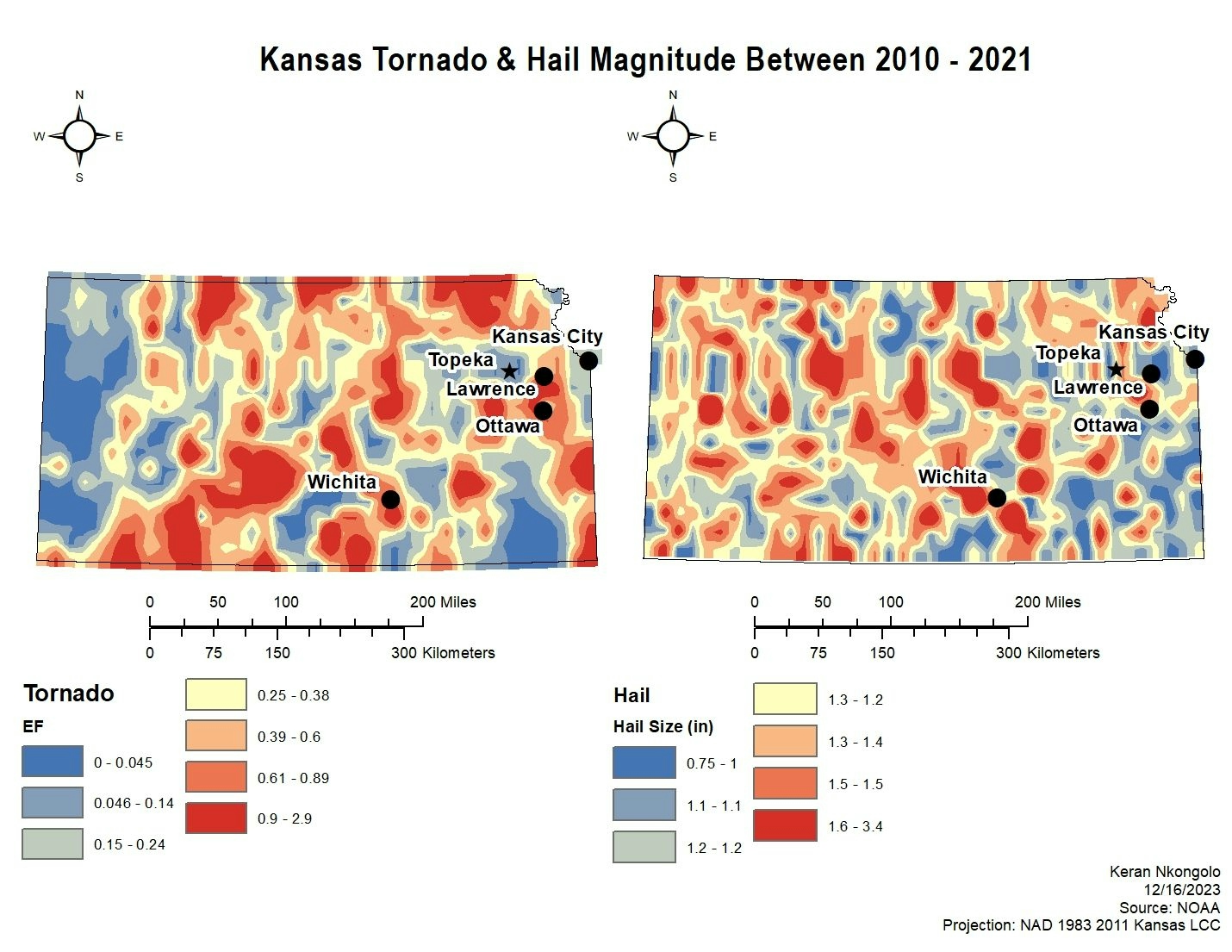
.svg "Keran Nkongolo")
.jpg&w=3840&q=100)


Join the community!
We're a place where geospatial professionals showcase their works and discover opportunities.
Principais ocorrências Terras-Raras - MG
More by Miriela Ulloa Santana
You might also like
We're a place where geospatial professionals showcase their works and discover opportunities.