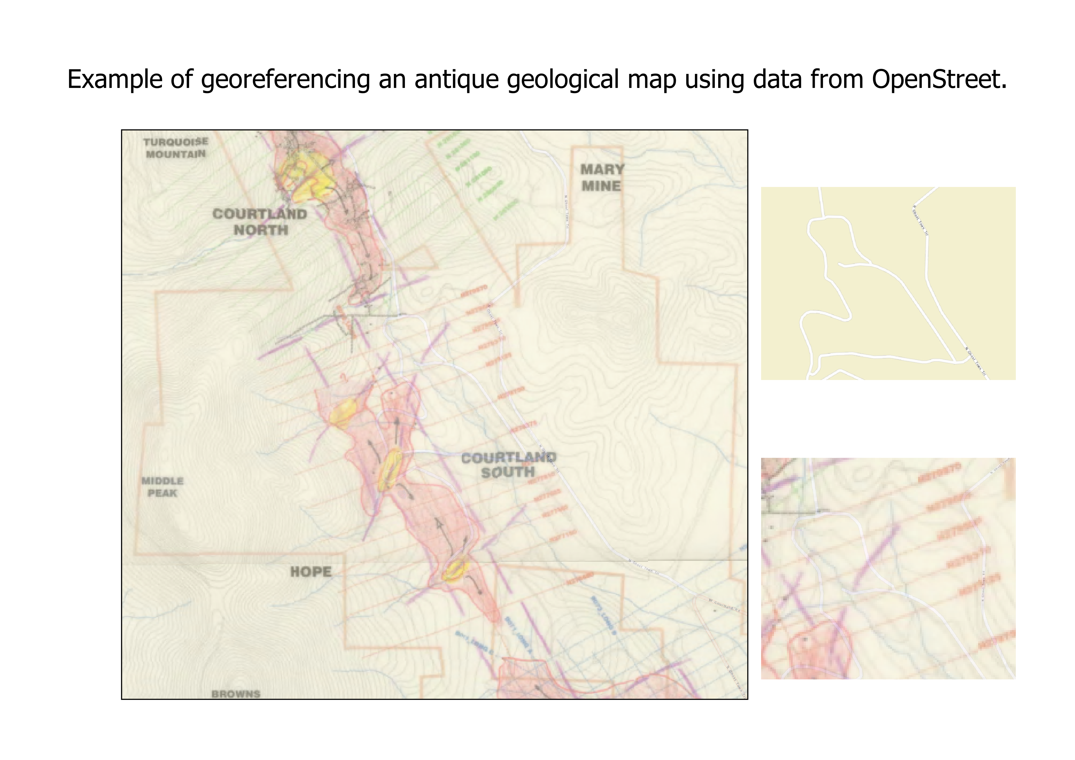
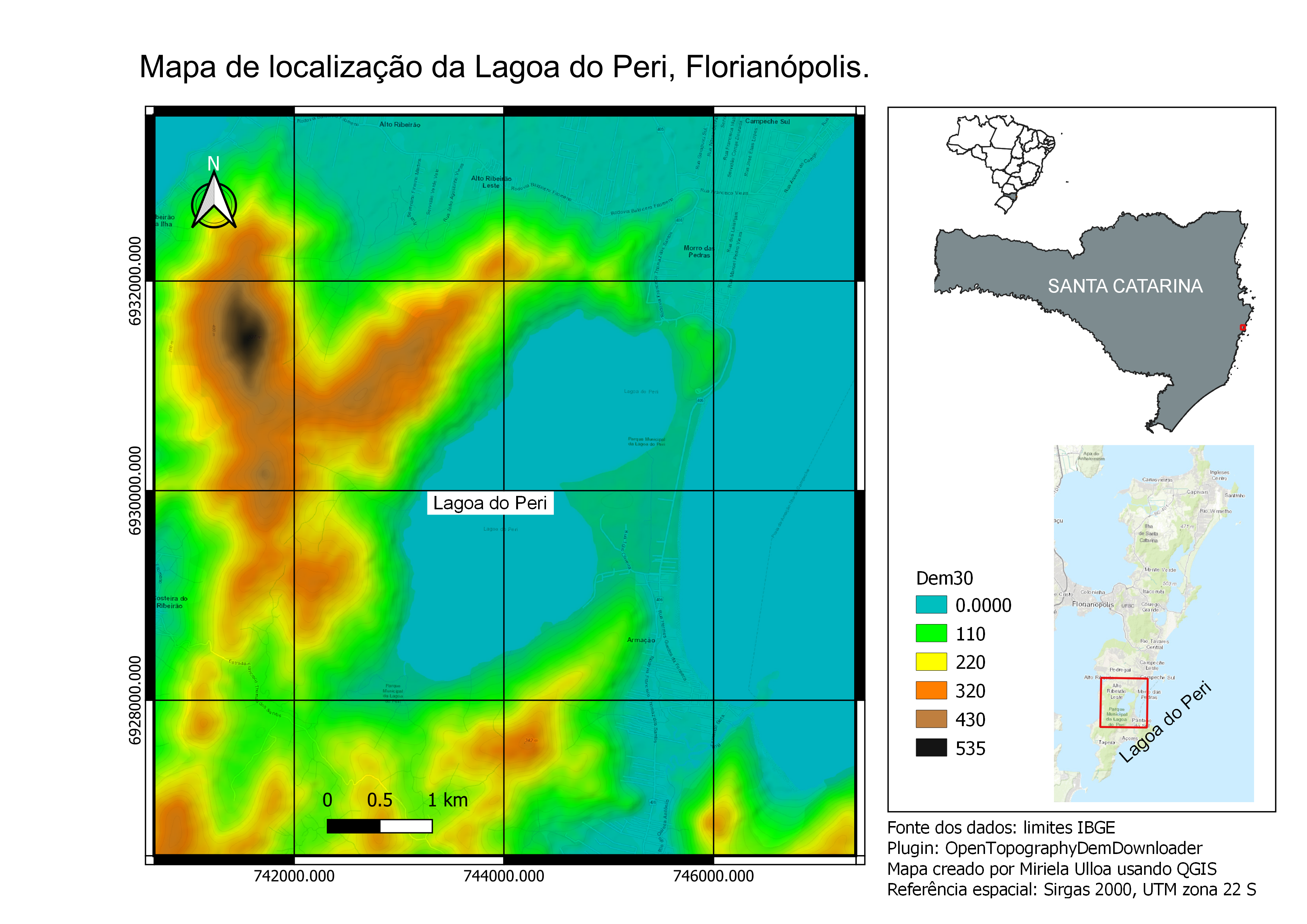
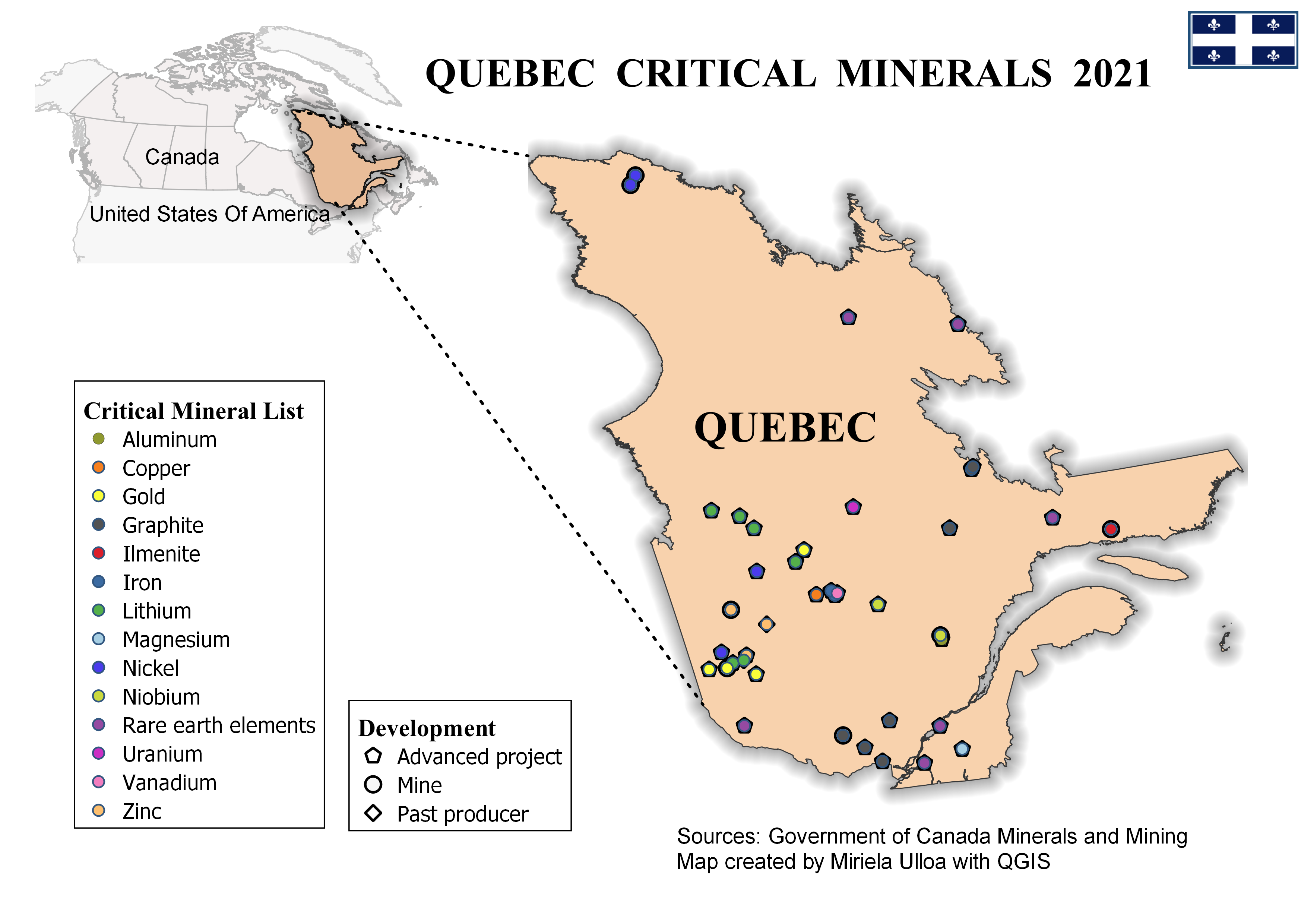
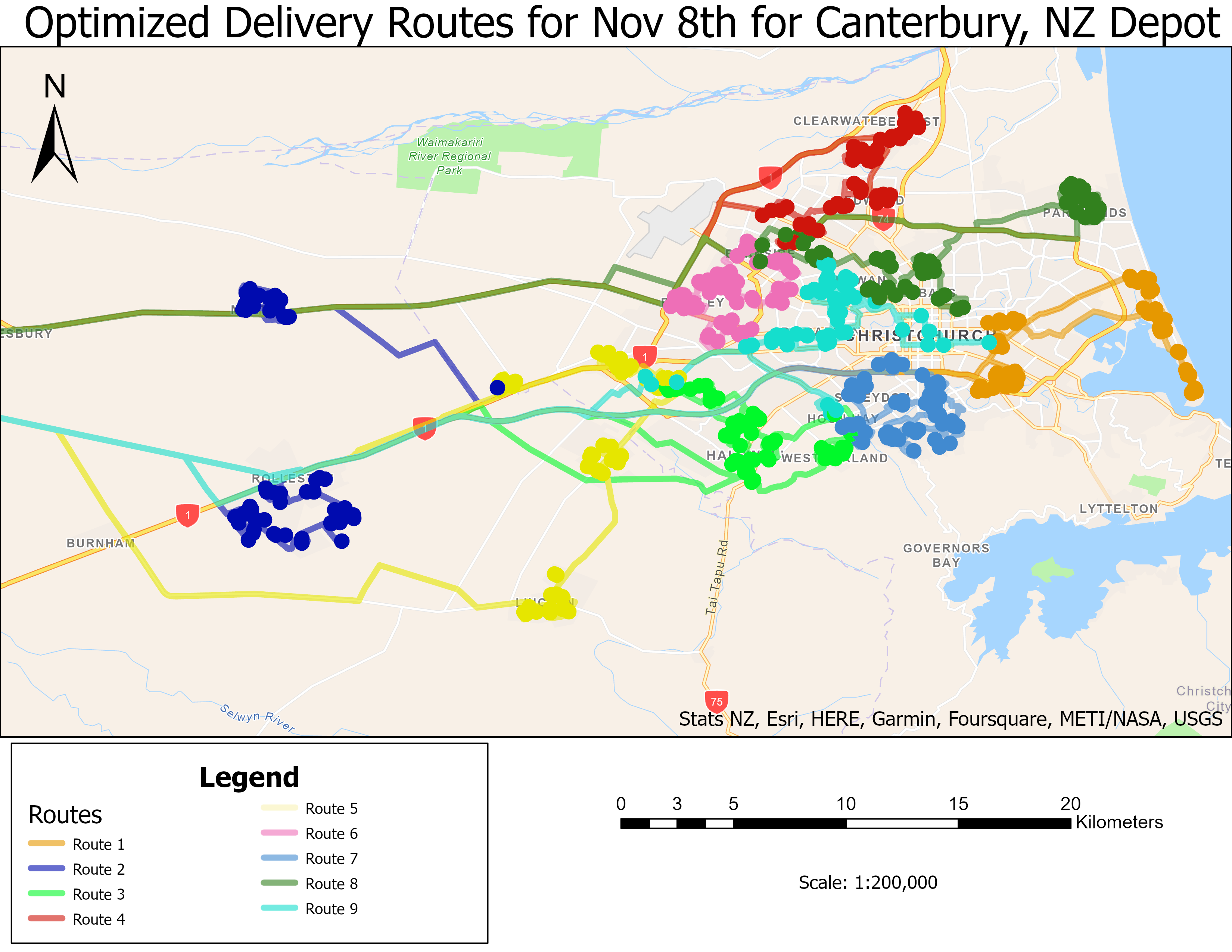
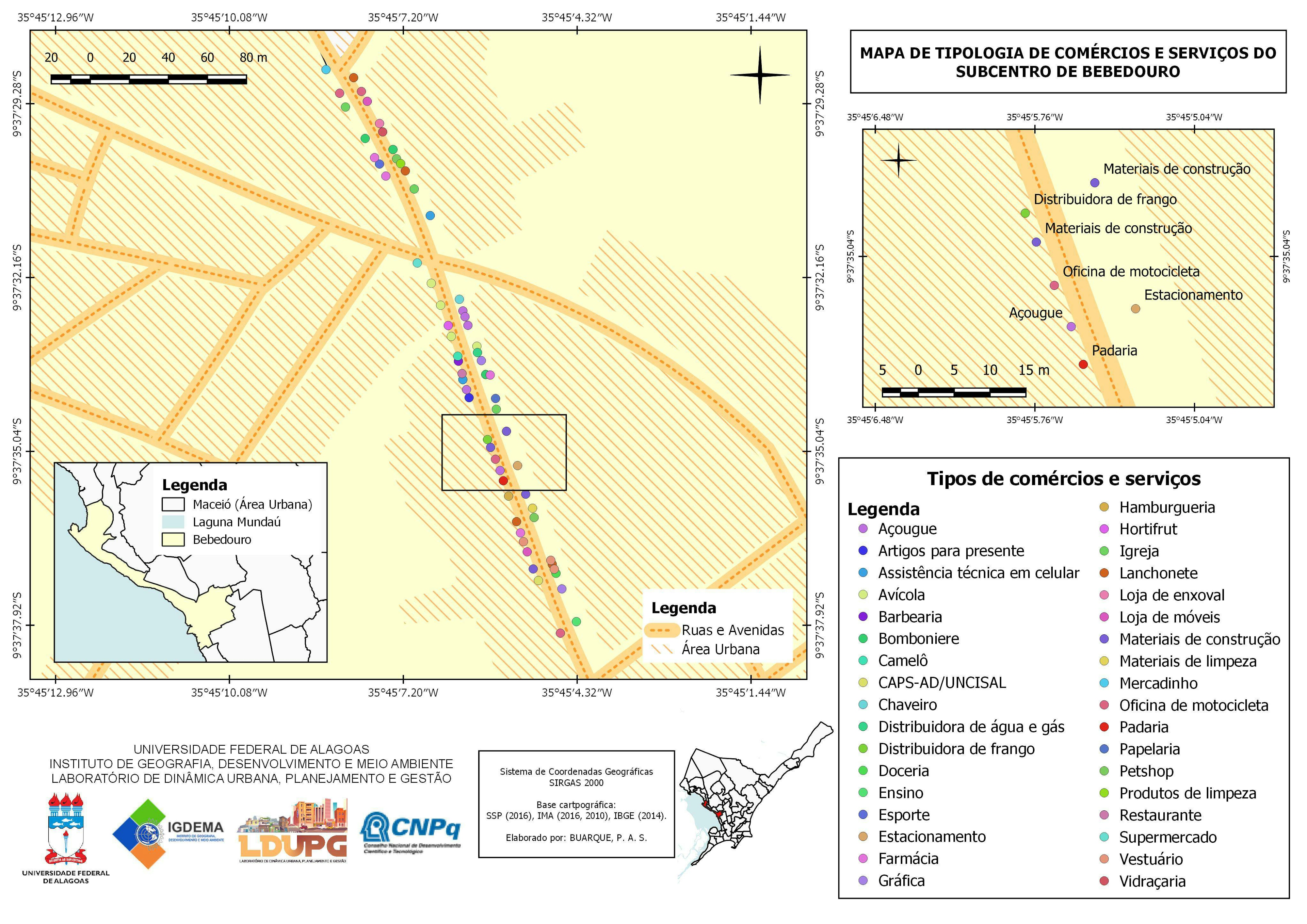
Georeferencing antique geological map.

Tools used
OpenStreetMapQGIS
More by Miriela Ulloa Santana


You might also like


.svg "Keran Nkongolo")


.jpg&w=3840&q=100)

Join the community!
We're a place where geospatial professionals showcase their works and discover opportunities.
Georeferencing antique geological map.
More by Miriela Ulloa Santana
You might also like
We're a place where geospatial professionals showcase their works and discover opportunities.