
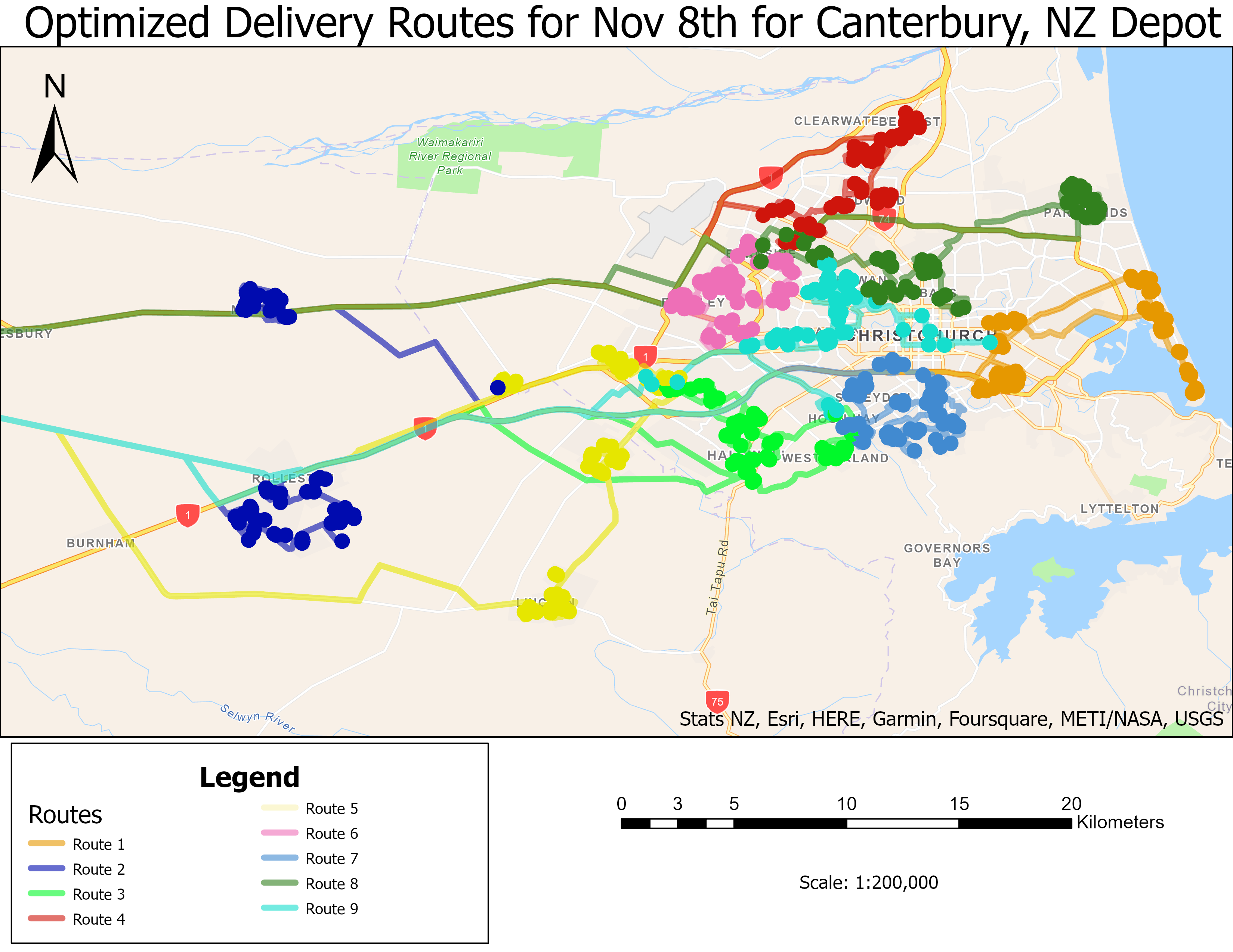
This is from Section 2 of the GIS for Climate Action MOOC by ESRI. The scenario was to create optimized truck deliveries routes in order to reduce GHG emissions. This involved geocoding delivery locations using ESRI's ArcGIS Online service, followed by setting up a depot and delivery locations within the Vehicle Routing Problem toolset.
ESRI GIS for Climate Action MOOC Sample
Plug-ins used
Vehicle Routing Problem, ArcGIS Geocoding Service
tags
MOOC, GIS for Climate Action
More by Martijn Dieleman


You might also like


.svg "Keran Nkongolo")

Join the community!
We're a place where geospatial professionals showcase their works and discover opportunities.