This map was created during the MOOC to showcase using the Presence-Only Prediction (MaxEnt) tool in ArcGIS Pro to conduct a crop suitability raster analysis.
Note that the data sources were provided as part of the ESRI MOOC
Climate Action MOOC Presence-Only MaxEnt
This map was created during the MOOC to showcase using the Presence-Only Prediction (MaxEnt) tool in ArcGIS Pro to conduct a crop suitability raster analysis.
Note that the data sources were provided as part of the ESRI MOOC
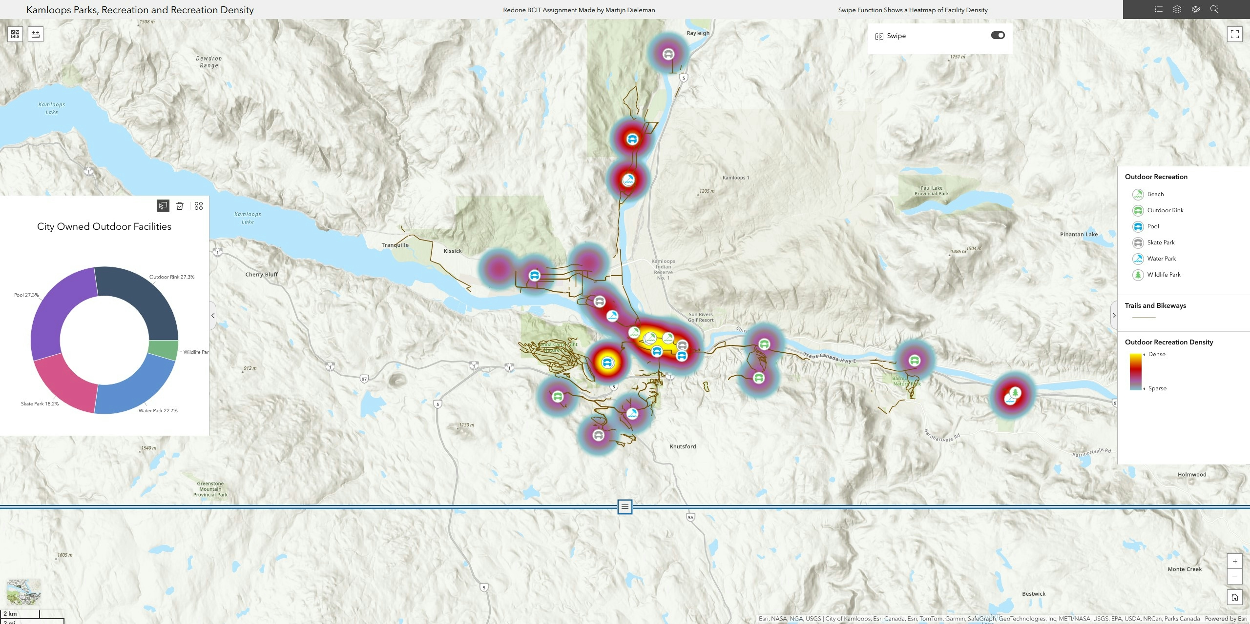
More by Martijn Dieleman
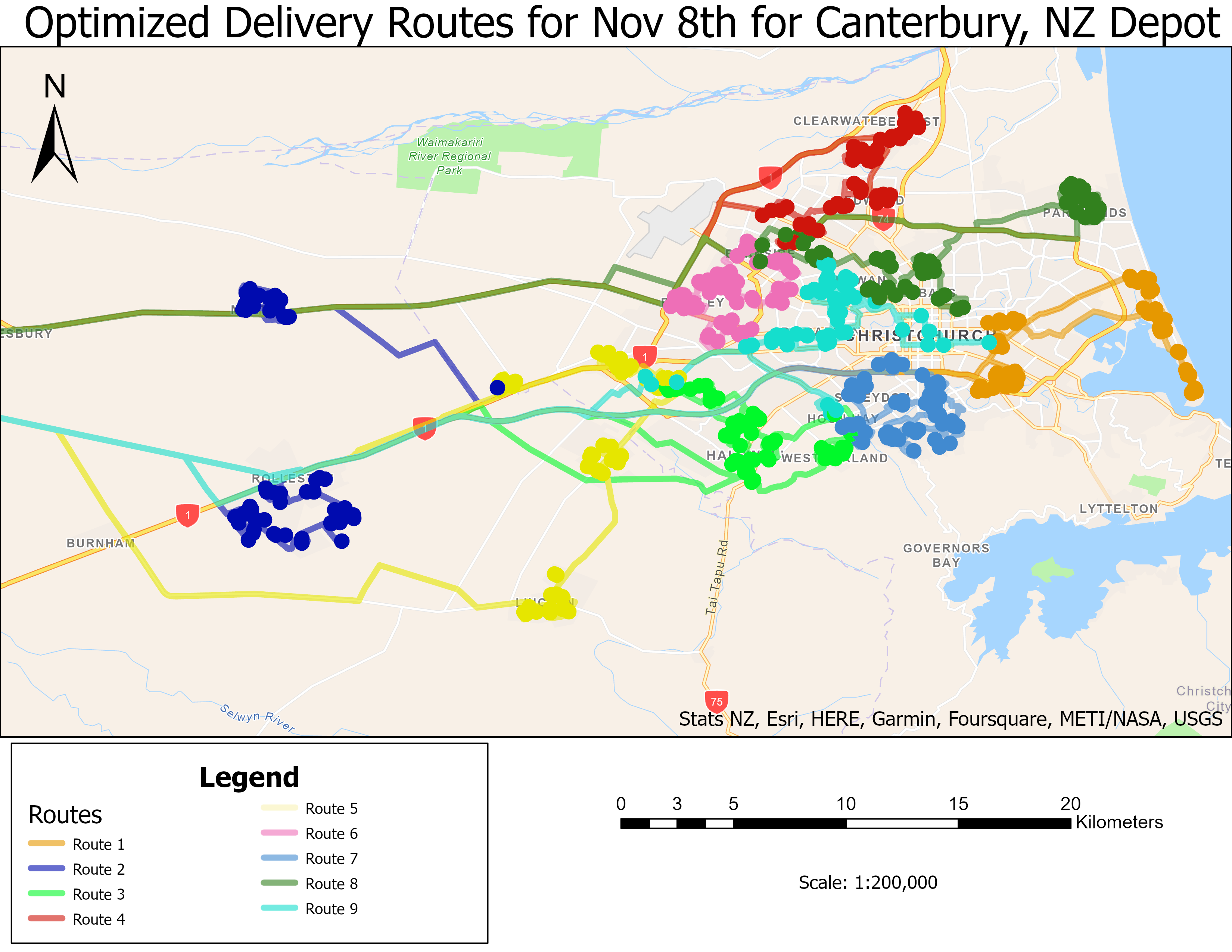
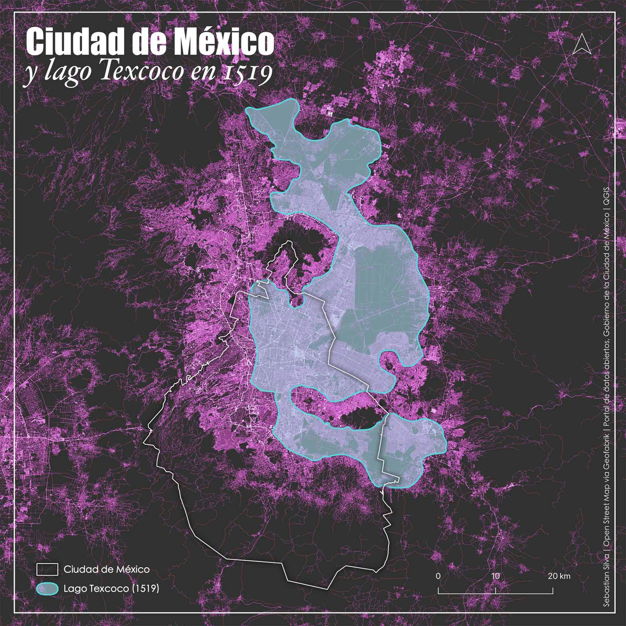
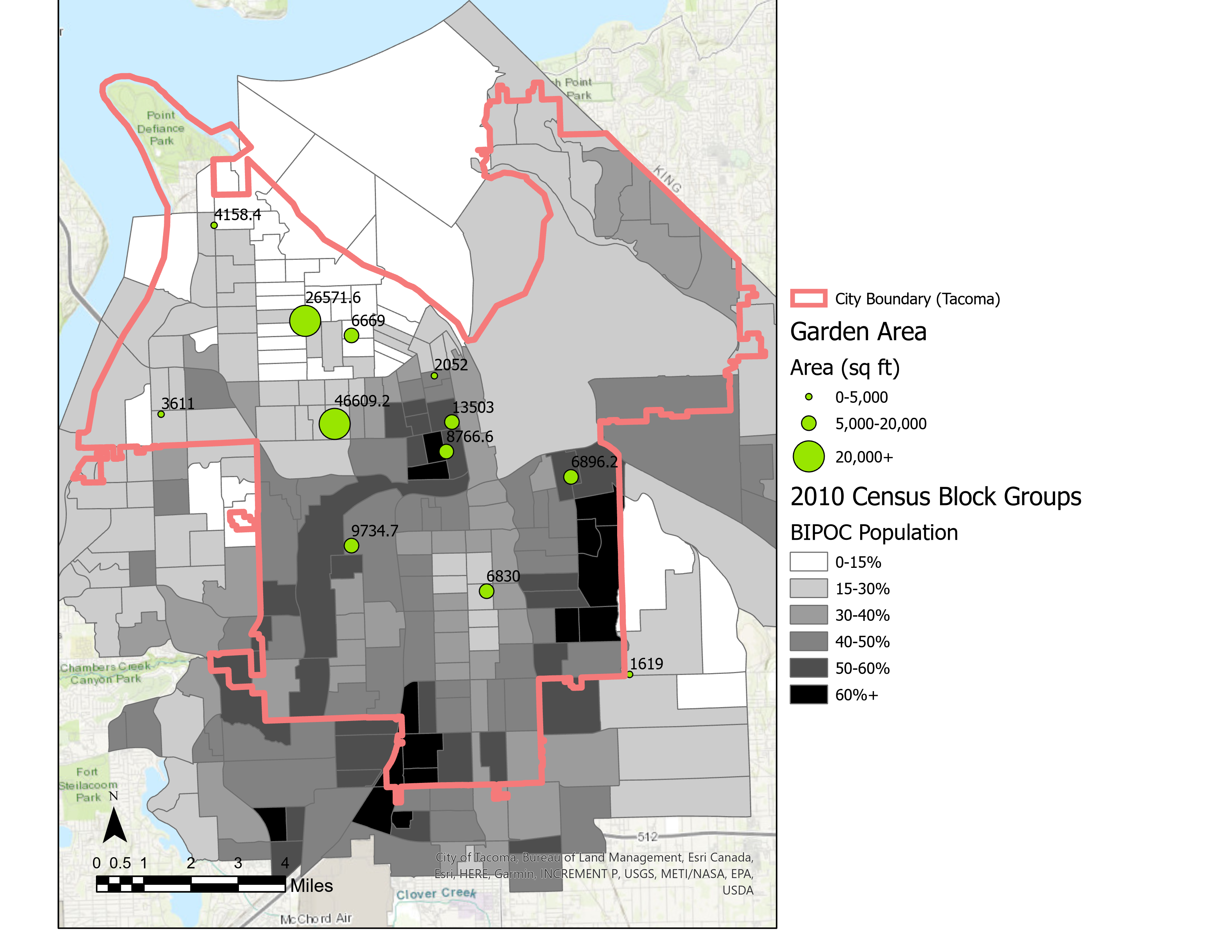
You might also like
We're a place where geospatial professionals showcase their works and discover opportunities.