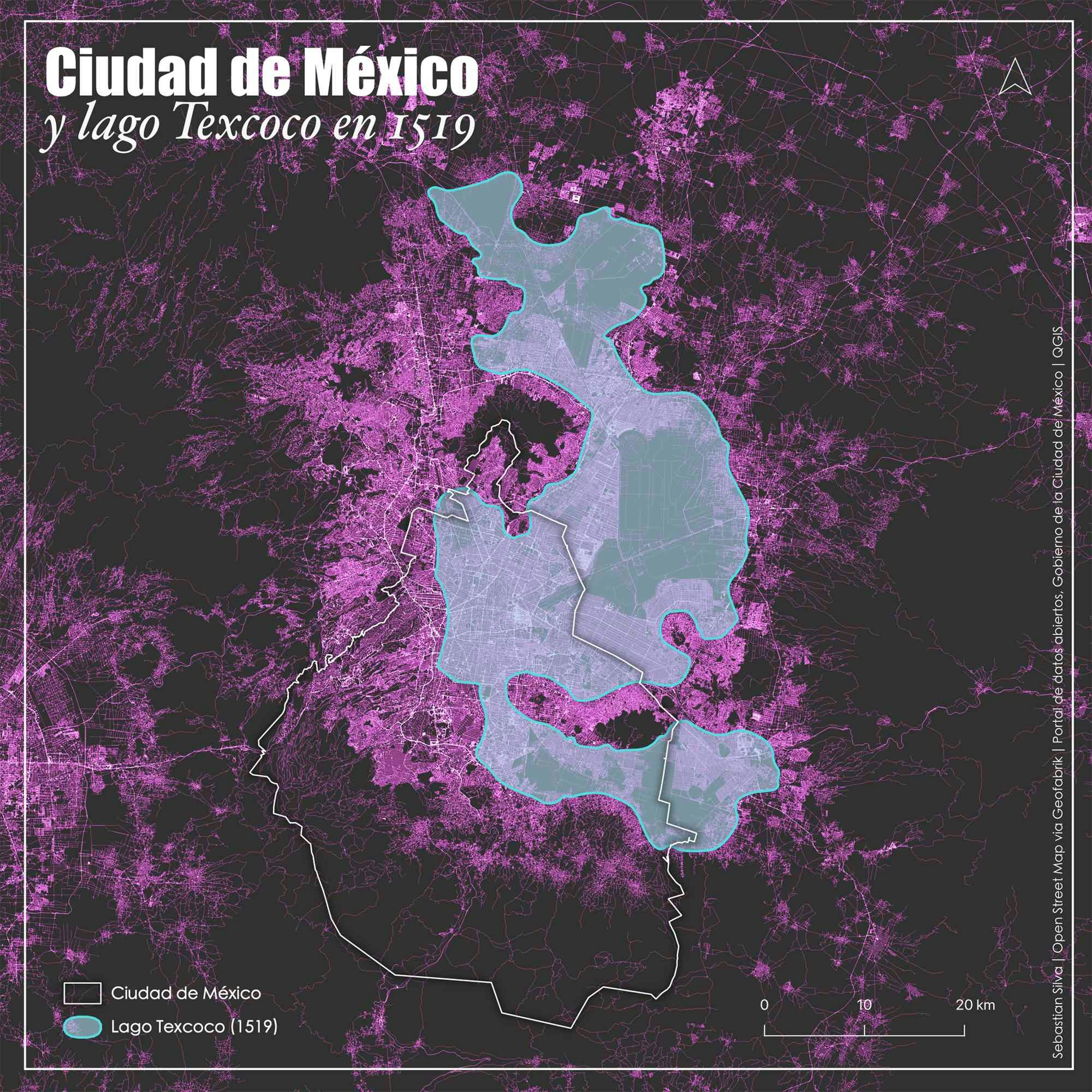
Texcoco lake, Mexico City - 1519

Tools used
QGIS
More by Sebastian Silva

You might also like


Join the community!
We're a place where geospatial professionals showcase their works and discover opportunities.
Texcoco lake, Mexico City - 1519
More by Sebastian Silva
You might also like
We're a place where geospatial professionals showcase their works and discover opportunities.