
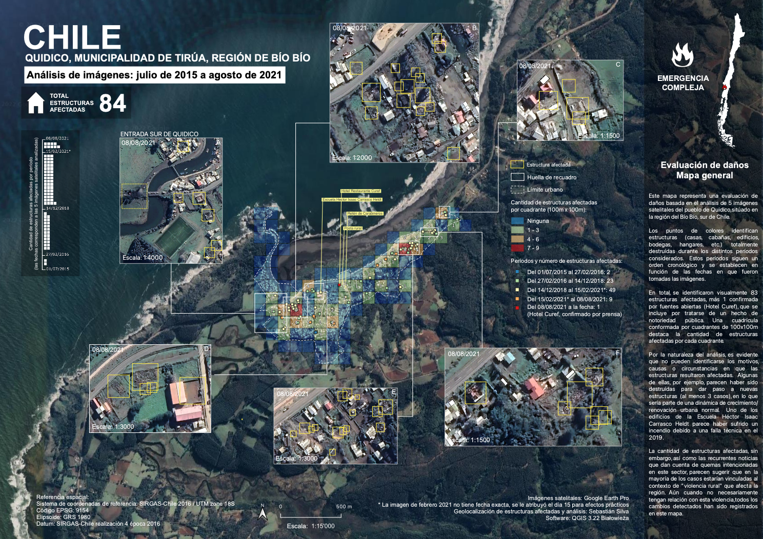
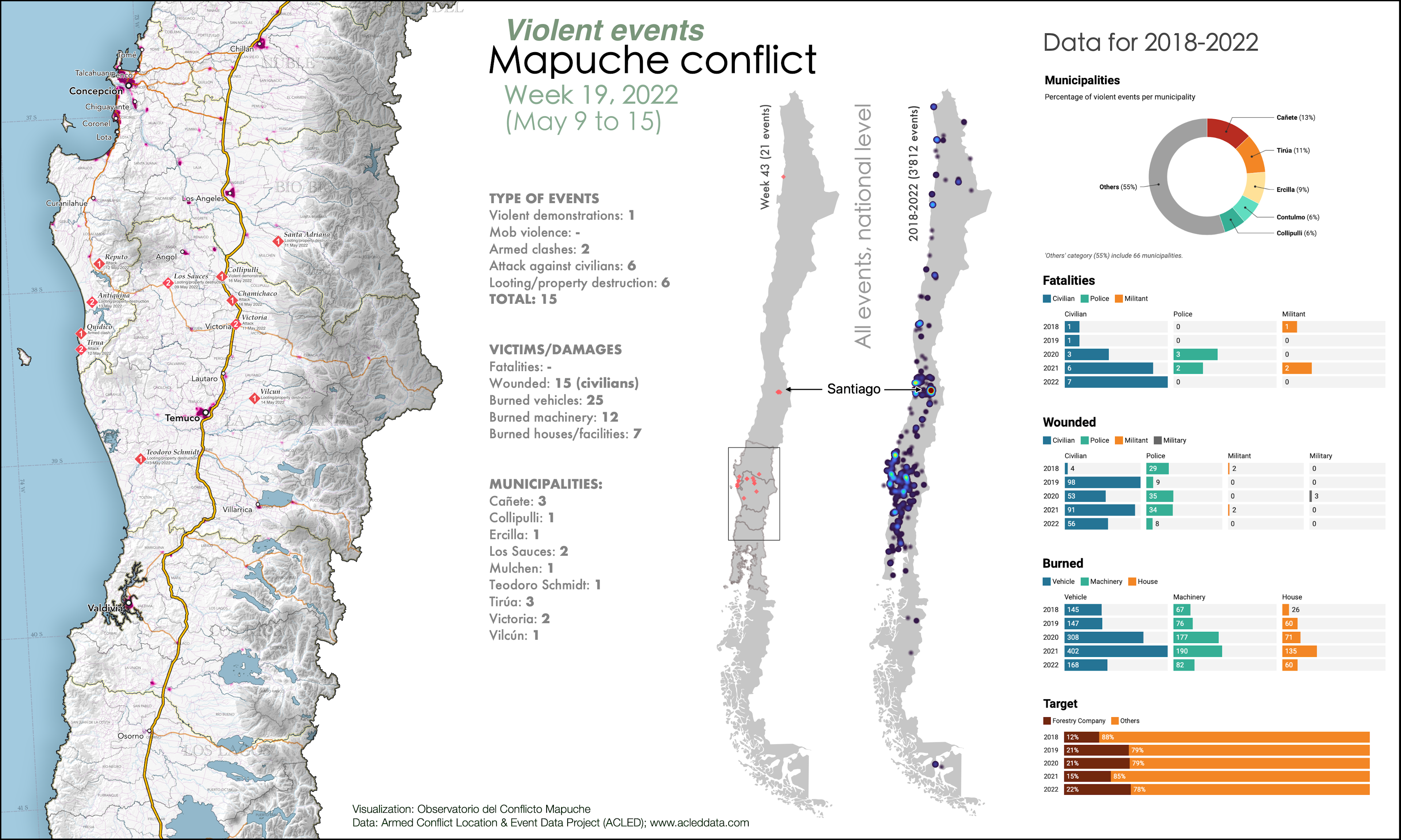
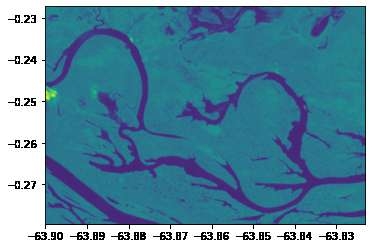
Damage assessment, Quidico (Chile)
Damage assessment, Quidico (Chile)
Tools used
QGIS
Plug-ins used
QuickMapServices
tags
ImageIntimagery analysisQGIS
More by Sebastian Silva

You might also like


Join the community!
We're a place where geospatial professionals showcase their works and discover opportunities.