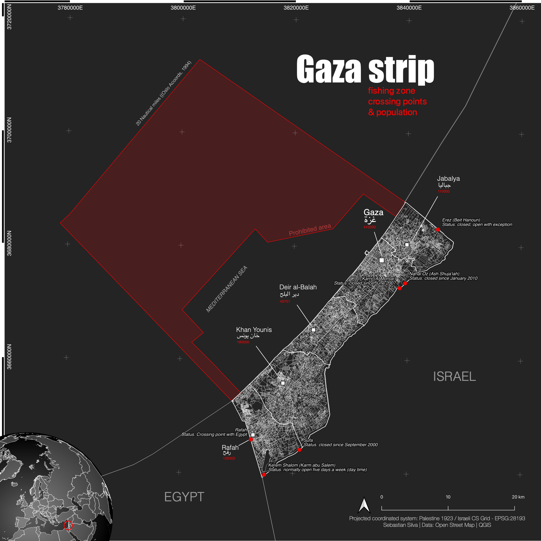
Gaza Strip: fishing zone, cross. points

Tools used
QGIS
More by Sebastian Silva

You might also like


.svg "Alec Soltes")


Join the community!
We're a place where geospatial professionals showcase their works and discover opportunities.
Gaza Strip: fishing zone, cross. points
More by Sebastian Silva
You might also like
We're a place where geospatial professionals showcase their works and discover opportunities.