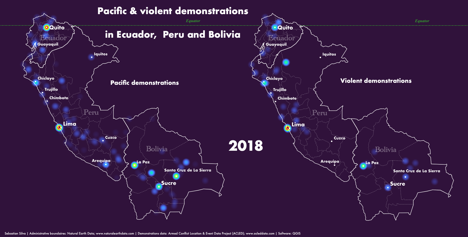
Demonstrations in the Andean region,2018

Tools used
QGIS
More by Sebastian Silva

You might also like


Join the community!
We're a place where geospatial professionals showcase their works and discover opportunities.
Demonstrations in the Andean region,2018
More by Sebastian Silva
You might also like
We're a place where geospatial professionals showcase their works and discover opportunities.