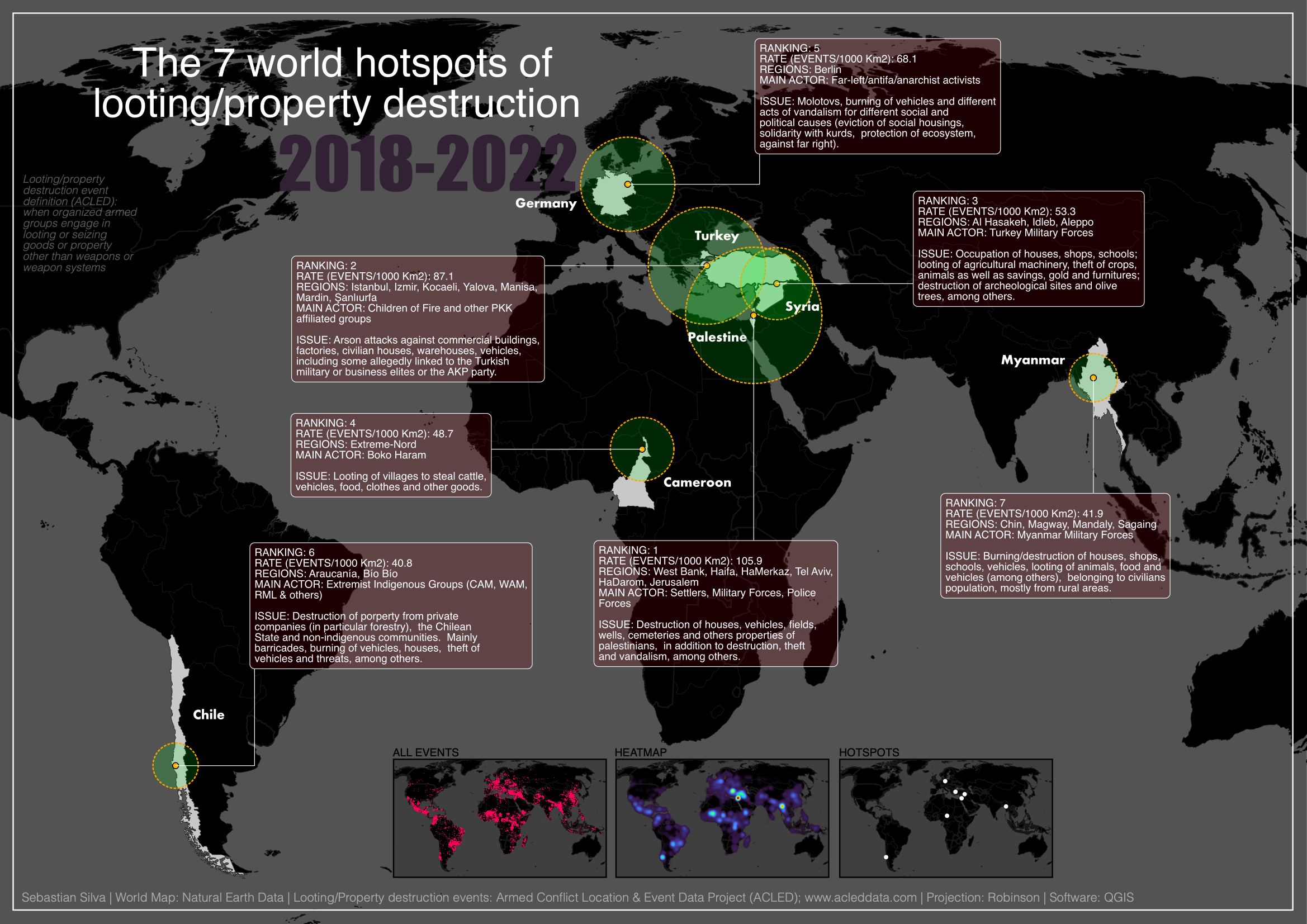
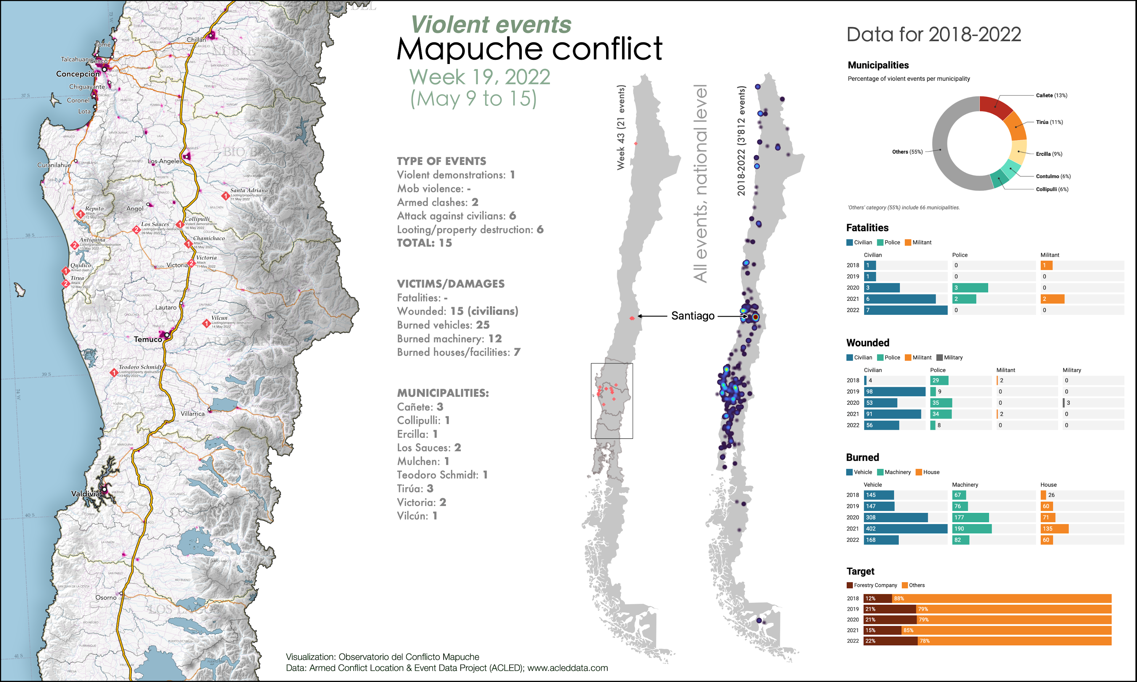
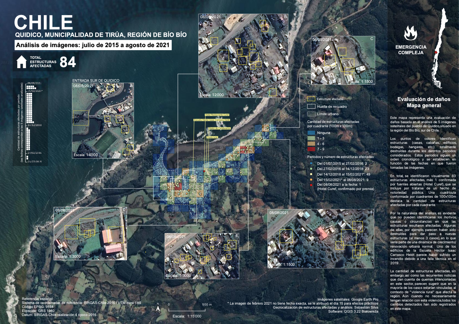
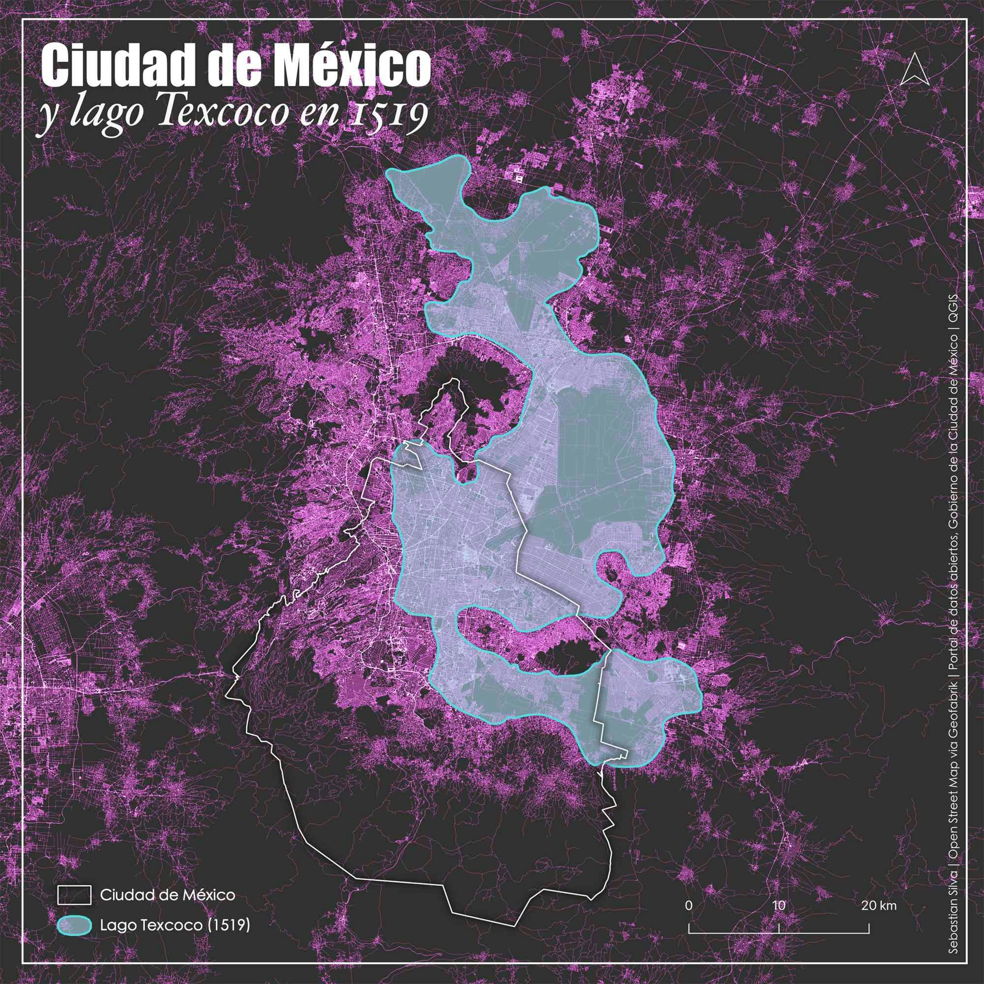
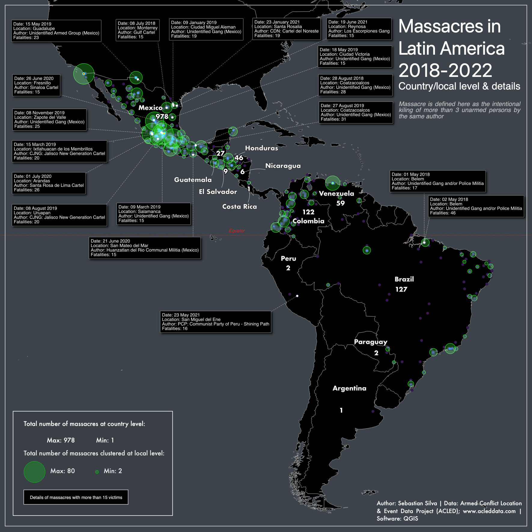
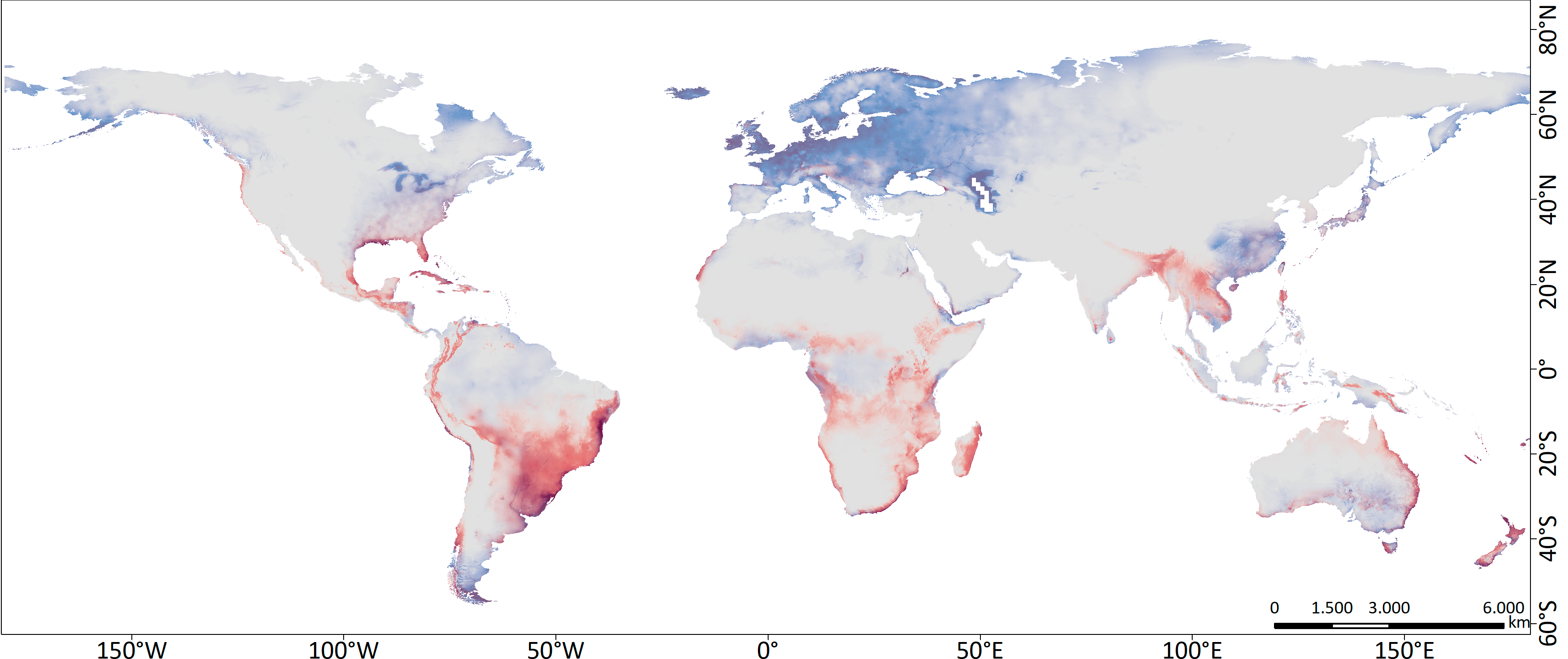
Looting/destruction world hotspot

Tools used
QGIS
More by Sebastian Silva

You might also like


.png&w=3840&q=100)


Join the community!
We're a place where geospatial professionals showcase their works and discover opportunities.
Looting/destruction world hotspot
More by Sebastian Silva
You might also like
We're a place where geospatial professionals showcase their works and discover opportunities.