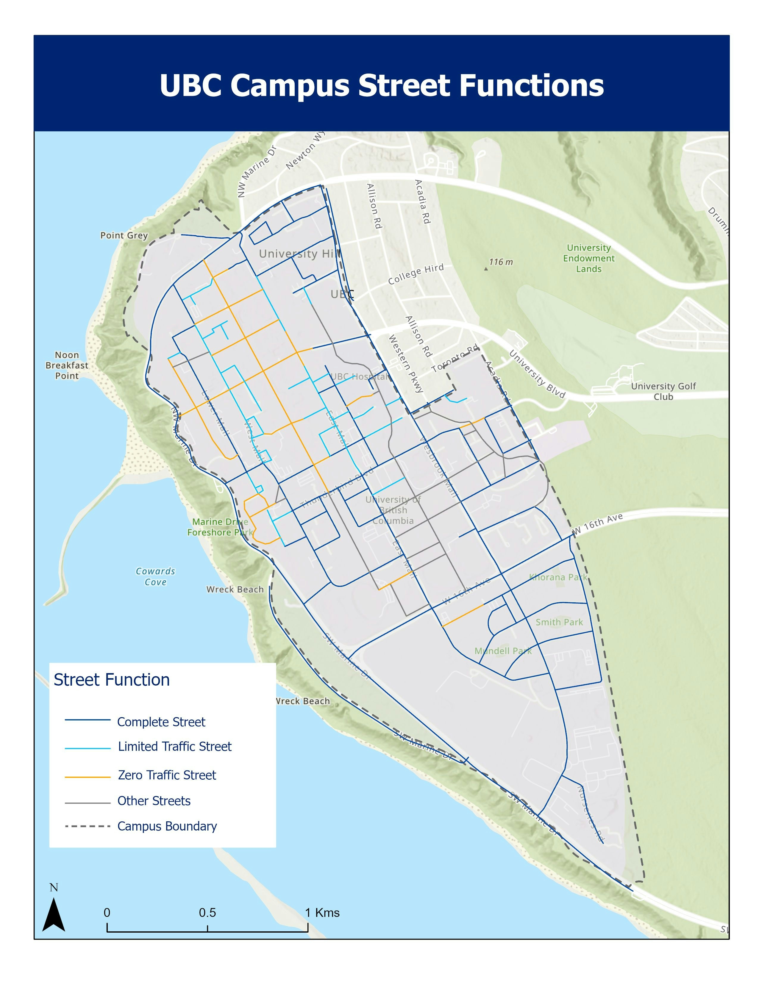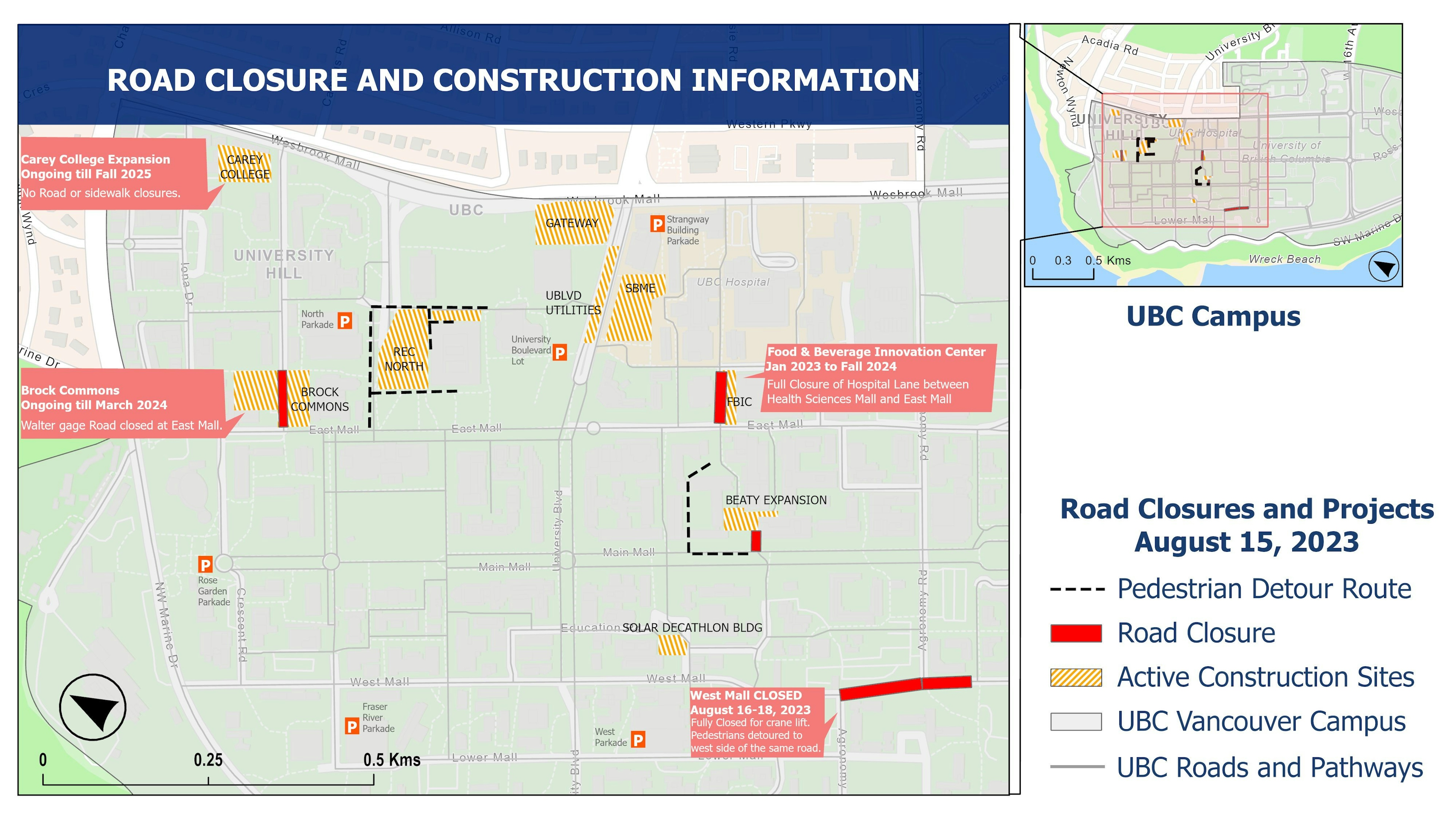
•Created for communicating information about roadworks, construction and route changes to the public
•Appropriate legend and easy-to-read symbology used for easier interpretation
• A combination of dark blue and white for the title and other headings was used as per requirements.
•A small-scale map has been included on the right for site context.
•Light grey legend is used for existing routes.
•Facilities under construction and parking lots are also highlighted in the map.