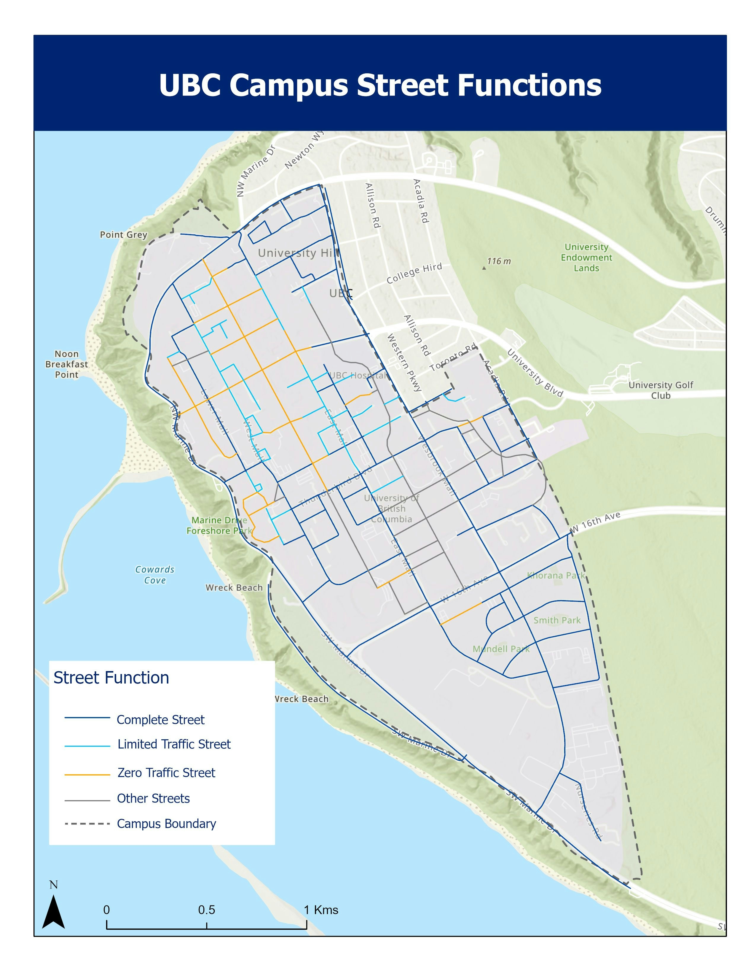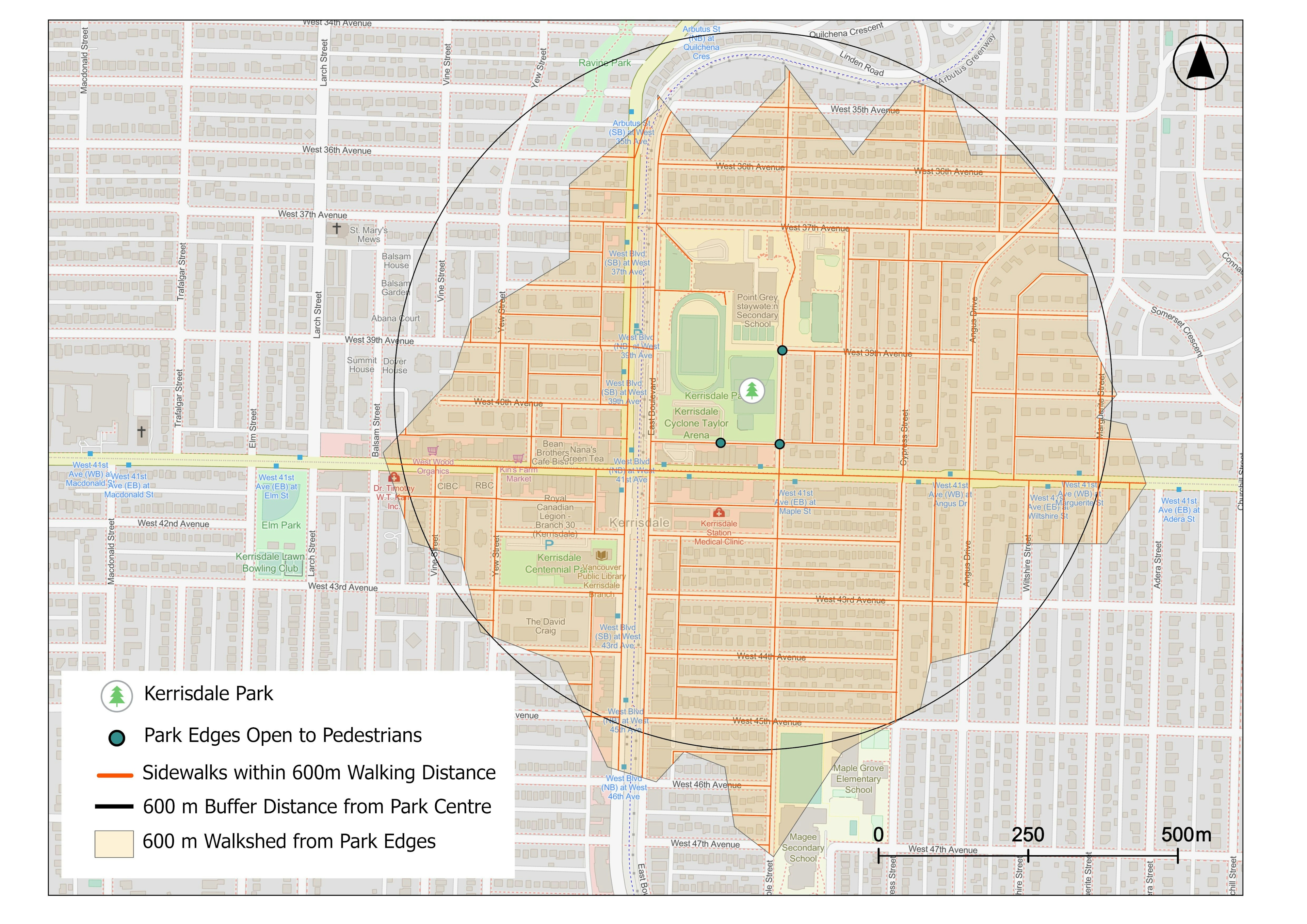
A Map created as a part of Site Redesign Project last year (2022). A Walkshed Analysis, used to understand walk or bike access to a site, was conducted to comprehend the amenities available in proximity to the park.
Open Data used from City of Vancouver VanMap portal. Used Summarize Nearby Tool from the Analysis Toolbar in ArcGIS Pro. Another possible way to conduct the same analysis is through Service Area Tool in Network Analysis Toolbar.