
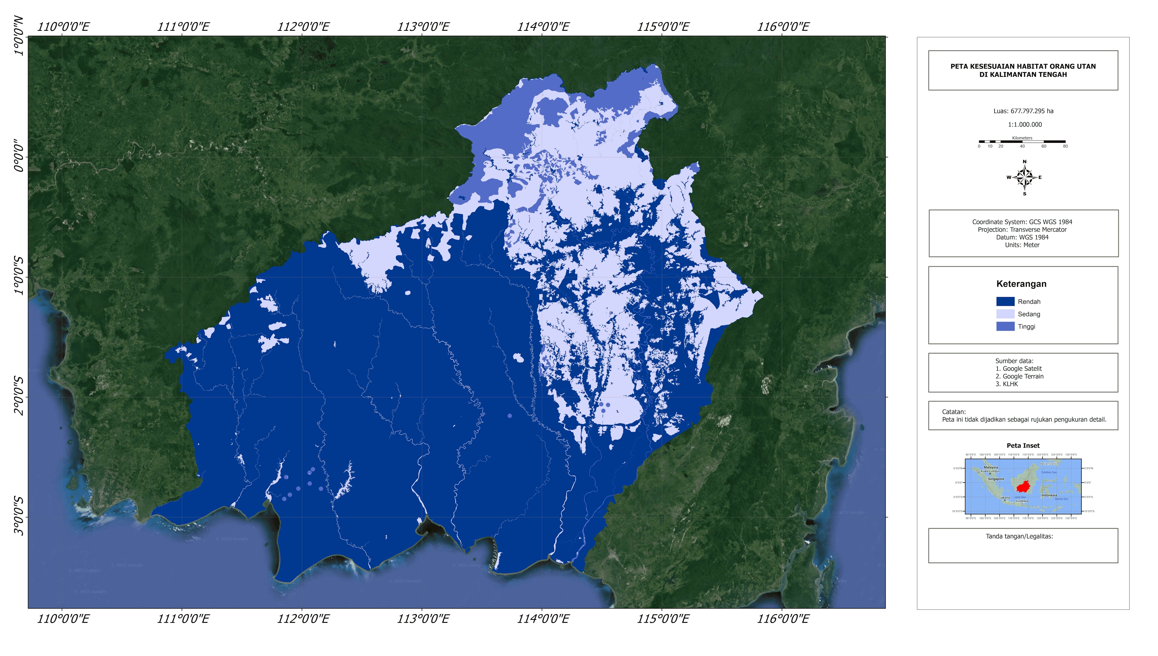
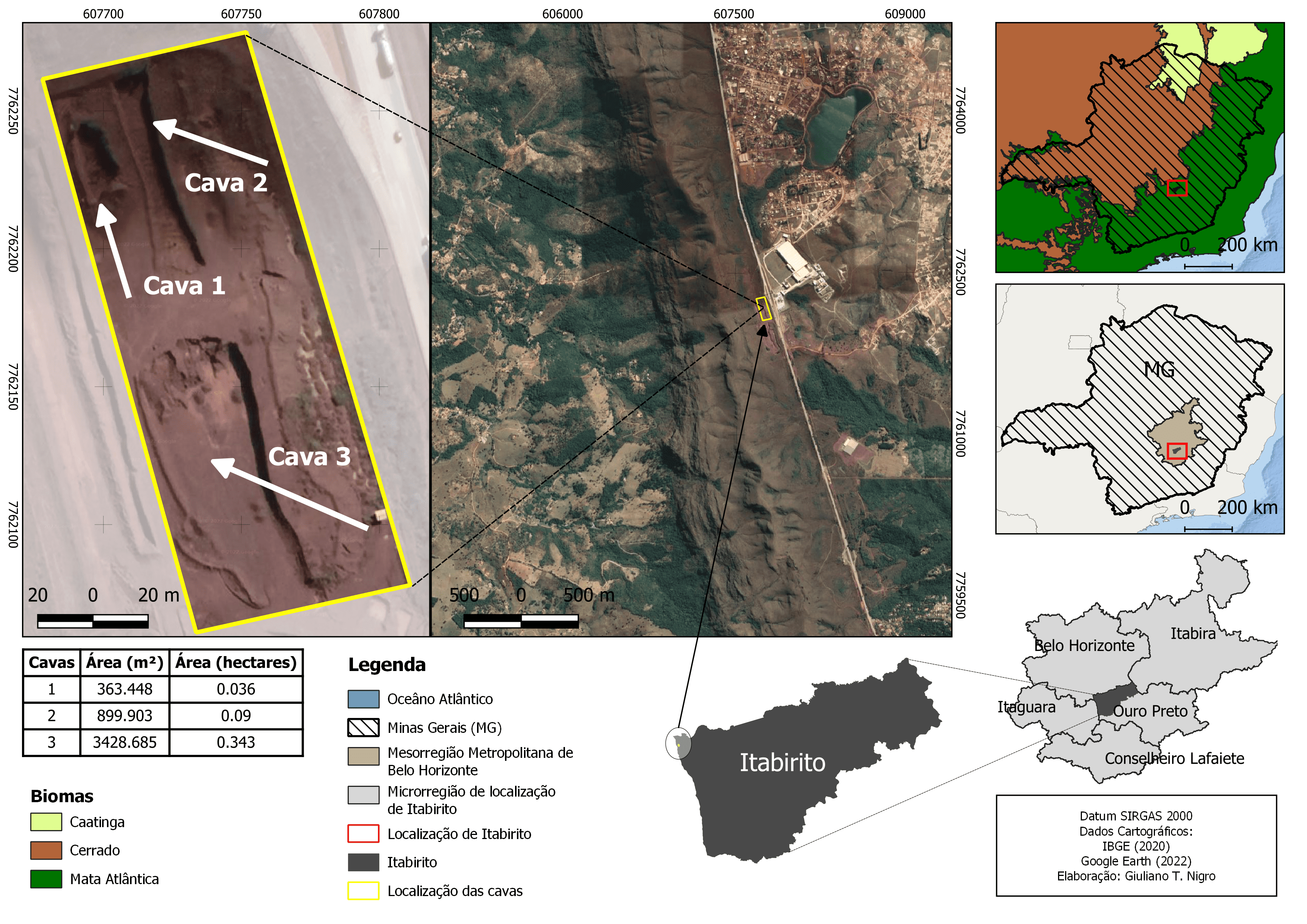
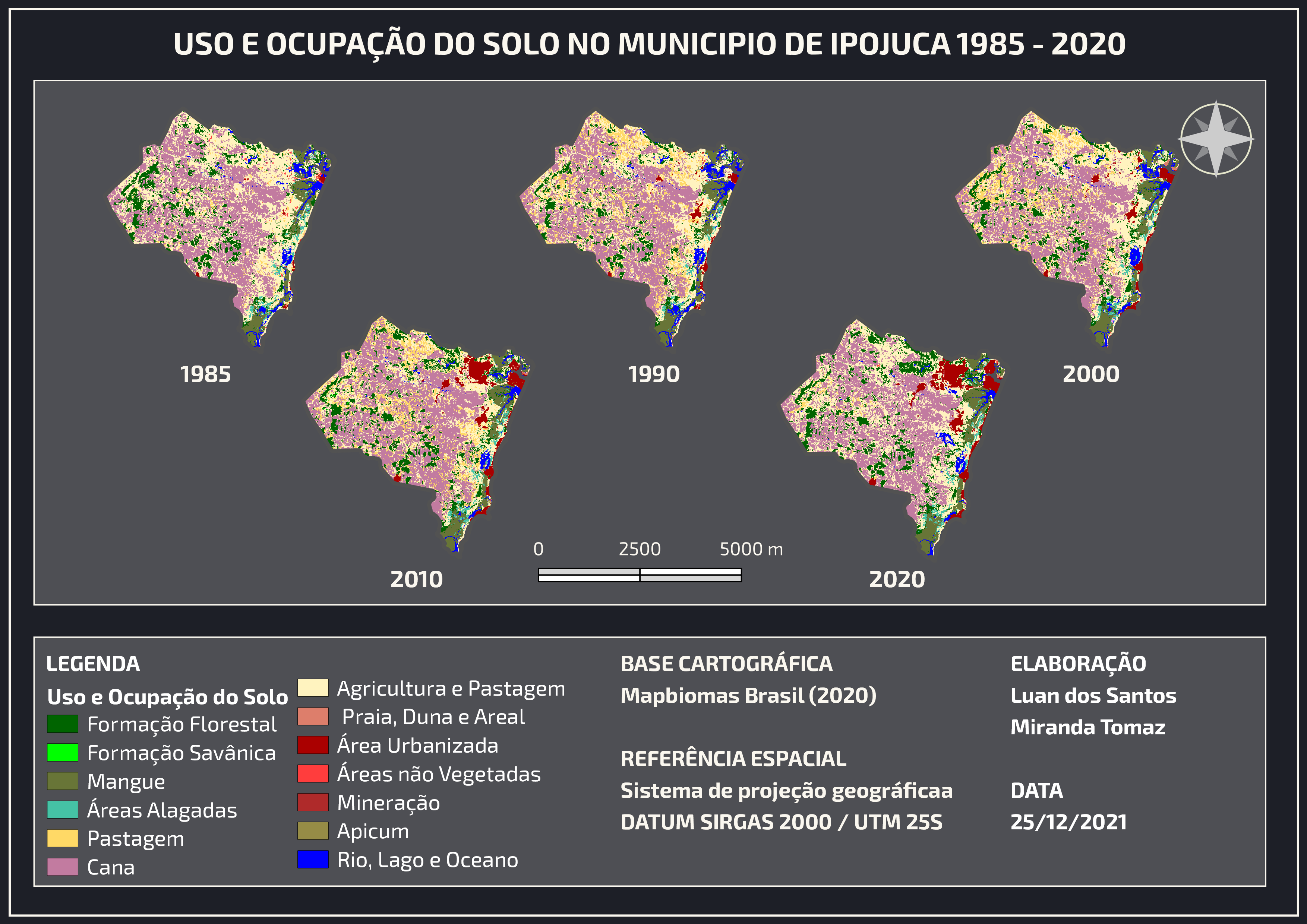
Map making is done by considering 3 parameters which are weighted for each parameter. The parameters used are data on species presence, land cover, and water availability. If the score < 40 then the suitability level is low, if it is between 40 and 60 it is moderate, and > 60 it is high suitability.
Orangutan Habitat Suitability
Tools used
Adobe PhotoshopArcMap
Plug-ins used
image classification
tags
#Habitat SuitabilitySpatial analyst
More by Ilham Muhammad Shuhada


You might also like


Join the community!
We're a place where geospatial professionals showcase their works and discover opportunities.