
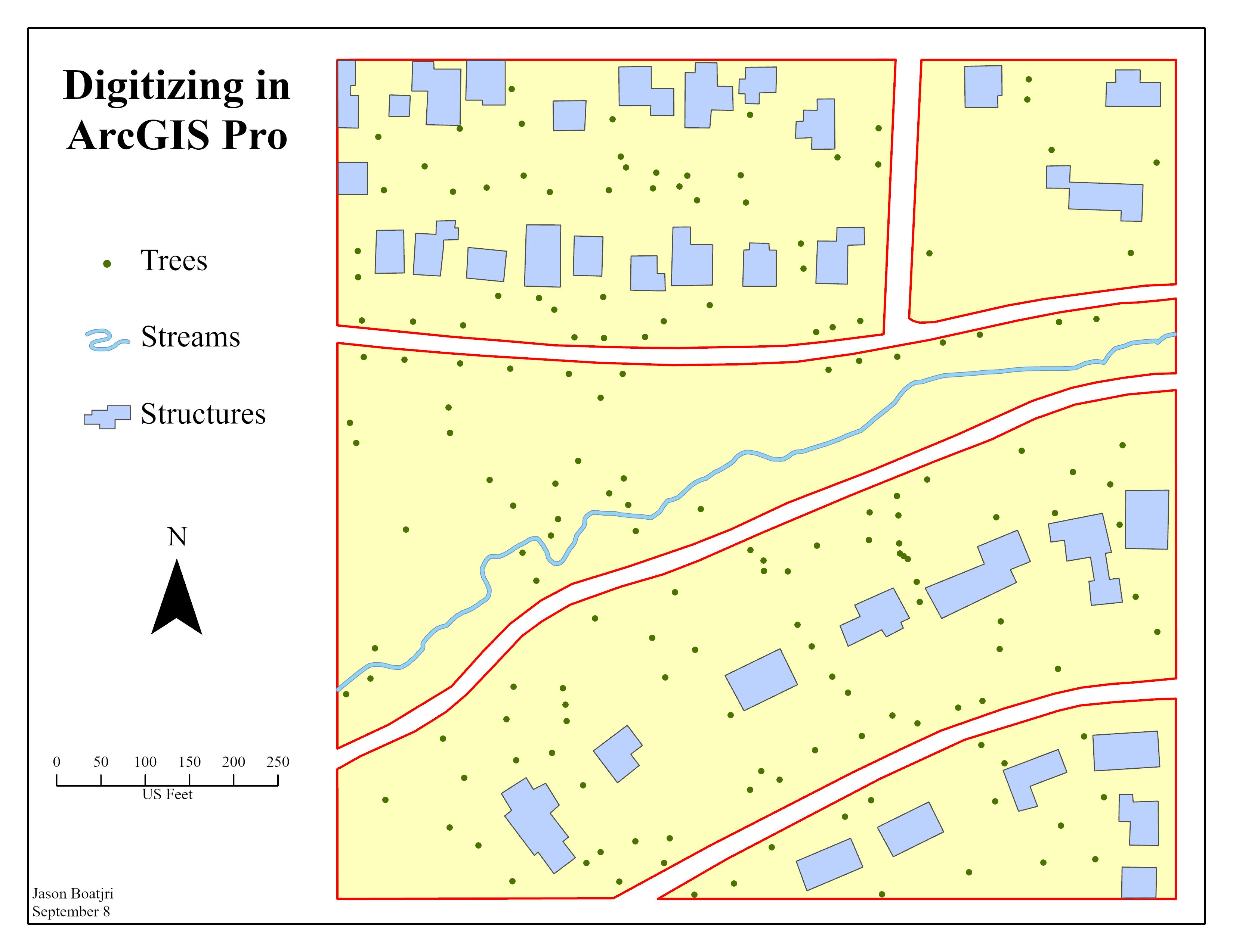
An assignment I have done in my cartography class, digitizing a satellite image of a neighborhood into vector layers. The layers consist of a polygon feature class for structures, a polyline feature class for streams, and a point feature class for trees.
Digitizing Image of a Neighborhood
Tools used
ArcGIS Pro
Plug-ins used
Digitizing
tags
digitising
More by Jason Boatjri


You might also like


_2067263.png&w=3840&q=100)


Join the community!
We're a place where geospatial professionals showcase their works and discover opportunities.