

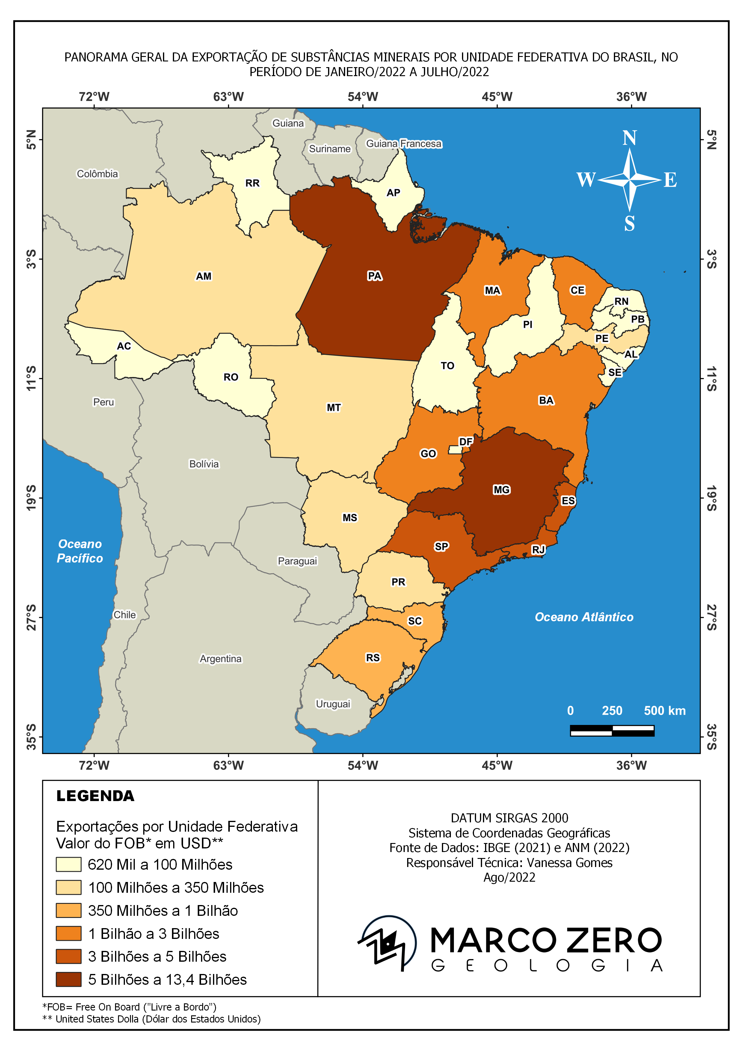
The Greater Atlanta Metro area map illustrates the changes in urban land cover from 2000 to 2011. Notably, suburban areas like Fairburn and McDonough experienced exponential growth, whereas the core of Atlanta saw minimal development. Data evidence points out that the Outer Zone and Outer Periphery populations increased by more than 30% since 2000. The project utilized NDVI data from 2000 and 2011, specifically Landsat data of impervious surfaces. By subtracting the two years using raster calculator, I identified changes in urban areas. I created a sensitivity threshold to detect urban changes by reclassifying the raster image and setting a value greater than 0.1. The statistics for the population were harvested from the 2000 and 2010 U.S. Census Bureau. I incorporated this data with county shapefiles using a spatial join and created a multiple-ring buffer to divide the area into four 12 km zones. I then used summary statistics to compare the two years and calculated the growth percentages for each zone.
Urban Change of Greater Atlanta
Tools used
ArcGIS Pro
Plug-ins used
Data Managementmultiple ring Buffersraster calculatorSpatial Join
tags
urban sprawl
More by Jason Boatjri


You might also like


_2239484.png&w=3840&q=100)


Join the community!
We're a place where geospatial professionals showcase their works and discover opportunities.