

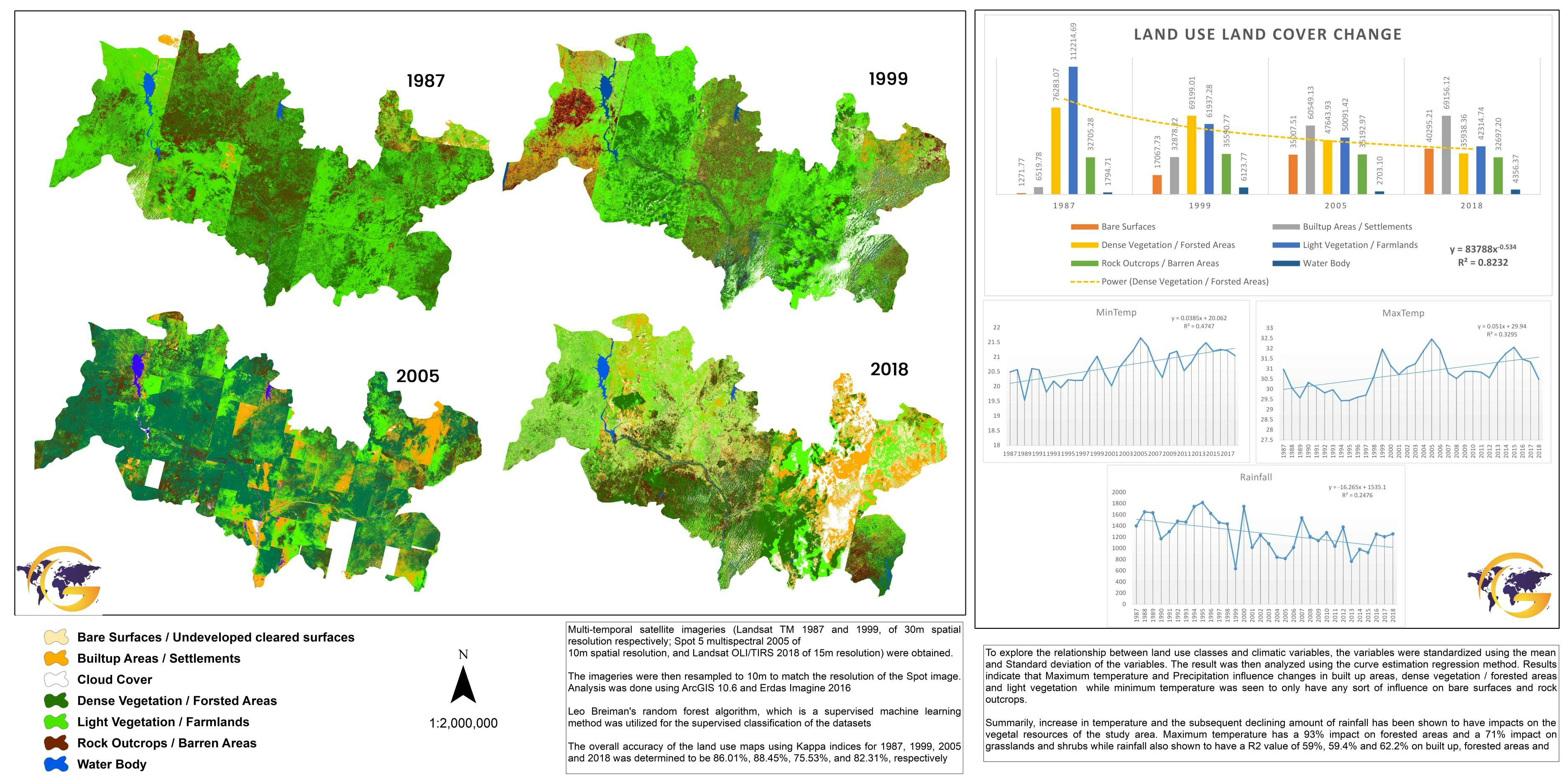
In this project, I frame a map analyzing auto store sales visualized by block groups in the Roanoke, Virginia area using the sale records and customers' addresses attached. The methodology is the number of customers in each block group divided by the total of match addresses processed from the geocoding address tool. The number is then converted into a percentage by times 100. The results were that after 3 miles there was a sharp decline in visiting patrons, and the bulk of the customers were within 3 miles of the store. The geoprocessing tools used for boundary were multiple ring buffers and buffer based on clusters of where customers lived. Spatial data was formed utilizing geocoding addresses, summarize within, merge, and feature class to feature class.
Percent of Sales by Block Group
Tools used
ArcGIS Pro
Plug-ins used
Conversion ToolsData ManagementGeocodingSpatial analysis,
tags
Spatial analyst
More by Jason Boatjri


You might also like


.jpg&w=3840&q=100)


Join the community!
We're a place where geospatial professionals showcase their works and discover opportunities.