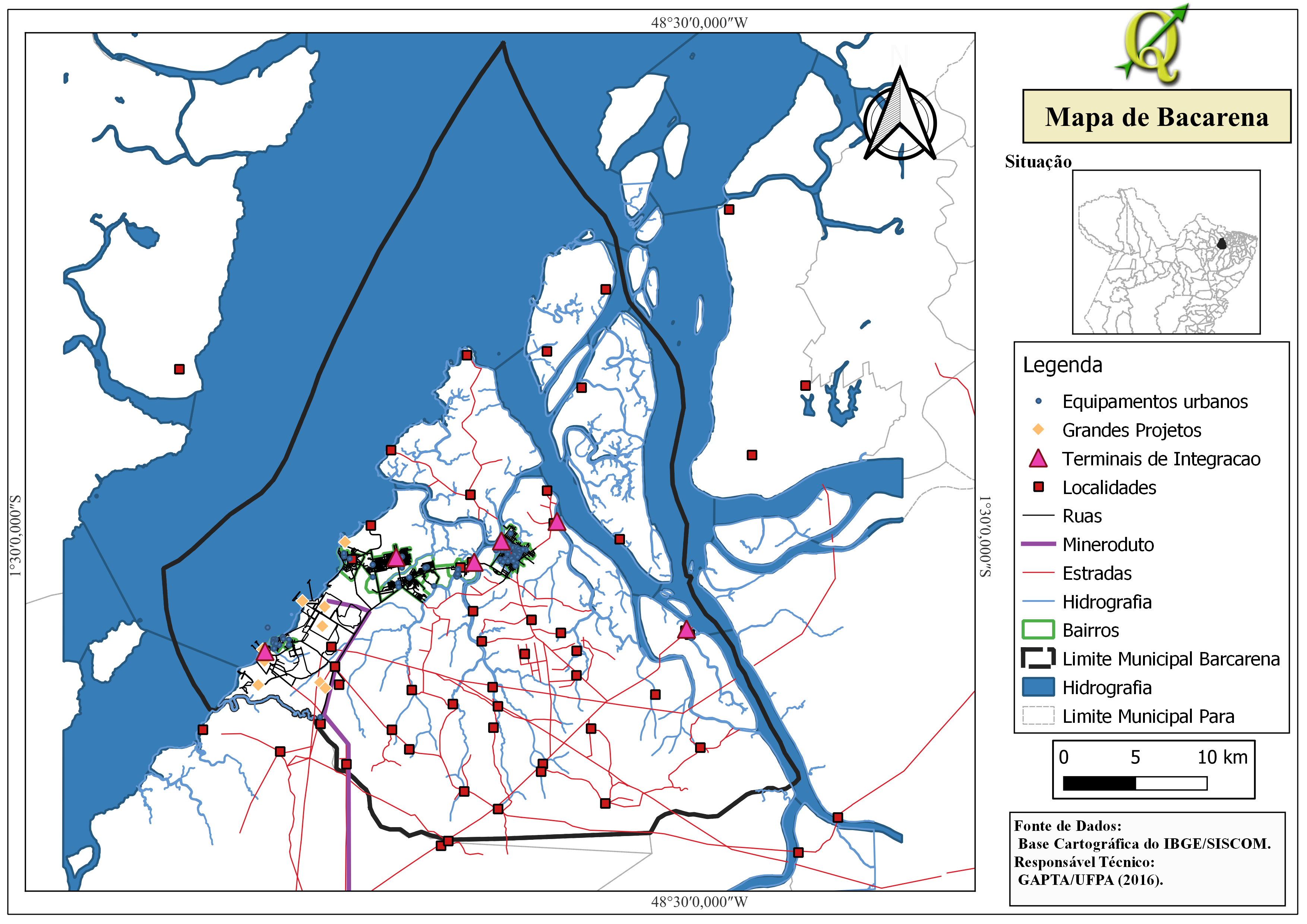
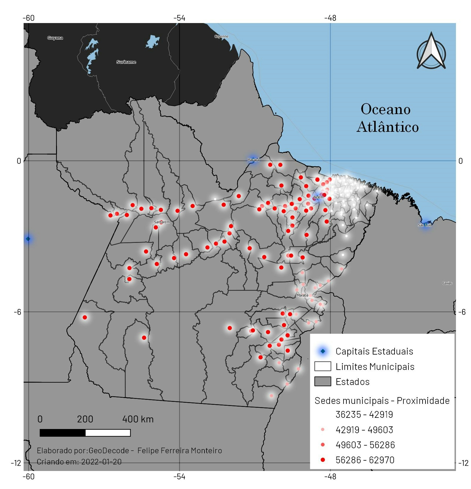
Sign up or log in to your Spatialnode account.

Takes less than a few seconds.

Mapa de Bacarena

Fenando Paulo Neto Alberto
Fenando Paulo Neto Alberto•

January 12, 2022

Mapa de Bacarena


Tools used

QGIS

Plug-ins used

geemap

tags

geemapMapserverQGISSupermap GIS

More by Fenando Paulo Neto Alberto

Representação do Relevo de Monte Azul-MG
23
Modelo Digital de Elevação 3D
21
Mapa Topografico de Petrópolis - RJ
547
Zonas De Angola
Zonas De Angola
39
MAPA DE LOCALIZAÇÃO MONTE AZUL-MG
505
MAPA DE LOCALIZAÇÃO D´SÃO JOÃO - GO
241
MAPA TOPOGRÁFICO DE SÃO JOÃO D´ALIANÇA
180
LÍNGUAS NACIONAIS DE ANGOLA
2.6K
Modeo 3D da Altitude de Monte Azul-MG
393
Mapa de Localização Tala Hady
362
Mapa Demográfico de Angola
644
Relevo Natural de Angola
412

You might also like

MANDERA LOCATION CONTEXT MAP (KENYA)
MOSES MWANIA MULYUNGI
MANDERA LOCATION CONTEXT MAP (KENYA)
MOSES MWANIA MULYUNGI
13
Oil Spills Using GIS and Remote Sensing
Mercy Onaopemipo Akintola
Oil Spills Using GIS and Remote Sensing
Mercy Onaopemipo Akintola
60
Building UIs in Earth Engine Apps
Zach Torres
Building UIs in Earth Engine Apps
Zach Torres
63
Mapping - Wildlife Analysis
Jeffrey Erwin
Mapping - Wildlife Analysis
Jeffrey Erwin
5
Vegetation Health Analysis using NDVI
Ogungbemi Ezekiel Tobiloba
Vegetation Health Analysis using NDVI
Ogungbemi Ezekiel Tobiloba
19
ENSINO DE GEOGRAFIA - 9º ANO (EUROPA)
Itamar Sateles de Sá
ENSINO DE GEOGRAFIA - 9º ANO (EUROPA)
Itamar Sateles...
46
Hexagonal Population Map in Makassar City
Bimo Aji Widyantoro
Hexagonal Population Map in Makassar City
Bimo Aji Widyantoro
126
2D Shaded relief map of Africa.
Bamidele Daniel Ohinoyi
2D Shaded relief map of Africa.
Bamidele Daniel Ohinoyi
72
Fragmentation - random forest algorithm
Emilian
Fragmentation - random forest algorithm
Emilian
11
Jaguar corridors Orinoco basin- Colombia
Angela Mejia
Jaguar corridors Orinoco basin- Colombia
Angela Mejia
10
School network - unavailability  of OSM
Girma Kussa
School network - unavailability of OSM
Girma Kussa
50
Kootenai River REM
Matt Dempsey
Kootenai River REM
Matt Dempsey
14

Join the community!

We're a place where geospatial professionals showcase their works and discover opportunities.

Sign Up for free