Sign up or log in to your Spatialnode account.

Takes less than a few seconds.

Africa Landuse Use Map

Adedoyin Ajeyomi
Adedoyin Ajeyomi•

November 15, 2021

Africa Landuse Use Map

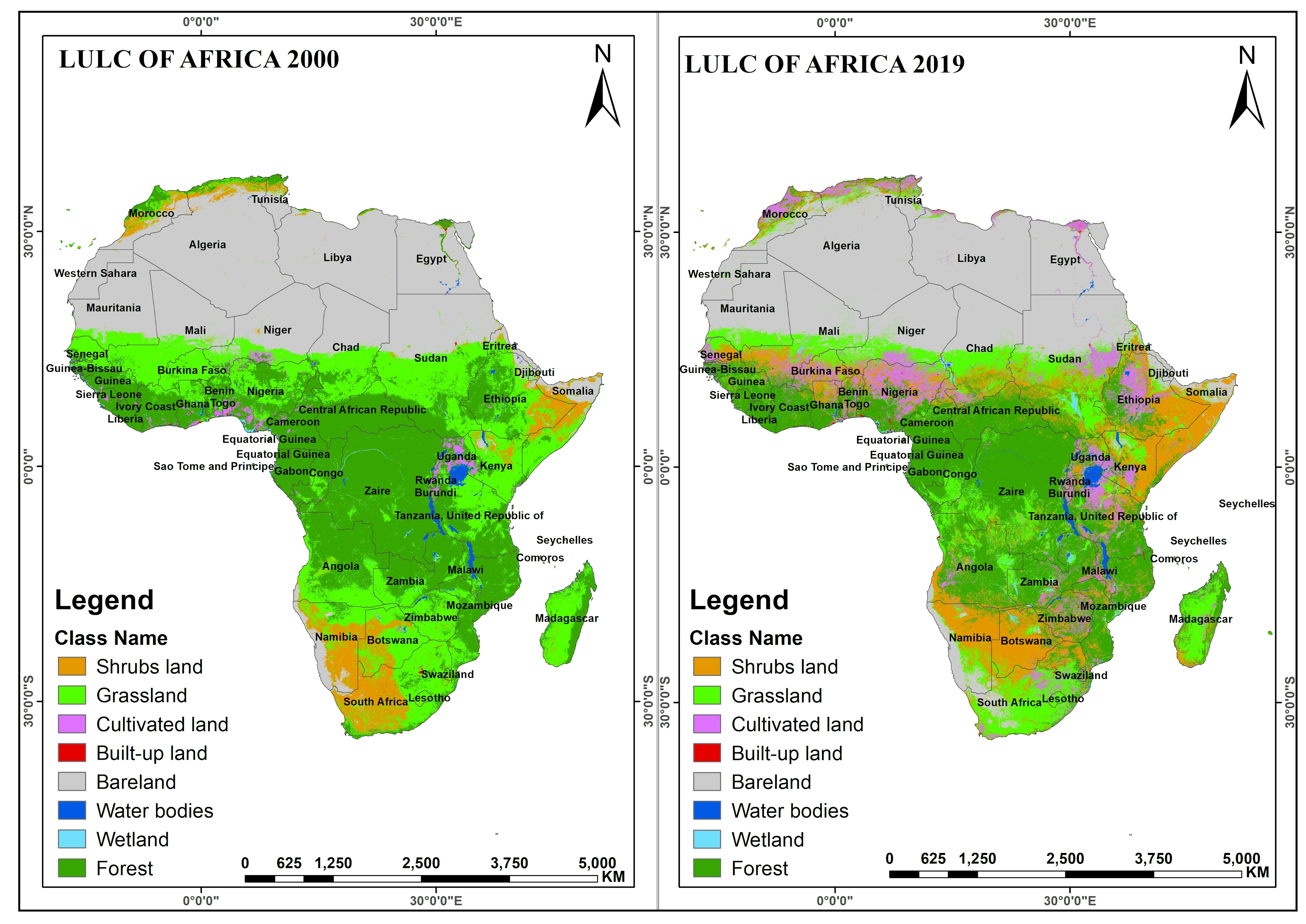
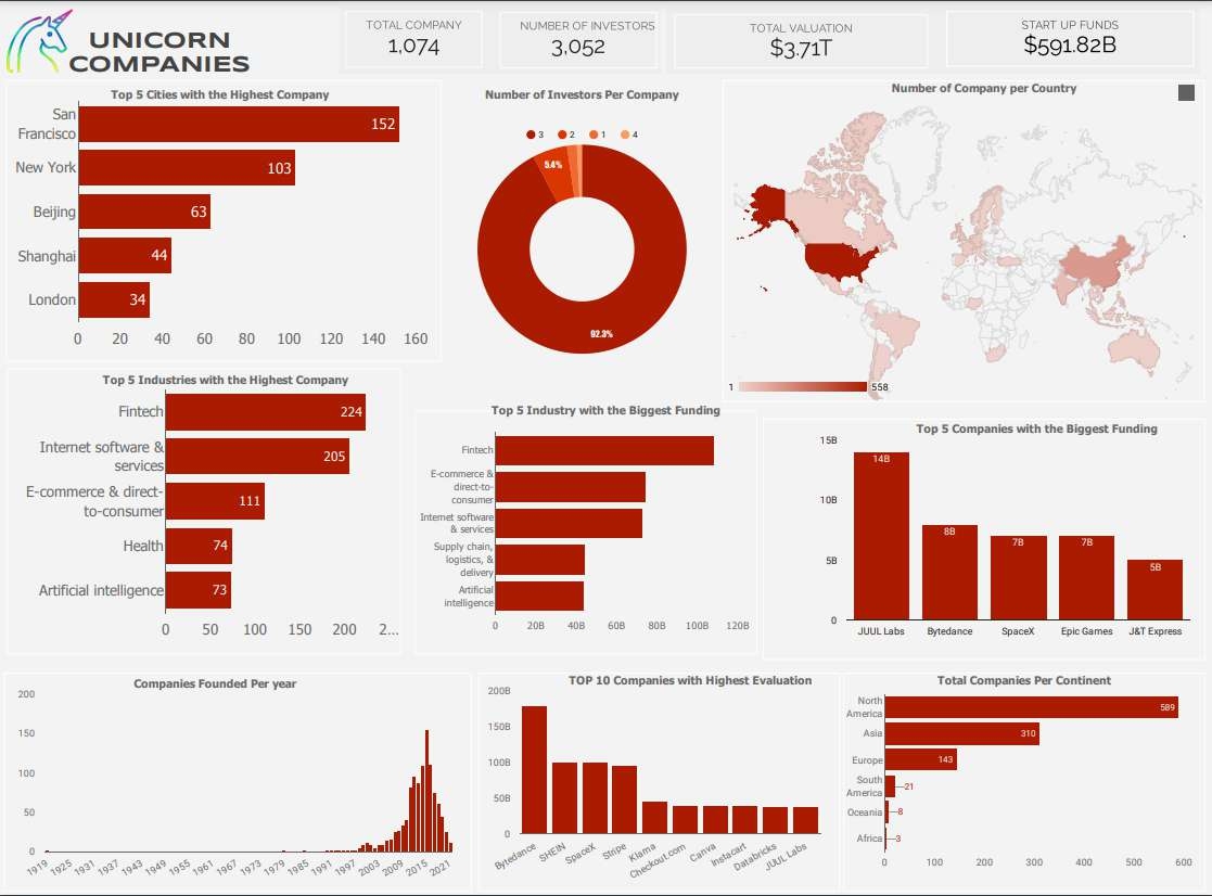
Africa LAnduse Map for 2000 and 2000 collected from Modis satellite using GEE and styled with Arcmap


Tools used

ArcMapGoogle Earth Engine(GEE)

Plug-ins used

ArcMap

tags

Esri

More by Adedoyin Ajeyomi

Land SURFACE Temperature
154
3 PANEL MAP
3 PANEL MAP
146
Suitability Map for Ski Resort
164
Hospital Accessibility Map
165
Cartographic basemap with hillshade
137
Soil Properties Map for Rivers State
559
2020 Land Use Land Cover Map of Africa
109
Risk Assessment Map
Risk Assessment Map
184
Lagos in a Single Map
444
Landuse Map from Sentinel 1
204
Lagos state population map
486
Unioncorn Companies Analytics
75

You might also like

Change Detection
Vincent Abere
Change Detection
Vincent Abere
98
Mapa de produção de trigo
Anderson. G.P
Mapa de produção de trigo
Anderson. G.P
83
IGR at the state level in Nigeria (2020)
Bamidele Daniel Ohinoyi
IGR at the state level in Nigeria (2020)
Bamidele Daniel Ohinoyi
58
Bicycle Parking Racks in Toronto
Marcelo Aguilera
Bicycle Parking Racks in Toronto
Marcelo Aguilera
409
3D Model of NZ Coastal Erosion Hotspot
Emmet O Donnell
3D Model of NZ Coastal Erosion Hotspot
Emmet O Donnell
18
Rios e Linha de Costa do Recife-PE
Carlos Alberto
Rios e Linha de Costa do Recife-PE
Carlos Alberto
23
Garbage Truck Route Within the Compound
Ebrahim Taher
Garbage Truck Route Within the Compound
Ebrahim Taher
39
Analise Temporal do NDVI médio
José  de Alencar Peixoto Filho
Analise Temporal do NDVI médio
José ...
42
Monterey Bay Diorama
Brett Peters
Monterey Bay Diorama
Brett Peters
49
Elevation Map Bay of Bengal (Bangladesh)
Loviena Garcia
Elevation Map Bay of Bengal (Bangladesh)
Loviena GarciaPro
13
EGNOS TRAN - Maritime
Kareen Bröker
EGNOS TRAN - Maritime
Kareen Bröker
19
Advanced map (analytical) - Slope
Fabrício H. Oda
Advanced map (analytical) - Slope
Fabrício H. Oda
5

Join the community!

We're a place where geospatial professionals showcase their works and discover opportunities.

Sign Up for free