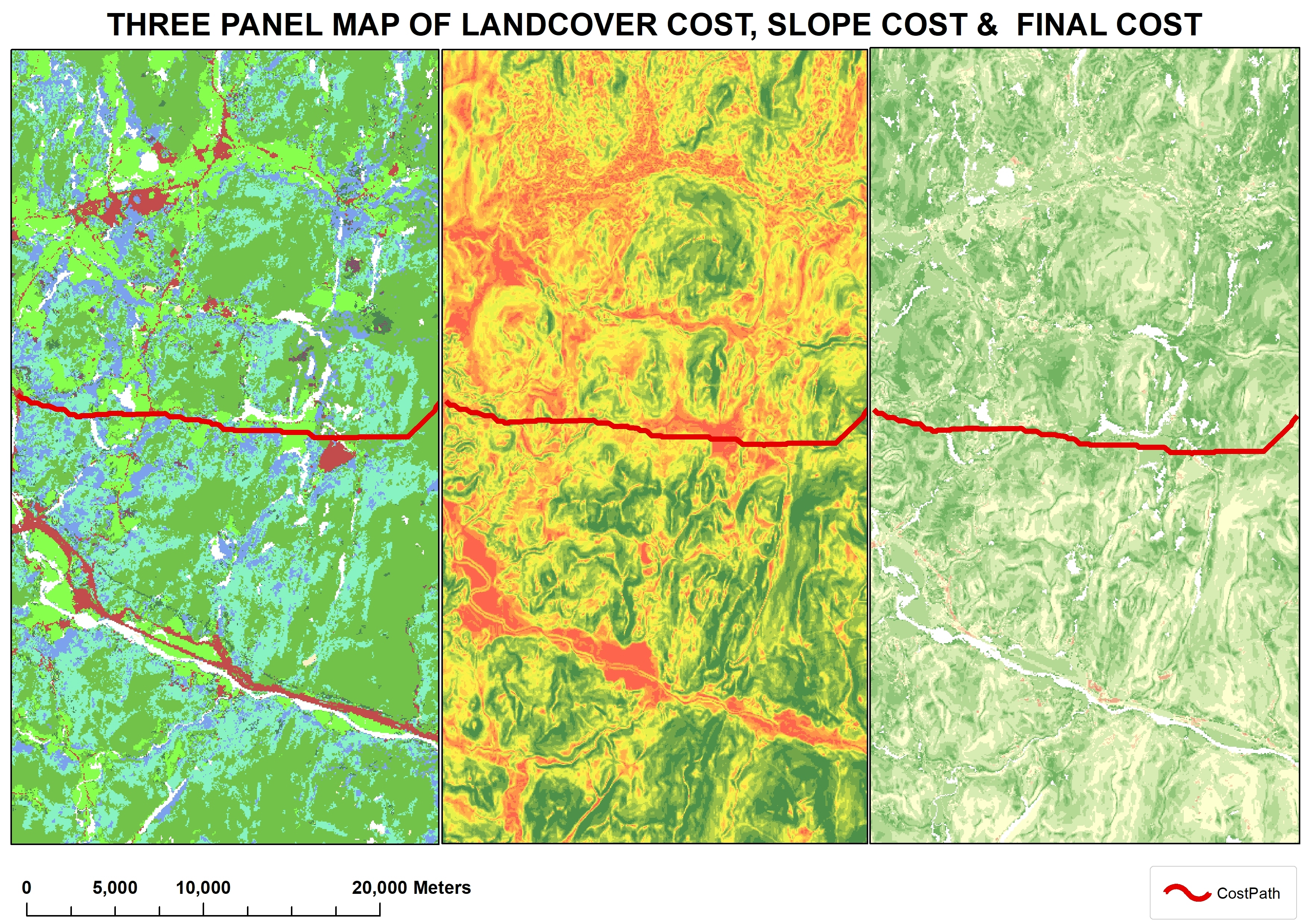
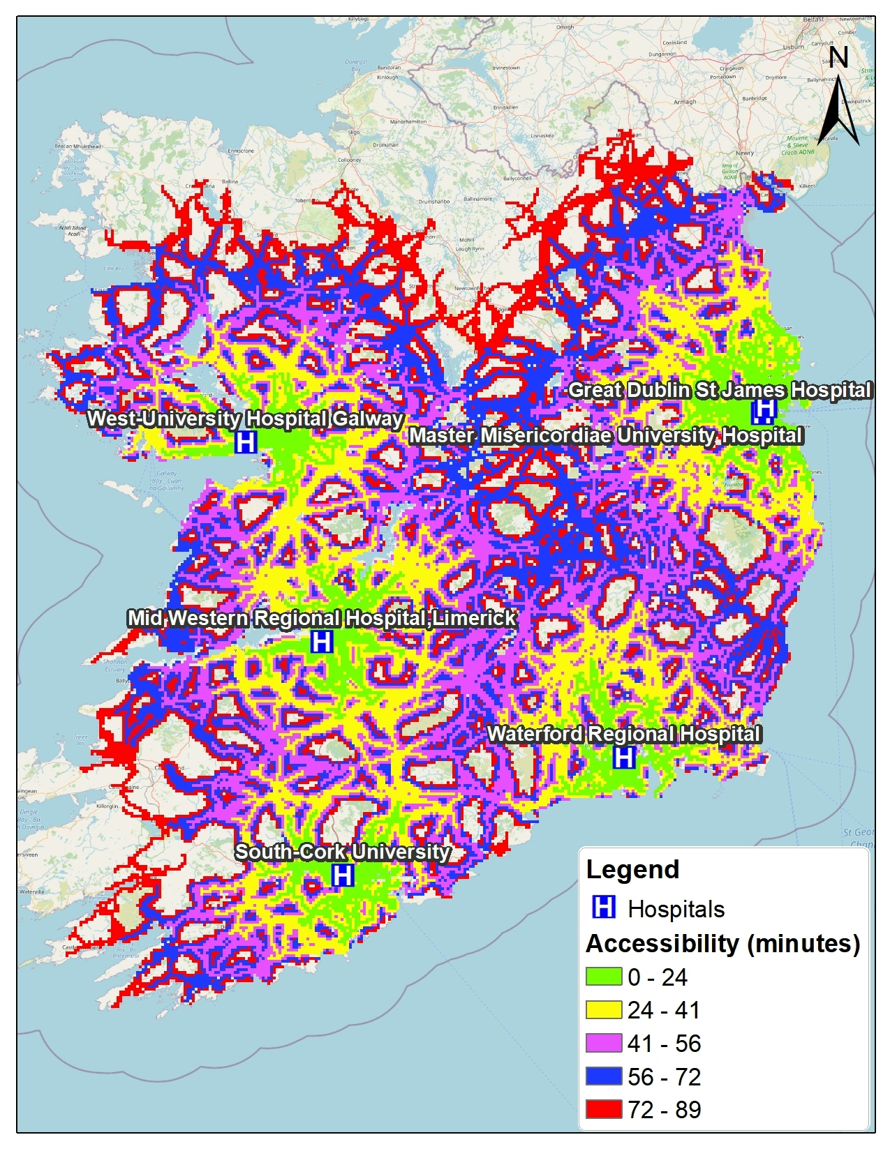
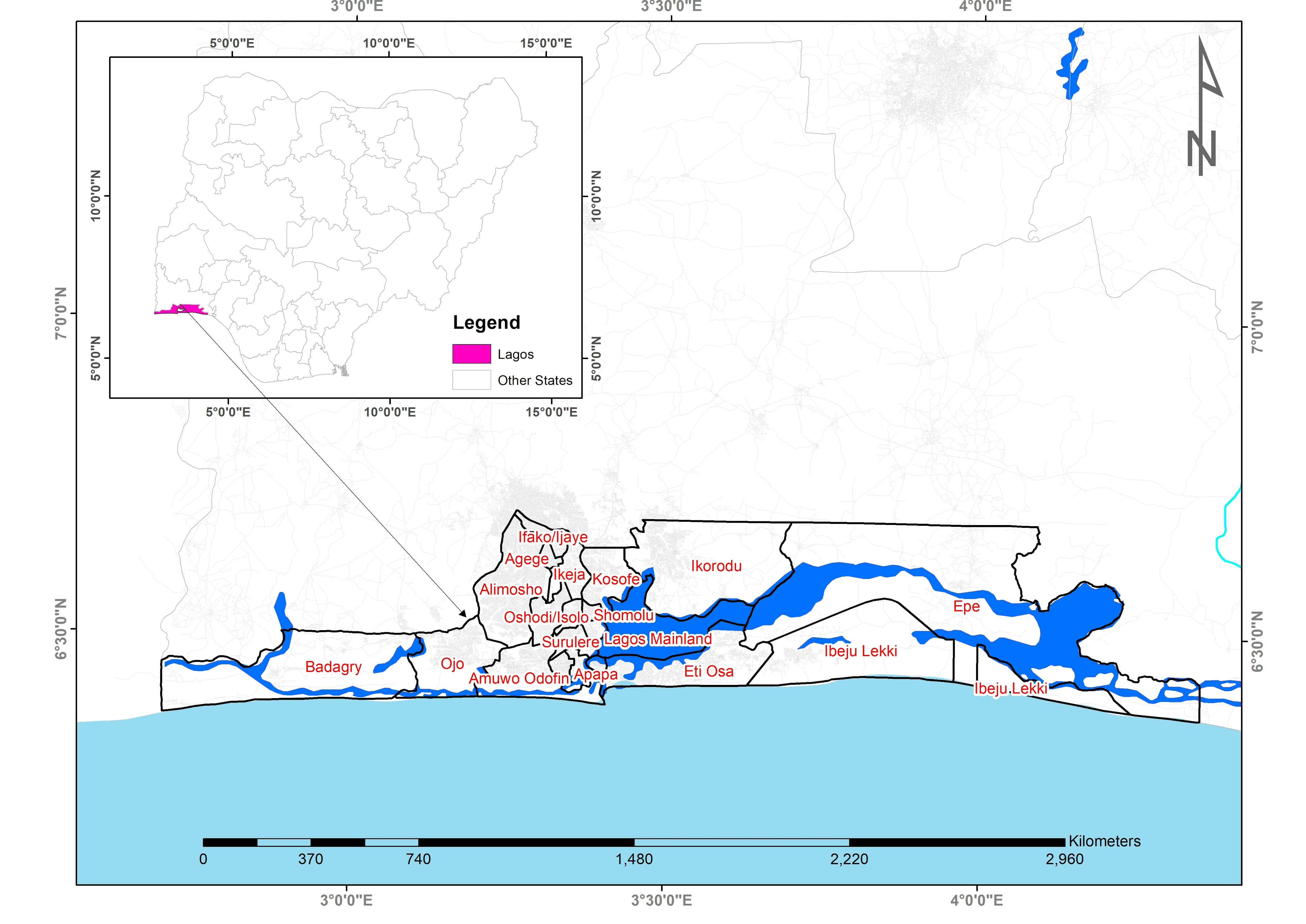
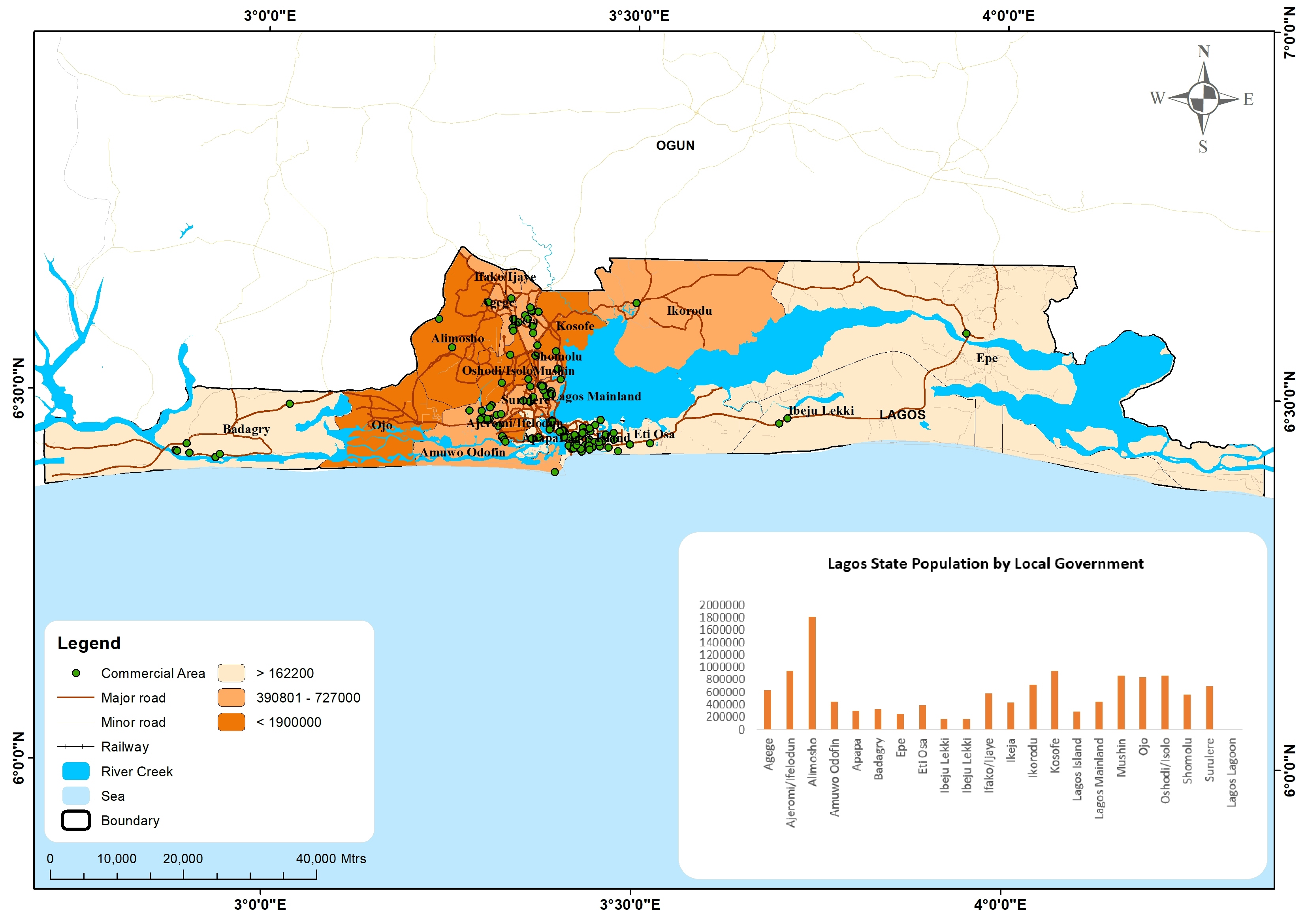
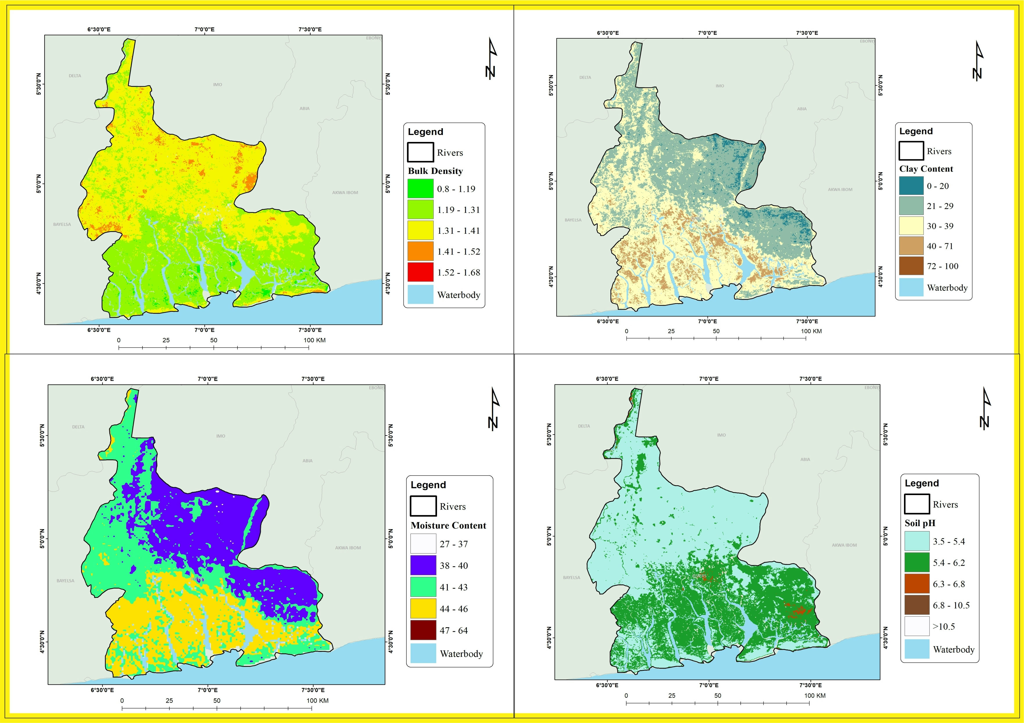
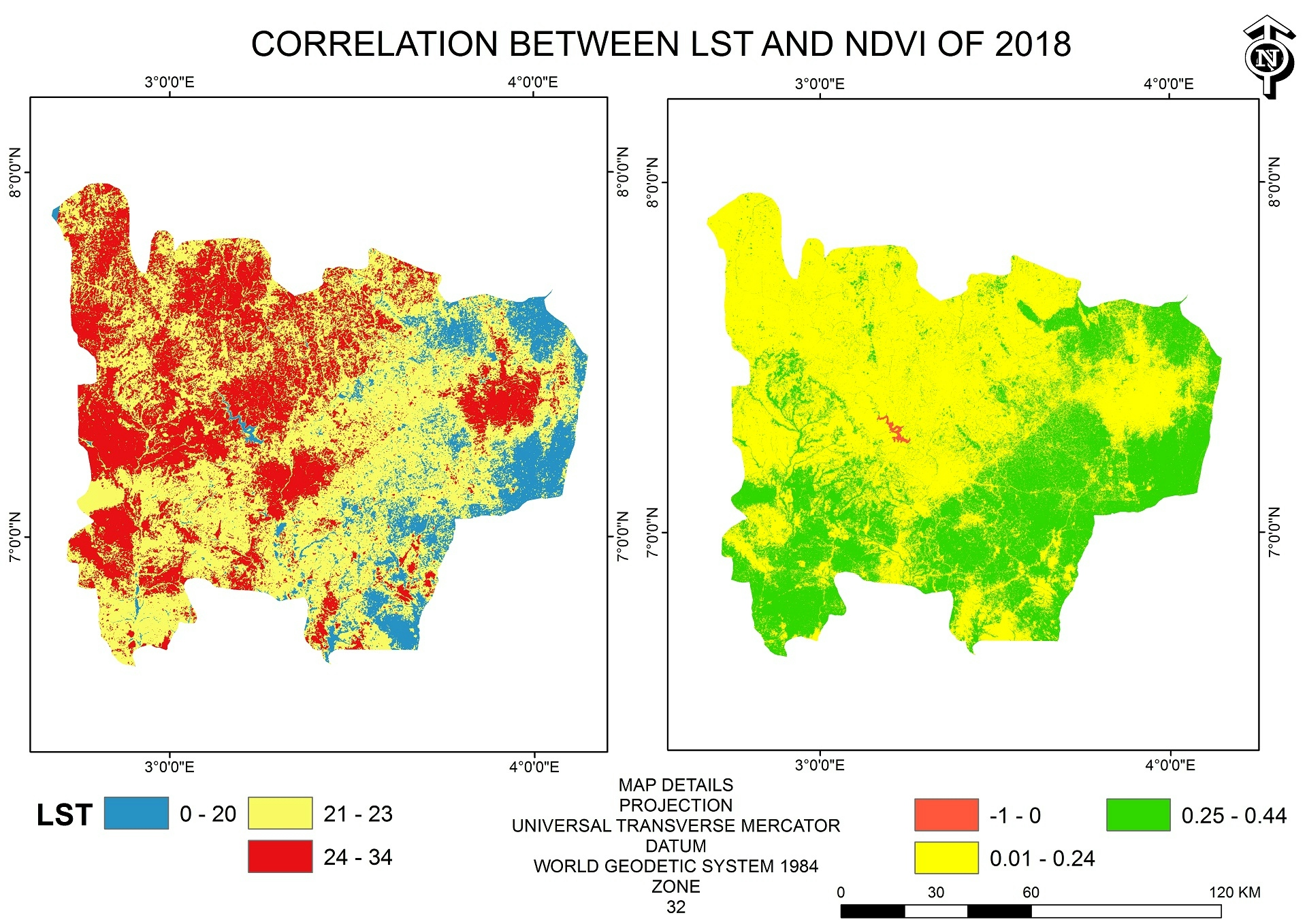
Sign up or log in to your Spatialnode account.

Takes less than a few seconds.

3 PANEL MAP

Adedoyin Ajeyomi
Adedoyin Ajeyomi•

December 31, 2021

3 PANEL MAP

Tools used

ArcMap

Plug-ins used

ArcMap

More by Adedoyin Ajeyomi

Africa Landuse Use Map
459
2020 Land Use Land Cover Map of Africa
125
Cartographic basemap with hillshade
138
Landuse Map from Sentinel 1
206
Suitability Map for Ski Resort
165
Hospital Accessibility Map
165
Risk Assessment Map
Risk Assessment Map
184
Study Area Map
Study Area Map
195
Delta State 3D Model
178
Lagos in a Single Map
445
Lagos state population map
498
Unioncorn Companies Analytics
75

You might also like

Beltrami County 2025 Dust Control Sites
Isaac Ajayi
Beltrami County 2025 Dust Control Sites
Isaac AjayiPro
6
Change Detection
Vincent Abere
Change Detection
Vincent Abere
98
World Mine Production Manganese 2021
Miriela Ulloa Santana
World Mine Production Manganese 2021
Miriela Ulloa Santana
222
IDH Estado de São Paulo
Sidney dos Santos
IDH Estado de São Paulo
Sidney dos Santos
102
geological sediments in switzerland
fernand Lopes
geological sediments in switzerland
fernand Lopes
13
CV/resume in story map format
All That Geo
CV/resume in story map format
All That Geo
201
4c: Modifying Water Infrastructure Map
Patrick Ansell
4c: Modifying Water Infrastructure Map
Patrick Ansell
12
U of A Conservation Planning Upper Peace
Martijn Dieleman
U of A Conservation Planning Upper Peace
Martijn Dieleman
25
Ground Water Vulnerability Index
Marvin Ayeh
Ground Water Vulnerability Index
Marvin Ayeh
12
Sustentabilidade da Pegada Hídrica Azul
Elifas Augusto Pereira da Silva
Sustentabilidade da Pegada Hídrica Azul
Elifas Augusto...
4
Poligonal por Distância e Azimutes
Giovanni Augusto Valente da Silva
Poligonal por Distância e Azimutes
Giovanni Augusto...
21
USDA Data Science Program - Capstone
Jeffrey Erwin
USDA Data Science Program - Capstone
Jeffrey Erwin
18

Join the community!

We're a place where geospatial professionals showcase their works and discover opportunities.
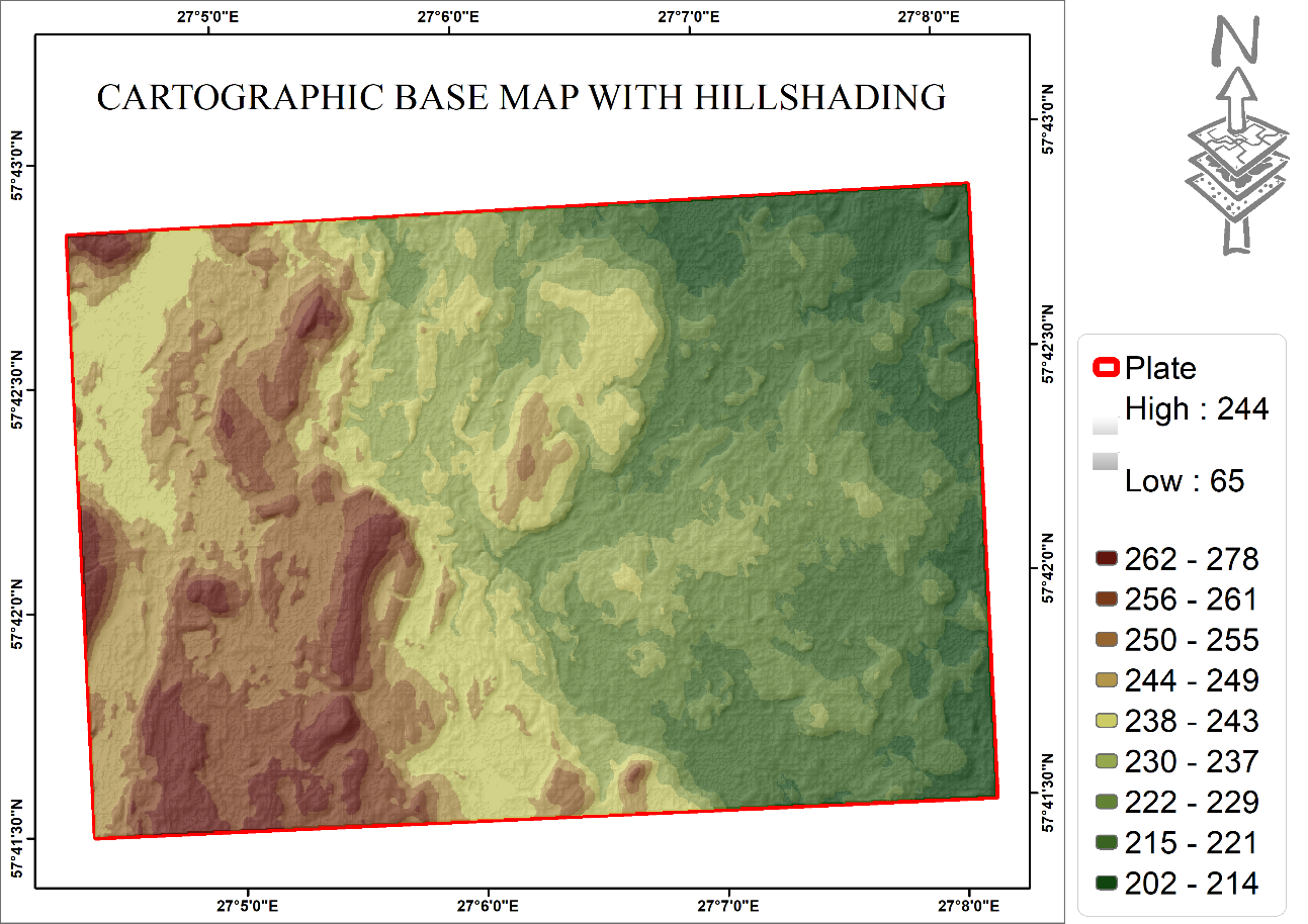
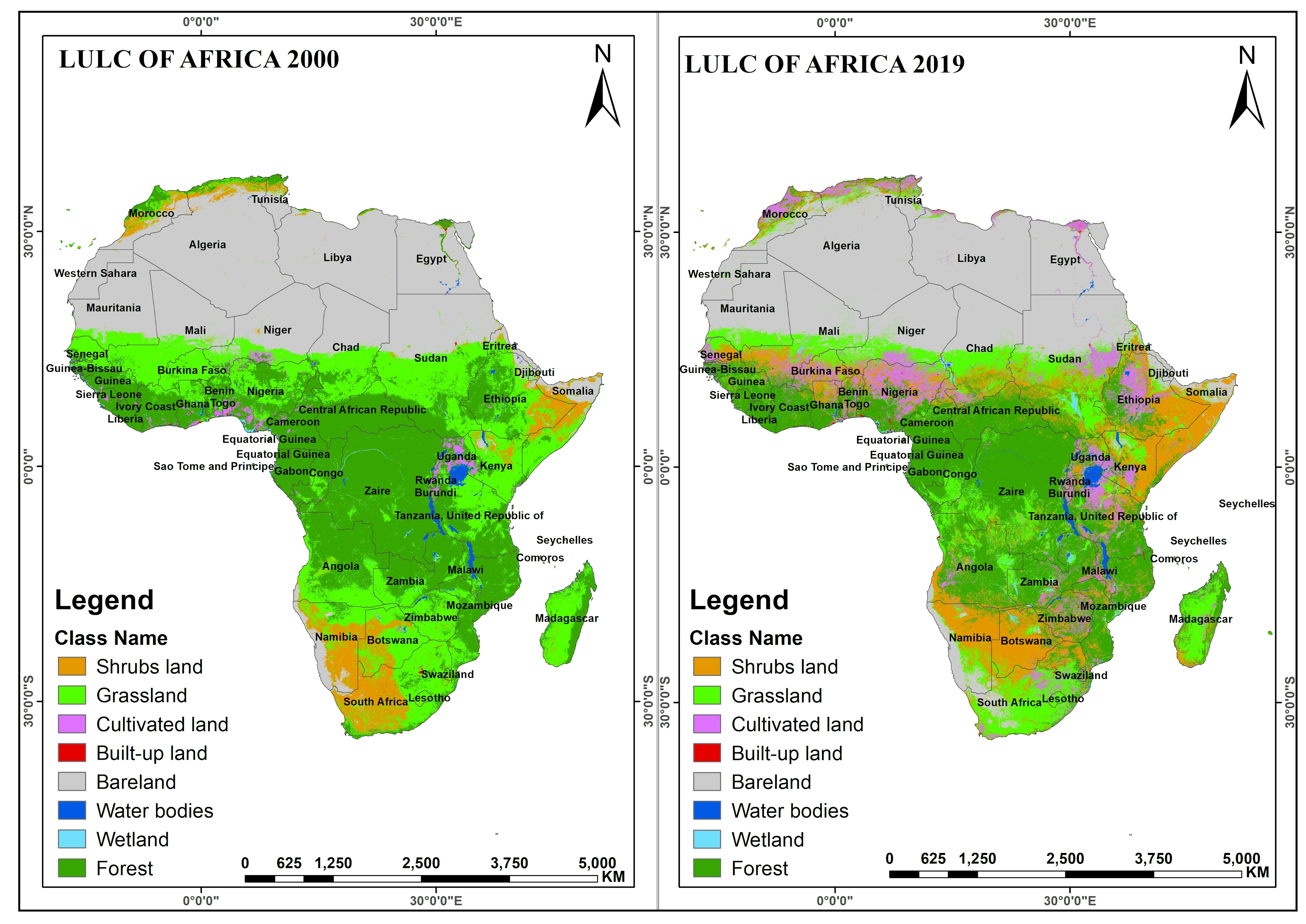
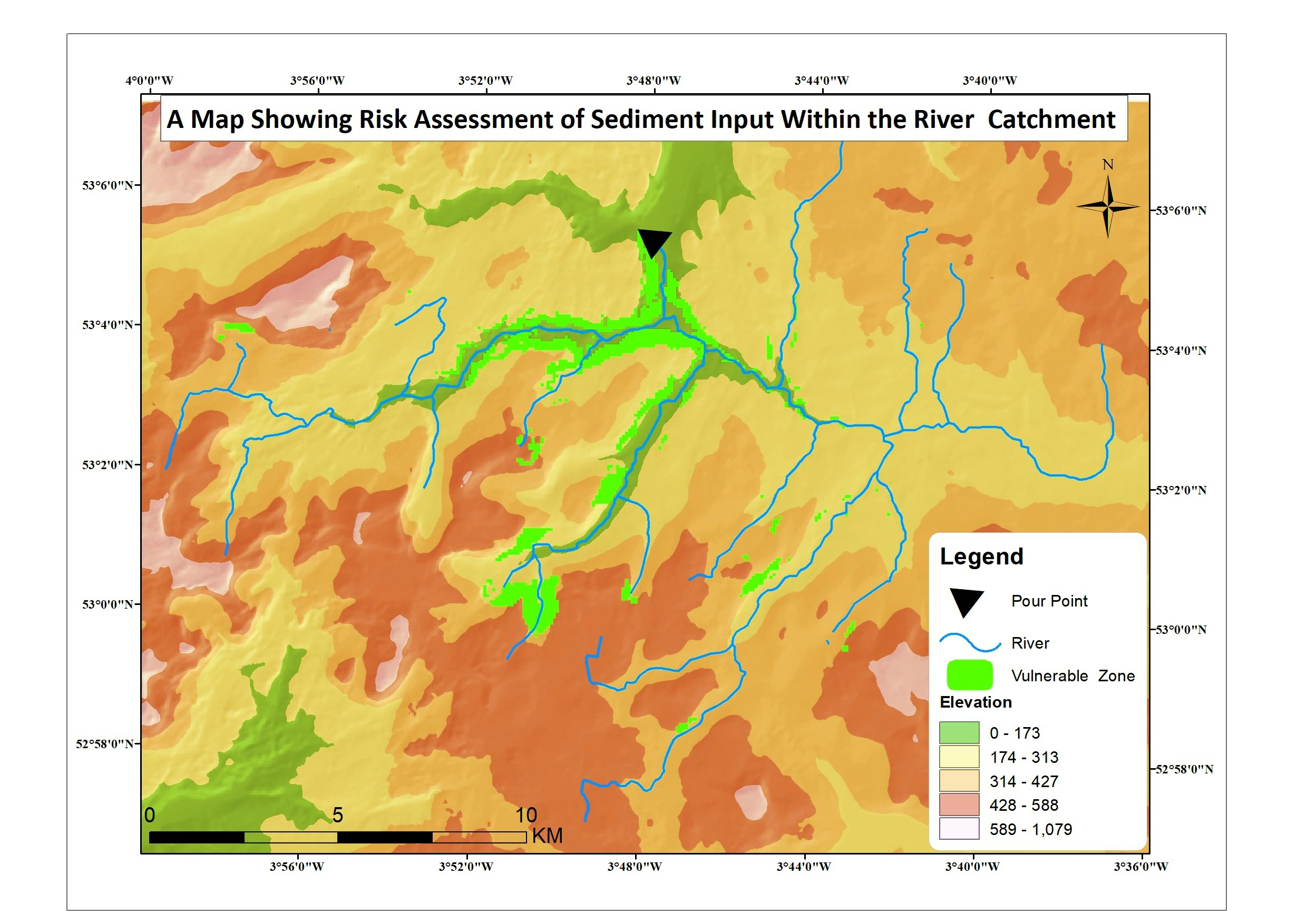
Sign Up for free