Sign up or log in to your Spatialnode account.

Takes less than a few seconds.

Ekiti State Map

Adedoyin Ajeyomi
Adedoyin Ajeyomi•

May 18, 2022

Ekiti State Map

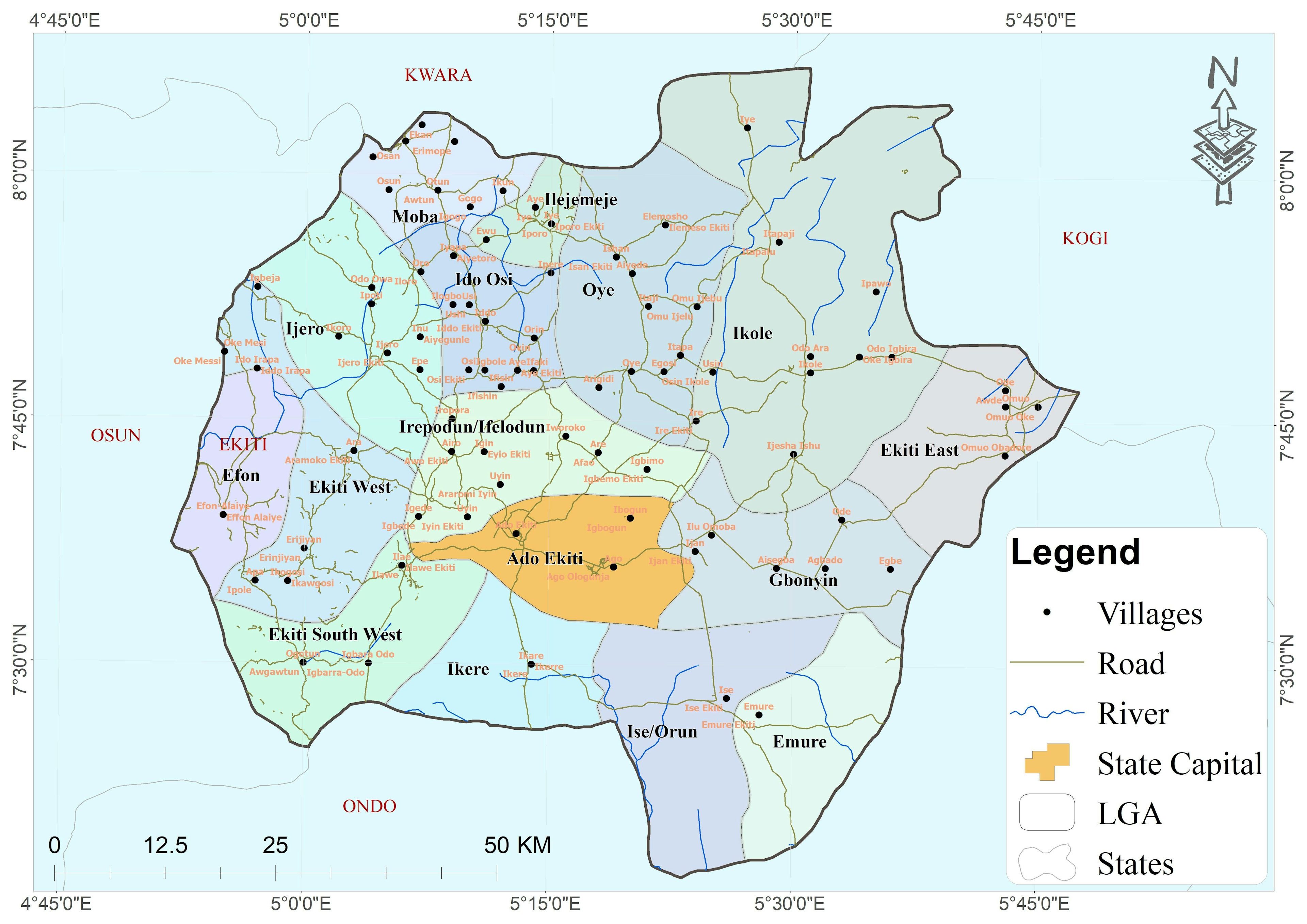
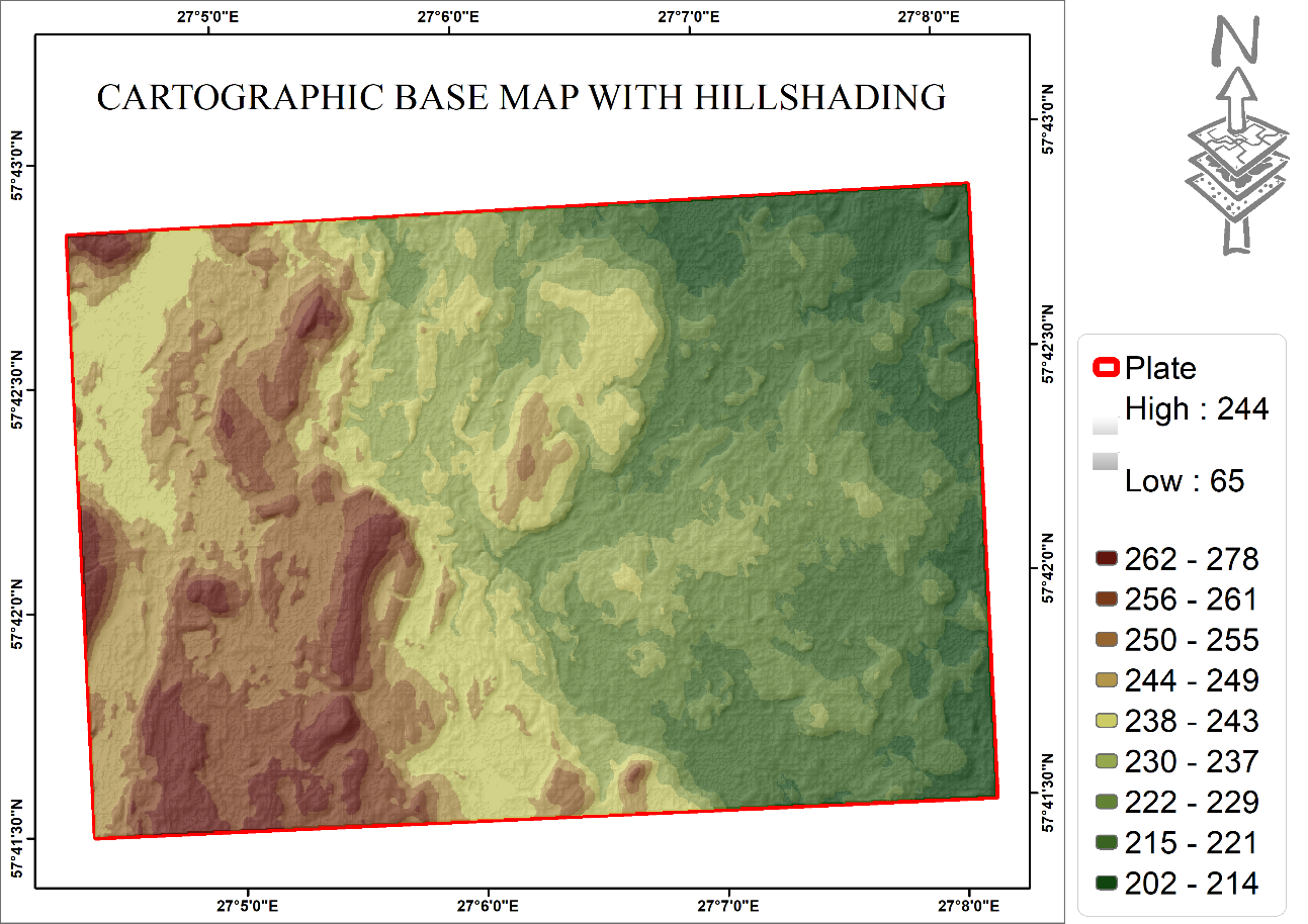
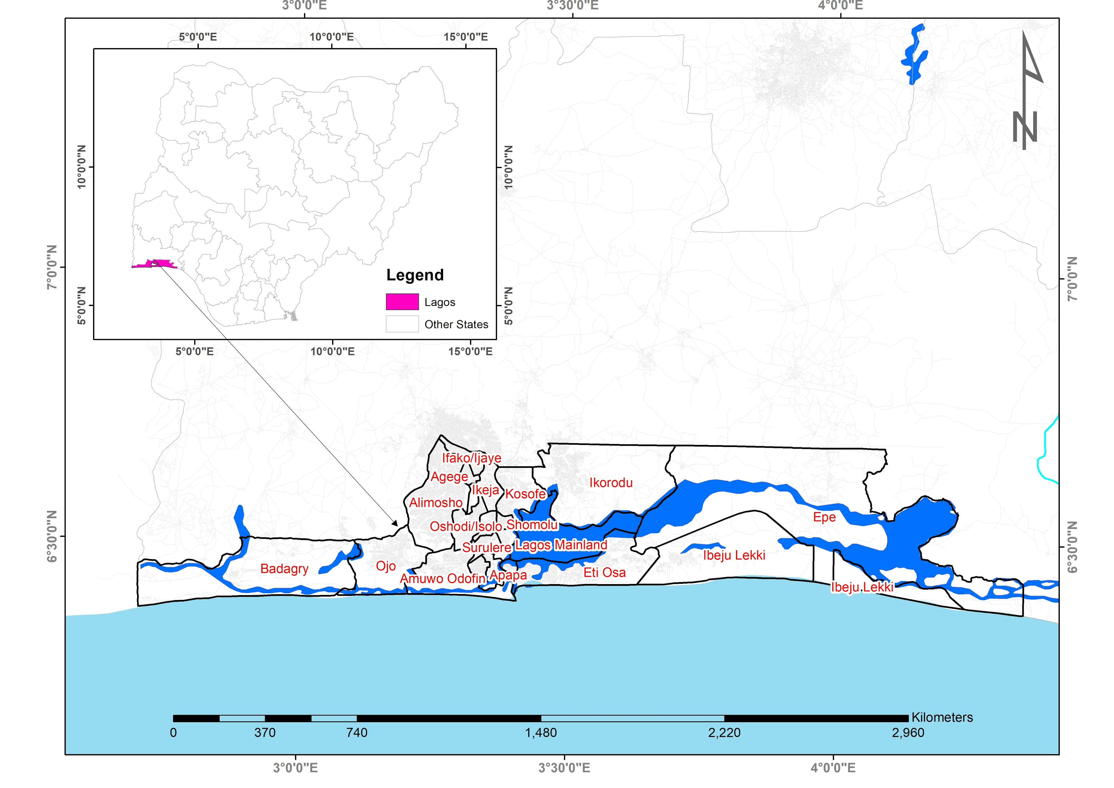
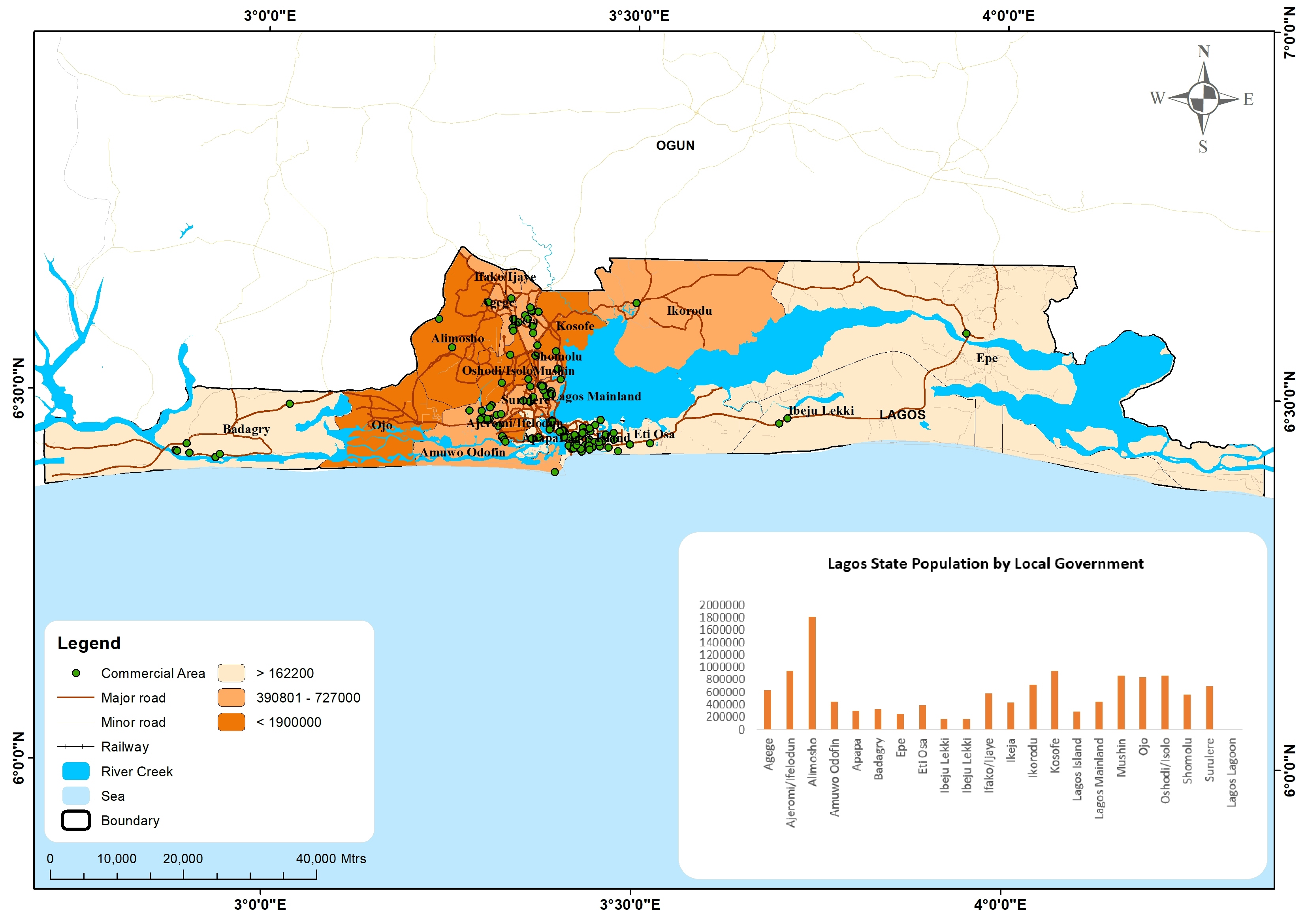
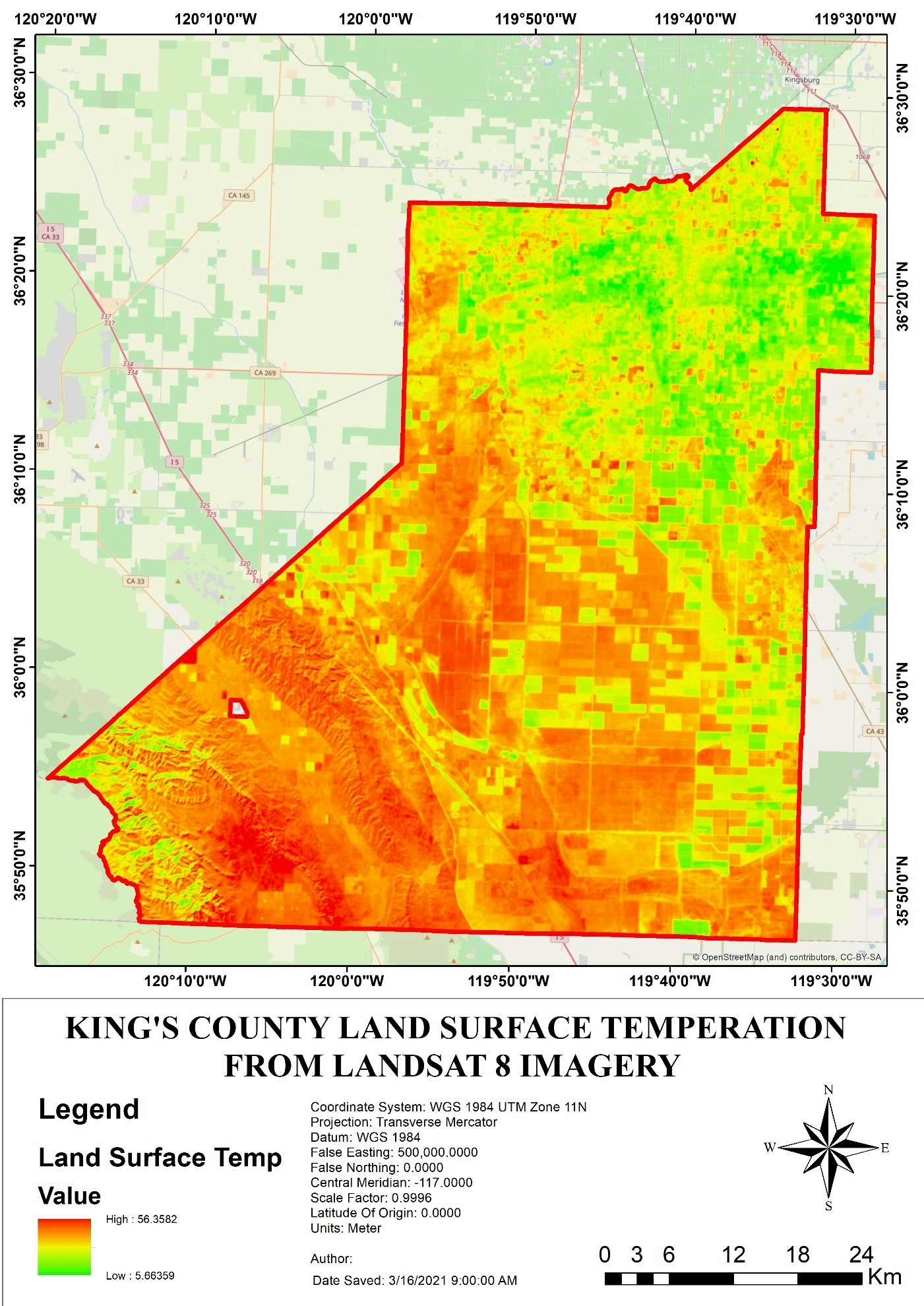
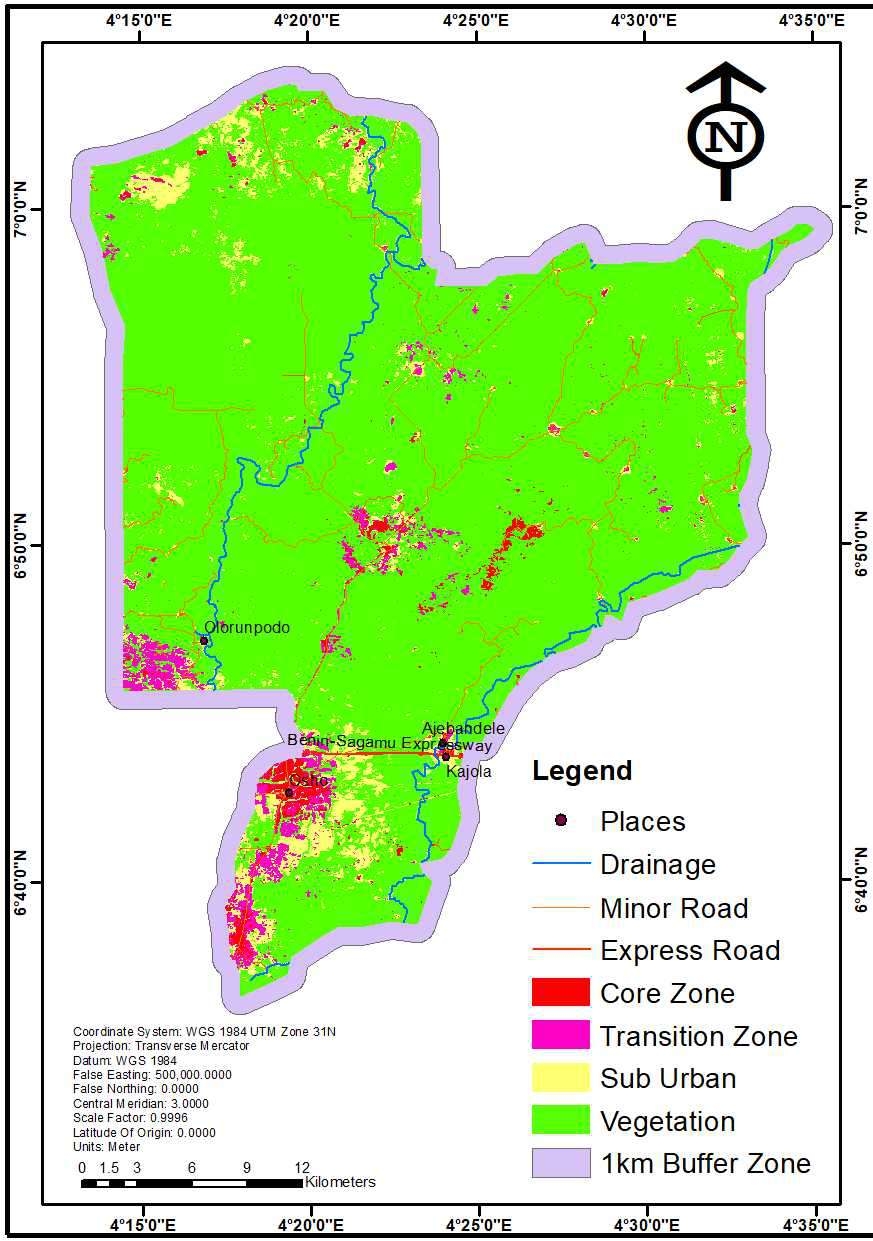
A detailed Administrative Map of Ekiti State


Tools used

ArcMap OSM

Plug-ins used

ArcMap

tags

ArcMapCartographyEsriOSM

More by Adedoyin Ajeyomi

Unioncorn Companies Analytics
75
Cartographic basemap with hillshade
137
Land SURFACE Temperature
154
Landuse Map from Sentinel 1
203
Soil Properties Map for Rivers State
559
Lagos state population map
473
Risk Assessment Map
Risk Assessment Map
184
Study Area Map
Study Area Map
189
Africa Landuse Use Map
459
3 PANEL MAP
3 PANEL MAP
145
2020 Land Use Land Cover Map of Africa
105
Delta State 3D Model
175

You might also like

Traffic Counts Data Point collections
JAYASHRI KORADE
Traffic Counts Data Point collections
JAYASHRI KORADE
70
Texcoco lake, Mexico City - 1519
Sebastian Silva
Texcoco lake, Mexico City - 1519
Sebastian Silva
63
Ski slope suitability model
Katalin Peter
Ski slope suitability model
Katalin Peter
23
Cláudio D´Assunção Ferreira
Perícia em condomínio
Cláudio D´Assunção Ferreira
5
Mapa da Pegada Hídrica Azul
Elifas Augusto Pereira da Silva
Mapa da Pegada Hídrica Azul
Elifas Augusto...
5
Street Map Art, Mainland LGA, Lagos, NGA
Bamidele Daniel Ohinoyi
Street Map Art, Mainland LGA, Lagos, NGA
Bamidele Daniel Ohinoyi
275
Predicting Sheep Resource Selection
Ryan Shields
Predicting Sheep Resource Selection
Ryan Shields
64
Find the Nearest Health Centre
John Wahome Gathoni
Find the Nearest Health Centre
John Wahome Gathoni
21
QGIS Custom function example
Rafael Pinheiro Machado
QGIS Custom function example
Rafael Pinheiro Machado
64
How to Measure Land Use Mix via Entropy
Stewart Berry
How to Measure Land Use Mix via Entropy
Stewart Berry
328
Data Visualization using Python
PETER NDIRITU THUKU
Data Visualization using Python
PETER NDIRITU THUKU
36
Localização de sítio e materiais
Lucas Moreira
Localização de sítio e materiais
Lucas Moreira
11

Join the community!

We're a place where geospatial professionals showcase their works and discover opportunities.

Sign Up for free