
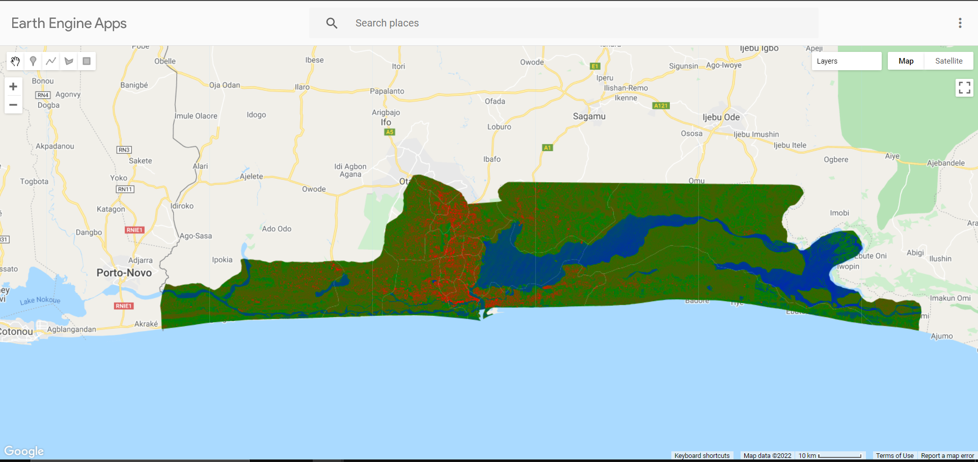
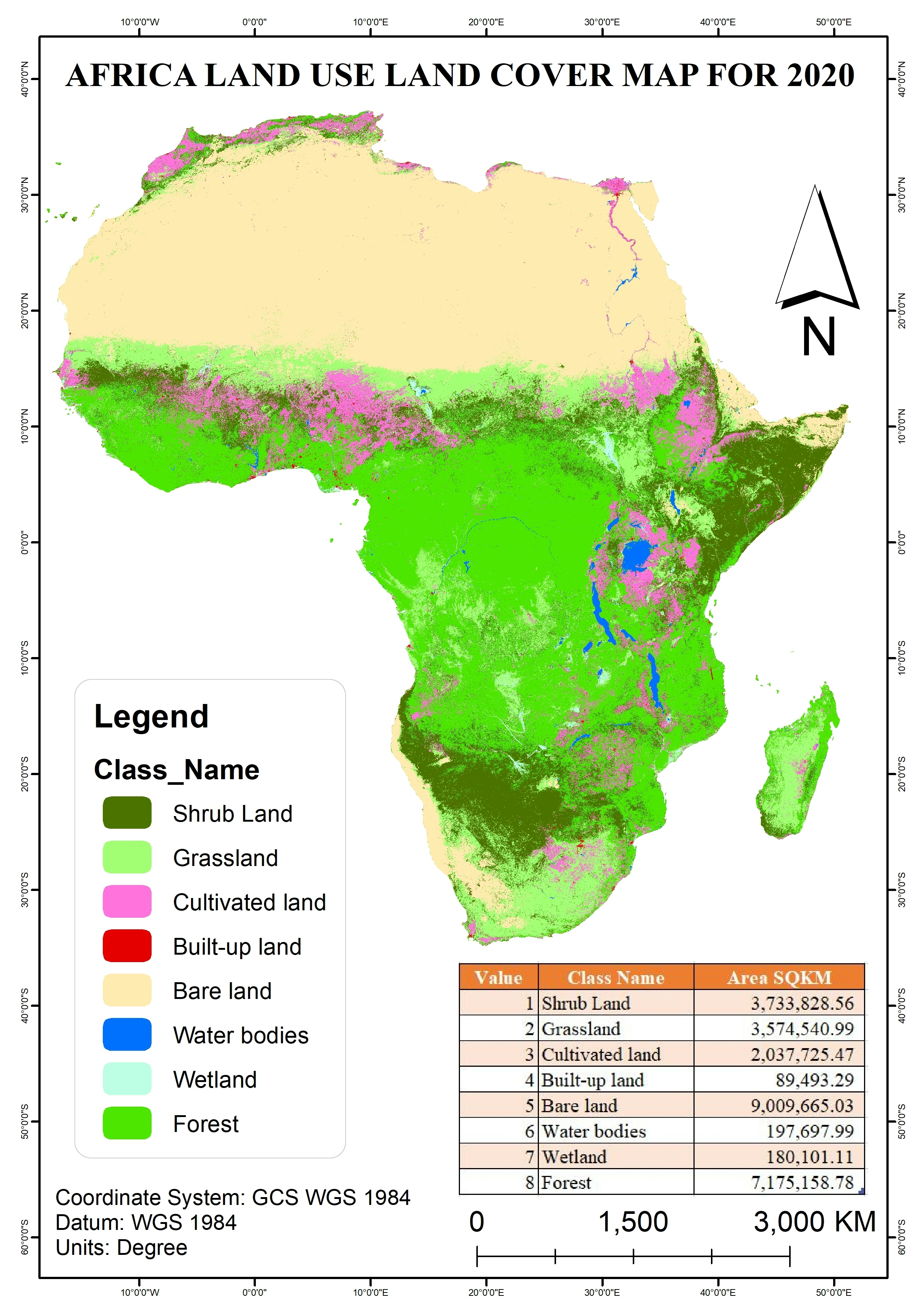
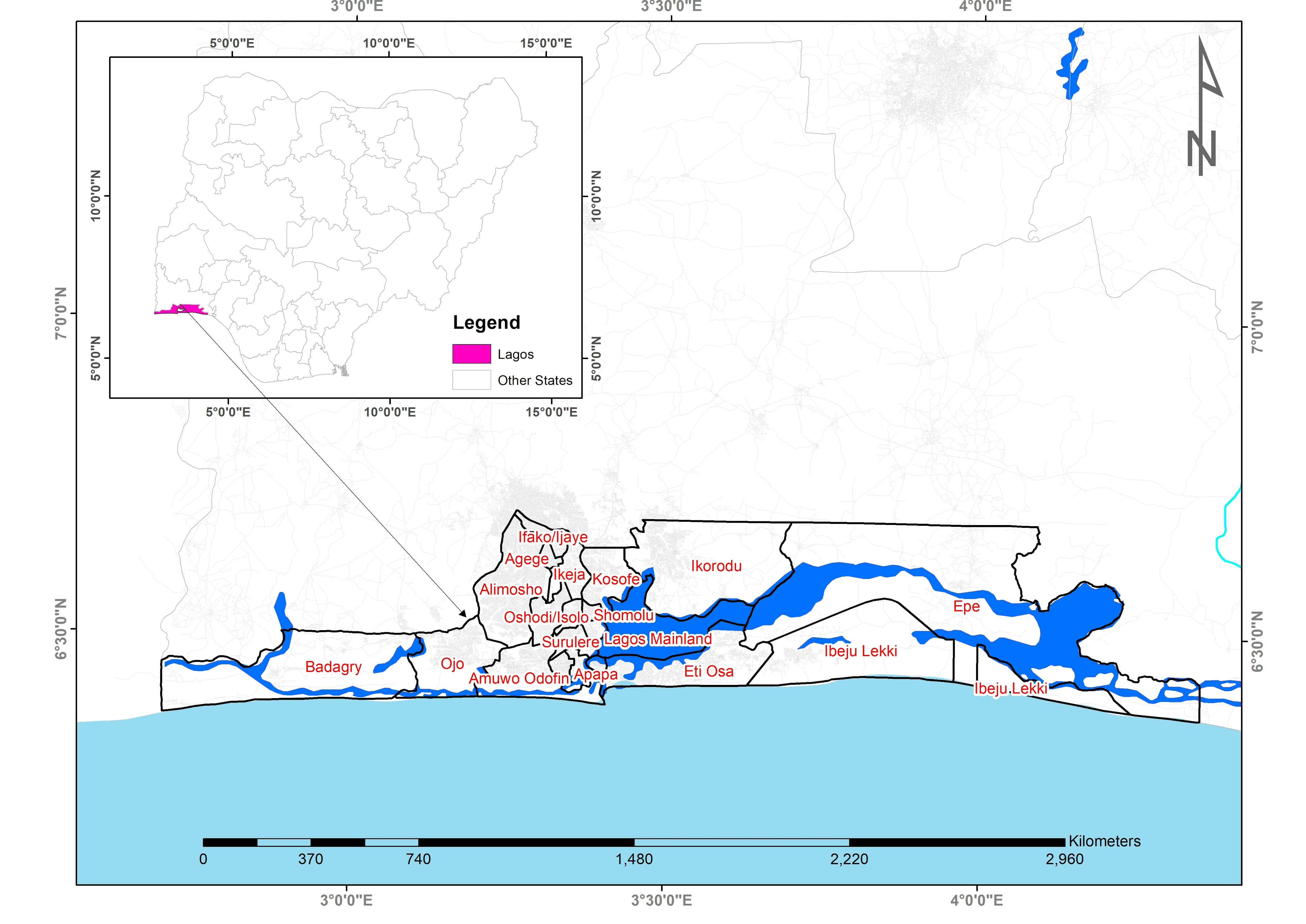
Landuse Landover Map of Lagos state derived from Sentinel 1 Radar Satellite using Random Forest Algorithm for classification.
Landuse Map from Sentinel 1
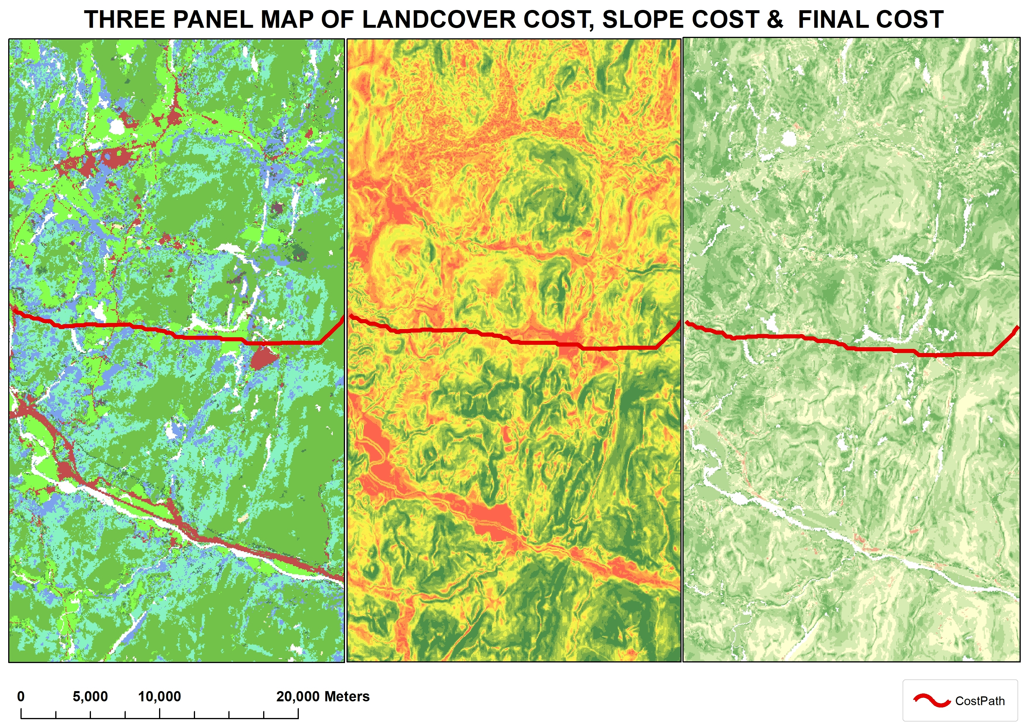
Tools used
Google Earth Engine(GEE)
Plug-ins used
Google Earth Engine(GEE)

You might also like


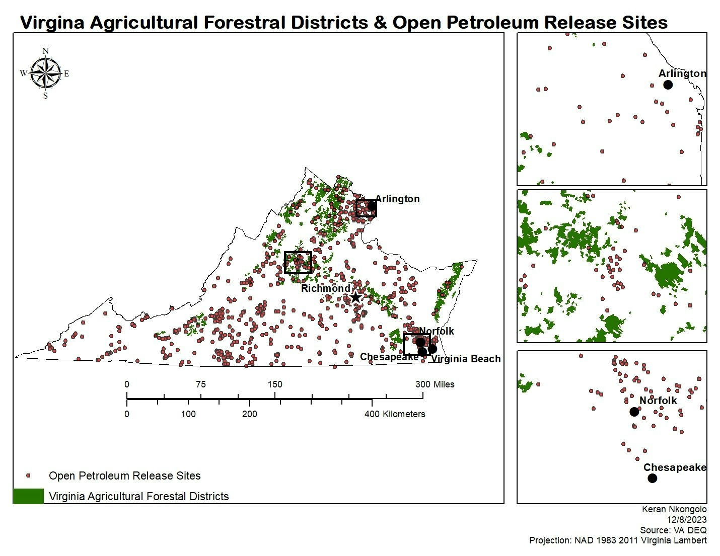
.svg "Keran Nkongolo")


Join the community!
We're a place where geospatial professionals showcase their works and discover opportunities.