
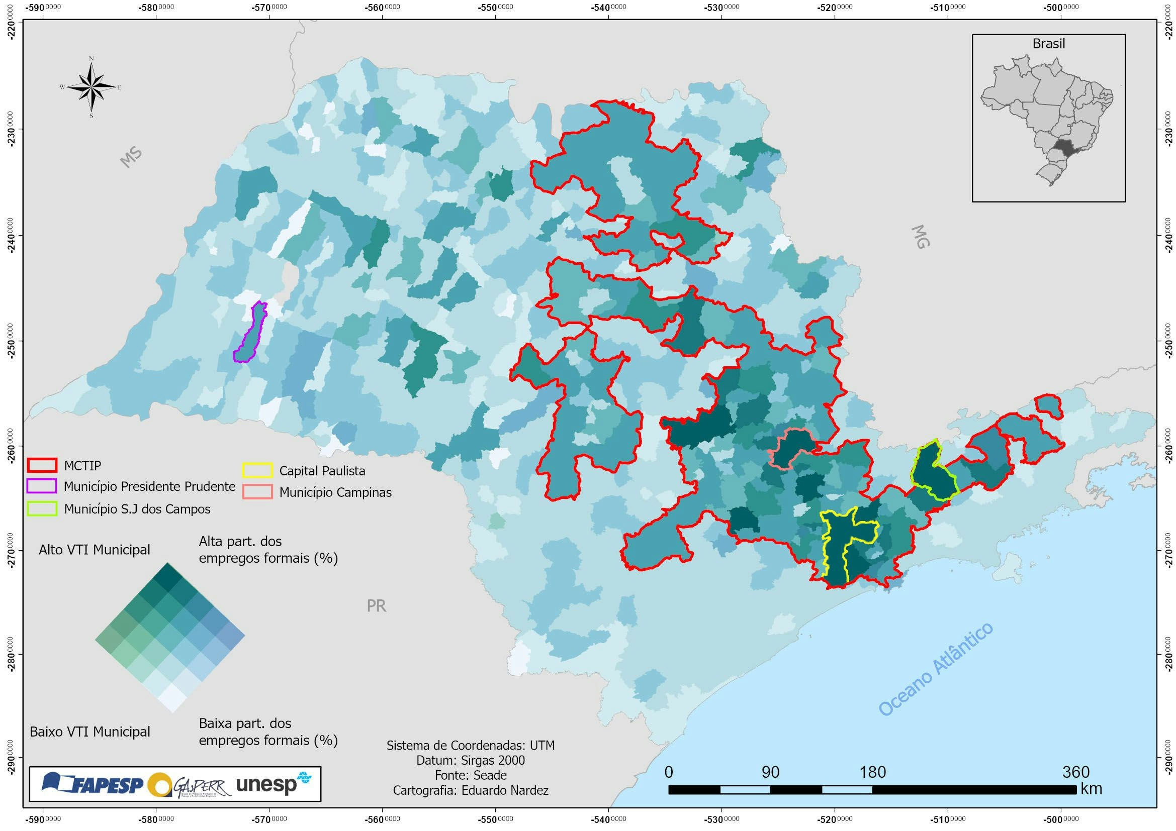
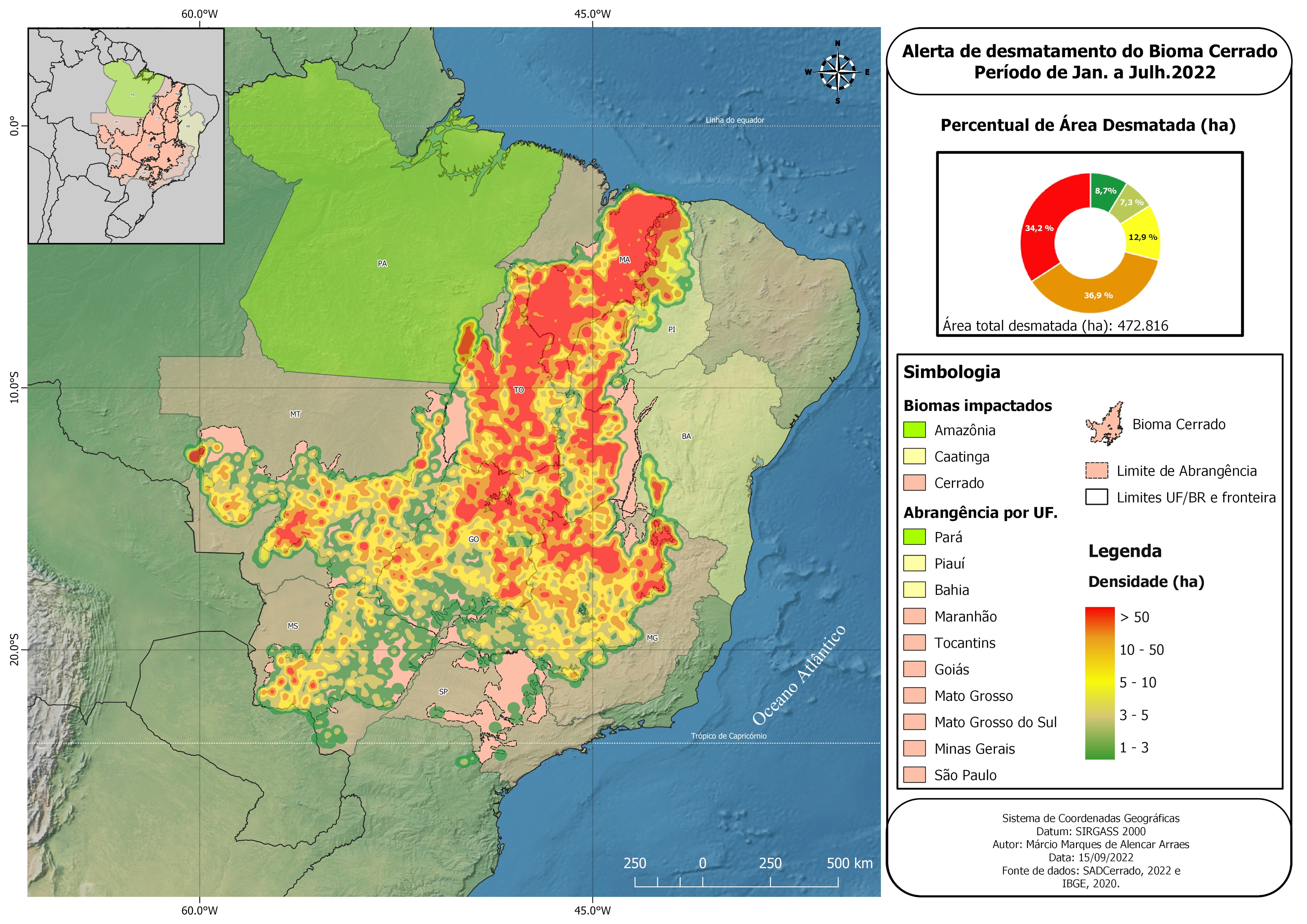
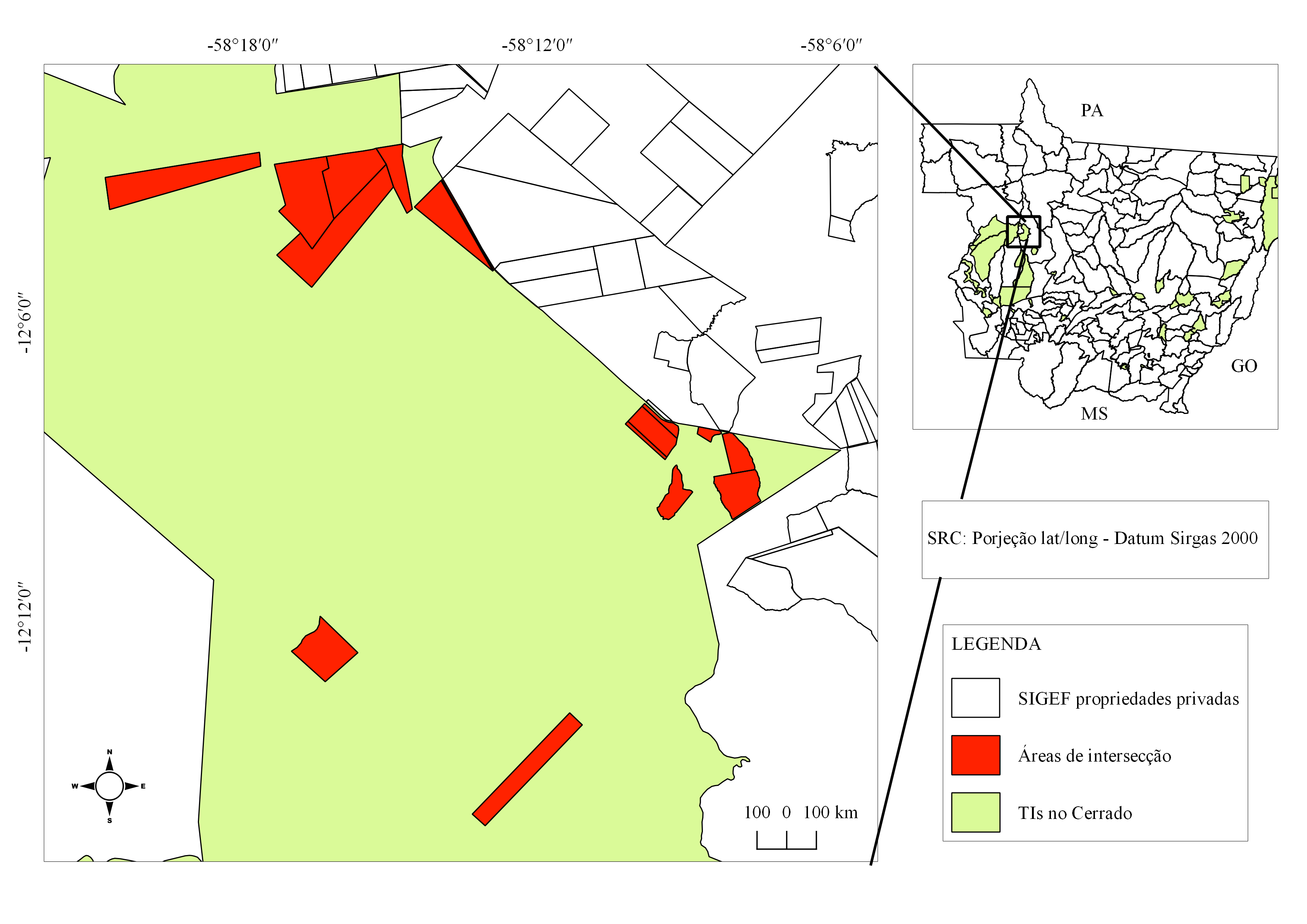
Jjj
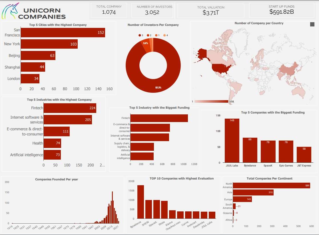
Unioncorn Companies Analytics
Tools used
ExcelGoogle Map
Plug-ins used
Data Visualization
tags
Data VisualizationGoogle

You might also like


Join the community!
We're a place where geospatial professionals showcase their works and discover opportunities.