Sign up or log in to your Spatialnode account.

Takes less than a few seconds.

Waste Container Inventory

Sean Willis
Sean Willis•

February 21, 2023

Waste Container Inventory

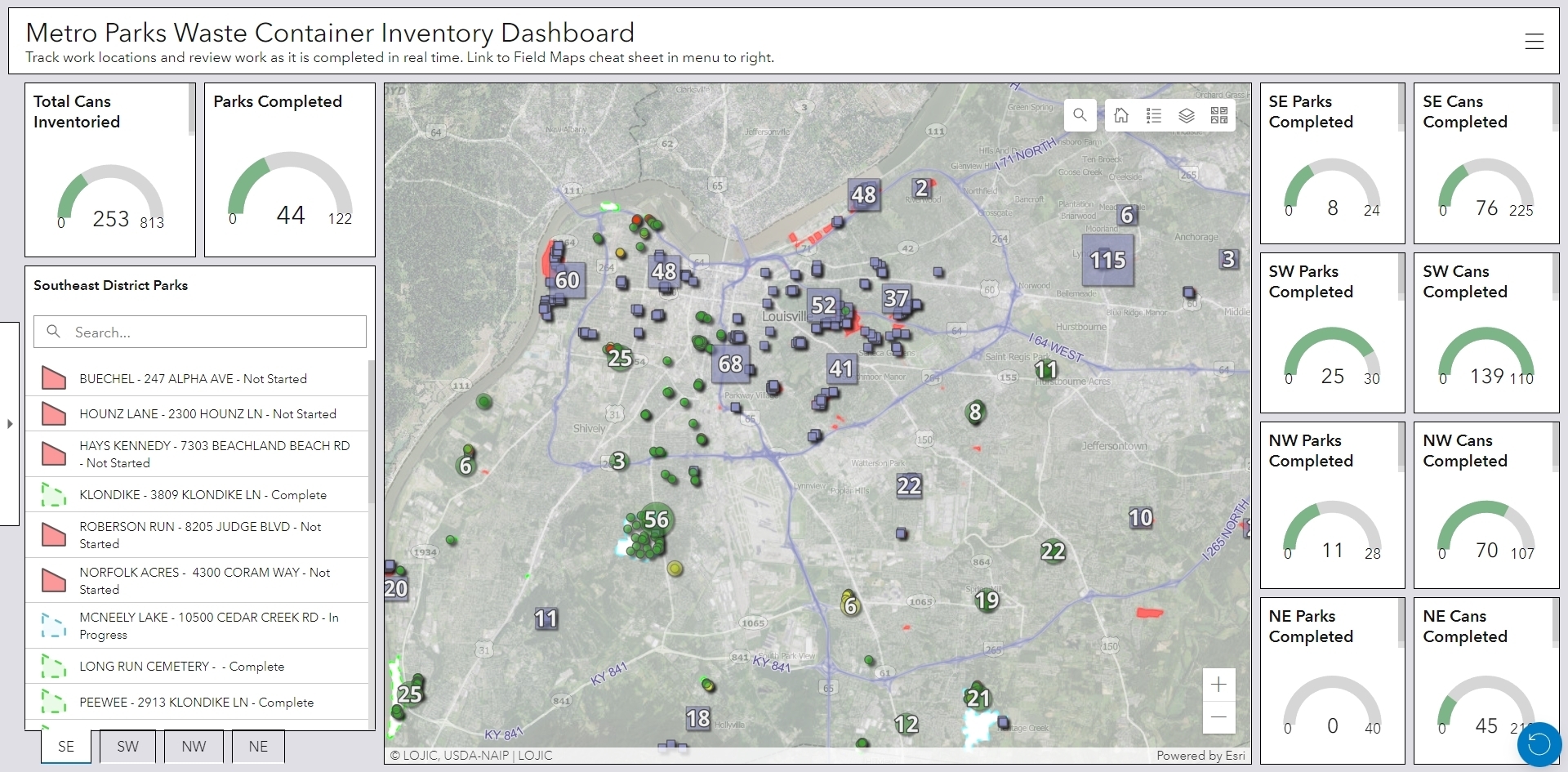
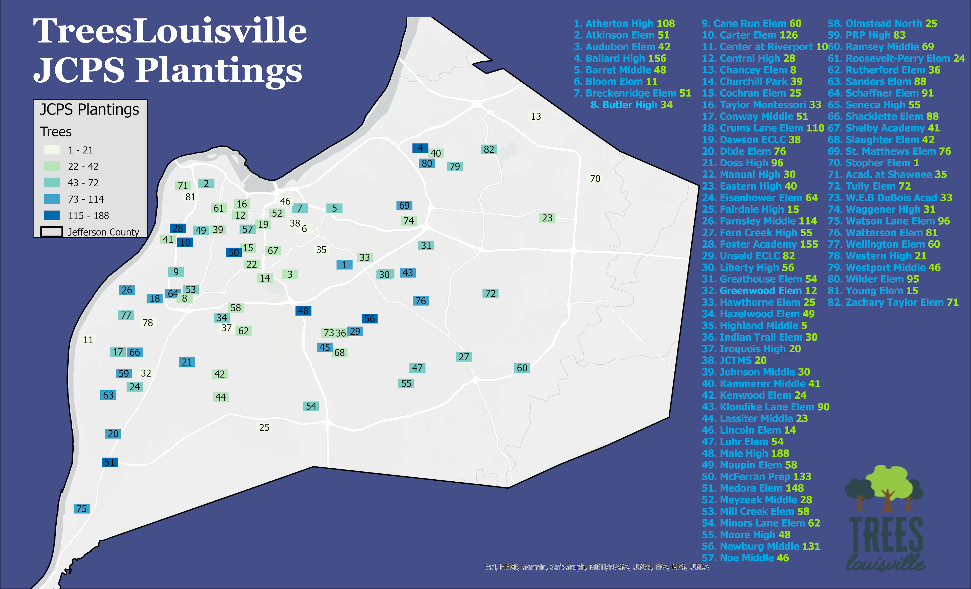
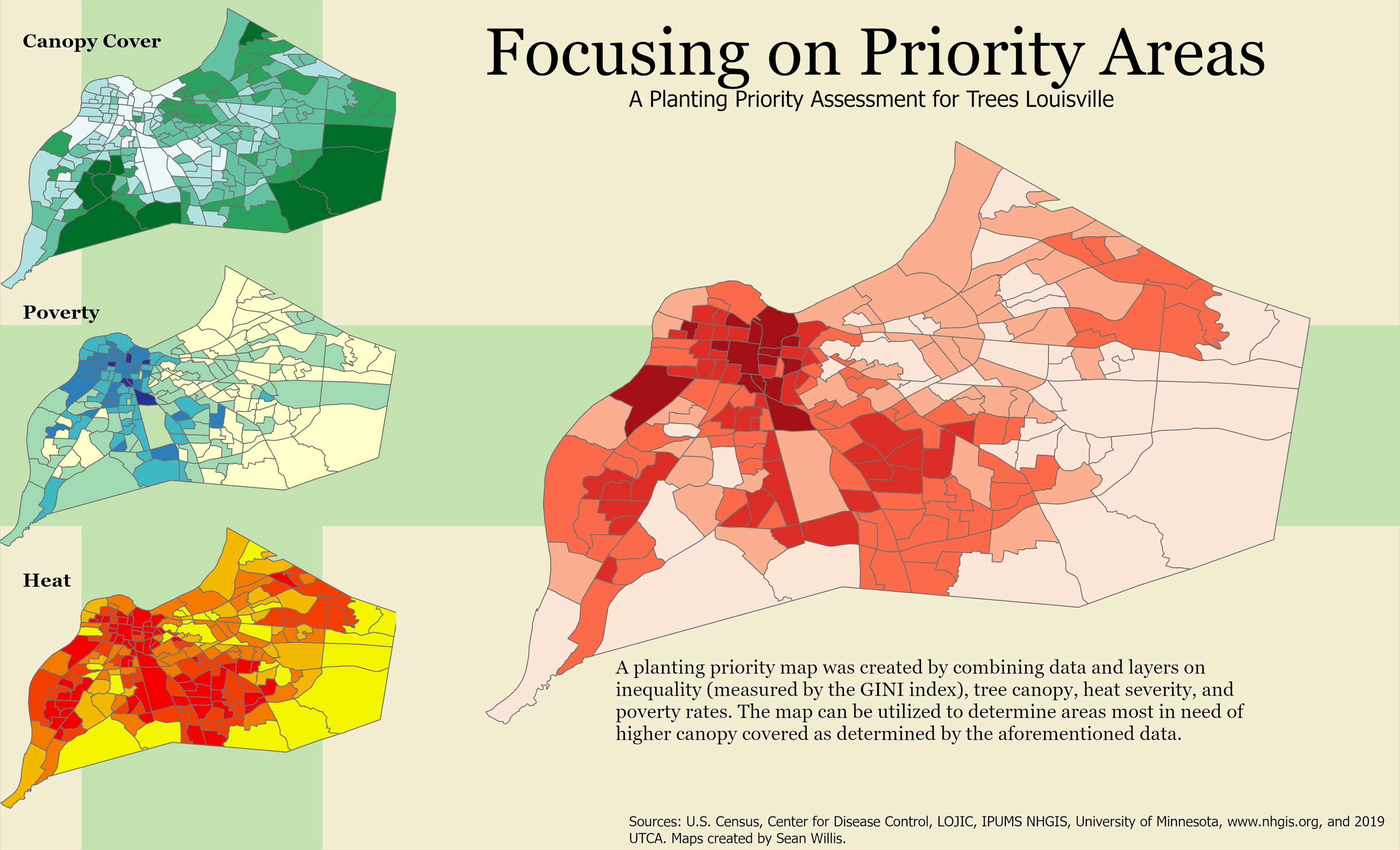
Example of a dashboard I have made. Made for Louisville Parks and Rec to track progress on inventorying waste containers in city parks.


Tools used

ArcGIS DashboardsArcGIS OnlineArcGIS Pro

Plug-ins used

None

tags

ArcGIS OnlineDashboards

More by Sean Willis

TARC Stops by Headway
15
Louisville Light Rail Proposal
89
Jefferson County Tax Income
61
Priority Planting in Louisville, KY
123
Intersection Collisions in Louisville
21
TreesLouisville JCPS Plantings
45
Canopy Cover by Zip Code
128
Louisville, KY Housing Density
25
Old Louisville Property Tax Income
17
JCPS District 4 Tree Plantings
43
Canopy Cover and Heat Severity
79
Tree Canopy in Redlined Districts
126

You might also like

Projeto Rodo Anel BH
Adriano jose de Barros
Projeto Rodo Anel BH
Adriano jose...
6
Elevation Map of Abakaliki Nigeria
Emeka Ude
Elevation Map of Abakaliki Nigeria
Emeka Ude
52
Point Cloud Processing and Analysis
Wong Yong Bin
Point Cloud Processing and Analysis
Wong Yong Bin
30
temperature map
Adriano jose de Barros
temperature map
Adriano jose...
21
NDVI Map of Fulton County
Kolawole Arowoogun
NDVI Map of Fulton County
Kolawole Arowoogun
73
 Hypsometry of the central region of RS
Gustavo Soares Arrial
Hypsometry of the central region of RS
Gustavo Soares Arrial
90
Mapa de Uso e Ocupação do Solo
RODRIGO DE ARAUJO BELOTE
Mapa de Uso e Ocupação do Solo
RODRIGO DE...
15
Incêndio Florestal
Simone Malhado da Silva
Incêndio Florestal
Simone Malhado...
3
Multidimensional Raster Predictive Model
Zach Torres
Multidimensional Raster Predictive Model
Zach Torres
85
Cobertura Sentinel-2 Cuba
Dayniel Hernández Mestre
Cobertura Sentinel-2 Cuba
Dayniel Hernández Mestre
49
Landcover map of Tanzania
Hemed Lungo
Landcover map of Tanzania
Hemed Lungo
18
Pemba Ward wise population distributon
Hashimu Misanya
Pemba Ward wise population distributon
Hashimu Misanya
41

Join the community!

We're a place where geospatial professionals showcase their works and discover opportunities.

Sign Up for free