Sign up or log in to your Spatialnode account.

Takes less than a few seconds.

Canopy Cover by Zip Code

Sean Willis
Sean Willis•

July 21, 2022

Canopy Cover by Zip Code

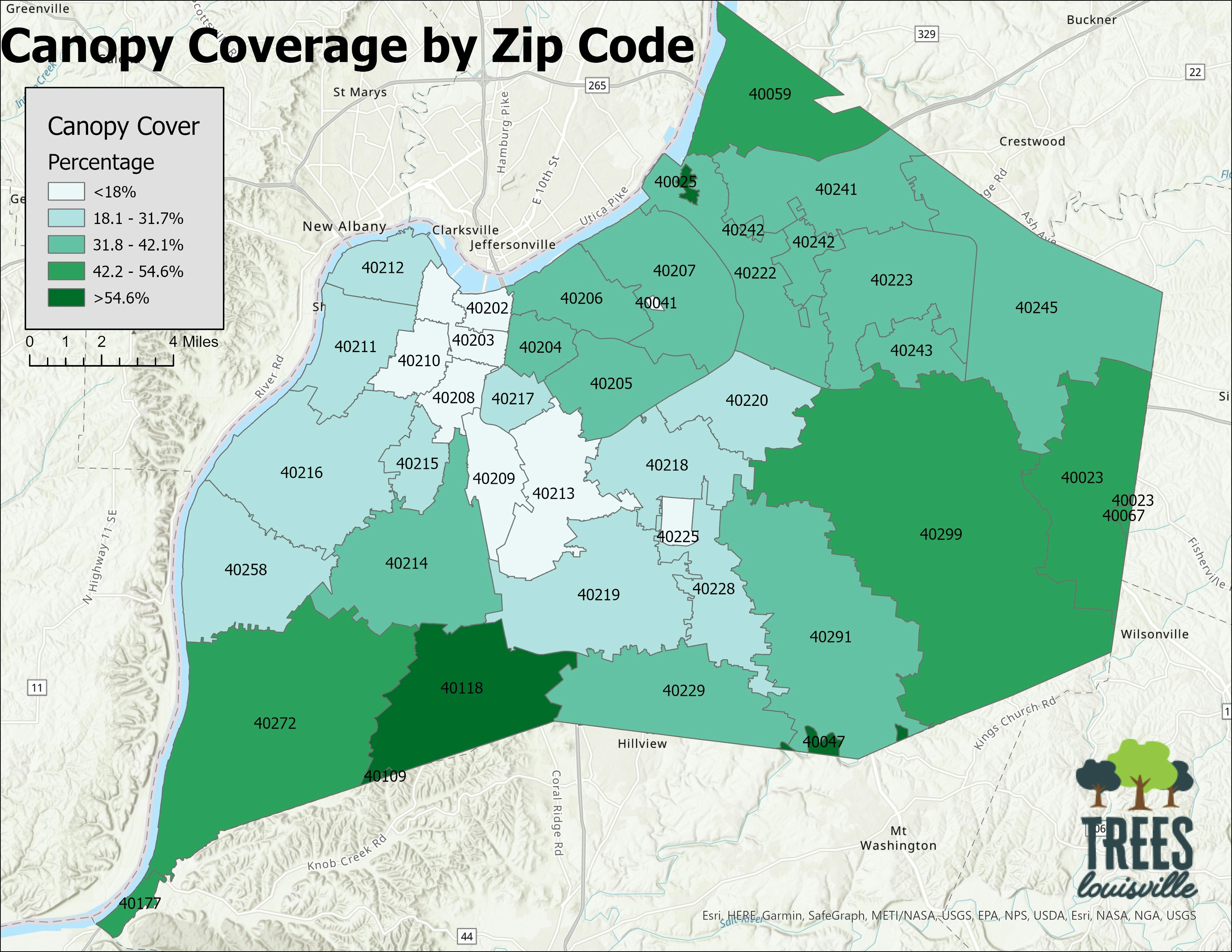
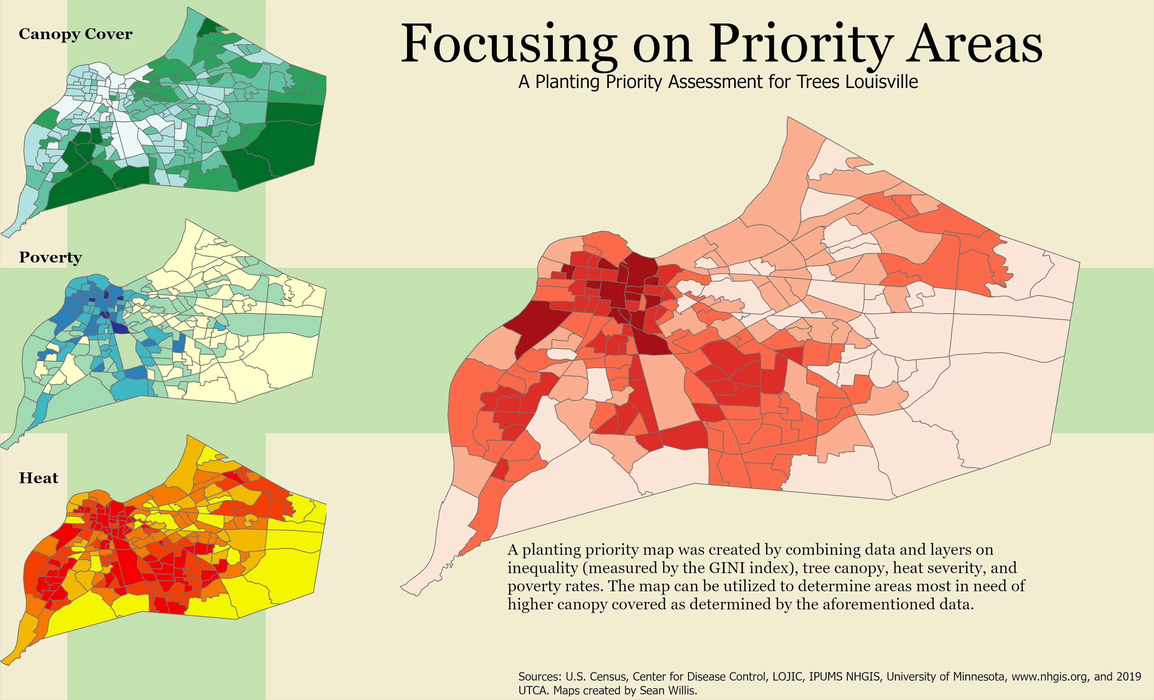
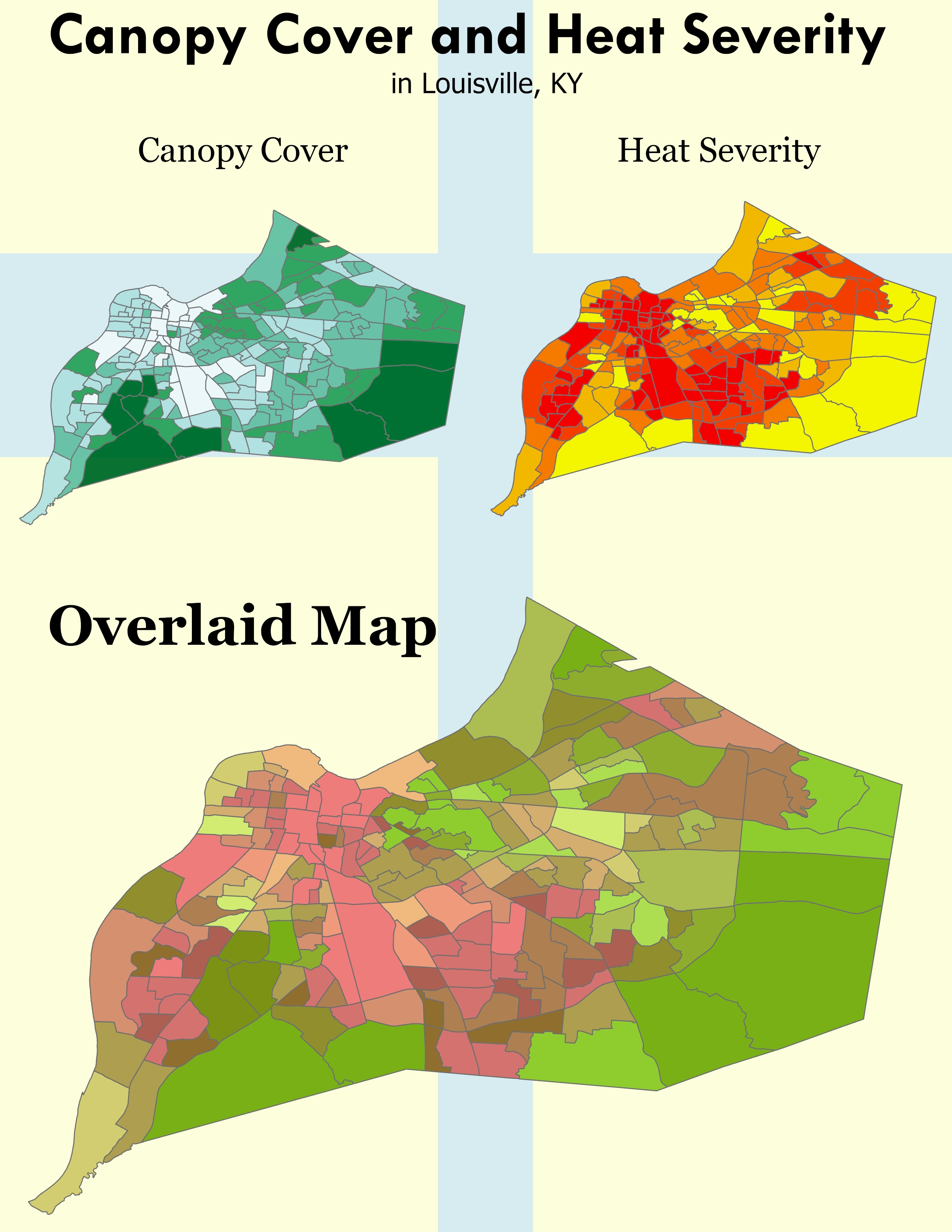
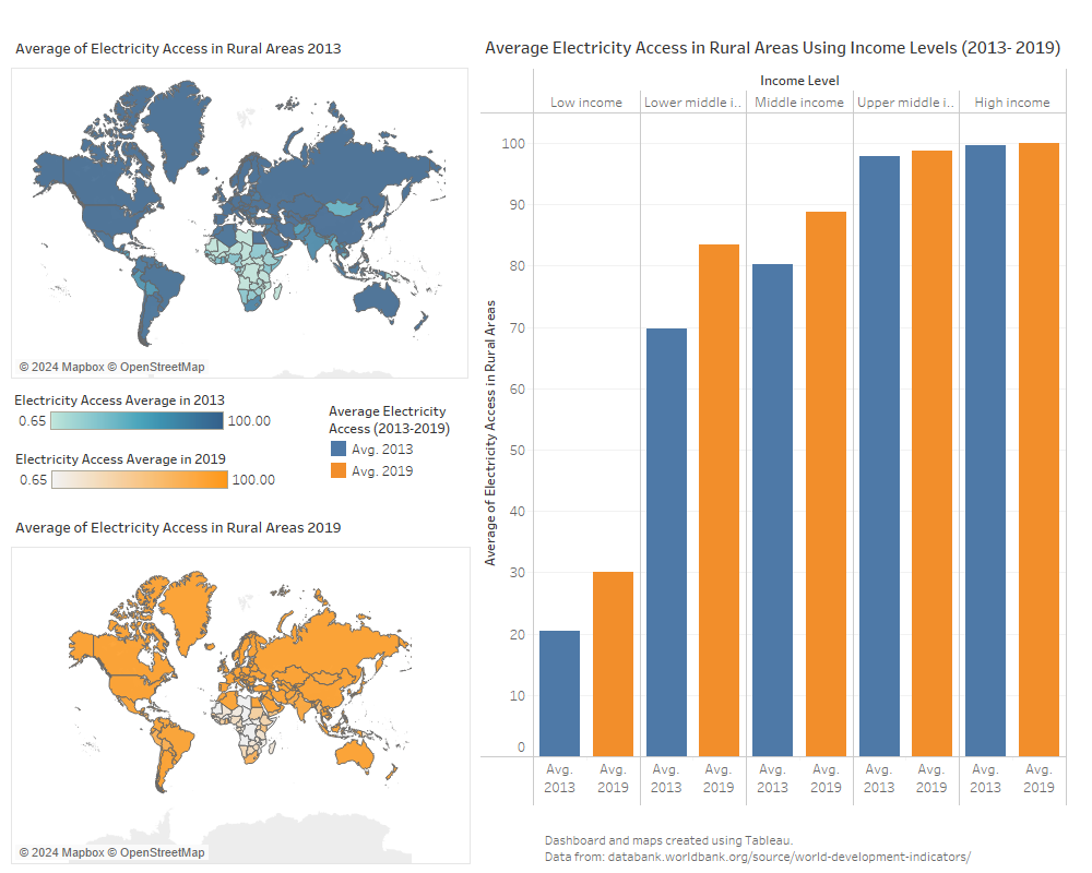
Utilized canopy data from the Louisville UTCA 2019 to determine canopy coverage within the city, classified by zip code.


Tools used

ArcGIS Pro

tags

louisvillemapstrees

More by Sean Willis

Tree Canopy in Redlined Districts
125
TARC Stops by Headway
15
TreesLouisville JCPS Plantings
45
JCPS District 4 Tree Plantings
43
Canopy Cover and Heat Severity
76
Jefferson County Tax Income
61
Louisville, KY Housing Density
25
Louisville Light Rail Proposal
89
Priority Planting in Louisville, KY
122
Waste Container Inventory
22
Old Louisville Property Tax Income
17
Intersection Collisions in Louisville
21

You might also like

California and its Major Urban Areas
Hugo He
California and its Major Urban Areas
Hugo He
14
Map of the Medjerda River Basin
Idriss Riahi
Map of the Medjerda River Basin
Idriss Riahi
175
Top 10 Most Multicultural Cities
Ria Rathod
Top 10 Most Multicultural Cities
Ria Rathod
48
Mapa de Área de Preservação Permanente
Mauricio Matheus
Mapa de Área de Preservação Permanente
Mauricio Matheus
36
Updating Water Line Connections
Ani Pearn
Updating Water Line Connections
Ani Pearn
7
Map Production Using Python
Amon Melly
Map Production Using Python
Amon Melly
137
Geomorfologia da Bacia do Rio Itajaí
Vivian Maria
Geomorfologia da Bacia do Rio Itajaí
Vivian Maria
17
Concentração do público estudantil
WILLIAN S. SANTOS 🇧🇷
Concentração do público estudantil
WILLIAN S....
19
Facility Mapping (FM)
omoogun bankole
Facility Mapping (FM)
omoogun bankole
11
POPULATION BOOM!!! (ABUJA)
Idris Halima Ohunene
POPULATION BOOM!!! (ABUJA)
Idris Halima Ohunene
51
Advancing Precision Ag in Ontario!
Nicole Rabe
Advancing Precision Ag in Ontario!
Nicole Rabe
35
Altimétria e Hidrografia de Jardim
Elifas Augusto Pereira da Silva
Altimétria e Hidrografia de Jardim
Elifas Augusto...
8

Join the community!

We're a place where geospatial professionals showcase their works and discover opportunities.

Sign Up for free