
I love making maps and getting comfortable in the chairs next to the fireplace reading a new book at my local library. Why not put them together??
Besides books, there's so many resources at the library that anyone can access for free.
In this project, all the data I used was accessed from the Dane County Open Source Data, and my study area is the Madison, WI area.
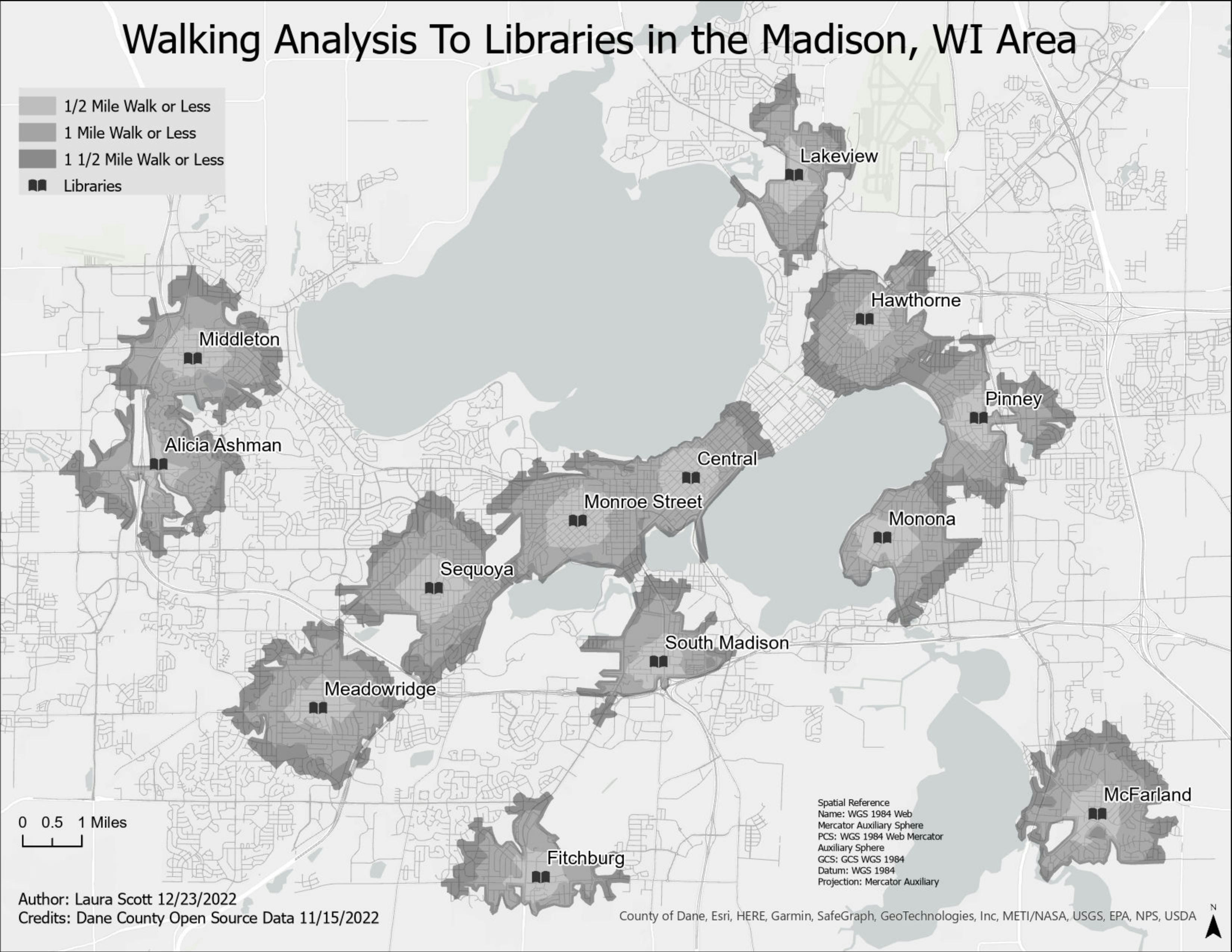
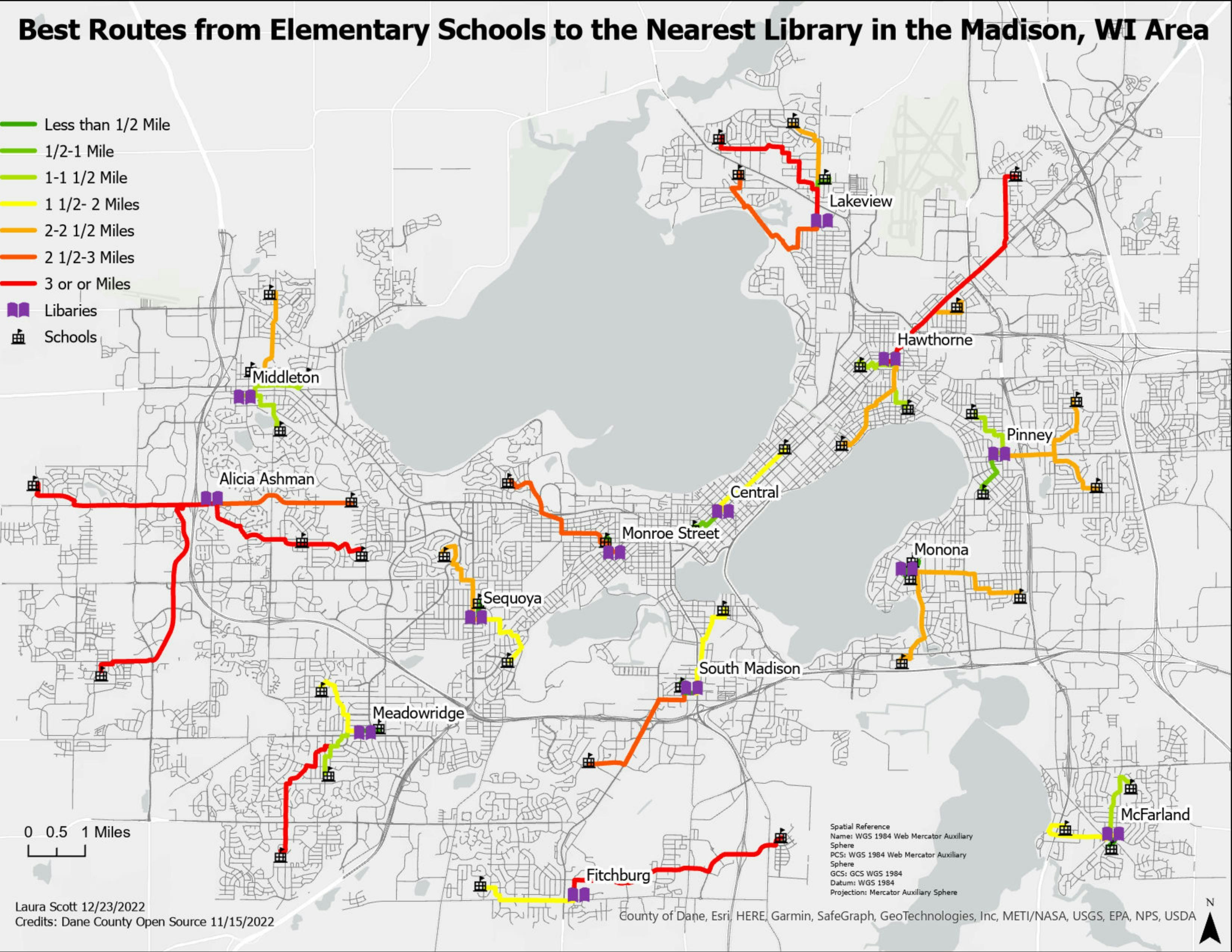
I created a walking analysis to libraries in my study area using network analysis. Before I could create the network, I had to delete any road that did not have a sidewalk or was not accessible to foot traffic. Once the network was created, I identified all areas that were accessible within a half mile, one mile, and one-and-a-half mile.


_645201.jpg&w=48&q=40 "Eguagie-suyi Precious")

