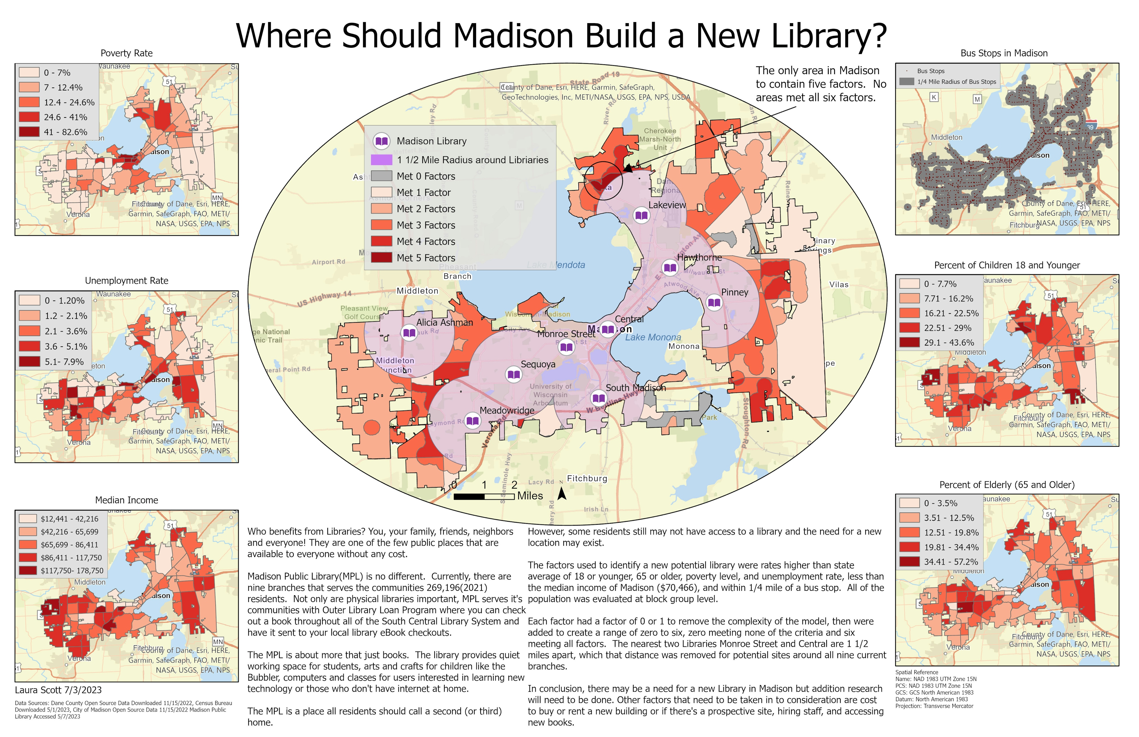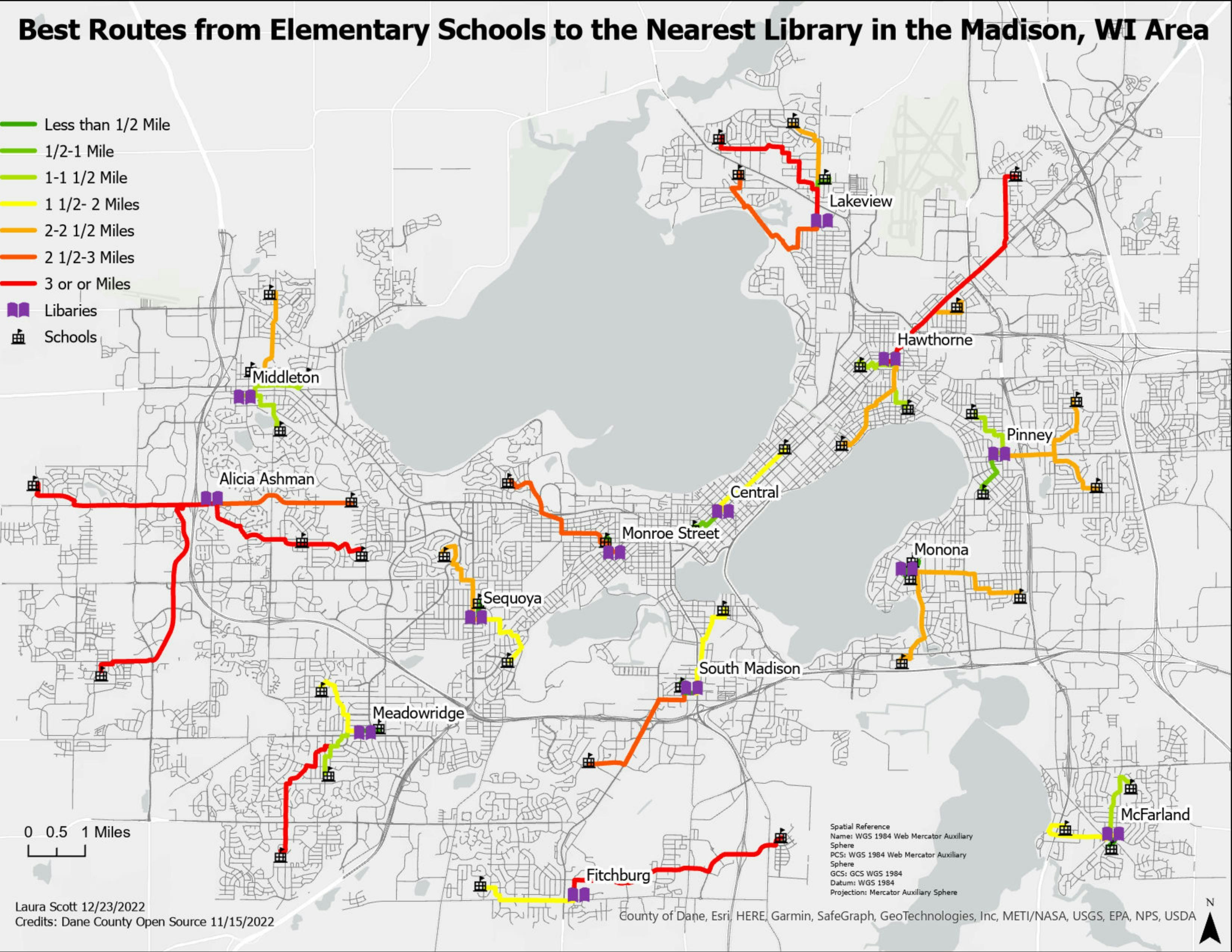
I love making maps and getting comfortable in the chairs next to the fireplace reading a new book at my local library. Why not put them together??
In this project, all the data I used was accessed from the Dane County Open Source Data, and my study area is the Madison, WI area.
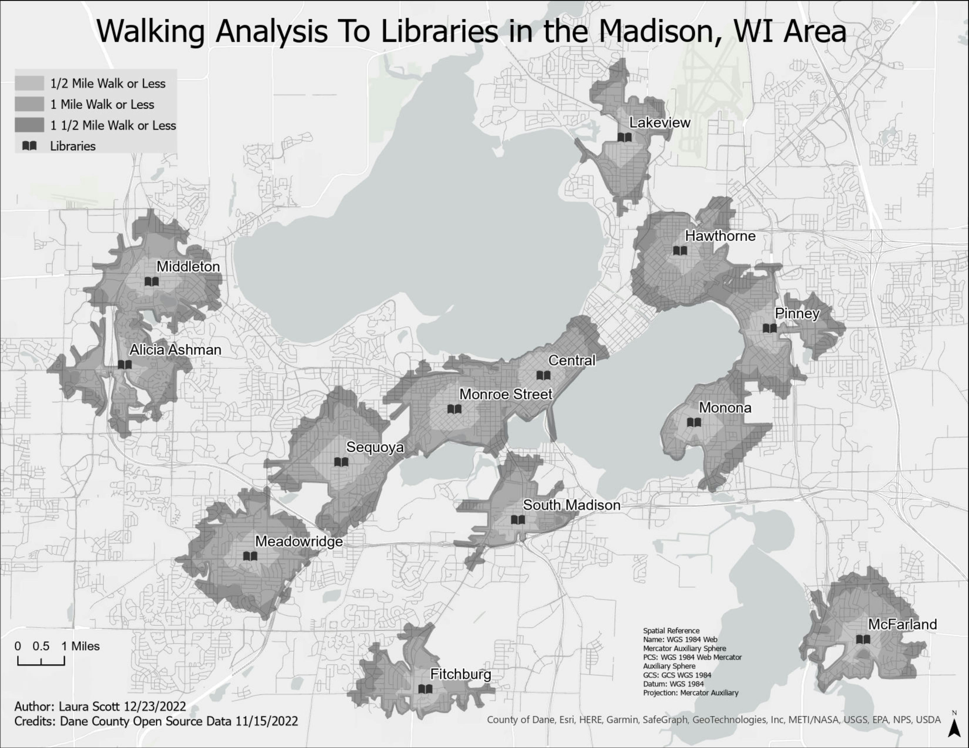
I created a walking analysis to libraries in my study area using network analysis. Before I could create the network, I had to delete any road that did not have a sidewalk or was not accessible to foot traffic.
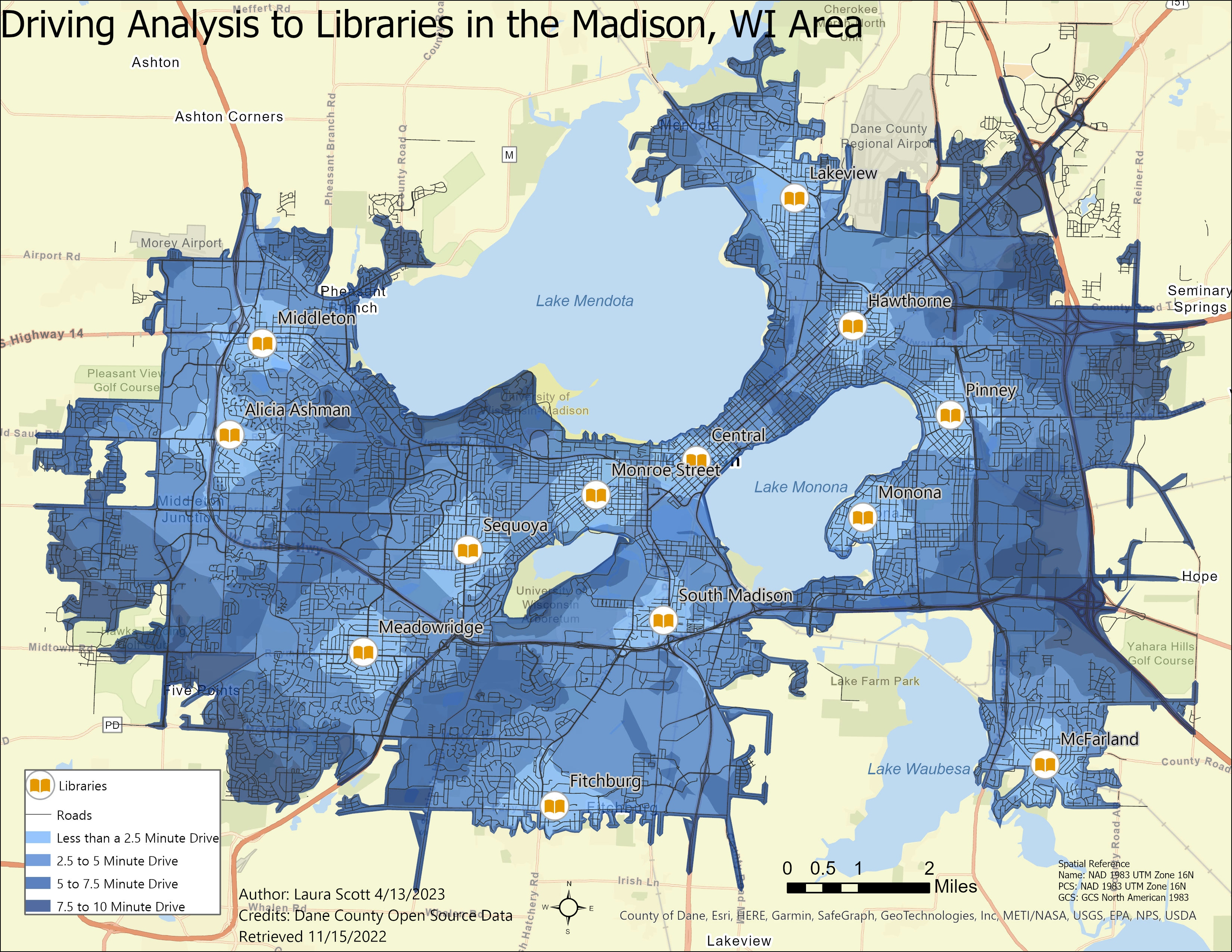
Once I created the network, I used the Best Routes tool to identify the path from Elementary Schools in the study area to the nearest library.