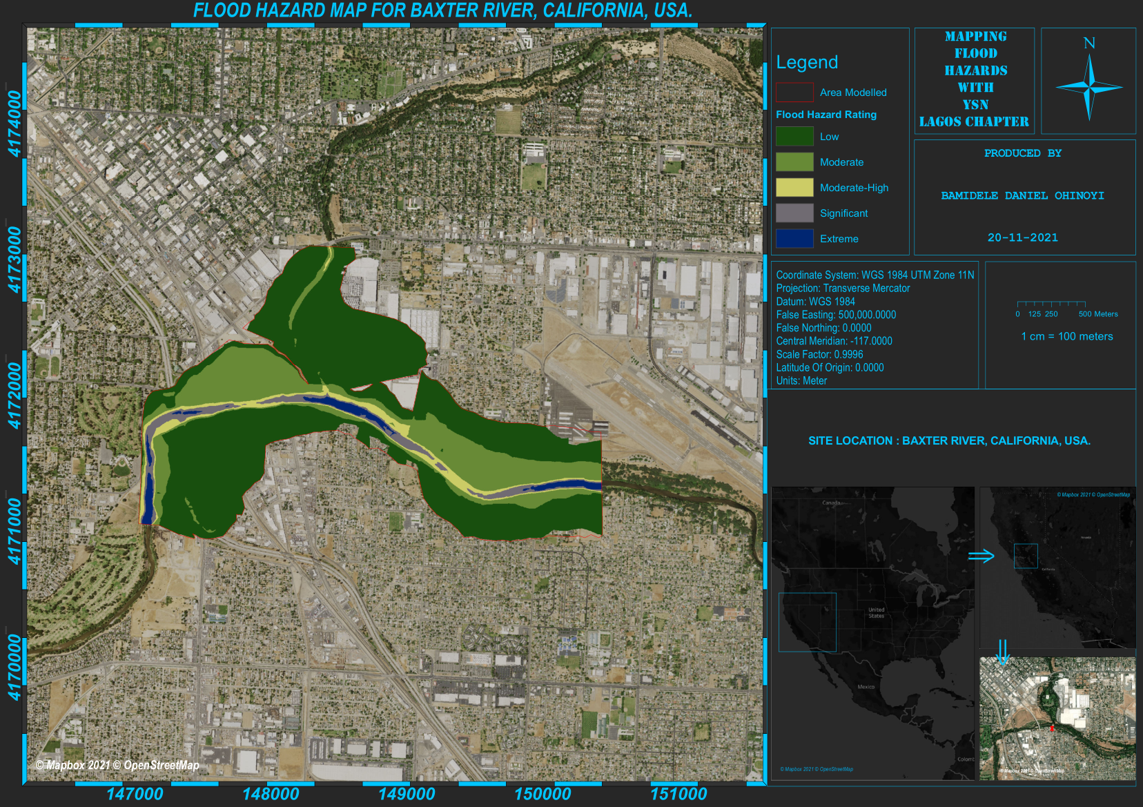
This project was carried out to model a river flood scenario using the Baxter River area located in California, USA, as a study area. This analysis helped us to determine the flood hazard rating for areas adjacent to the river to identify facilities and properties which may be at risk of a flood hazard.
Using HEC-RAS, a powerful and robust software, I was able to model a flood scenario in the surrounding area. flood rating results for the area showed areas with low risk and areas which were the most vulnerable if the river overflowed its bank.


.svg "Keran Nkongolo")