

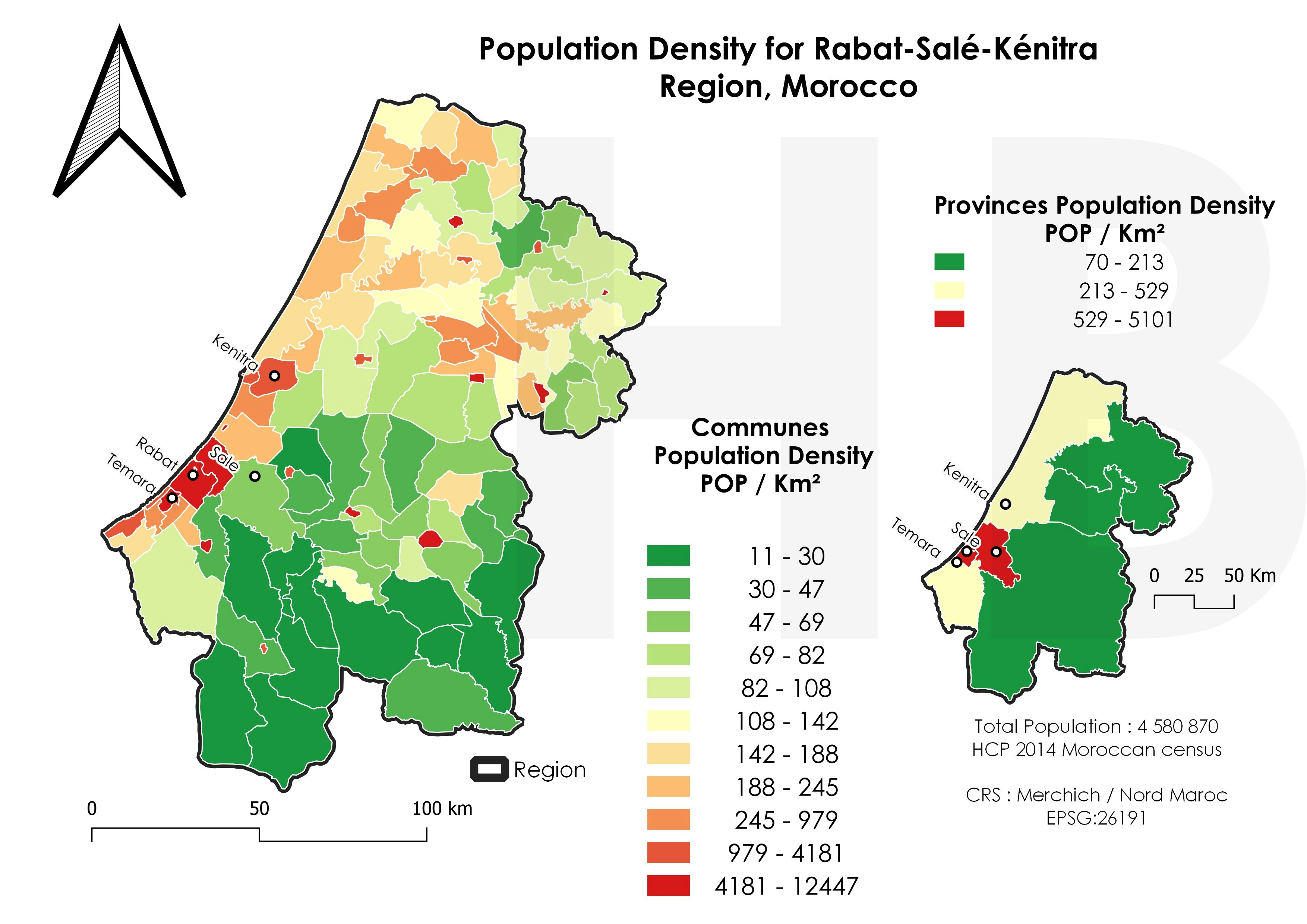
This project was started as part of Palawan State University's plan to put up a floating restaurant within the bay of Puerto Princesa. Since the existing government chart of the area is a bit too old and the information needed by the pilot of their barge was a little too sparse, they decided that a bathymetry of the planned route within the bay should be undertaken. I was therefore asked to perform it. It wasn't really a type of work suitable for professional chart making but good enough for their need. I later on discovered that the existing government chart's bathymetric points was still quite correct so we incorporated it to the result of our readings and I was able to re-generate the chart of the whole bay instead of just the estuary near the University and its immediate vicinity. Much later, I learned that satellite image from either Landsat or Sentinel 2 can be used to determine the depths in an area provided that satellite image within the same date the sample points were taken an be obtained. I was able to download Landsat 8 images and was able to perform Near shore bathymetric analysis of that area. I must say though that the result should only be used for coastal resource management and not for navigational purposes as numerous factors affects the accuracy of the analysis. One of the major factor is sedimentation.
Puerto Princesa Bay Harbor Chart
Plug-ins used
Magnetic Declination.Near Shore Bathymetry.Quick OSMSCP
tags
bathymetryMarine CartographyRemote SensingSpatial Analysis


You might also like


Join the community!
We're a place where geospatial professionals showcase their works and discover opportunities.