
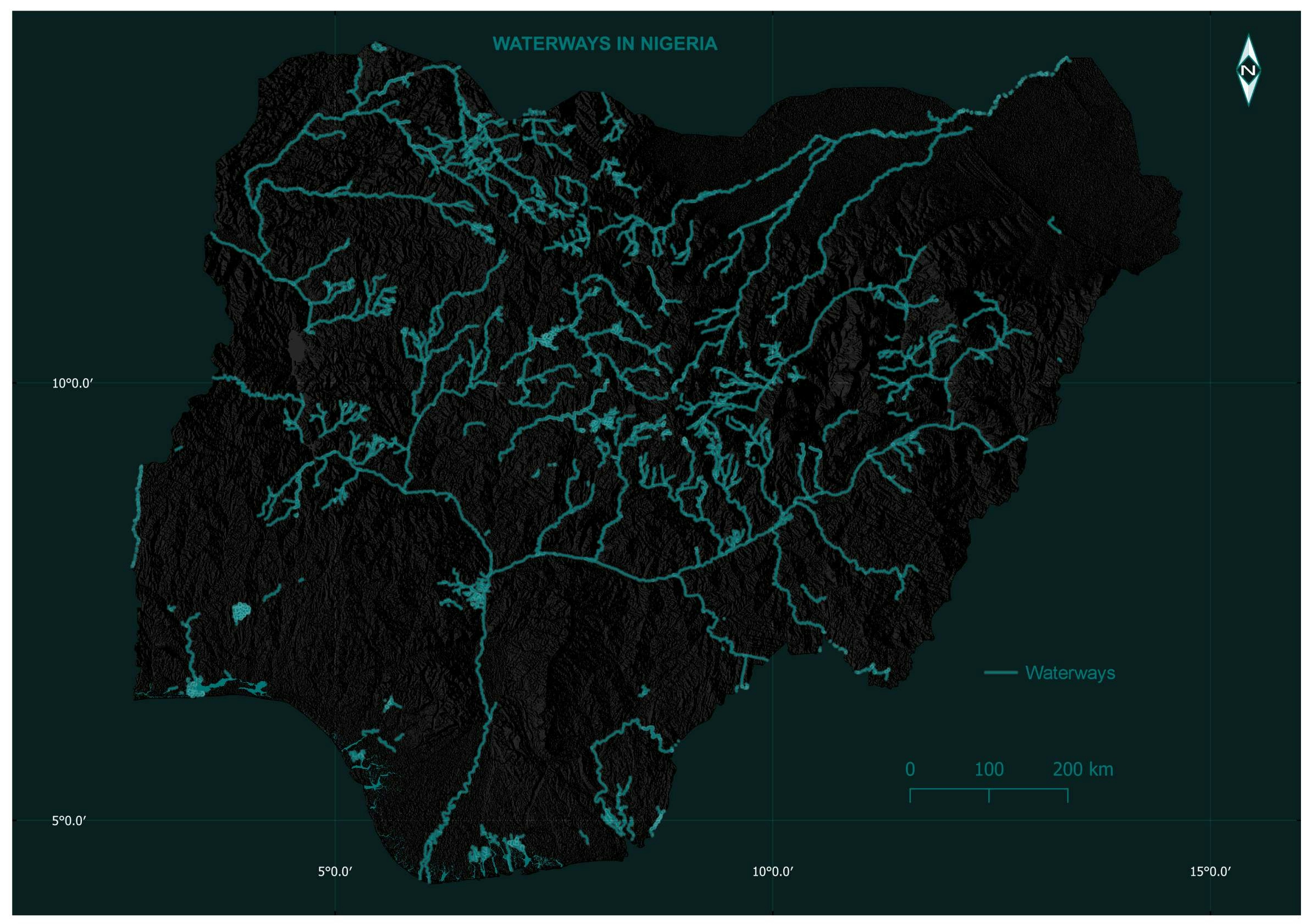
Map showing all the waterways in Nigeria. Prepared using QGIS. Data source: GRID3.
Waterways in Nigeria.
Tools used
QGIS
Plug-ins used
QGIS
tags
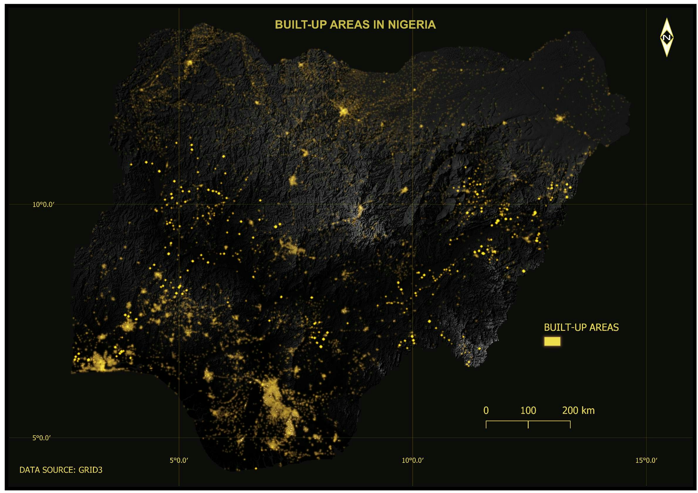
BUILT-UP AREASmodern map NigeriaQGISSRTM
More by Bamidele Daniel Ohinoyi

You might also like


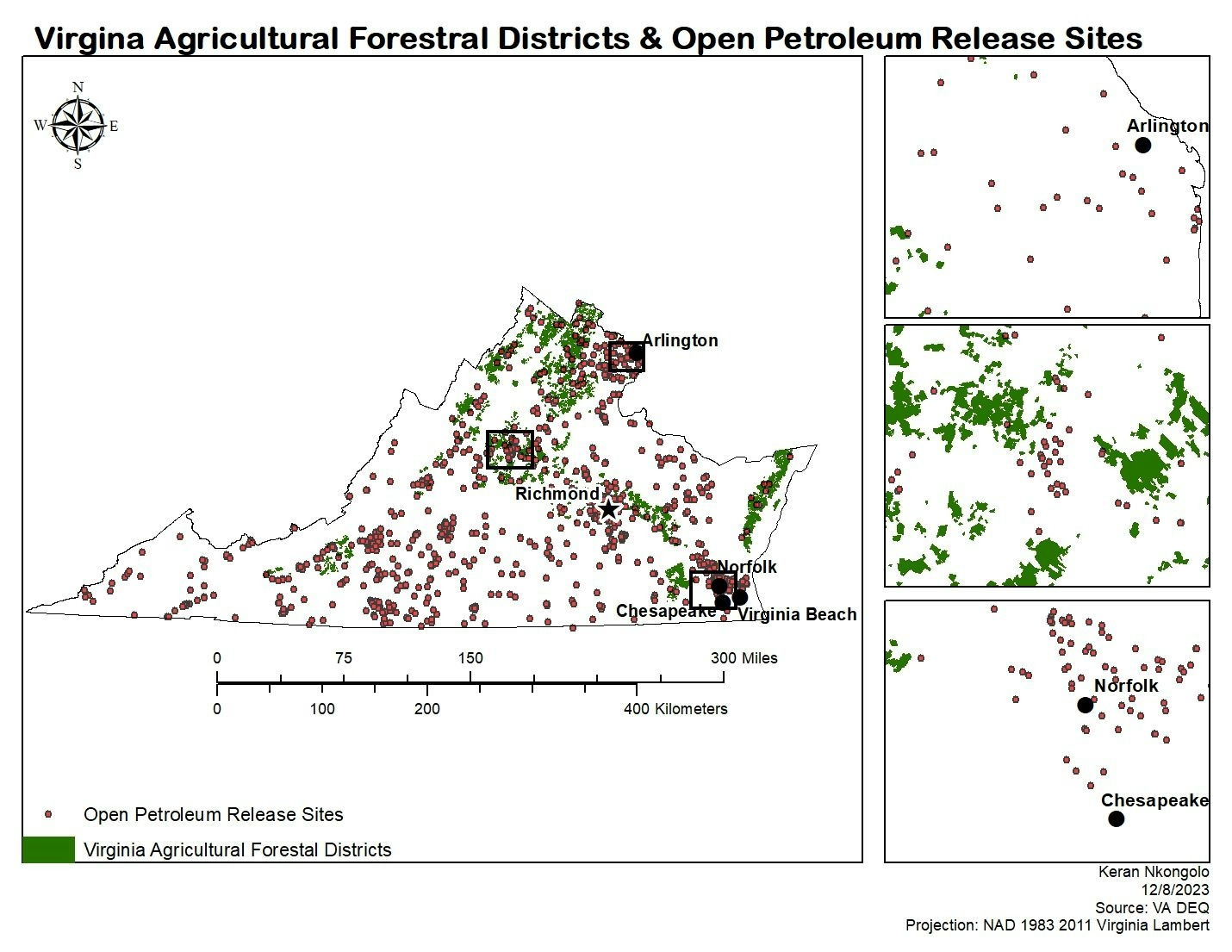
.svg "Keran Nkongolo")

Join the community!
We're a place where geospatial professionals showcase their works and discover opportunities.