Sign up or log in to your Spatialnode account.

Takes less than a few seconds.

Virginia Agricultural Forest Districts

Keran Nkongolo
Keran Nkongolo•

December 15, 2023

Virginia Agricultural Forest Districts

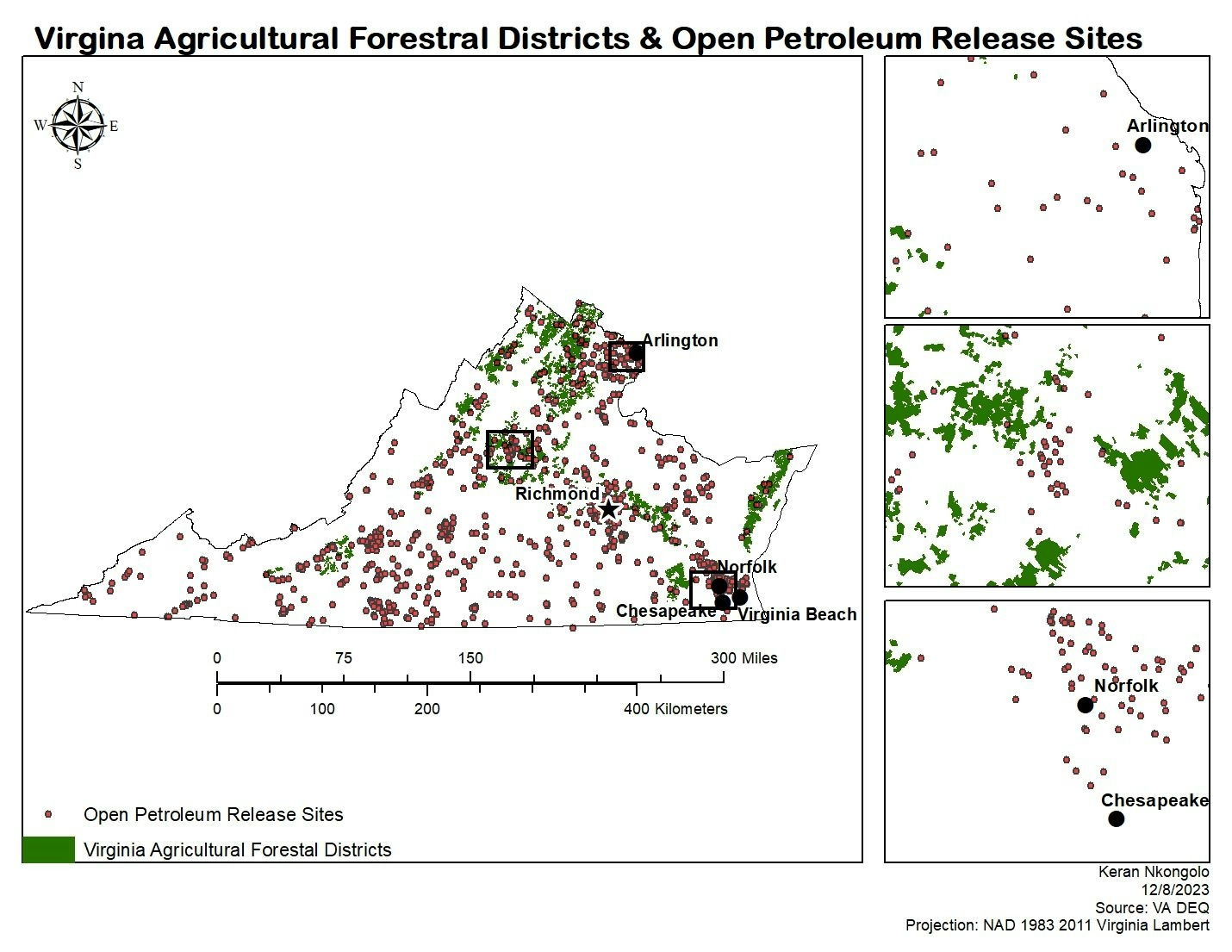
This project displayed the location active petroleum release sited in the state of Virgina, and whether they are located in or around agricultural forest districts in the state.


Plug-ins used

ArcMap

tags

ArcMap

More by Keran Nkongolo

Kansa Oil Fields
Kansa Oil Fields
18
South Dakota Oil Fields
10
Iowa Conservation and Recreation
7
Oregon Groundwater & Abandoned Mines
39
Santa Fe Supervised Classification
21
North Dakota Corn For Grain
7
CO Oil and Gas Wells
14
Las Vegas ML Classification
30
MA Areas of Critical Concern
12
Arsenic in Durango, Mexico
26
CA Acres Burned and Wildfires
18
Nebraska Endangered
Nebraska Endangered
6

You might also like

Riverside Geospatial Support
Armster Edwards
Riverside Geospatial Support
Armster Edwards
27
Mapping - Congressional Districts Map
Jeffrey Erwin
Mapping - Congressional Districts Map
Jeffrey Erwin
13
Índice de Vegetação - NDVI
Carlos Joubert Sousa da Rocha
Índice de Vegetação - NDVI
Carlos Joubert...
198
MAPA DE LOCALIZAÇÃO DE UIRAÚNA/PB
Jonatha Iuri
MAPA DE LOCALIZAÇÃO DE UIRAÚNA/PB
Jonatha Iuri
160
Blue Whale Migration Map
Oswald Onimhawo
Blue Whale Migration Map
Oswald Onimhawo
26
Vegetação da Caatinga
Matheus Maciel
Vegetação da Caatinga
Matheus Maciel
17
Cambio de coberturas - Deforestación 🪵
Jair Granados Chacón
Cambio de coberturas - Deforestación 🪵
Jair Granados Chacón
12
Coordinate Systems
Coordinate Systems
Coordinate Systems
Nick Linell
Coordinate Systems
Nick LinellPro
3
Mapa de localização e população
Eliezer Lucio Fernandes Lima
Mapa de localização e população
Eliezer Lucio...
107
Moor Green Lakes
Millie Brand
Moor Green Lakes
Millie Brand
27
NDVI para detecção de área desmatada
Luiz Prado
NDVI para detecção de área desmatada
Luiz Prado
170
Remote Sensing of Orchard
Reese Dresch
Remote Sensing of Orchard
Reese Dresch
27

Join the community!

We're a place where geospatial professionals showcase their works and discover opportunities.

Sign Up for free