Sign up or log in to your Spatialnode account.

Takes less than a few seconds.

Following the Desert Locusts

Sara Fatimah
Sara Fatimah•

May 05, 2022

Following the Desert Locusts

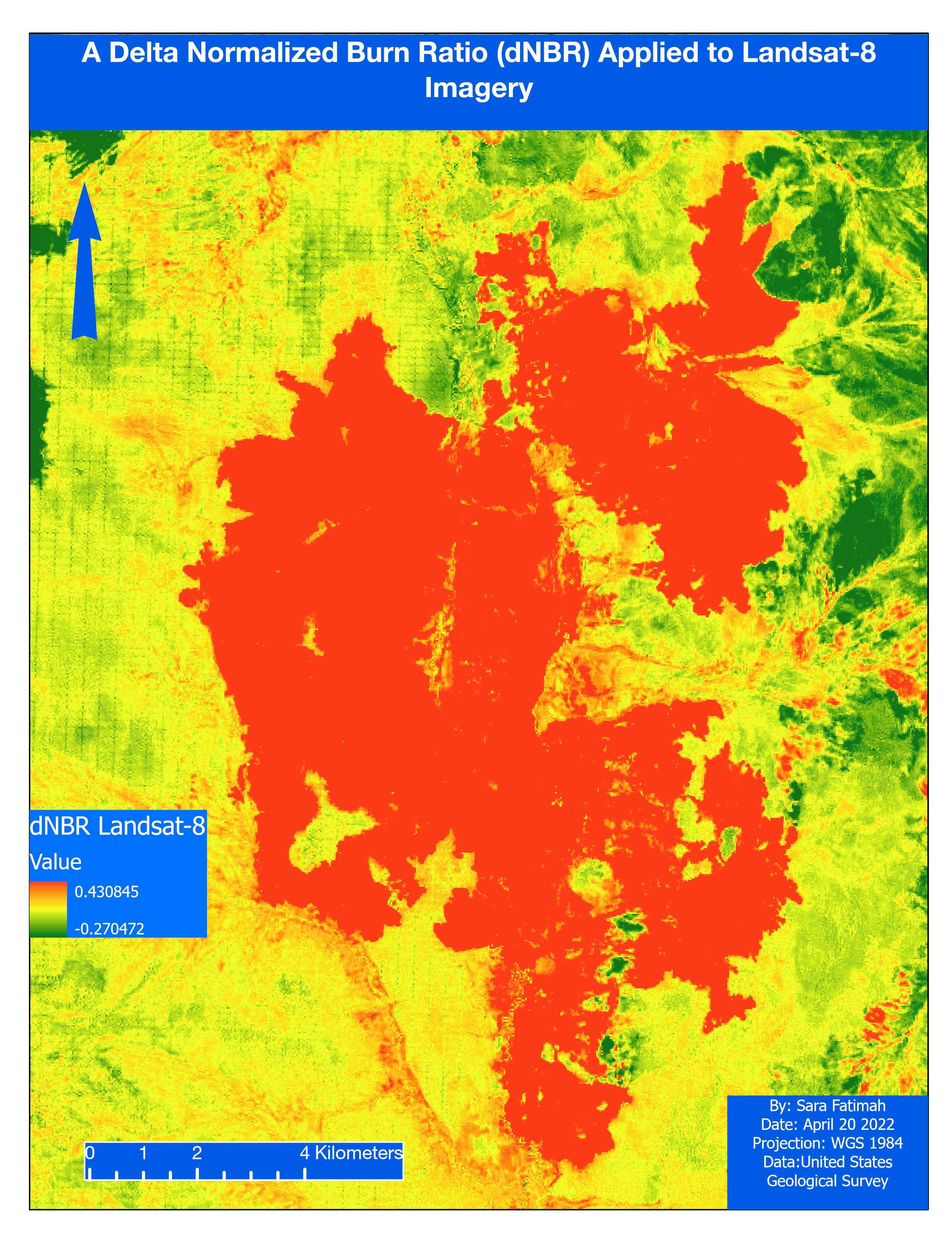
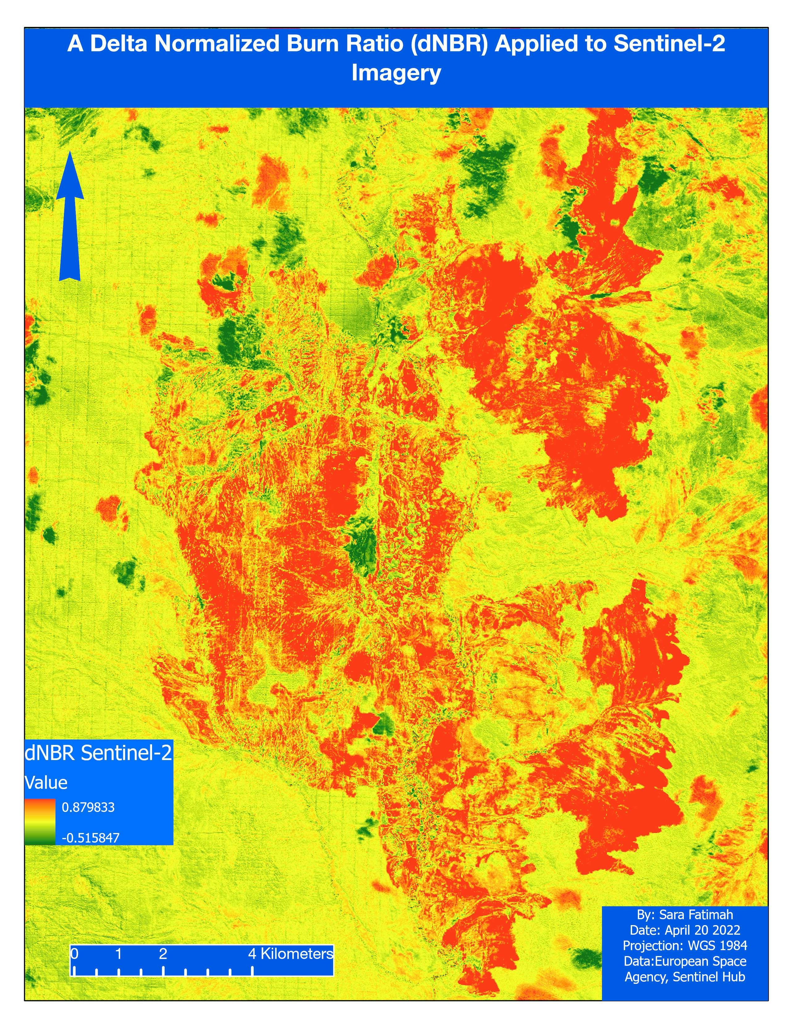
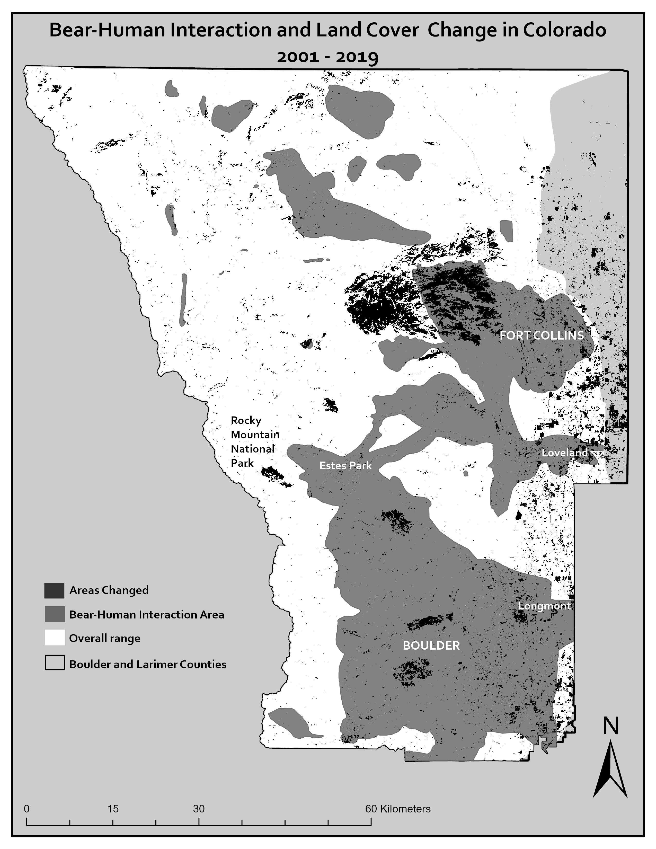
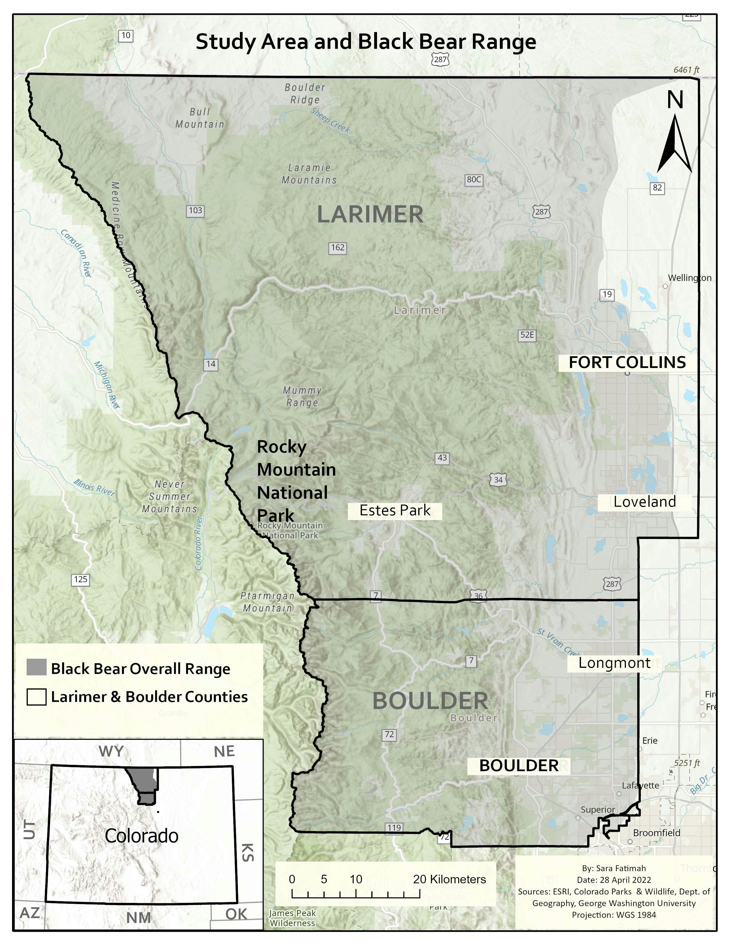
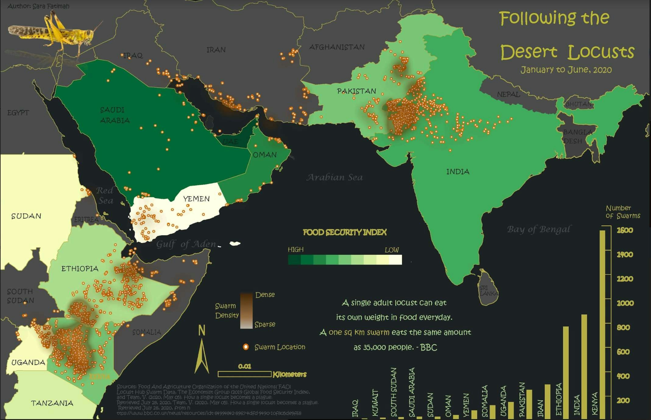
Map displaying the locust invasion in South Asia, the Middle East, and Eastern Africa in 2020.

Software used: ArcMap


Tools used

ArcMapExcel

Plug-ins used

Spatial analyst

tags

CartographyData VisualizationFood

More by Sara Fatimah

Death by Design
Death by Design
37
Landslide Hazard Assesment
32
Woody Areas & Postgraduates in DC
29
Interactive Air Quality Map
113
2001 Landcover, Northern Colorado
24
2019 Landcover Northern Colorado
43
Sage-grouse habitat
Sage-grouse habitat
18
Study Area & Black Bear Habitat
22
Prince of Wales Island.
13
Preliminary findings from research.
22
Mapping Wildfires in Eastern Siberia
28
Landsat 8: Mapping Wildfires
16

You might also like

Mapa de Localização
Diego Alves da Rocha
Mapa de Localização
Diego Alves...
53
Mapa - Unidades Geoambientais CE
Johnson Sarmento de O. Nascimento
Mapa - Unidades Geoambientais CE
Johnson Sarmento...
29
Densidade Demográfica
João Alison Dionísio Mendonça
Densidade Demográfica
João Alison...
10
Land use
omoogun bankole
Land use
omoogun bankole
3
Digital Elevation Model of Oyo State.
Olawuyi Abolade Pelumi
Digital Elevation Model of Oyo State.
Olawuyi Abolade Pelumi
34
Food Desert Identification in Atlanta
Dane Lewandowski
Food Desert Identification in Atlanta
Dane Lewandowski
29
Lubigi Wetland Vulnerability Map Uganda
Akor, Daniel Enechojo
Lubigi Wetland Vulnerability Map Uganda
Akor, Daniel Enechojo
93
Hidrografia do município do Recife
Matheus Maciel
Hidrografia do município do Recife
Matheus Maciel
242
OIL SPILL MAP
Kareem Hakeem Akinlabi
OIL SPILL MAP
Kareem Hakeem Akinlabi
19
Data Collection usin ARCGIS Survey 123
Jesse Kato
Data Collection usin ARCGIS Survey 123
Jesse Kato
102
Bangladesh Mangrove Monitor: A Web App
Md Rokib Uddin Oney
Bangladesh Mangrove Monitor: A Web App
Md Rokib...
11
Phoenix ML Classification
Keran Nkongolo
Phoenix ML Classification
Keran NkongoloPro
16

Join the community!

We're a place where geospatial professionals showcase their works and discover opportunities.

Sign Up for free