Sign up or log in to your Spatialnode account.

Takes less than a few seconds.

The Stiperstones & The Hollies

Millie Brand
Millie Brand•

June 10, 2022

The Stiperstones & The Hollies

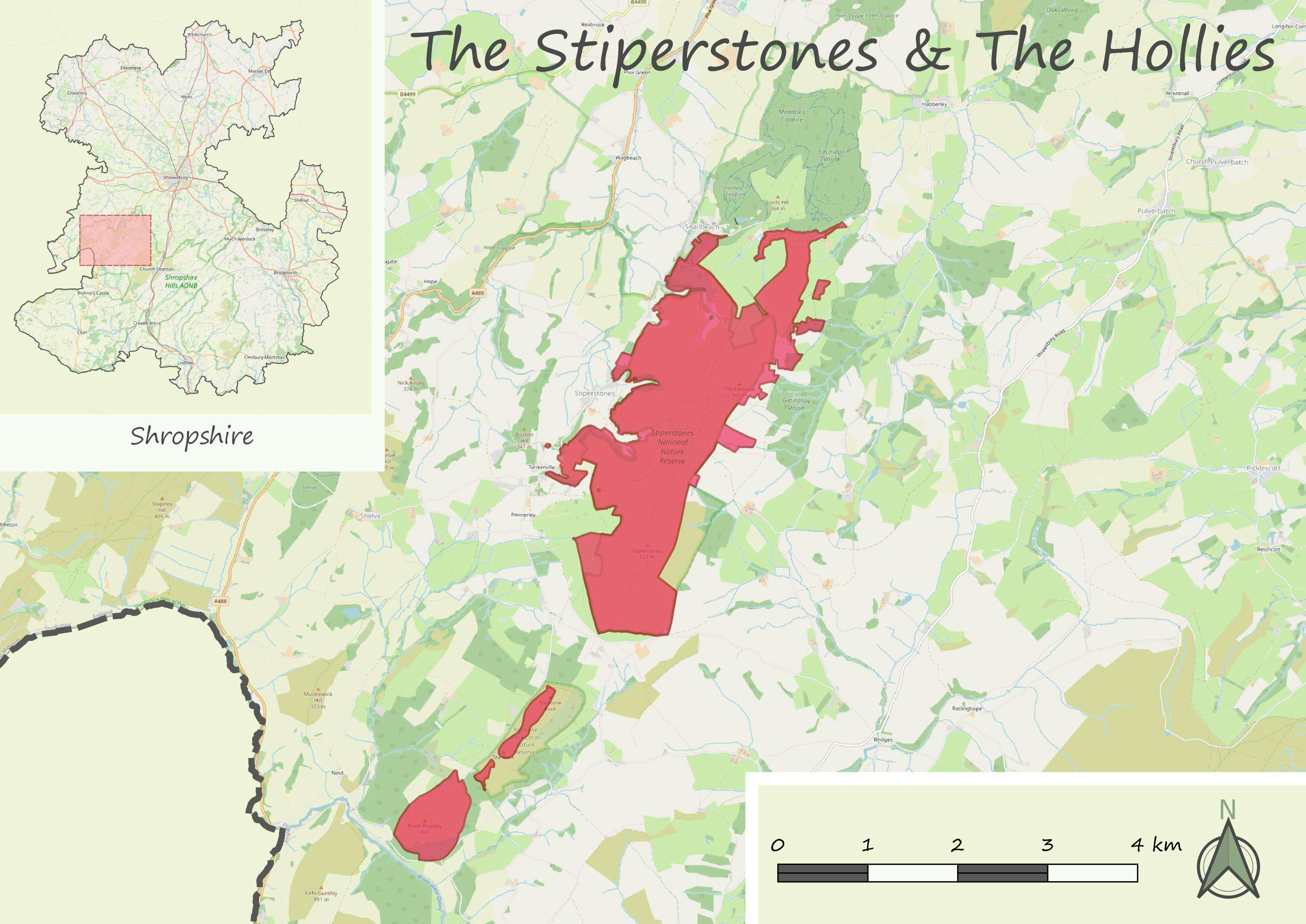
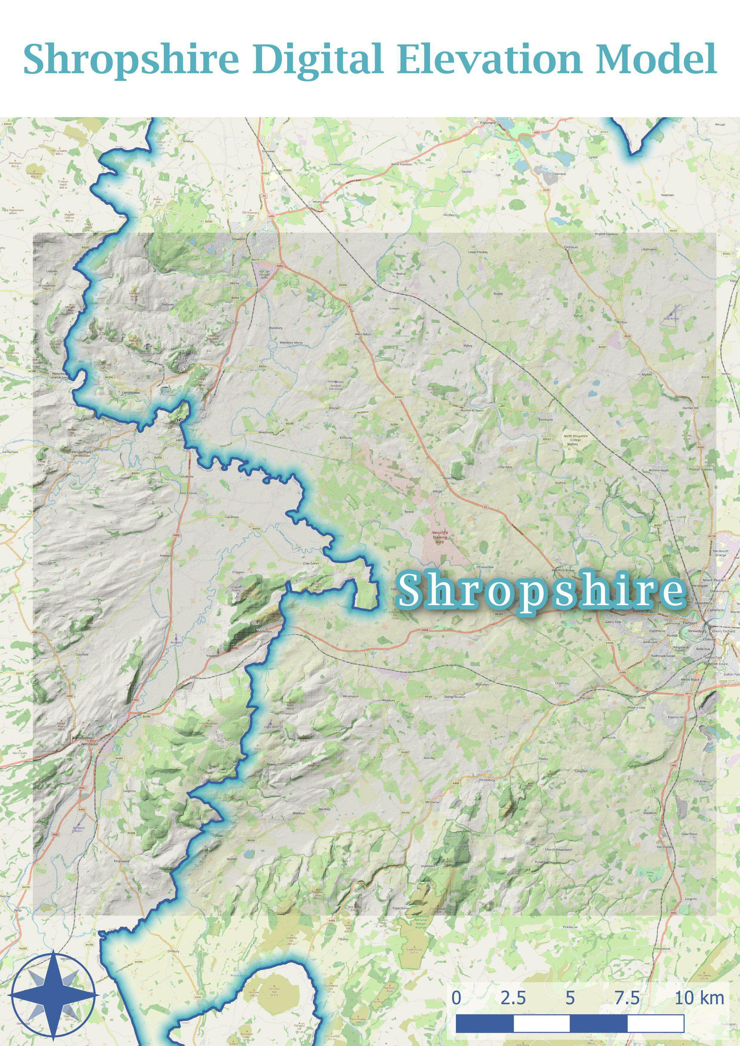
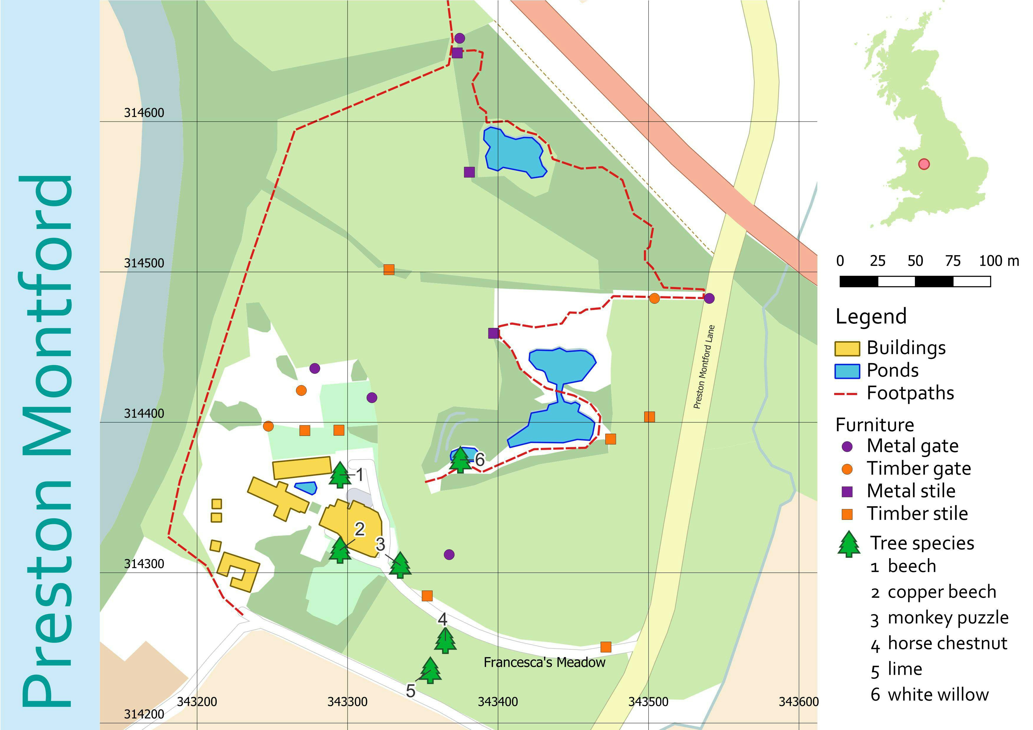
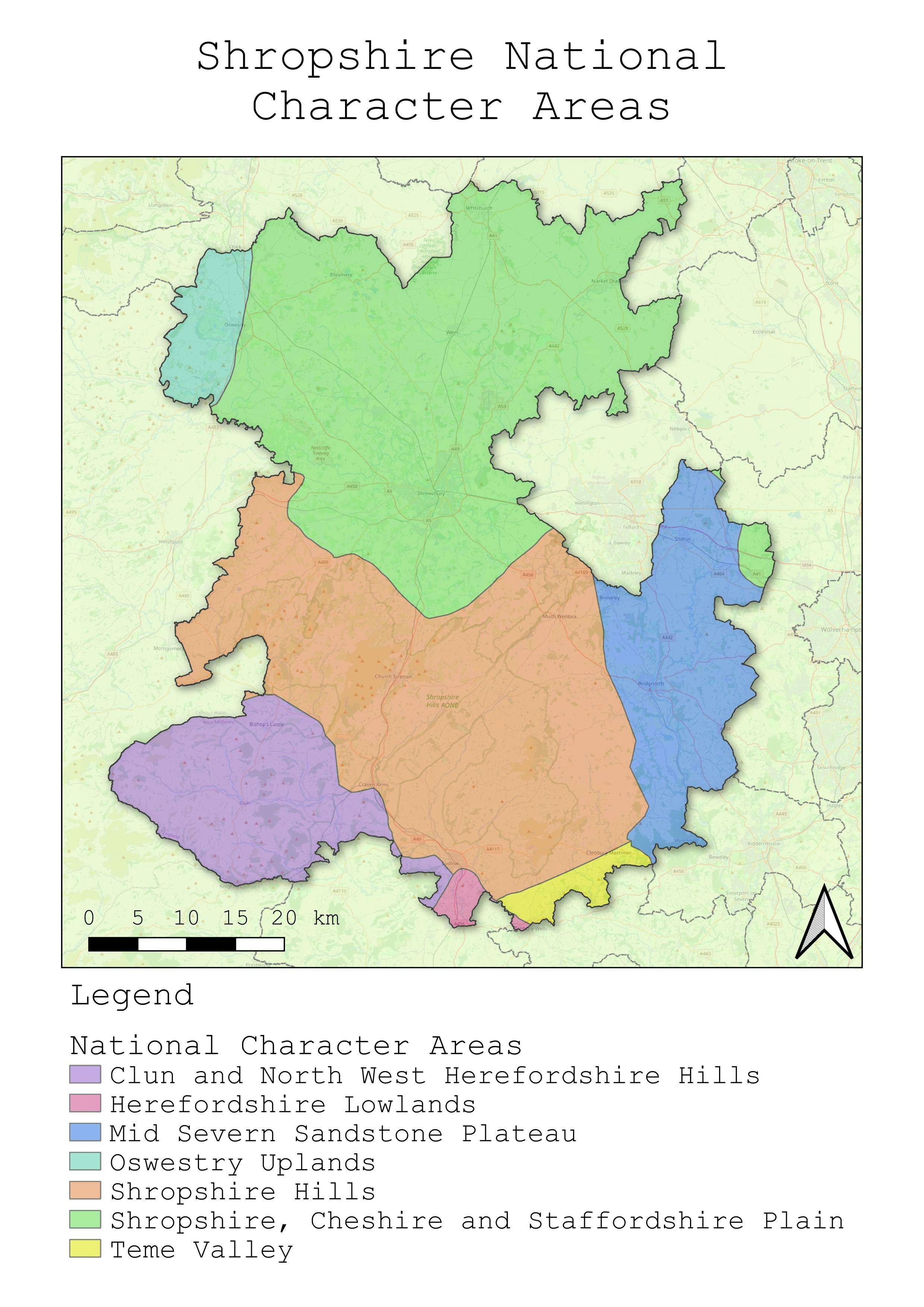
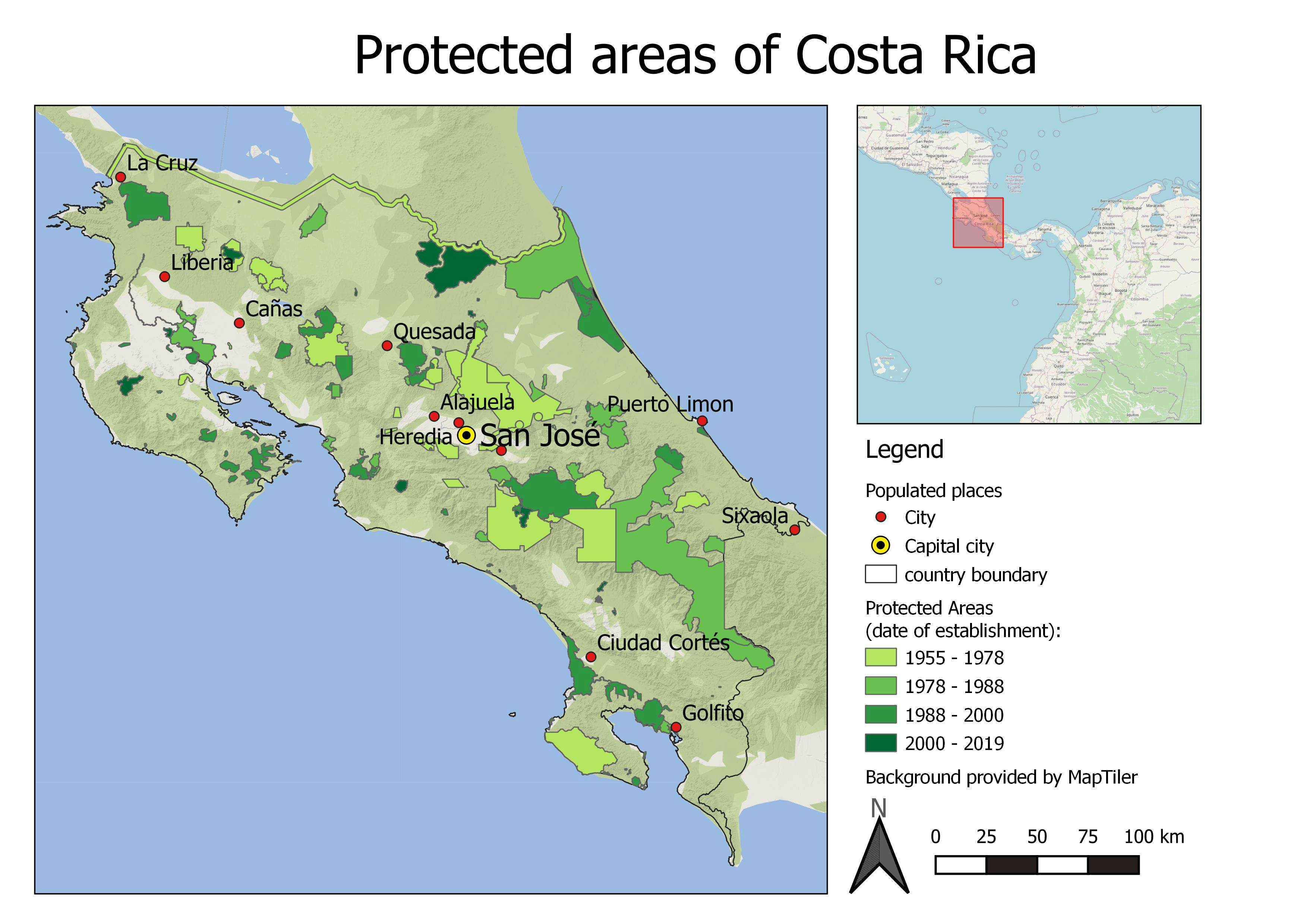
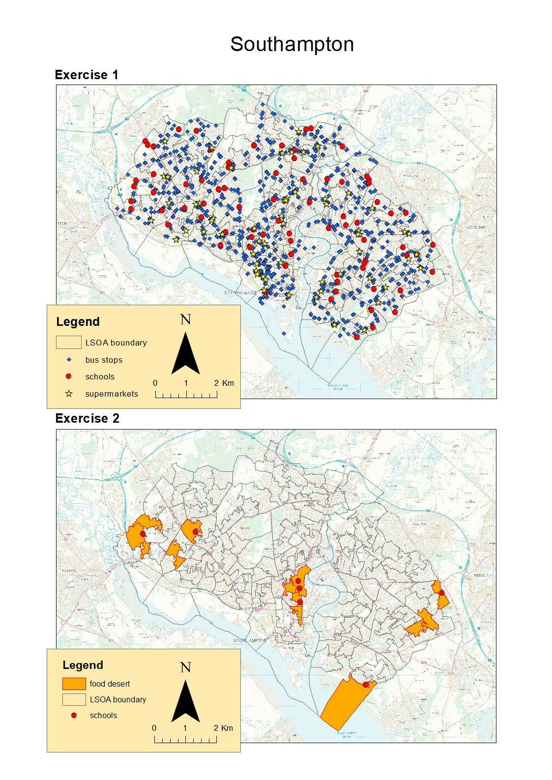
FSC QGIS for Ecologists course - day 3

This map puts together everything I have learnt over the past few days, including filtering, creating map overviews, and using Ordnance Survey data.


Tools used

QGIS

Plug-ins used

OSMDownloader

tags

Special Area of Conservation

More by Millie Brand

Shropshire elevation
17
Features of Preston Montford
15
Land cover classification
25
Moor Green Lakes
Moor Green Lakes
24
Rondonia land use classifcation
42
Southampton Food Deserts
24
Costa Rica research proposal
26
Shropshire National Character Areas
9
Protected areas of Costa Rica
17

You might also like

Death by Design
Sara Fatimah
Death by Design
Sara Fatimah
36
Modelo de Elevação Relativa
Gabriel Henrique Braga Matos
Modelo de Elevação Relativa
Gabriel Henrique...
28
Map of Oyo State
Olaoluwa Israel Akinnibi
Map of Oyo State
Olaoluwa Israel Akinnibi
62
Diretrizes de altimetria #02
Isabel Freitas Aniceto
Diretrizes de altimetria #02
Isabel Freitas Aniceto
6
College Projects (2019 - 2020)
Bagus Wijanarko
College Projects (2019 - 2020)
Bagus Wijanarko
24
Parâmetros Físicos Montes Claros - MG
Francielle Caminhas
Parâmetros Físicos Montes Claros - MG
Francielle Caminhas
92
CROP MAP OF PART OF IKOT ESSIEN VILLAGE
Edidiong Ekrikpo
CROP MAP OF PART OF IKOT ESSIEN VILLAGE
Edidiong Ekrikpo
18
DETERMINATION OF GEOID SURFACE
Ireoluwa Orodiji
DETERMINATION OF GEOID SURFACE
Ireoluwa Orodiji
6
Mapa Hipsométrico - Rio do Prado
Brenner Rodrigues
Mapa Hipsométrico - Rio do Prado
Brenner Rodrigues
8
Focos de incêndio em Minas Gerais
Vitória Serra Bernardes
Focos de incêndio em Minas Gerais
Vitória Serra Bernardes
202
London region duration for 2019
Ologun Emmanuel Ayowole
London region duration for 2019
Ologun Emmanuel Ayowole
23
LAND USE LAND COVER, MACHAKOS COUNTY2022
MOSES MWANIA MULYUNGI
LAND USE LAND COVER, MACHAKOS COUNTY2022
MOSES MWANIA MULYUNGI
93

Join the community!

We're a place where geospatial professionals showcase their works and discover opportunities.

Sign Up for free