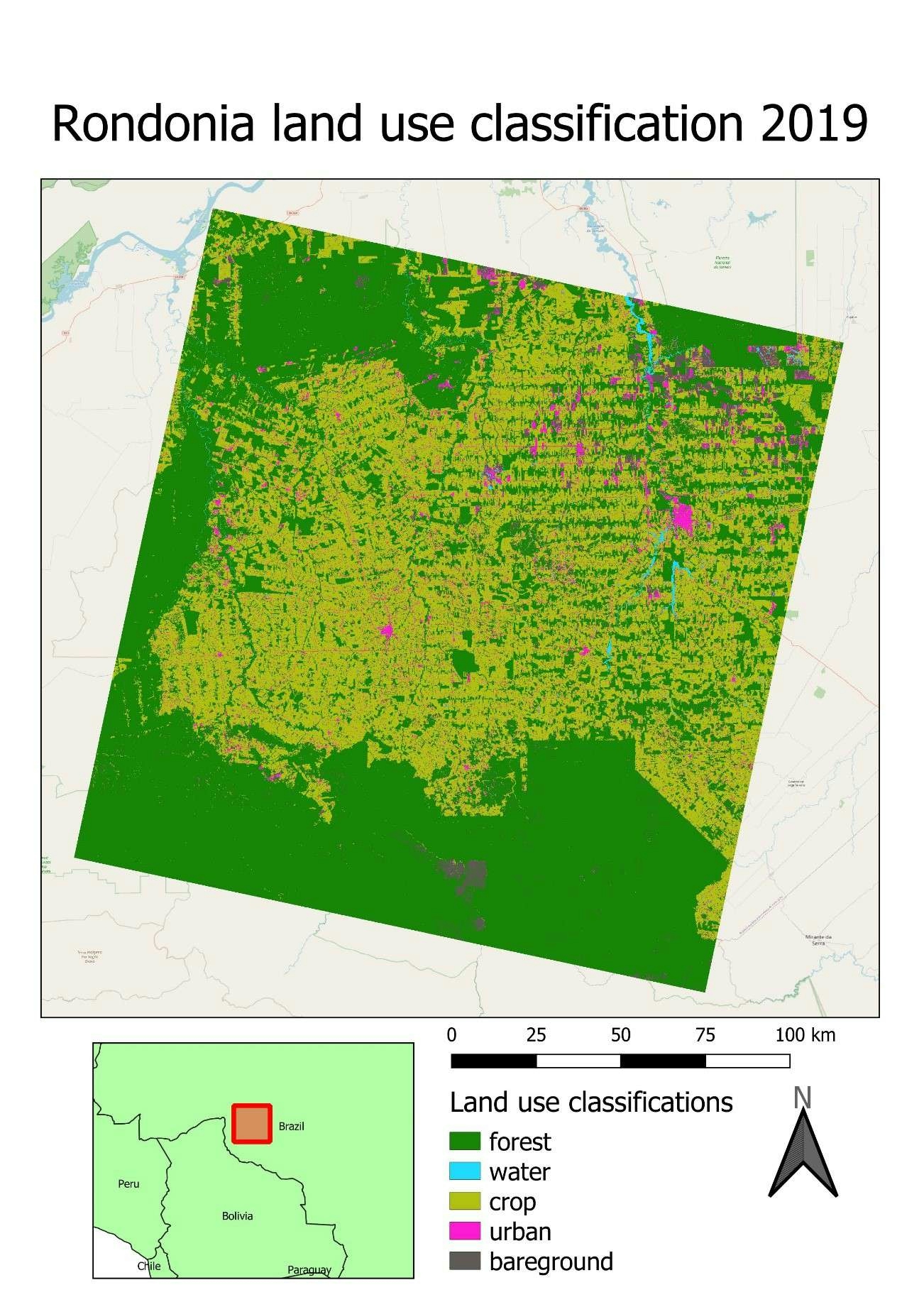
A project as part of the Environmental Change module in my BSc Geography degree. Two Random Forest Classifications were carried out in 1984 and 2019 (pictured) using Landsat imagery, to compare the changes in land cover in Rondonia, Brazil.
Over the study period, forest cover has decreased by 41%. This is likely due to deforestation, as suggested by the 'fishbone' pattern characterised by shifting agriculture and cattle ranching.