Sign up or log in to your Spatialnode account.

Takes less than a few seconds.

Moor Green Lakes

Millie Brand
Millie Brand•

June 10, 2022

Moor Green Lakes

FSC QGIS for Ecologists course

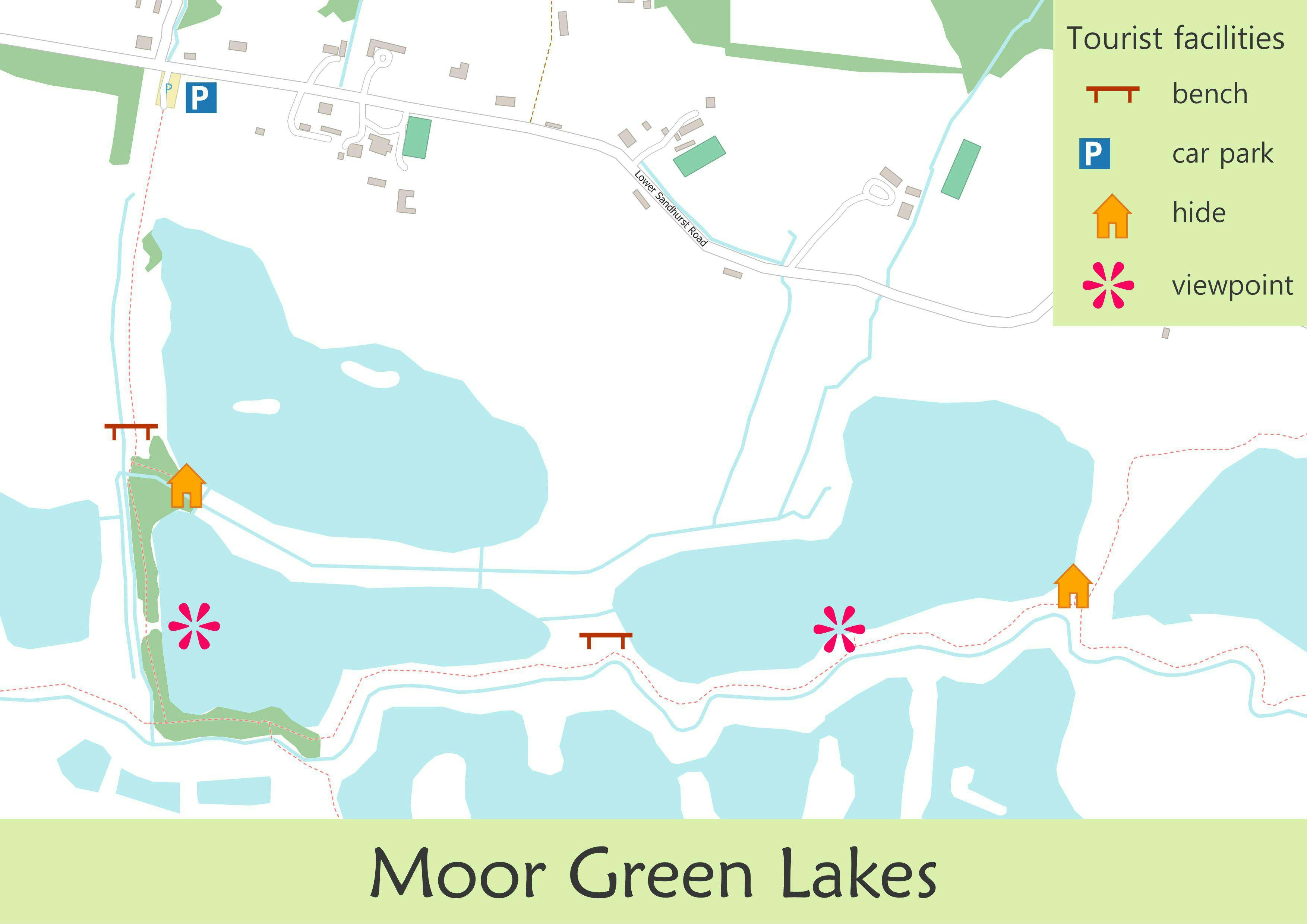
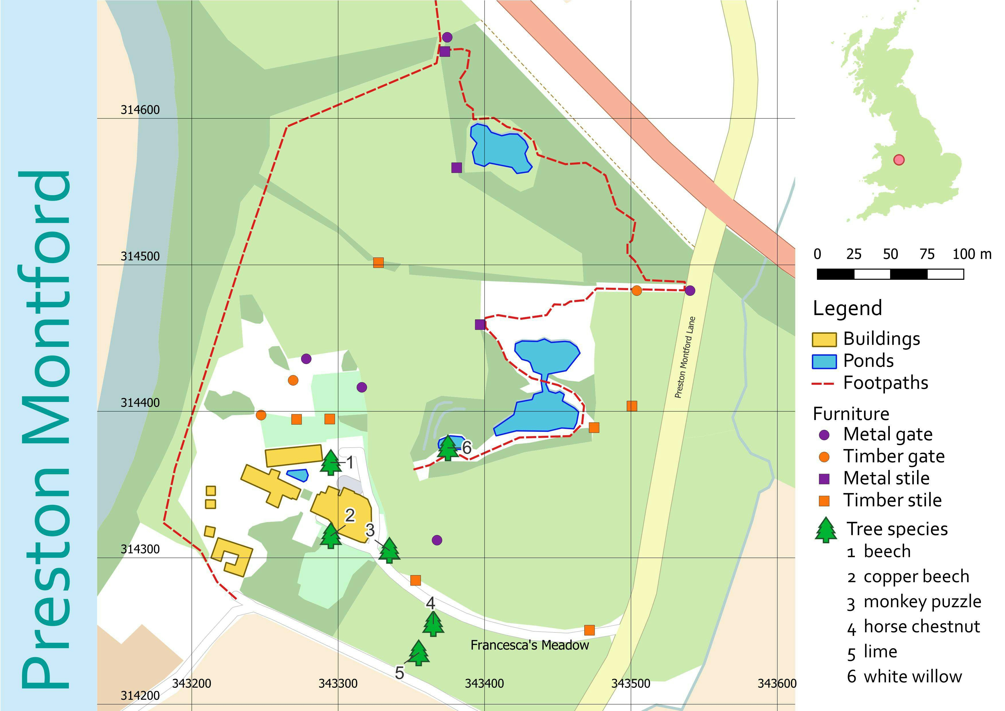
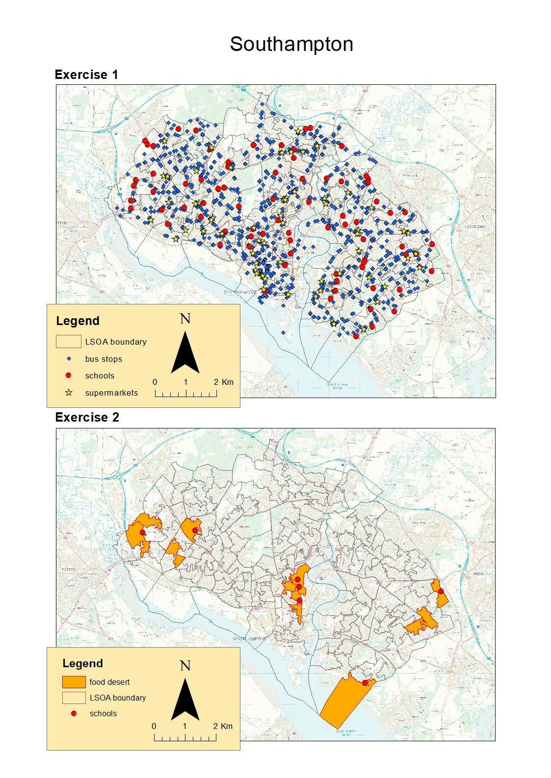
In this project I had a refresher on georeferencing, by adding point data from a raster image. I also manipulated vector data imported using the OSMDownloader.


Tools used

QGIS

Plug-ins used

OSMDownloaderTomBio

tags

georeferencing

More by Millie Brand

Land cover classification
26
Costa Rica research proposal
30
Shropshire National Character Areas
13
Shropshire elevation
23
Southampton Food Deserts
32
Protected areas of Costa Rica
23
The Stiperstones & The Hollies
26
Rondonia land use classifcation
51
Features of Preston Montford
15

You might also like

Uso e Ocupação - Lagoa da Pampulha
Maria Gabriela Menegussi
Uso e Ocupação - Lagoa da Pampulha
Maria Gabriela Menegussi
12
Earth gone wild! Green edition. 💚
Alexa Cristina
Earth gone wild! Green edition. 💚
Alexa Cristina
16
Analise Temporal do NDVI médio
José  de Alencar Peixoto Filho
Analise Temporal do NDVI médio
José ...
42
Mapa de localização e população
Eliezer Lucio Fernandes Lima
Mapa de localização e população
Eliezer Lucio...
110
Dobropillya 2030: City Expansion
Oleh Shapochkin
Dobropillya 2030: City Expansion
Oleh Shapochkin
38
RGB - True Colour Composite
Bertrand Lobo
RGB - True Colour Composite
Bertrand Lobo
80
2024 CNWI Priority Areas in BC Map
Rodney Wong
2024 CNWI Priority Areas in BC Map
Rodney Wong
13
Wildlife Sightings
Marica di Girolamo
Wildlife Sightings
Marica di Girolamo
21
Forest Trends in Nyungwe National Park
Marissa Kulkarni
Forest Trends in Nyungwe National Park
Marissa Kulkarni
43
Denver Center
Adam O Dolce
Denver Center
Adam O Dolce
78
Sustainable Urban Planning in the E.U.
Cedar Bachmann
Sustainable Urban Planning in the E.U.
Cedar BachmannPro
9
Point Cloud Processing and Analysis
Wong Yong Bin
Point Cloud Processing and Analysis
Wong Yong Bin
30

Join the community!

We're a place where geospatial professionals showcase their works and discover opportunities.

Sign Up for free