
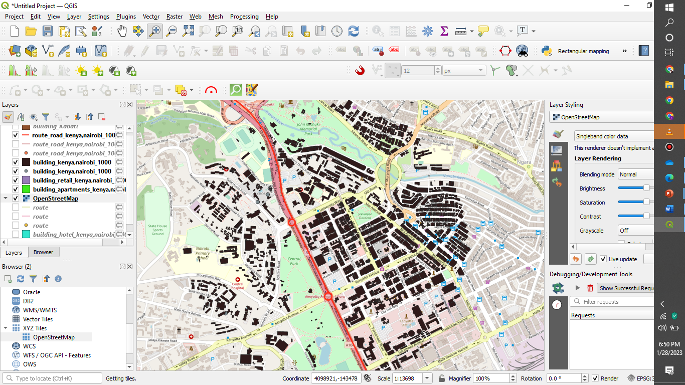
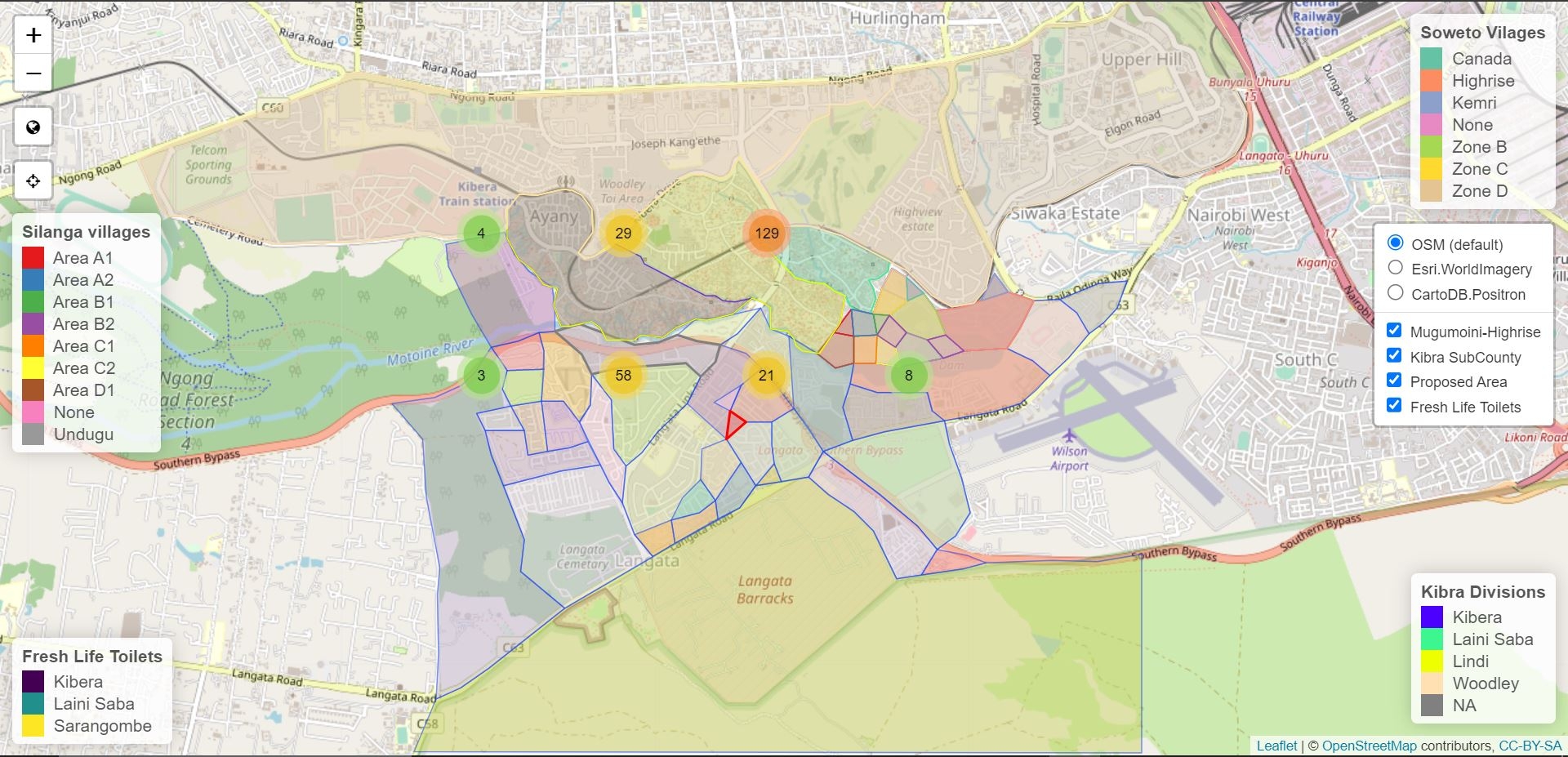
QUICK OSM IN GIS PROCEDURE MAPPING OF BUILDINGS
1. Download and install an open source GIS software such as QGIS or ArcGIS.
2. Download OpenStreetMap (OSM) data for the area of interest. This can be done through the Export tool in the OSM website or by using a GIS plugin such as the QuickOSM plugin for QGIS.
3. Open the downloaded OSM data in the GIS software.
4. Symbology can be changed to make the data easier to read.
5. Use the Select Features tool to select the buildings of interest.
6. Create a new layer for the buildings of interest.
7. Use the Buffer tool to create a buffer around the buildings.
8. Export the data to a new layer.
9. Analyze the data as needed.
10. Create a map of the buildings and their associated buffers.
QUICK OSM MAPPING OF NAIROBI BUILDINGS
Tools used
QGIS
Plug-ins used
QuickOSM
tags
OSMQGIS
More by Francis Ndiritu


You might also like


Join the community!
We're a place where geospatial professionals showcase their works and discover opportunities.