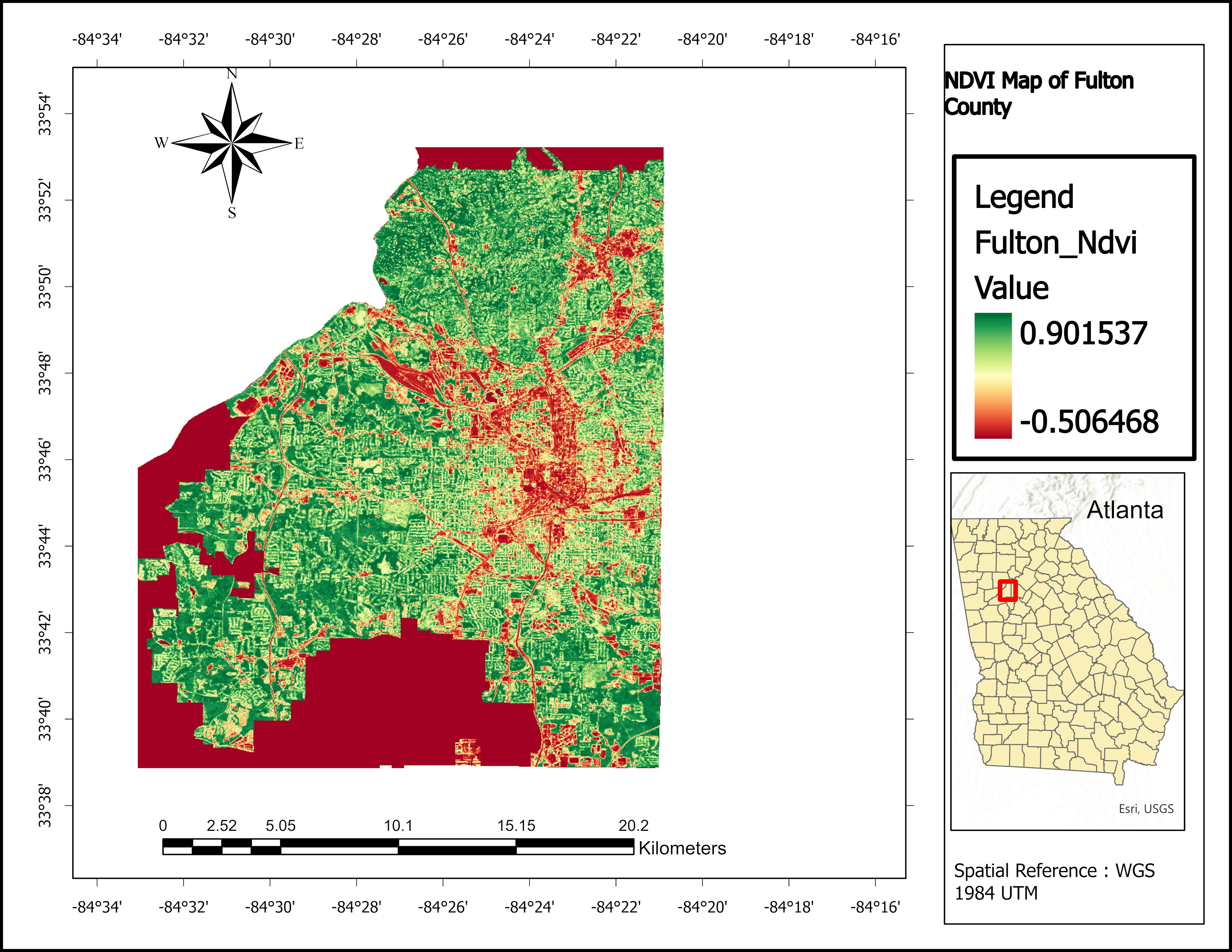
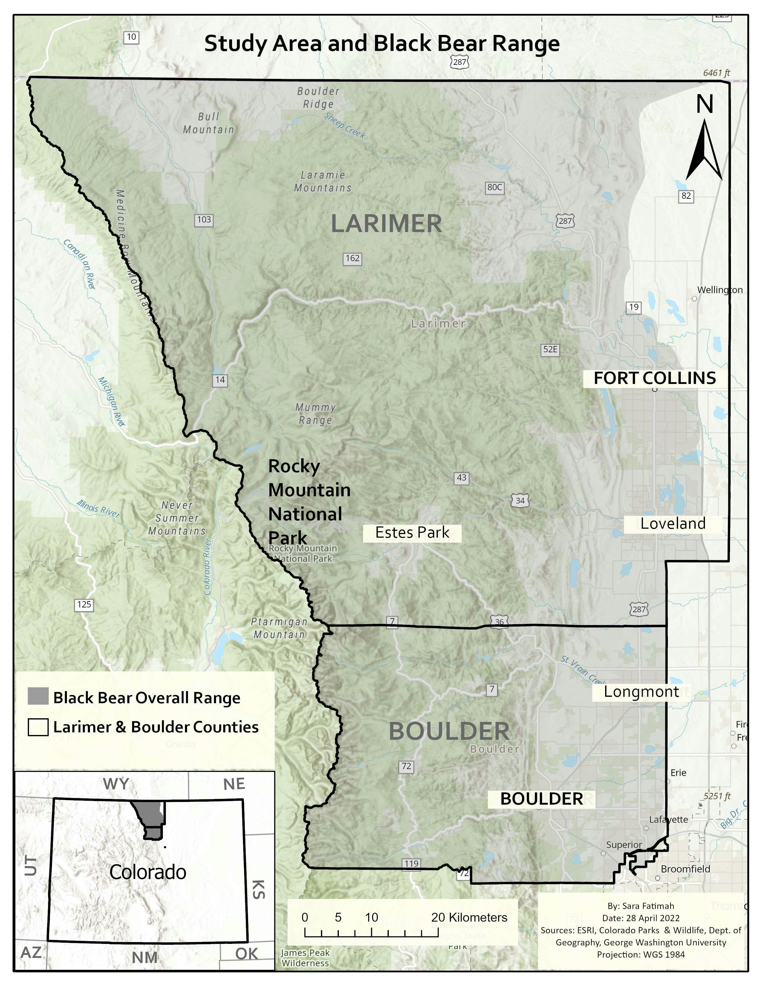
Sources: DIVA GIS
Software used: ArcGIS Pro
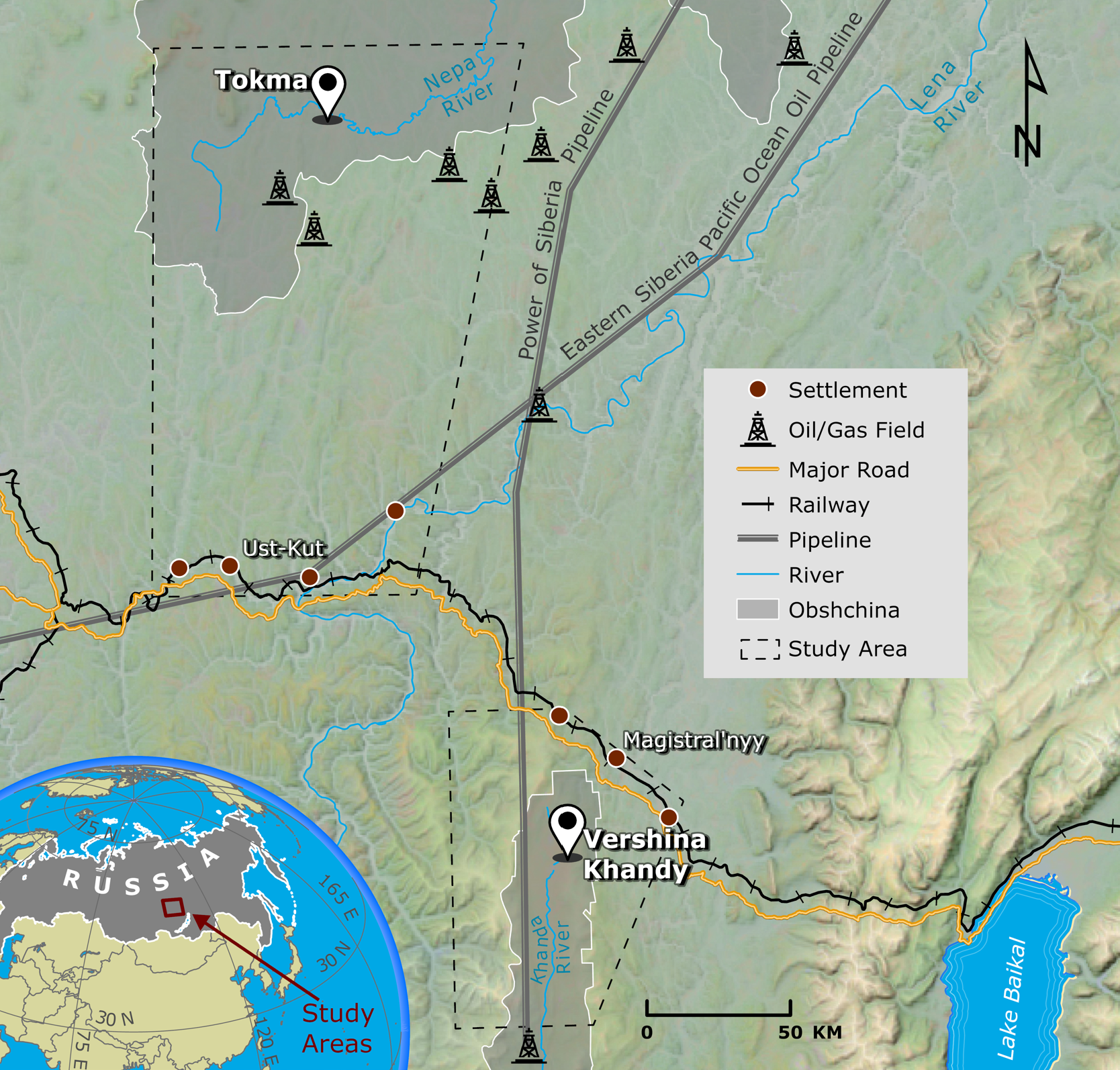
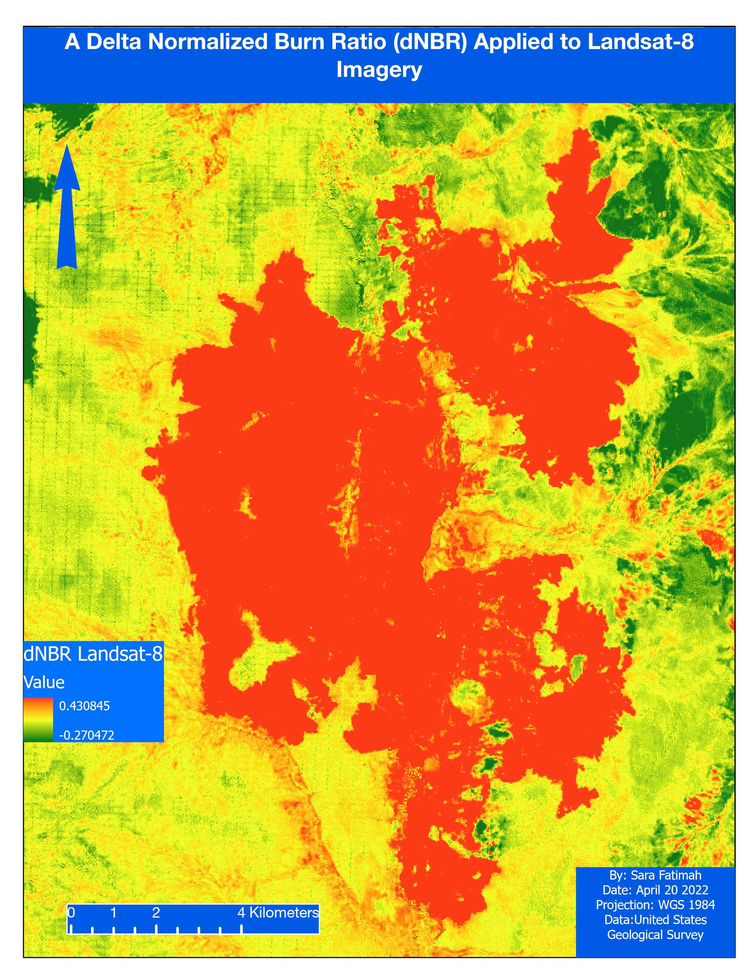
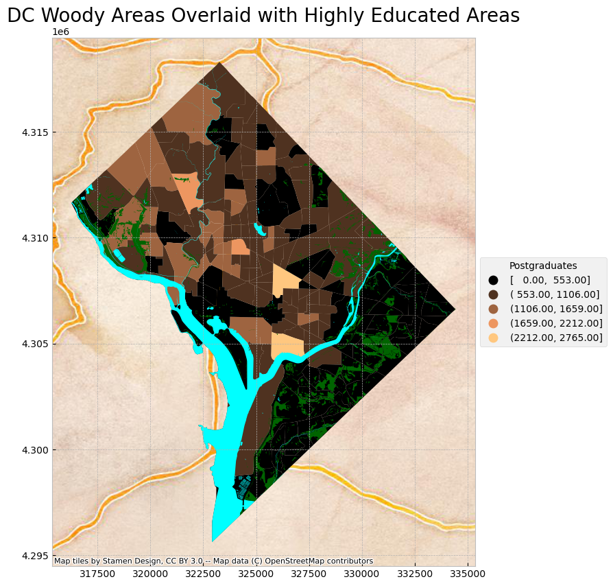
Map for a project in Eastern Siberia
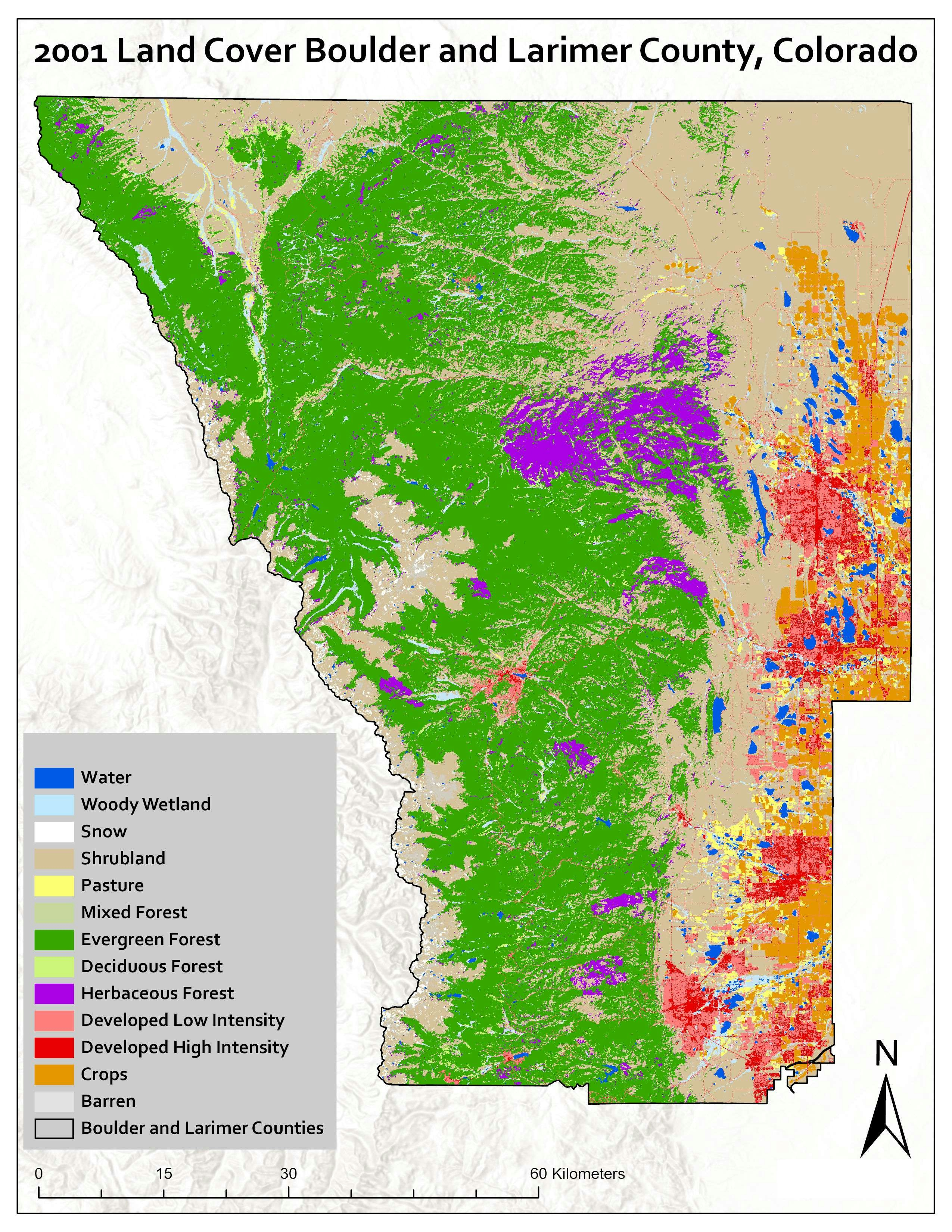
Sources: DIVA GIS
Software used: ArcGIS Pro
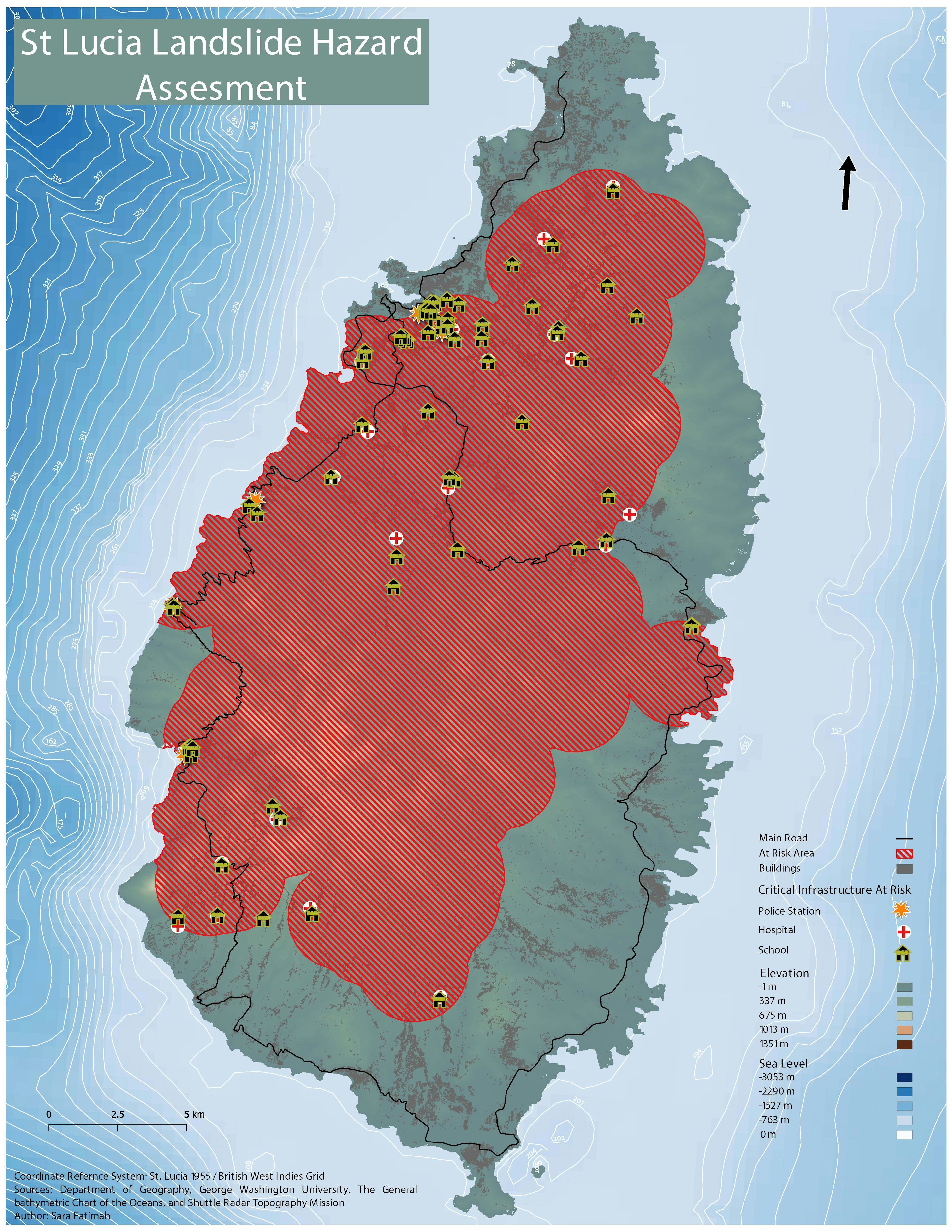
More by Sara Fatimah
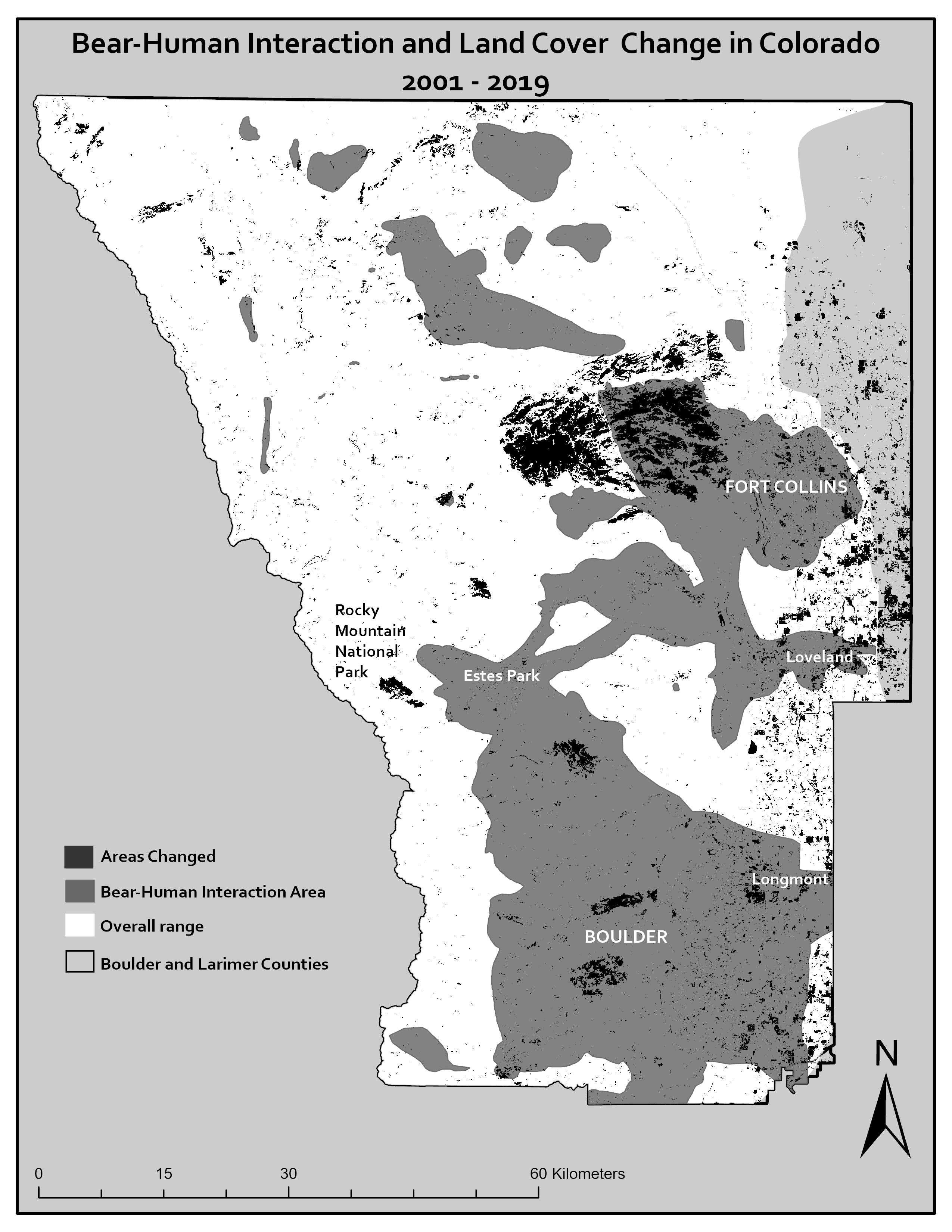
You might also like
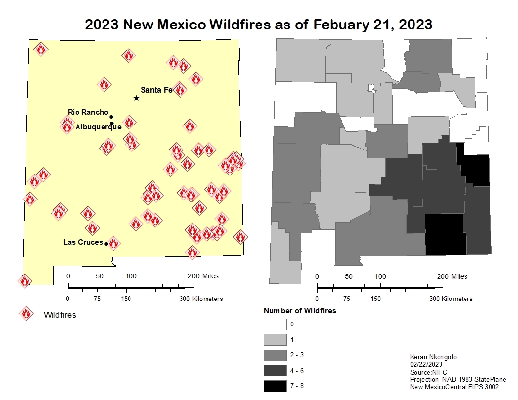
We're a place where geospatial professionals showcase their works and discover opportunities.


.svg "Keran Nkongolo")