Sign up or log in to your Spatialnode account.

Takes less than a few seconds.

Landslide Hazard Assesment

Sara Fatimah
Sara Fatimah•

May 05, 2022

Landslide Hazard Assesment

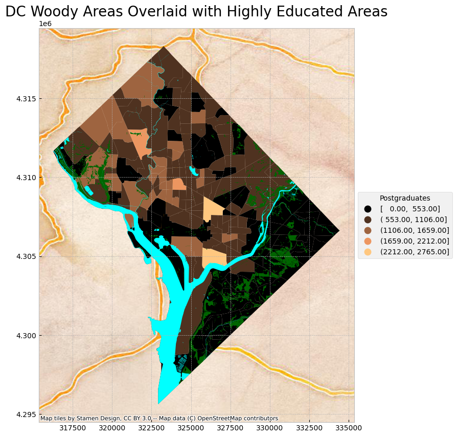
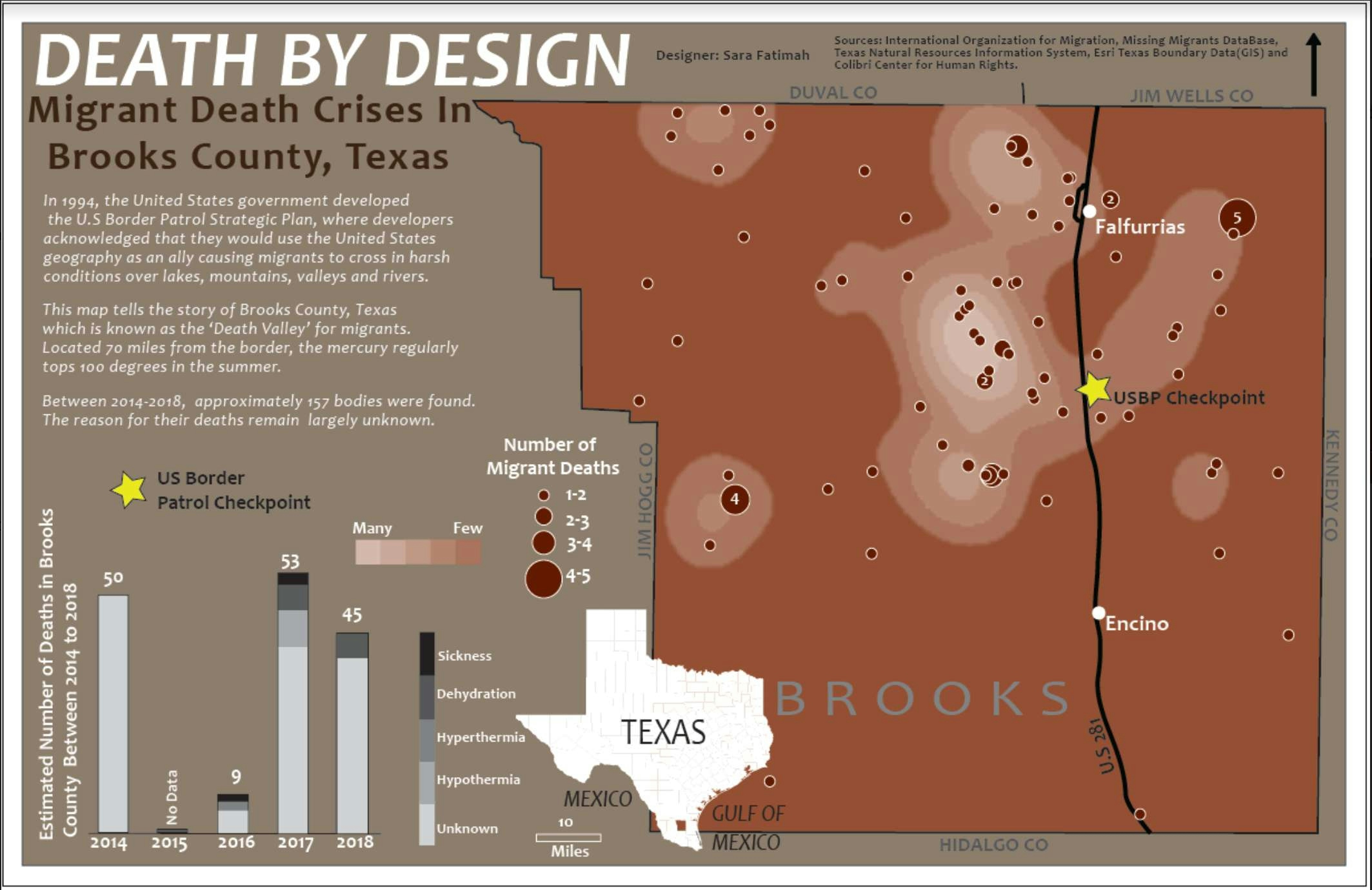
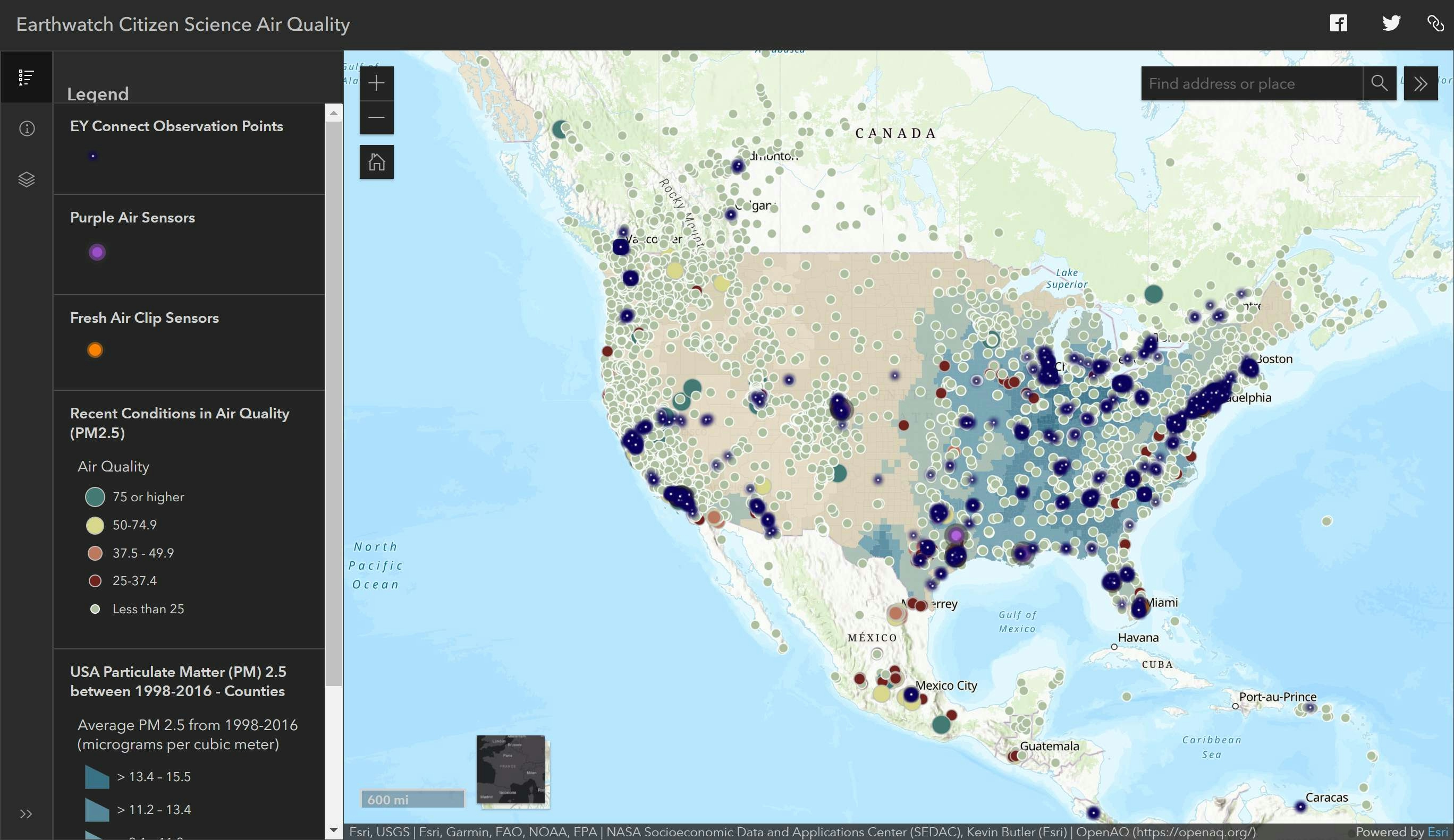
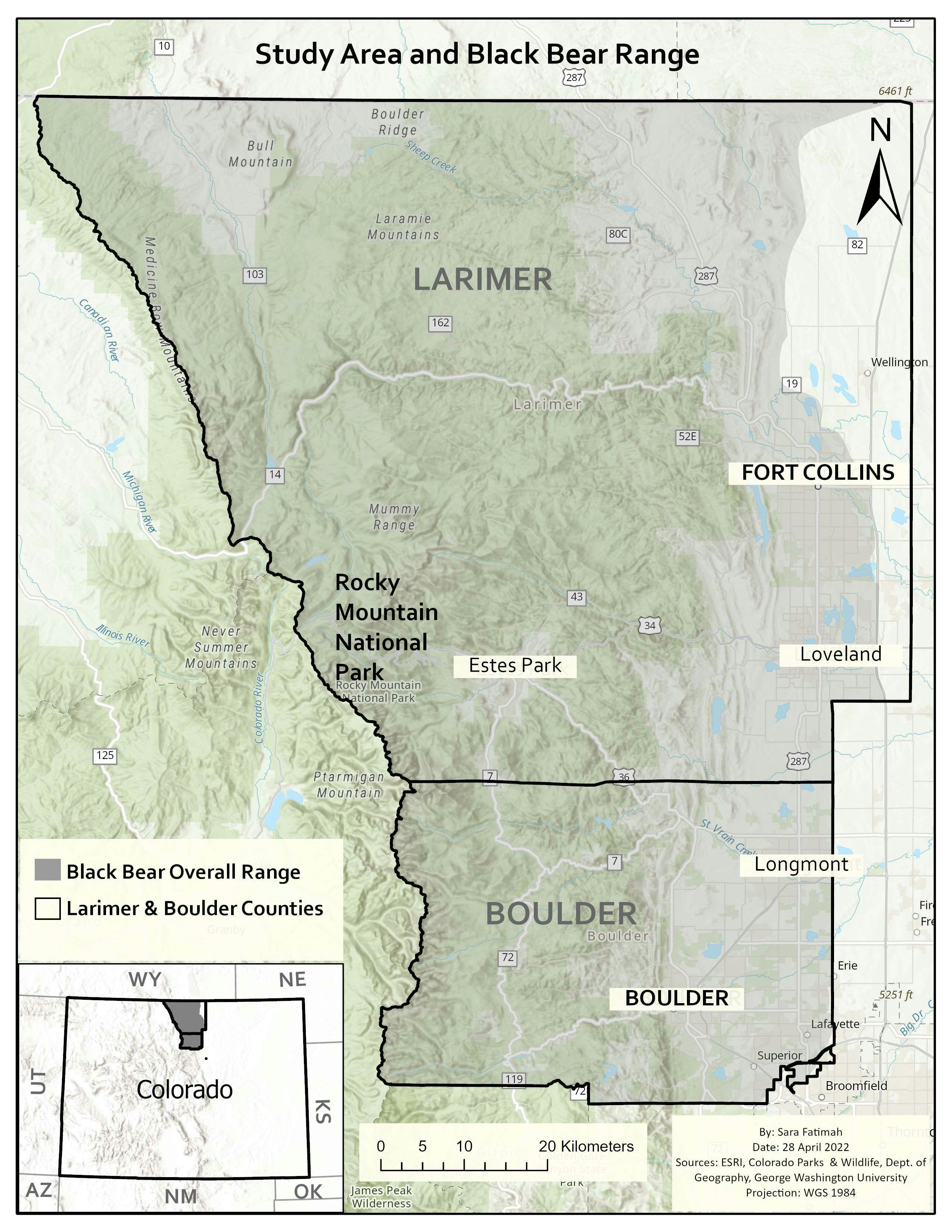
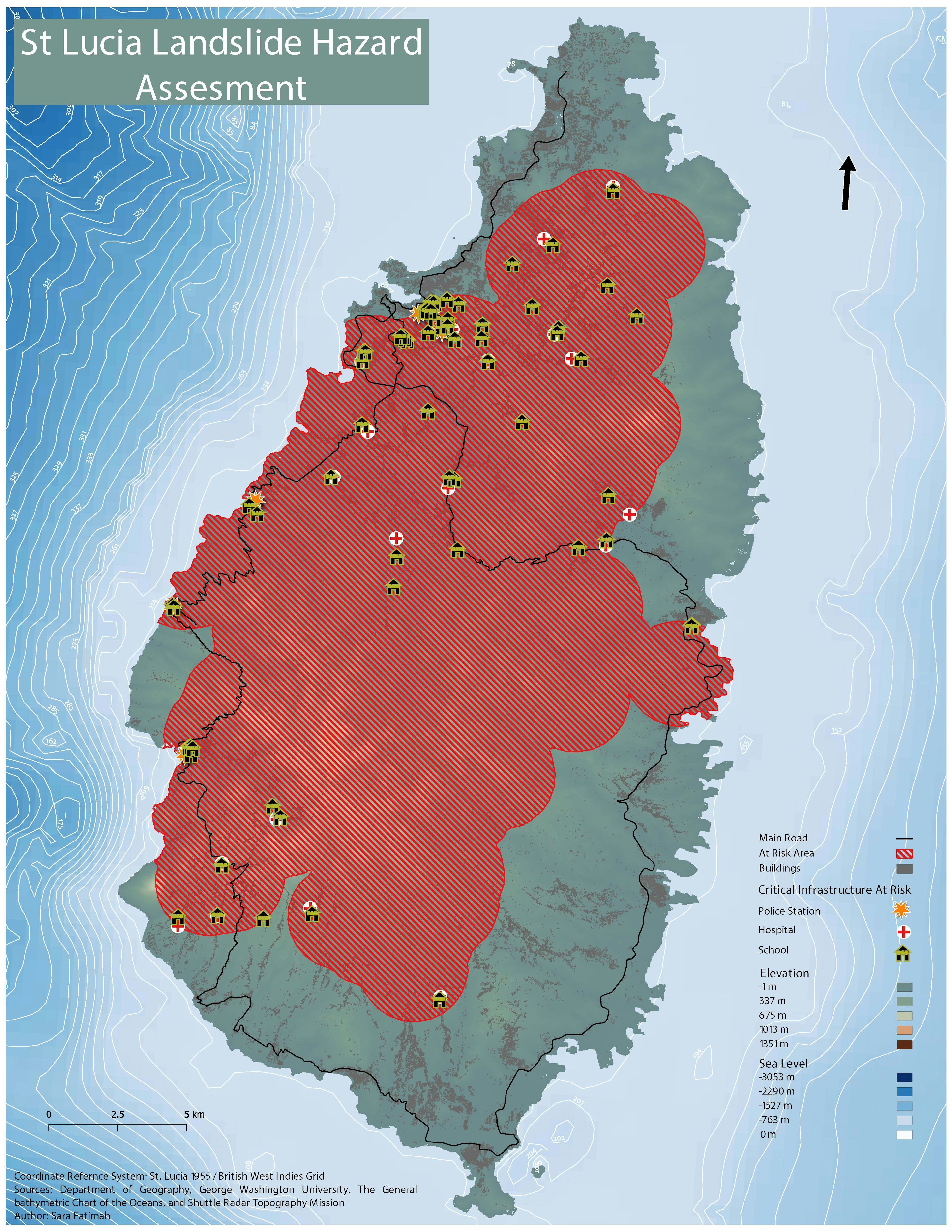
Map displaying the landslide hazard assessment for St Lucia

Software used: QGIS


Tools used

Adobe IllustratorExcelQGIS

Plug-ins used

Spatial analyst

tags

CartographyData VisualizationSpatial Data Science

More by Sara Fatimah

2001 Landcover, Northern Colorado
24
Mapping Wildfires in Eastern Siberia
28
Map for a project in Eastern Siberia
33
2019 Landcover Northern Colorado
43
Death by Design
Death by Design
37
Following the Desert Locusts
87
Prince of Wales Island.
13
Sage-grouse habitat
Sage-grouse habitat
19
Human Bear Interaction
46
Woody Areas & Postgraduates in DC
30
Interactive Air Quality Map
115
Study Area & Black Bear Habitat
22

You might also like

Environmental Zoning of Niterói
rafael menezes de souza
Environmental Zoning of Niterói
rafael menezes...
58
How to Automate Territory Optimization
Stewart Berry
How to Automate Territory Optimization
Stewart Berry
45
Mapa Temático- diagnóstico médico de IST
Robert Caetano
Mapa Temático- diagnóstico médico de IST
Robert Caetano
52
Mapa de Uso do Solo
Layanara Faria
Mapa de Uso do Solo
Layanara Faria
32
TOTAL DEATHS VISUALIZATION
Spencer Scoresby
TOTAL DEATHS VISUALIZATION
Spencer Scoresby
4
Analysis of Distance to GP Services
Emmet O Donnell
Analysis of Distance to GP Services
Emmet O Donnell
13
Fator de uso e ocupação do solo
ana karla rodrigues lobato
Fator de uso e ocupação do solo
ana karla...
7
South Asian Populations in Metro Houston
Zach Torres
South Asian Populations in Metro Houston
Zach Torres
46
Mapa de Precipitação - RS
João Alison Dionísio Mendonça
Mapa de Precipitação - RS
João Alison...
118
Vegetation Change Analysis
Kit Tompkins
Vegetation Change Analysis
Kit Tompkins
11
Flood Hazard Mapping in QGIS
Peter Kimani
Flood Hazard Mapping in QGIS
Peter Kimani
123
Mapa simple de localización
Miriela Ulloa Santana
Mapa simple de localización
Miriela Ulloa Santana
33

Join the community!

We're a place where geospatial professionals showcase their works and discover opportunities.

Sign Up for free