Sign up or log in to your Spatialnode account.

Takes less than a few seconds.

Boulder County Road Network

Adam O Dolce
Adam O Dolce•

November 06, 2022

Boulder County Road Network

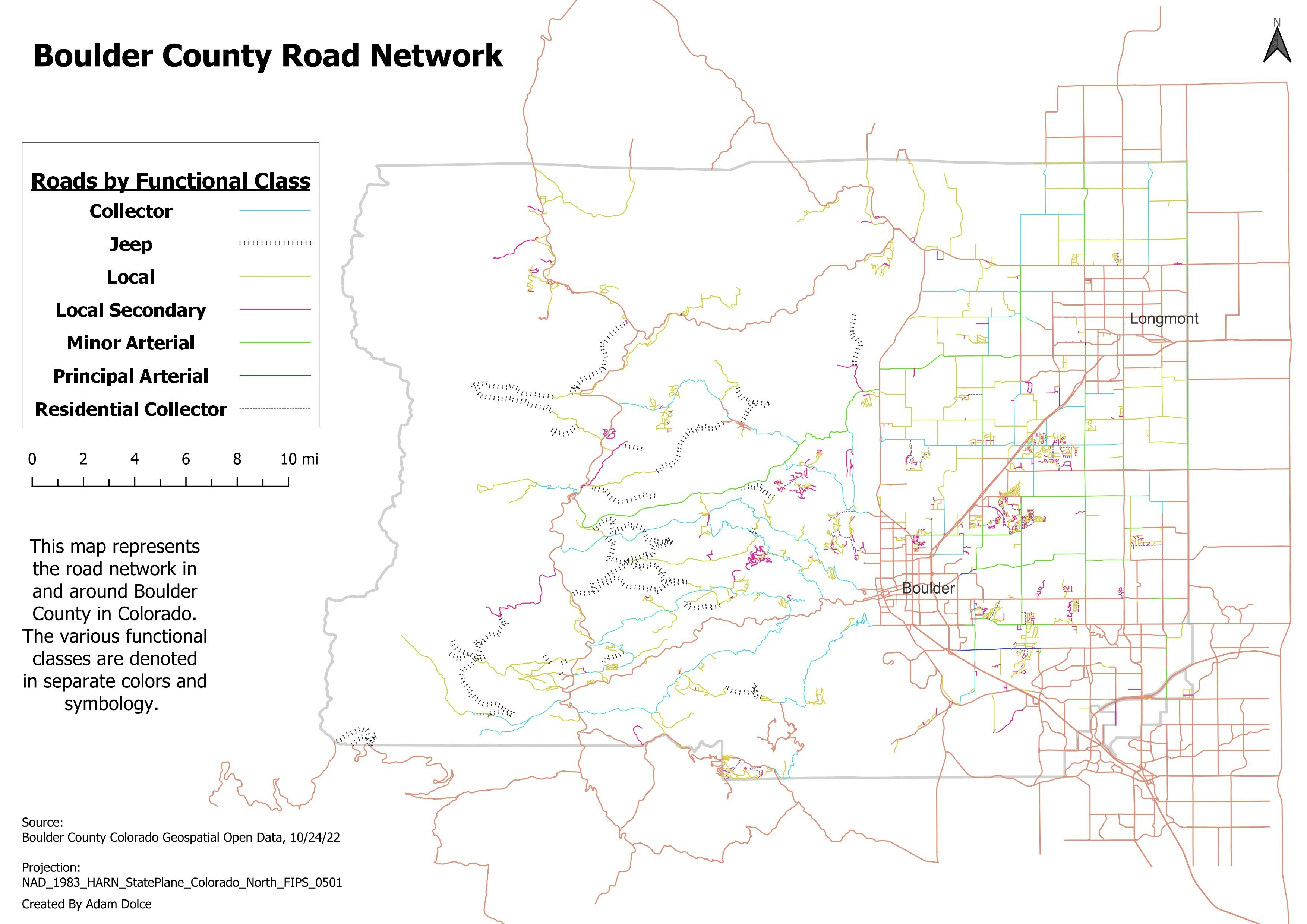
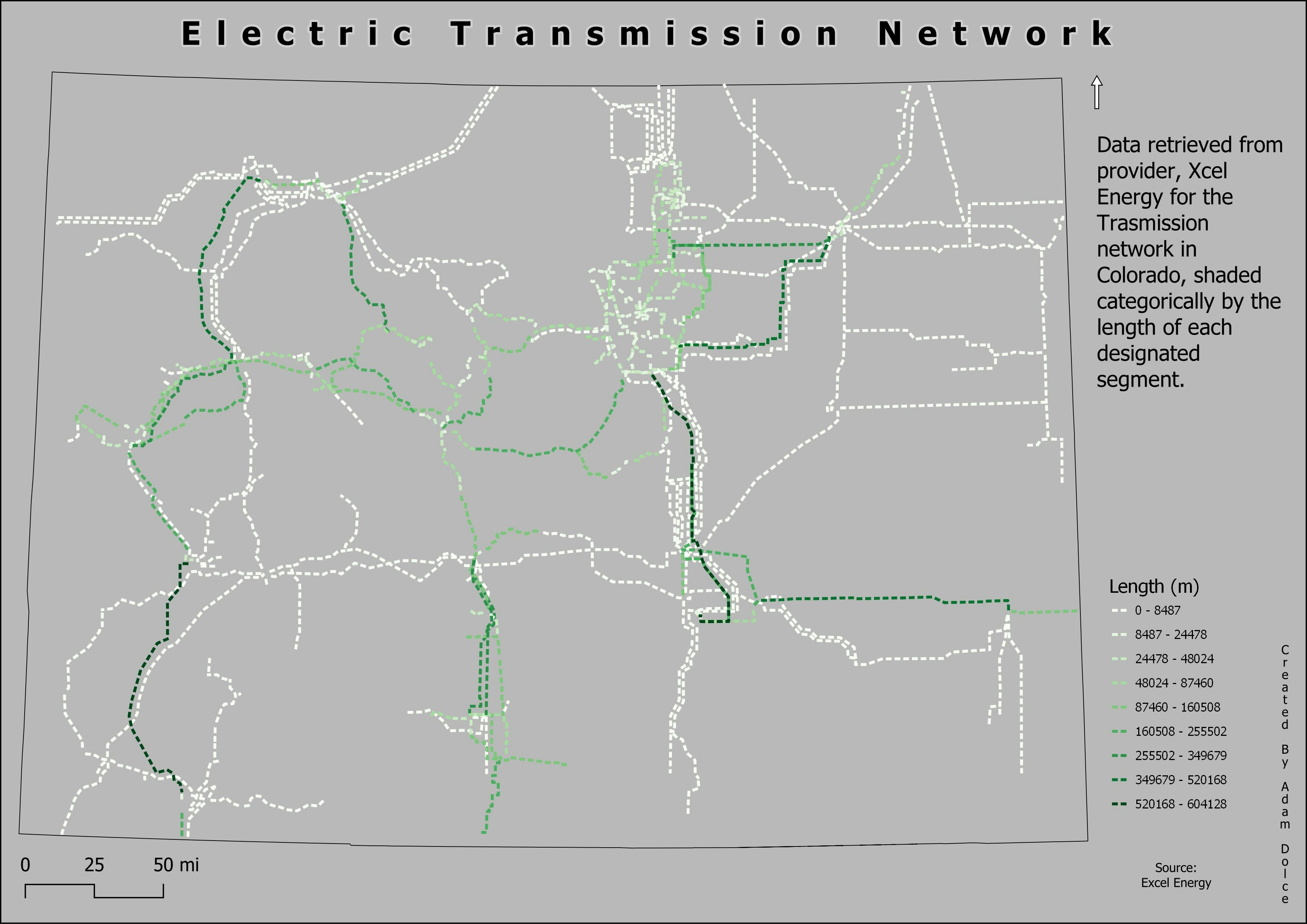
This map represents the road network in Bounder County Colorado. Categorized by the different functional classes.

#Day6 #Network #30daymapchallenge
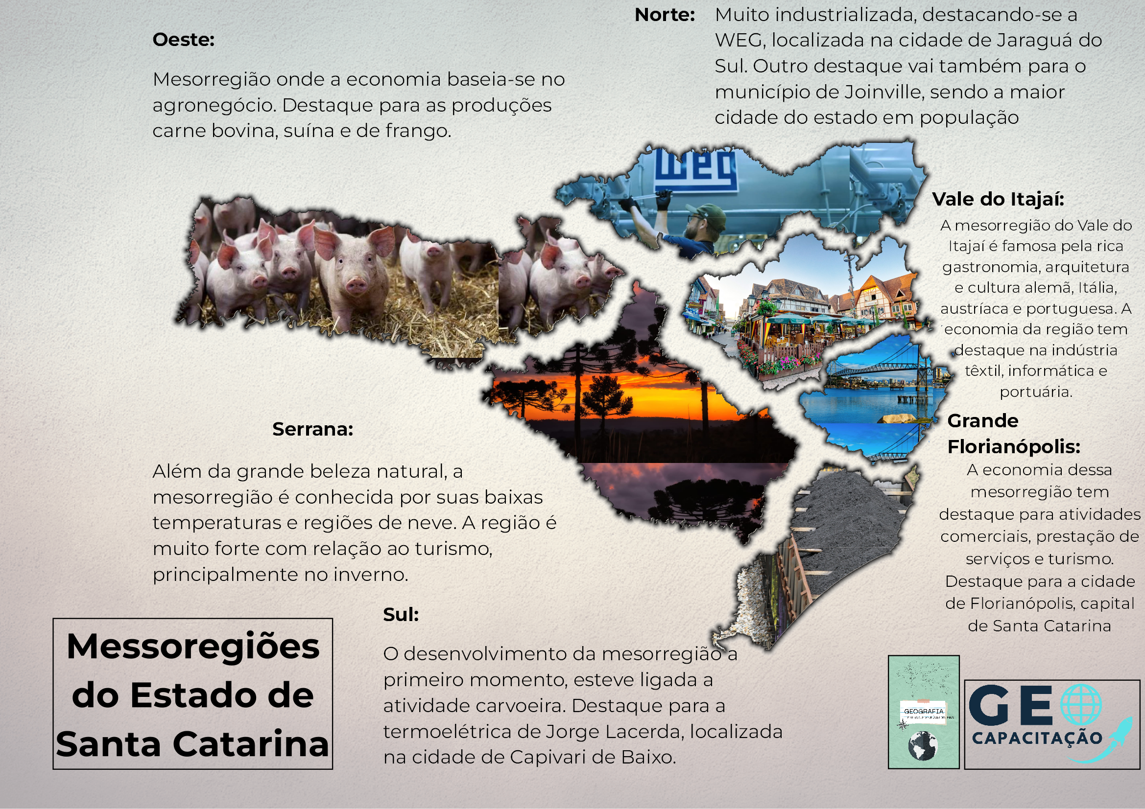

Tools used

QGIS

Plug-ins used

QGIS

tags

#30DayMapChallenge

More by Adam O Dolce

Registered EV Owners
91
December 2022 Earthquakes
26
Colorado Population
Colorado Population
24
Food and Drink
Food and Drink
83
Globe - Ortho
Globe - Ortho
57
Denver Center
Denver Center
77
Fire Districts
Fire Districts
55
Telluride in Blue
Telluride in Blue
24
DC Fast Chargers Near Interstate
66
Bike Paths
Bike Paths
20
EVSE Locations in Wenatchee
26
Food and Drink with Restaurant Names
89

You might also like

Academic exercise for text placement
Sherri Michl
Academic exercise for text placement
Sherri Michl
8
World Concentrations Data
Alysha Anderson
World Concentrations Data
Alysha Anderson
14
LOCALIZAÇÃO DE TUNEIRAS DO OESTE-PR
Itamar Sateles de Sá
LOCALIZAÇÃO DE TUNEIRAS DO OESTE-PR
Itamar Sateles...
321
Study Area Map
Damilola Fadipe
Study Area Map
Damilola Fadipe
28
Analysis of LULC along ABJ-KAD Rail
Lawrence Akpoterai
Analysis of LULC along ABJ-KAD Rail
Lawrence Akpoterai
77
Land Usage, Endangered Species on Kauai
Jamaica De Luna
Land Usage, Endangered Species on Kauai
Jamaica De LunaPro
16
Charlebury
Alastair Graham
Charlebury
Alastair Graham
176
POP. DENSITY ESTIMATES OF NIGERIA : 2021
Bamidele Daniel Ohinoyi
POP. DENSITY ESTIMATES OF NIGERIA : 2021
Bamidele Daniel Ohinoyi
471
Mapa Hipsométrico do Maciço da Tijuca
LETICIA MARIA LEAL MALHEIROS
Mapa Hipsométrico do Maciço da Tijuca
LETICIA MARIA...
137
Walking Analysis to Libraries in Madison
Laura Scott
Walking Analysis to Libraries in Madison
Laura Scott
40
Data Collection usin ARCGIS Survey 123
Jesse Kato
Data Collection usin ARCGIS Survey 123
Jesse Kato
102
Divisão das Mesorregiões de Minas Gerais
SUSANE LAIS DA SILVA CHAVES
Divisão das Mesorregiões de Minas Gerais
SUSANE LAIS...
190

Join the community!

We're a place where geospatial professionals showcase their works and discover opportunities.

Sign Up for free