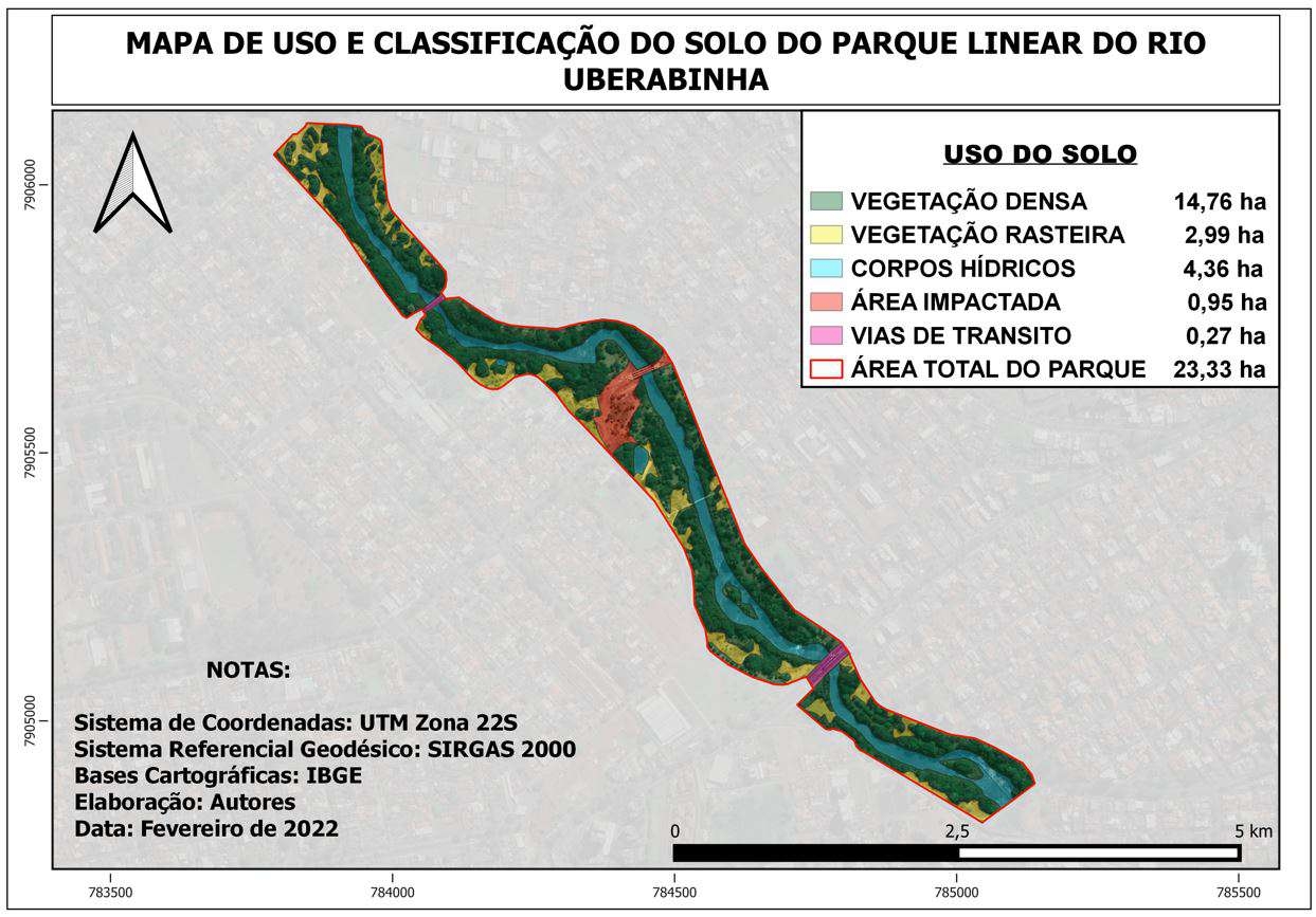
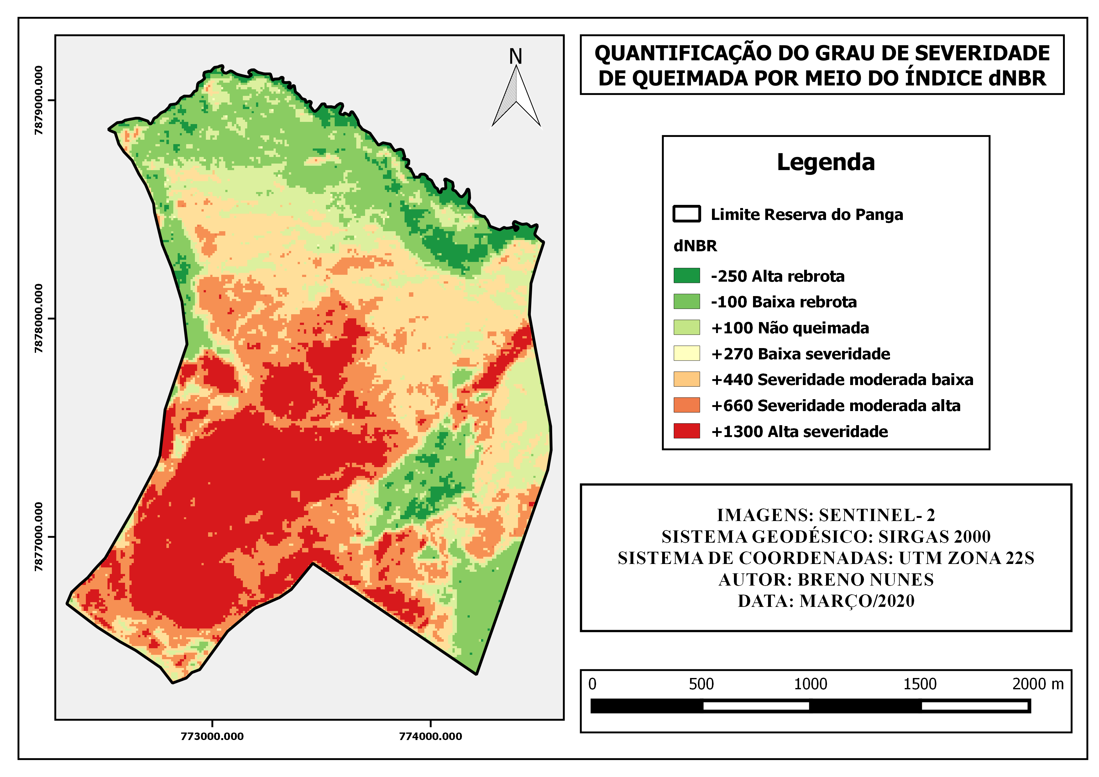
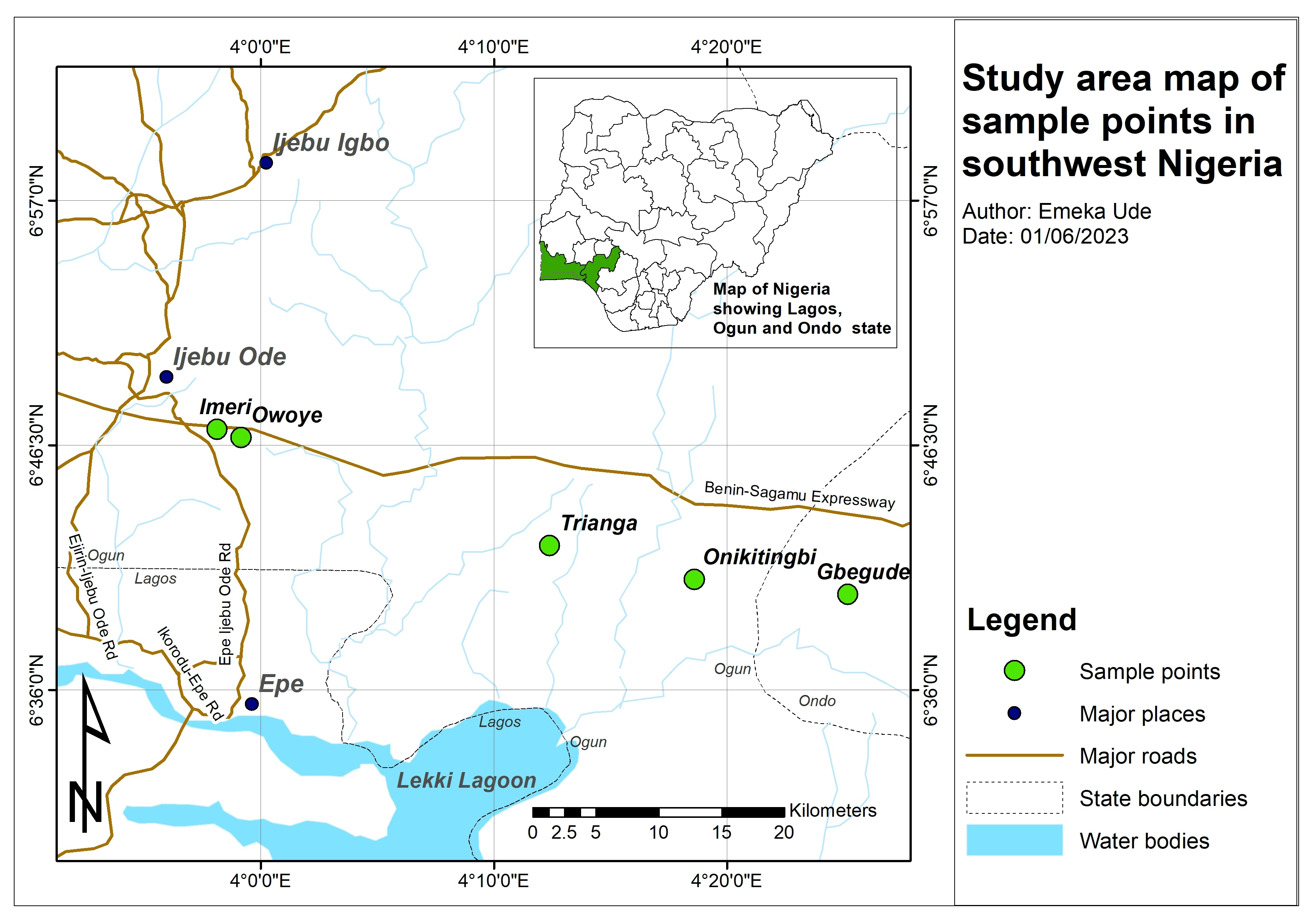
Mapa de Uso e Ocupação do Solo

Tools used
Google Earth Engine(GEE)QGIS
Plug-ins used
QGIS
tags
QGIS
More by Breno Nunes

You might also like

.svg "Maggie Zou")


Join the community!
We're a place where geospatial professionals showcase their works and discover opportunities.