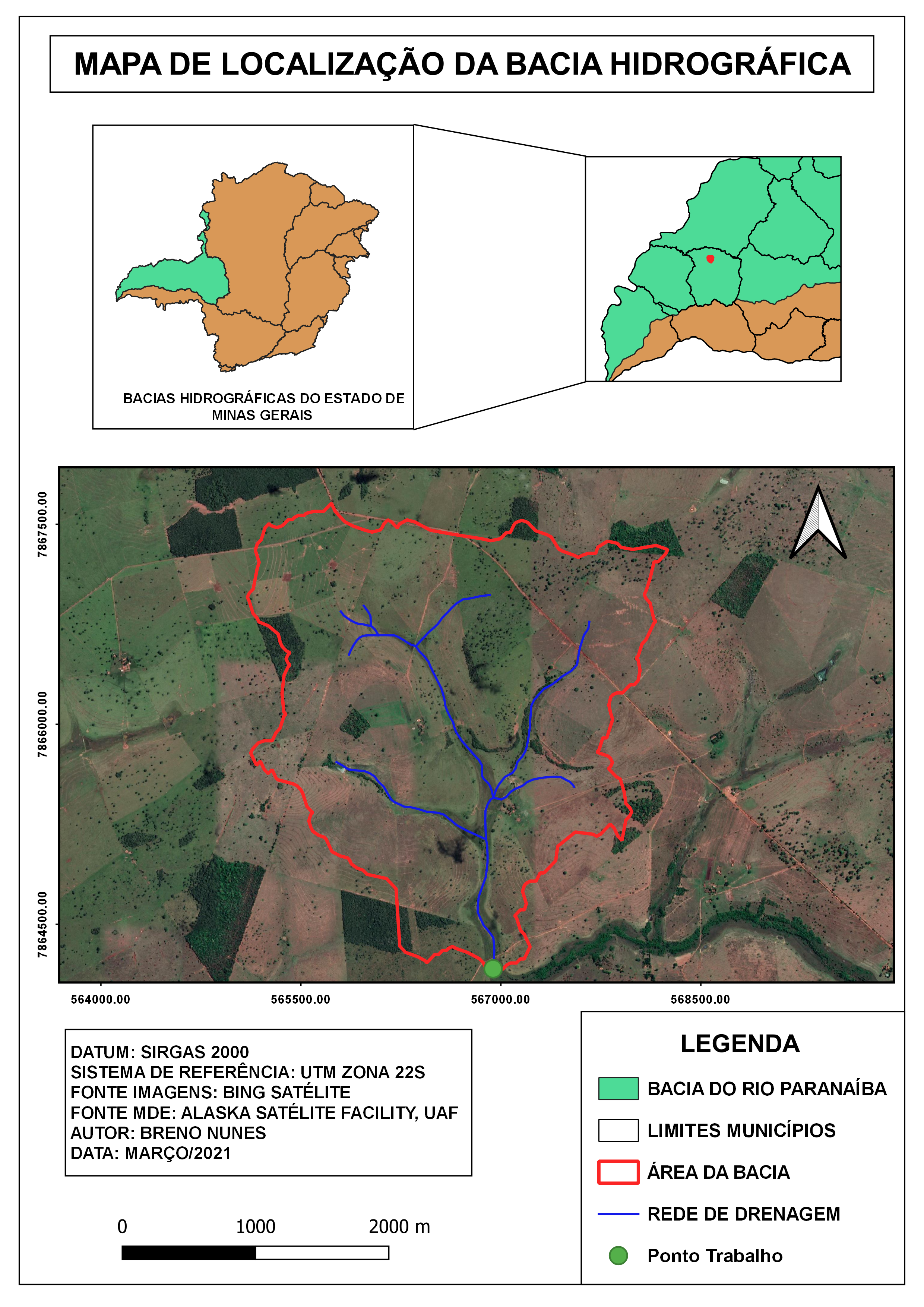
MAPA DE IDENTIFICAÇÃO DE INCÊNDIO


More by Breno Nunes
You might also like


Join the community!
We're a place where geospatial professionals showcase their works and discover opportunities.
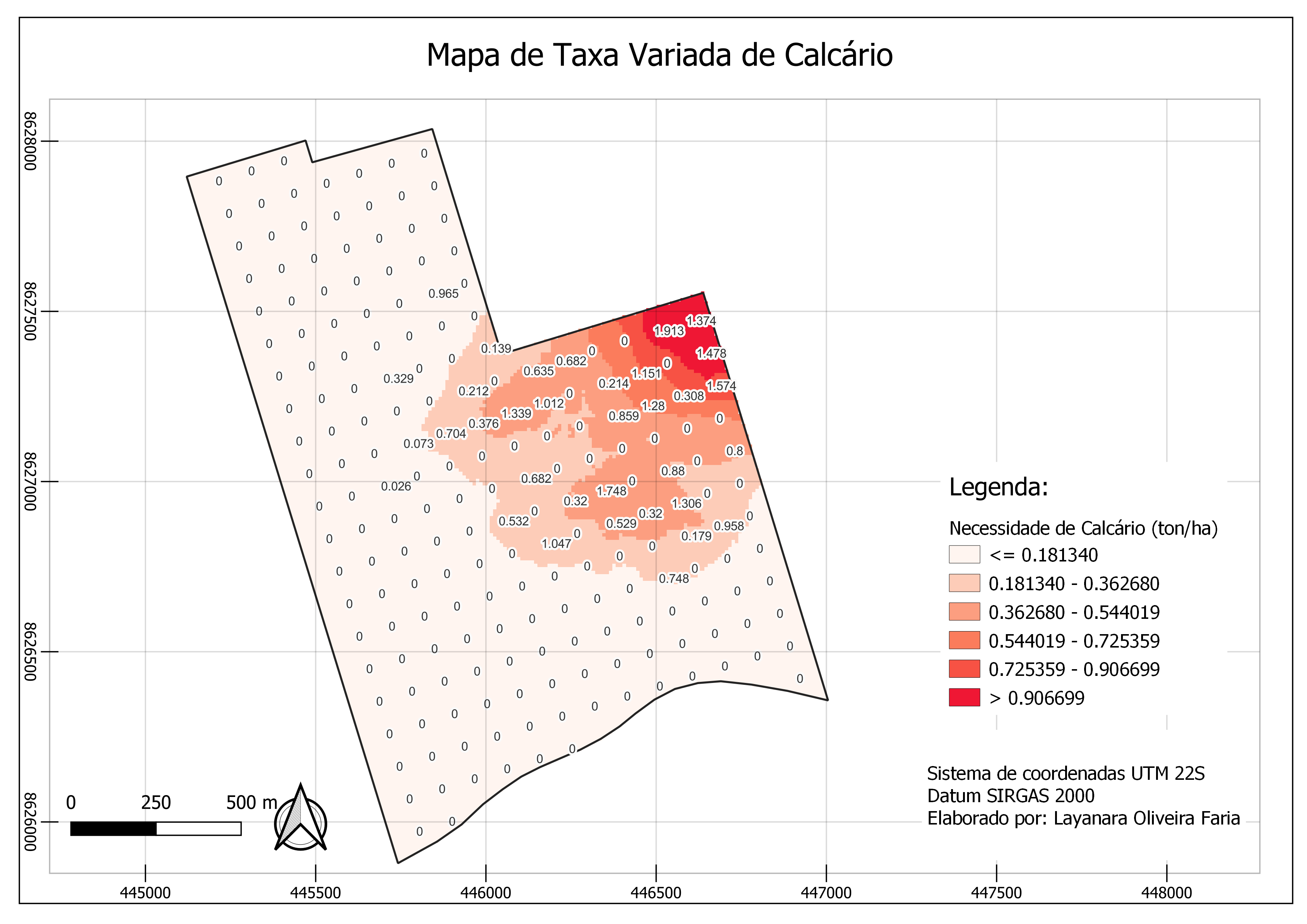
MAPA DE IDENTIFICAÇÃO DE INCÊNDIO
More by Breno Nunes
You might also like
We're a place where geospatial professionals showcase their works and discover opportunities.