Sign up or log in to your Spatialnode account.

Takes less than a few seconds.

Great Sand Dunes, CO

Seth Frame
Seth Frame•

July 07, 2022

Great Sand Dunes, CO

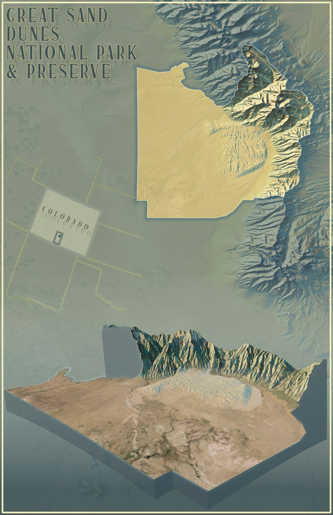
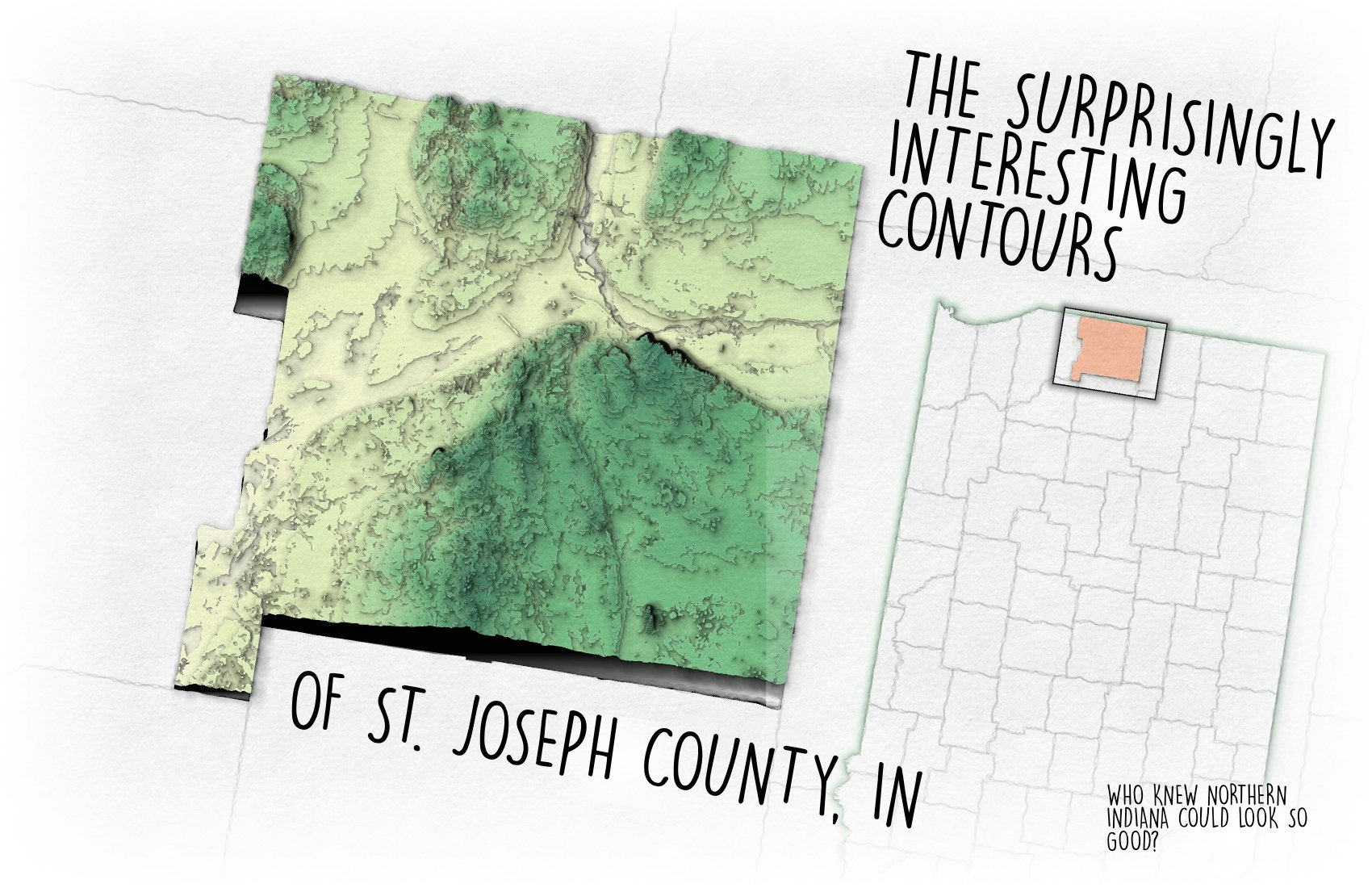
National park map series making use of the 'Imhof' style and 3D perspective. Great Sand Dunes National Park and Preserve, CO


Tools used

ArcGIS Pro

Plug-ins used

ArcGIS Pro

tags

ArcGIS ProCartography#mappychallenge

More by Seth Frame

Mount Tuk
Mount Tuk
83
Canyonlands National Park, UT
179
Channel Islands National Park, CA
127
Map of The Log from the Sea of Cortez
337
St. Joe County Contours
96

You might also like

LÍNGUAS NACIONAIS DE ANGOLA
Fenando Paulo Neto Alberto
LÍNGUAS NACIONAIS DE ANGOLA
Fenando Paulo...
2.9K
Soja, pivôs e terra indígena
Everaldo Rodrigues Mota Junior
Soja, pivôs e terra indígena
Everaldo Rodrigues...
132
Evapotranspiração na mudança do clima
Tainá Nogueira de Almeida
Evapotranspiração na mudança do clima
Tainá Nogueira...
58
Digital Elevation Model of Oyo State.
Olawuyi Abolade Pelumi
Digital Elevation Model of Oyo State.
Olawuyi Abolade Pelumi
36
Clusters of Indigenous Langs in Canada
Cedric Phillips
Clusters of Indigenous Langs in Canada
Cedric Phillips
8
Historical Wildfires in British Columbia
Max Lessard
Historical Wildfires in British Columbia
Max Lessard
33
Mapa de Área de Preservação Permanente
Thátila de Jesus Assis
Mapa de Área de Preservação Permanente
Thátila de...
11
City Creek Watershed Land Cover
Isaac Ajayi
City Creek Watershed Land Cover
Isaac AjayiPro
5
Áreas de influência do empreendimento
Leví Carneiro Oliveira
Áreas de influência do empreendimento
Leví Carneiro Oliveira
13
Commuter Modal Share in Oxford
William Ray
Commuter Modal Share in Oxford
William Ray
118
Choosing Projections
Zach Torres
Choosing Projections
Zach Torres
58
*In Progress* NJ Pinelands Health
Carolyn Anderson
*In Progress* NJ Pinelands Health
Carolyn Anderson
10

Join the community!

We're a place where geospatial professionals showcase their works and discover opportunities.

Sign Up for free