
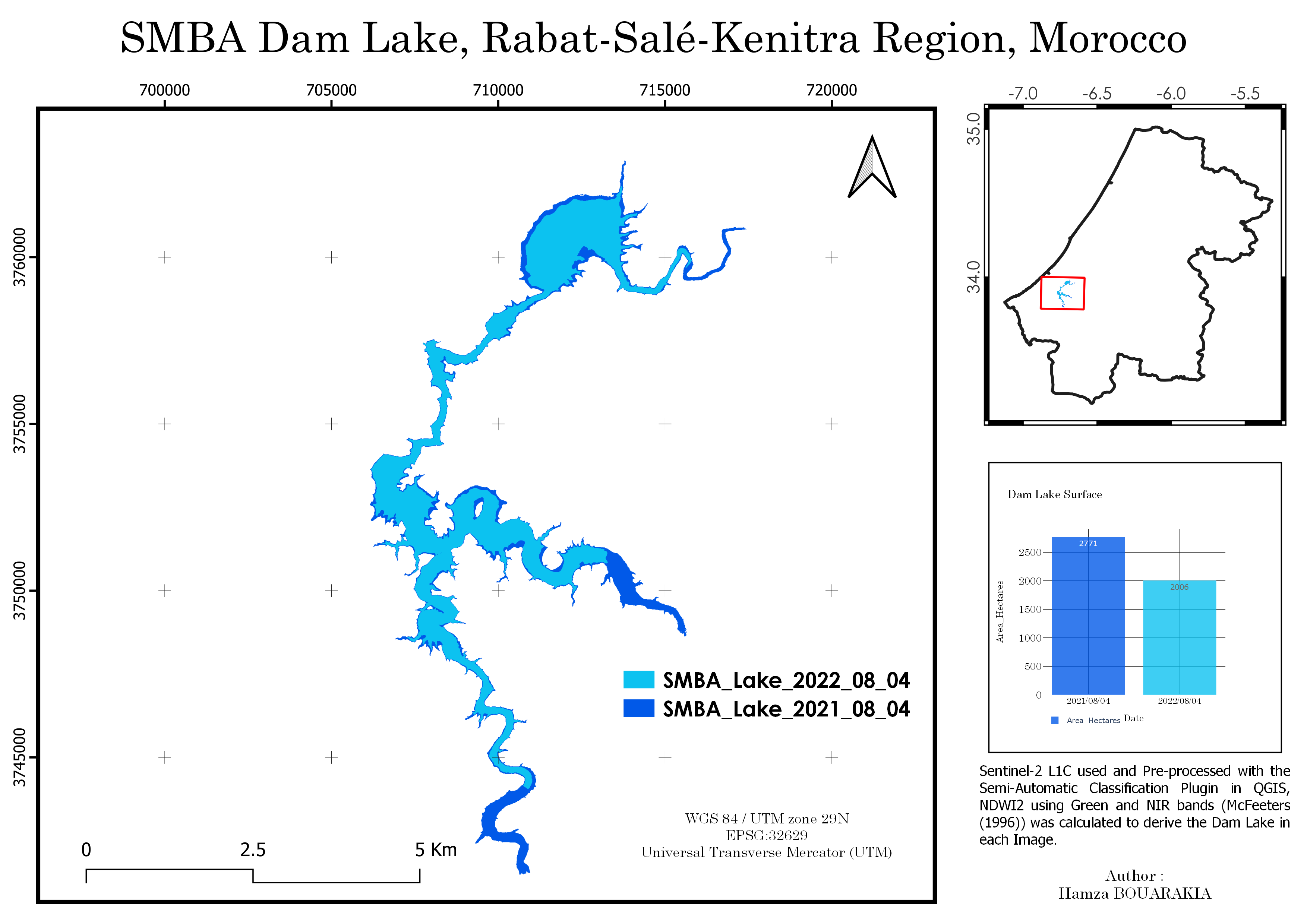
A Change detection was performed using 2 Sentinel-2 images for each year in the summer time to calculate how much the dam lake surface has changed.
SMBA Dam Lake 2021-2022, Morocco
Tools used
QGISRemote Sensing
Plug-ins used
Semi-Automatic Classification Plugin
tags
HydrologyOpen sourceQGIS
More by Hamza Bouarakia

You might also like


Join the community!
We're a place where geospatial professionals showcase their works and discover opportunities.