
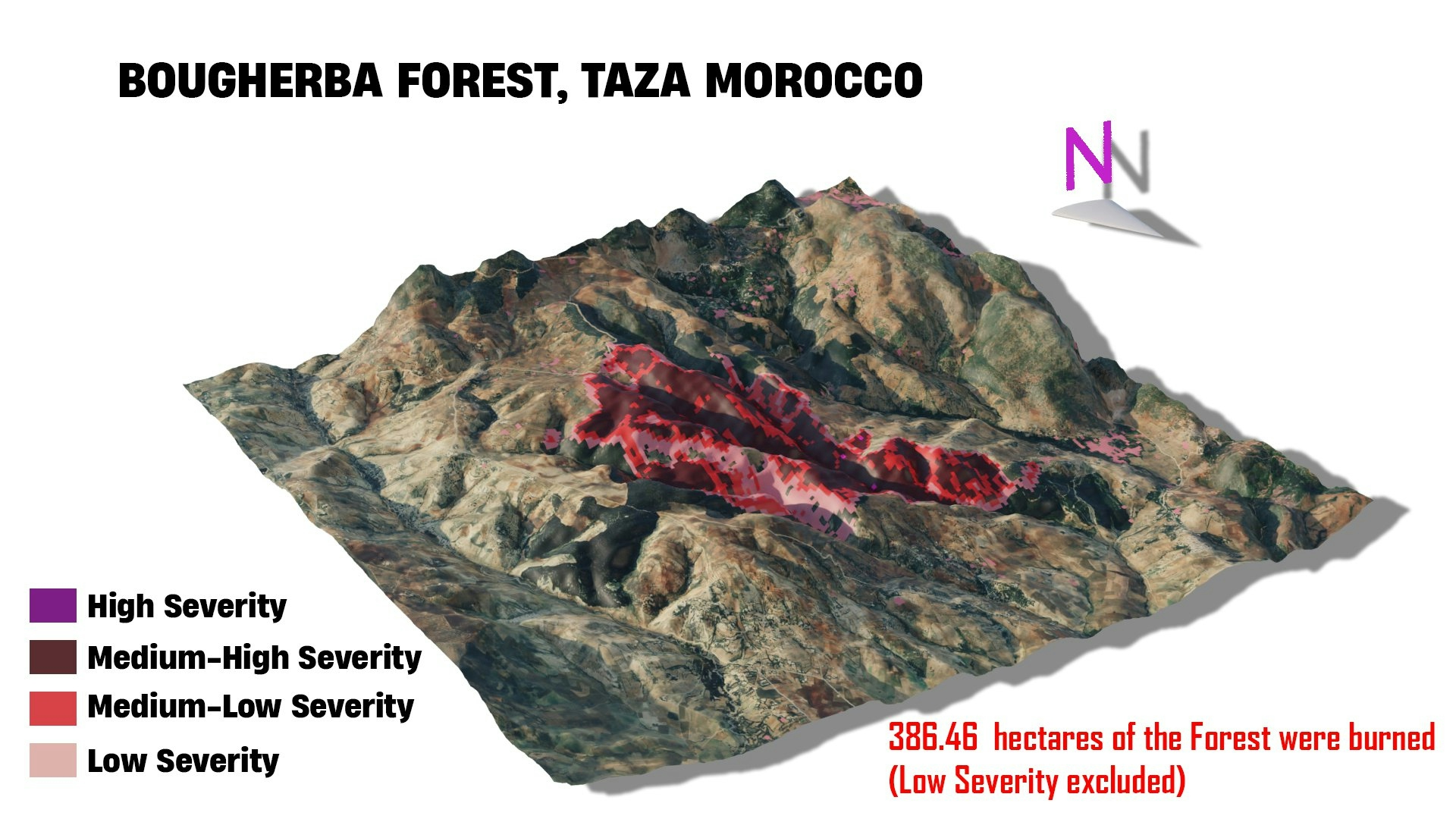
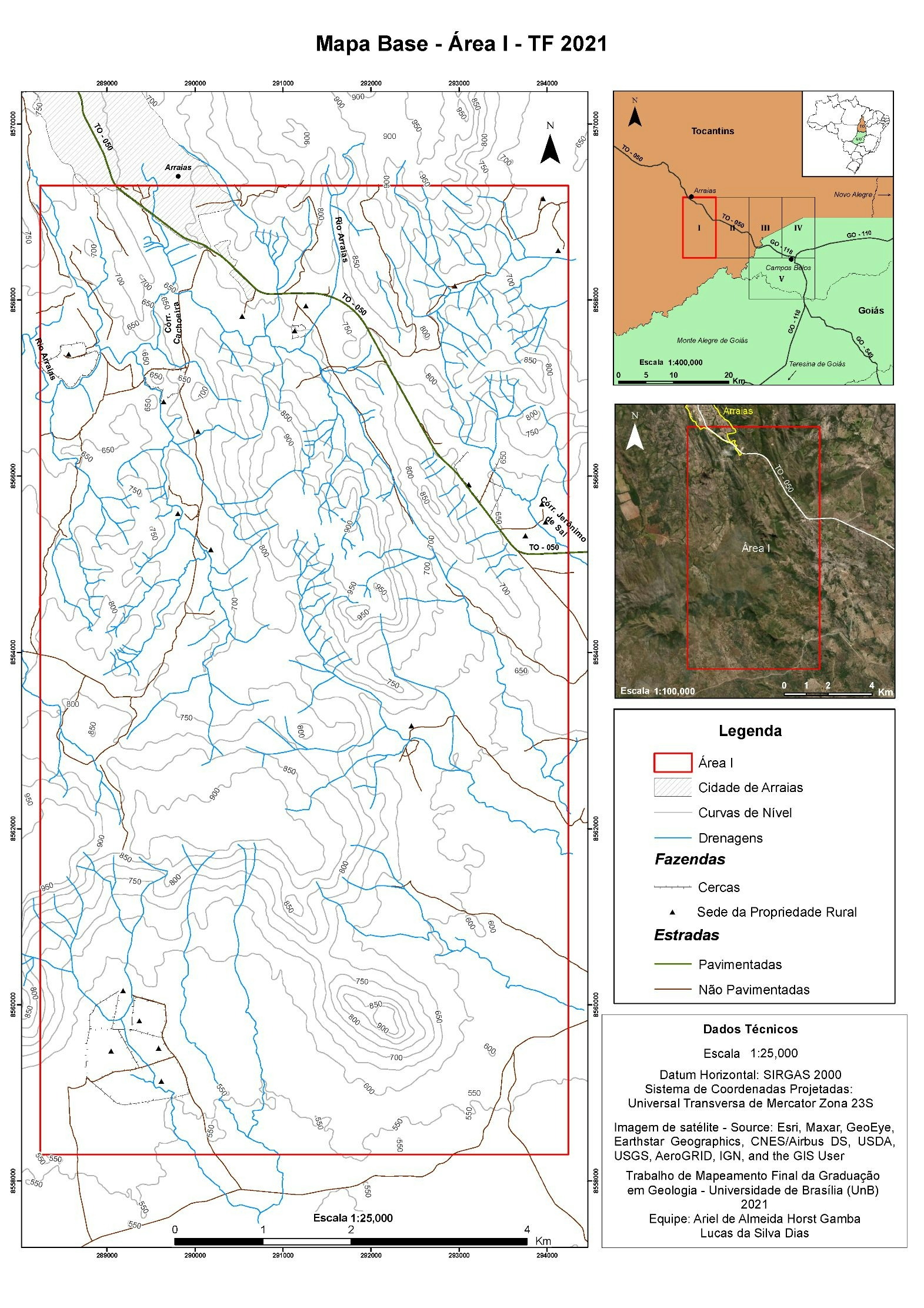
dNBR was calculated using 2 Landsat scenes, one before the forest fire ( Fire started in June 16 2022 ) and afterwards, the classes were chosen using the USGS Burn Severity classification.
Bougherba, Taza Forest Fire
Tools used
BlenderQGIS
Plug-ins used
QGIS
tags
forestLandsatmap fire#mappychallengeQGIS
More by Hamza Bouarakia

You might also like


Join the community!
We're a place where geospatial professionals showcase their works and discover opportunities.