
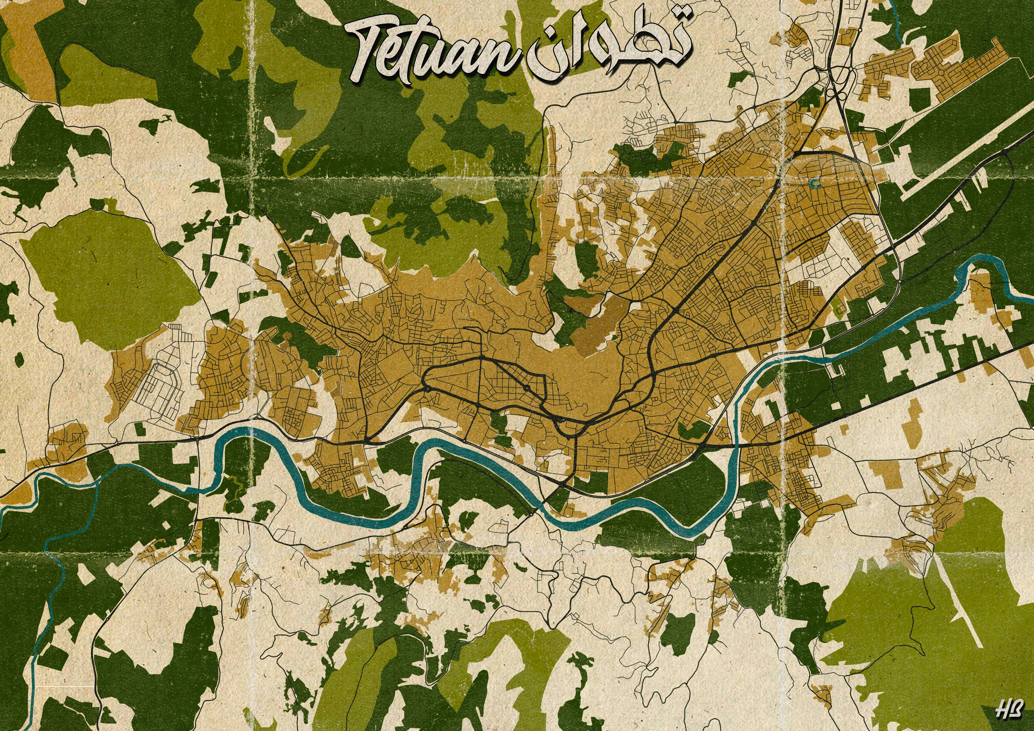
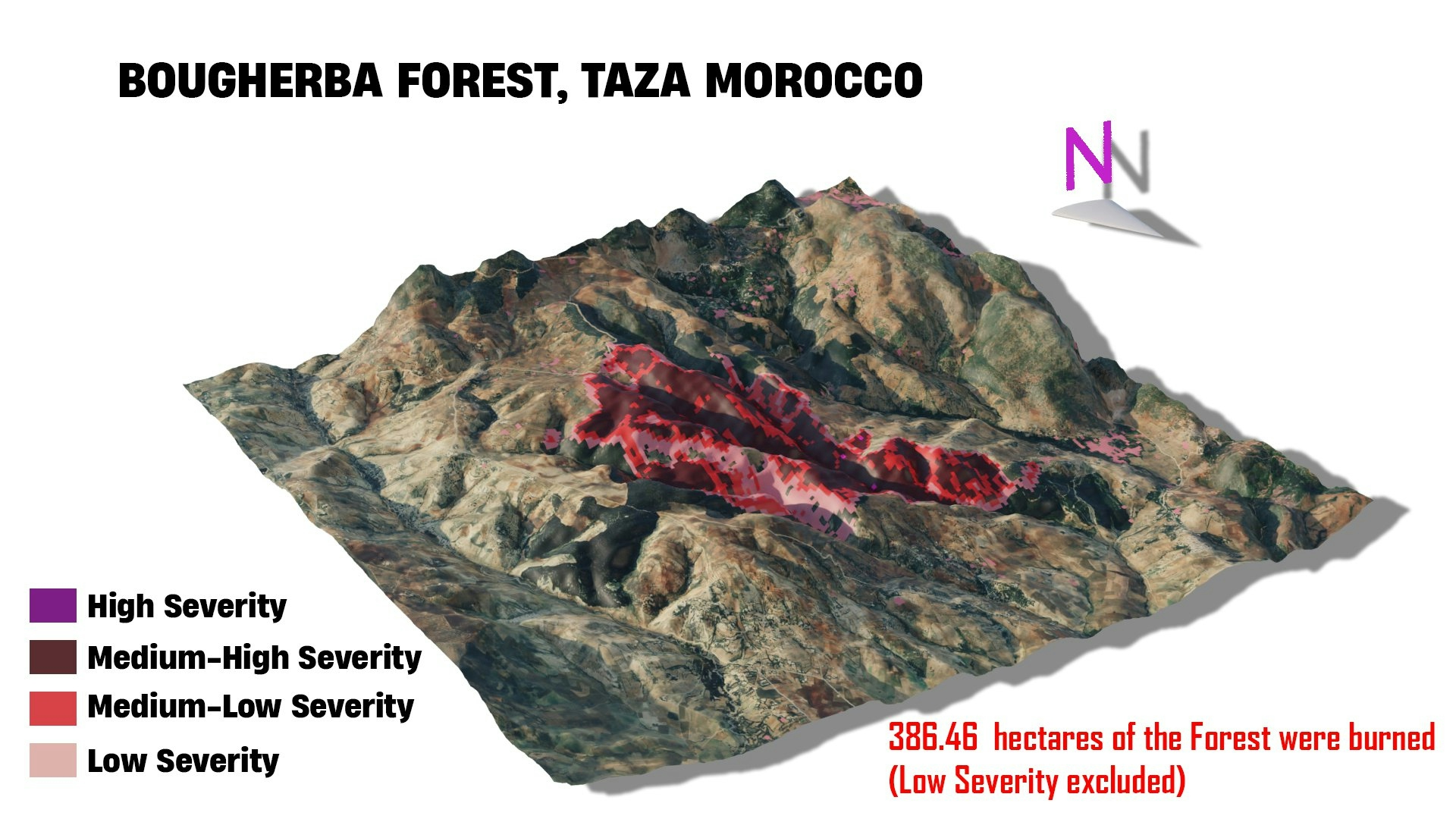
Openstreetmap data were downloaded using QuickOSM plugin in QGIS, the features were colored in QGIS and then the map were modified using Photoshop for the final result.
Vintage Map of Tétuan, Morocco
Tools used
Adobe PhotoshopOpenStreetMapQGIS
Plug-ins used
OpenStreetMapQuery
tags
#mappychallengeMoroccoVintage map
More by Hamza Bouarakia


You might also like


.jpg&w=3840&q=100)

Join the community!
We're a place where geospatial professionals showcase their works and discover opportunities.